Browse All

1864 Paradise Township, Lancaster County, Pen … County Atlas Plan of Paradise Township. |

1864 Strasburg Township, Lancaster County, Pe … County Atlas Plan of Strasburg Township. |

1864 Eden Township, Lancaster County, Pennsyl … County Atlas Plan of Eden Township. |

1875 Map of Mitchell County, State of Iowa. State Atlas Map of Mitchell County, State of Iowa. ( … |

1864 Bart Township, Lancaster County, Pennsyl … County Atlas Plan of Bart Township. |

1864 Sadsbury Township, Lancaster County, Pen … County Atlas Plan of Sadsbury Township. |

1864 Colerain Township, Lancaster County, Pen … County Atlas Plan of Colerain Township. |

1864 Little Britain Township, Lancaster Count … County Atlas Plan of Little Britain Township. |

1864 Fulton Township, Lancaster County, Penns … County Atlas Plan of Fulton Township. |

1864 Drumore Township, Lancaster County, Penn … County Atlas Plan of Drumore Township. |

1864 Providence Township, Lancaster County, P … County Atlas Plan of Providence Township. |

1864 Martir Township, Lancaster County, Penns … County Atlas Plan of Martir Township. |

1864 Conestoga Township, Lancaster County, Pe … County Atlas Plan of Conestoga Township. |

1875 Map of Worth County, State of Iowa. State Atlas Map of Worth County, State of Iowa. (Pub … |

1875 Map of Grundy County, State of Iowa, and … State Atlas Map of Grundy County, State of Iowa. (wi … |

1873 State of Maine. County Atlas Map of the State of Maine. Drawn and Eng … |

1873 Androscoggin County, Maine. County Atlas Map of Androscoggin Co., Maine. |

1873 Auburn, Androscoggin County, Maine. County Atlas City of Auburn. |

1873 Durham, Androscoggin County, Maine. Nort … County Atlas Durham. (insets) North Auburn. West Durh … |

1875 Map of Hardin County, State of Iowa. State Atlas Map of Hardin County, State of Iowa. Cha … |

1873 East Livermore, Androscoggin County, Mai … County Atlas East Livermore. (inset) West Auburn. |

1873 Livermore Falls, Androscoggin County, Ma … County Atlas Livermore Falls. |

1873 Greene, Androscoggin County, Maine. County Atlas Greene. |

1873 Leeds, Androscoggin County, Maine. County Atlas Leeds. |

1873 Lewiston, Androscoggin County, Maine. Ea … County Atlas City of Lewiston. (inset) East Auburn. |

1873 Lewiston and Auburn, Androscoggin County … County Atlas Lewiston and Auburn. |

1873 Lewiston and Auburn, Androscoggin County … County Atlas Lewiston and Auburn. |

1873 Lewiston and Auburn, Androscoggin County … County Atlas Lewiston and Auburn. |

1873 Lewiston and Auburn, Androscoggin County … County Atlas Lewiston and Auburn. |

1873 Lewiston and Auburn, Androscoggin County … County Atlas Lewiston and Auburn. |

1873 Lewiston and Auburn, Androscoggin County … County Atlas Lewiston and Auburn. |

1873 Lisbon, Androscoggin County, Maine. County Atlas Lisbon. |

1873 Lisbon Falls Village, Androscoggin Count … County Atlas Lisbon Falls Village. |

1873 Lisbon Village, Androscoggin County, Mai … County Atlas Lisbon Village. |

1873 Livermore, Androscoggin County, Maine. L … County Atlas Livermore. (insets) Livermore Village. W … |

1875 Map of Mills County, State of Iowa. State Atlas Map of Mills County, State of Iowa. Chas … |

1873 Minot, Androscoggin County, Maine. County Atlas Minot. |

1873 Mechanic Falls, Androscoggin County, Mai … County Atlas Mechanic Falls. |

1873 Poland, Androscoggin County, Maine. Pola … County Atlas Poland, Androscoggin County, Maine. (ins … |

1873 Turner, Androscoggin County, Maine. County Atlas Turner. |

1875 Plans of Hamburg, Sidney, Farragut, Rive … State Atlas Plan of Hamburg ... Fremont Co. (with) P … |

1873 Turner Village, Androscoggin County, Mai … County Atlas Turner Village. |

1873 Wales, Androscoggin County, Maine. County Atlas Wales. |

1873 South Turner. Lisbon Plains. Sabbasville … County Atlas South Turner. Lisbon Plains. Sabbasville … |

1873 Webster, Androscoggin County, Maine. County Atlas Webster. |

1875 Map of Fremont County, State of Iowa. State Atlas Map of Fremont County, State of Iowa. Ch … |

1875 Map of Page County, State of Iowa. State Atlas Map of Page County, State of Iowa. Chas. … |

1874 Map of Stillwater, Washington Co., Minn. State Atlas Map of Stillwater, T.30 N., R.20 W. of 4 … |

1875 Counties of St. John & Kings, New Brunsw … County Atlas Plan of the Counties of St. John & Kings … |
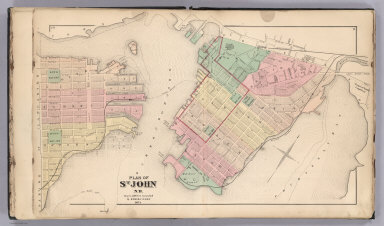
1875 St. John, N.B. (New Brunswick). County Atlas Plan of St. John, N.B. by Roe & Colby. ! … |