Browse All

1872 Nevada and California. [National Atlas, State Atlas] Atlas of the United States, Map of Nevad … |

1872 Washington and Oregon. Territory of Alas … [National Atlas, State Atlas] Atlas of the United States, Map of the W … |

1872 West Indies. [National Atlas, State Atlas] Map of the West Indies. Warner & Beers, … |

1875 Map of Franklin County, State of Iowa. State Atlas Map of Franklin County, State of Iowa. C … |

1872 Western Hemisphere. Eastern Hemisphere [National Atlas, State Atlas] Western Hemisphere. Eastern Hemisphere. |

1872 Morrison, Whiteside County, Illinois. [National Atlas, State Atlas] Morrison. |

1872 Mt. Pleasant Township, Whiteside County, … [National Atlas, State Atlas] Mt. Pleasant. |

1872 Lyndon Township, Whiteside County, Illin … [National Atlas, State Atlas] Lyndon. (insets) Lyndon. Round Ground. |

1872 Prophetstown Township, Whiteside County, … [National Atlas, State Atlas] Prophetstown. |

1872 Newton Township, Whiteside County, Illin … [National Atlas, State Atlas] Newton. (inset) Mineral Springs. |

1875 Map of Bremer County, Plan of Waverly, S … State Atlas Map of Bremer County, State of Iowa. (wi … |

1872 Garden Plain Township, Whiteside County, … [National Atlas, State Atlas] Garden Plain. (inset) Unionville. |

1872 Fulton Township, Whiteside County, Illin … [National Atlas, State Atlas] Fulton. |

1872 Hopkins Township, Whiteside County, Illi … [National Atlas, State Atlas] Hopkins. (insets) Galt. Empire. |
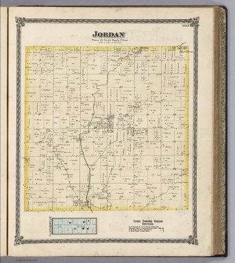
1872 Jordan Township, Whiteside County, Illin … [National Atlas, State Atlas] Jordan. (inset) Sanfordville. |

1875 Map of Butler County, State of Iowa. State Atlas Map of Butler County, State of Iowa. Cha … |

1875 Map of Black Hawk County, State of Iowa. State Atlas Map of Black Hawk County, State of Iowa. … |

1878 Railroad and Township Map of Kansas. County Atlas Rail Road and Township Map of Kansas. 18 … |

1878 Sectional Map of Leavenworth County, Kan … County Atlas Sectional Map of Leavenworth County, Kan … |

1878 Text: Patron's Directory (continued), Le … County Atlas (Text Page) Patron's Directory (continue … |

1878 Township 12 South, Range 22 E., Leavenwo … County Atlas Map of Township 12 South, Range 22 E. 6t … |

1878 Township 11 South, Range 22 E., Leavenwo … County Atlas Map of Township 11 South, Range 22 E. 6t … |

1878 Township 10 South, Range 22 E., Leavenwo … County Atlas Map of Township 10 South, Range 22 E. 6t … |

1878 Townships 9 and 10 South, Range 23 E., L … County Atlas Map of Township 9 & 10 South, Range 23 E … |

1878 Township 9 South, Range 22 E., Leavenwor … County Atlas Map of Township 9 South, Range 22 E. 6th … |

1878 Township 8 S, Range 22 & 23 E., Leavenwo … County Atlas Township 8 S, Range 22 & 23 E. 6th. P.M. |

1878 Tonganoxie. Fall Leaf. Kickapoo. Springd … County Atlas Tonganoxie. Fall Leaf. Kickapoo. Springd … |

1878 Townships 7 and 8 S. Range 21 E. 6th P.M … County Atlas Map of Townships 7 and 8 S. Range 21 E. … |

1878 Township 9 South, Range 21 East, Leavenw … County Atlas Map Township 9 South, Range 21 East 6 P. … |

1878 Township 10 South, Range 21 E., Leavenwo … County Atlas Map of Township 10 South, Range 21 E. 6t … |

1878 Township 11 South , Range 21 E., Leavenw … County Atlas Map of Township 11 South, Range 21 E. 6t … |

1878 Township 12 South, Ranges 21 E. and 20 E … County Atlas Map of Township 12 South, Range 21 E. 6t … |

1878 Townships 12 and 11 South, Range 20th E. … County Atlas Map of Township 12 South, Range 20 E. 6t … |

1878 Townships 10 and 9 South, Range 20 E., L … County Atlas Map of Townships 10 & 9 South, Range 20 … |

1878 Reno. Fair Mount. Summit. Townships 7 an … County Atlas Reno. Fair Mount. Summit. Townships 7 & … |

1878 Leavenworth City, Kansas. County Atlas Map of Leavenworth City, Compiled from O … |

1875 Map of Benton County, State of Iowa. State Atlas Map of Benton County, State of Iowa. Cha … |

1875 Plans of Vinton, Blairstown, Nevada and … State Atlas Plan of Vinton, Benton Co. (with) Plan o … |

1876 Western Hemisphere. Eastern Hemisphere. County Atlas Western Hemisphere. Entered ... 1875 by … |

1876 United States and Territories. County Atlas Map of the United States and Territories … |

1876 County and Road Map of Kentucky. County Atlas County & Road Map of Kentucky Compiled E … |

1875 Map of Fayette County, State of Iowa. State Atlas Map of Fayette County, State of Iowa. (P … |

1876 Daviess County, Kentucky. County Atlas Map of Daviess County, Ky. Showing preci … |

1876 Boston Precinct No. 5, Daviess County, K … County Atlas Boston Precinct No. 5, (Daviess County, … |

1875 Plans of Sioux Rapids, Onawa, Storm Lake … State Atlas Plan of Sioux Rapids, Buena Vista Co. (w … |

1876 Knottsville Precinct No. 4, Daviess Coun … County Atlas Knottsville Precinct No. 4, (Daviess Cou … |

1876 Yelvington Precinct No. 3., Daviess Coun … County Atlas Yelvington Precinct No. 3, (Daviess Coun … |

1876 Masonville Precinct No. 10, Daviess Coun … County Atlas Masonville Precinct No. 10, (Daviess Cou … |

1876 Murray Precinct No. 6, Daviess County, K … County Atlas Murray Precinct No. 6, (Daviess County, … |

1876 Uppertown Precinct No. 2, Daviess County … County Atlas Uppertown Precinct No. 2, (Daviess Count … |