Browse All

1871 City of Portland, Part of 7th Ward, Cumb … County Atlas City of Portland, Part of 7th Ward. |

1871 City of Portland, Parts of 6th & 7th War … County Atlas City of Portland, Parts of 6th & 7th War … |

1871 Text: Portland City Subscribers' Busines … County Atlas (Text Page) Portland City Subscribers' B … |

1871 Falmouth, Cumberland County, Maine. West … County Atlas Falmouth. (insets) West Falmouth, Town o … |

1871 Cumberland, Cumberland County, Maine. Po … County Atlas Cumberland. (insets) Poland Corners, Tow … |

1871 North Yarmouth, Cumberland County, Maine … County Atlas North Yarmouth. (insets) Crocketts Corne … |

1871 Pownal, Cumberland County, Maine. North … County Atlas Pownal. (inset) North Pownal, Town of Po … |

1871 Yarmouth, Cumberland County, Maine. County Atlas Yarmouth. |

1871 Brunswick Village, Cumberland County, Ma … County Atlas Brunswick Village. |

1871 Freeport, Cumberland County, Maine. County Atlas Freeport. |

1871 Freeport, Cumberland County, Maine. Nort … County Atlas Freeport, Town of Freeport. North Freepo … |

1871 Brunswick and Harpswell, Cumberland Coun … County Atlas Brunswick and Harpswell. (inset) West Ha … |

1840 Carta generale di Europa. World Atlas Carta generale di Europa. Questa carta . … |

1843 Carta generale del mondo conosciuto dagl … World Atlas Carta generale del mondo conosciuto dagl … |

1847 Impero di Alessandro. World Atlas Impero di Alessandro. Per l'esecuzione d … |

1846 Carta della Palestina sotto il dominio d … World Atlas Carta della Palestina sotto il dominio d … |

1851 Gallia Transalpina e le sue successive d … World Atlas Gallia Transalpina e le sue successive d … |

1880 United States of America, 1880. County Atlas Map of the United States of America, 188 … |

1880 Rail Road Map of Ohio. County Atlas New Rail Road Map of Ohio. Drawn by H.G. … |

1880 Outline Map of Auglaize County, Ohio. County Atlas Outline Map of Auglaize Co., Ohio. |

1880 Duchouquet Township, Auglaize County, Oh … County Atlas Duchouquet, Township 4 South, Range 6 Ea … |

1880 New Bremen, Ohio. County Atlas New Bremen. |
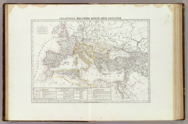
1847 Carta generale dell'Impero Romano sotto … World Atlas Carta generale dell'Impero Romano sotto … |

1880 German Township, Auglaize County, Ohio. County Atlas German, Township 7 South, Range 4 East. |

1880 St. Johns. Cridersville, Auglaize County … County Atlas St. Johns. Cridersville. |

1880 Freyburg. Moulton. Uniopolis. Glynwood, … County Atlas Freyburg. Moulton. Uniopolis. Glynwood. |

1847 Italia Antica. World Atlas Italia Antica. La presente Carte fa part … |

1880 Goshen Township, Auglaize County, Ohio. … County Atlas Goshen, Township 5 South, Range 8 East. … |

1880 Wayne Township, Auglaize County, Ohio. County Atlas Wayne, Township 5 South. Range 8 East. |

1843 Descrizione del globo in due emisferi. World Atlas Descrizione del globo in due emisferi ne … |

1880 Union Township, Auglaize County, Ohio. County Atlas Union, Township 5 South, Range 7 East. |

1880 Clay Township, Auglaize County, Ohio. County Atlas Clay, Township 6 South, Range 7 East. |

1880 Pusheta Township, Auglaize County, Ohio. County Atlas Pusheta, Township 6 South, Range 6 East. |

1880 South Part of Wapakoneta, Ohio. County Atlas South Part of Wapakoneta. |

1880 North Part of Wapakoneta, Auglaize Count … County Atlas North Part of Wapakoneta. |

1840 Carta generale di Europa. World Atlas Carta generale di Europa. Questa carta . … |

1880 West Part of Wapakoneta, New York. County Atlas West Part of Wapakoneta. |

1880 Moulton Township, Auglaize County, Ohio. County Atlas Moulton, Township 5 South, Range 5 East. |

1880 South Part of St. Mary's, Ohio. County Atlas South Part of St. Mary's. |

1880 South Part of St. Mary's, Ohio. County Atlas South Part of St. Mary's. |

1844 Carta generale dell'Italie e delle provi … World Atlas Carta generale dell'Italie e delle provi … |

1880 St. Marys, Auglaize County, Ohio. County Atlas St. Marys, Township 6 South, Range 4 Eas … |

1880 Noble Township, Auglaize County, Ohio. County Atlas Noble Township 5 South, Range 4 East. |

1880 Businesses of Edward Clark, Bakhaus and … County Atlas American House, Edward Clark, Prop. New … |

1880 Salem Township, Auglaize County, Ohio. K … County Atlas Salem, Township 4 South. Range 4 East. ( … |

1841 Regno delle due Sicilie. World Atlas Regno delle due Sicilie. Napoli, 1841. C … |

1880 Logan Township, Auglaize County, Ohio. County Atlas Logan, Township 4 South, Range 5 East. |

1880 Jackson Township, Auglaize County, Ohio. County Atlas Jackson Township 7 South, Range 4 East. |

1880 Minster, Ohio. County Atlas Minster. |

1880 Washington Township, Auglaize County, Oh … County Atlas Washington, Township 6 North, Range 5 Ea … |