Browse All

1776 The Provinces of Massachusetts Bay and N … National Atlas A Map of the most Inhabited part of New … |

1776 The Provinces of Massachusetts Bay and N … National Atlas A Map of the most Inhabited part of New … |

1776 The Provinces of New York, and New Jerse … National Atlas The Provinces of New York, and New Jerse … |

1776 New Map Of The Province of Quebec. National Atlas A New Map Of The Province of Quebec, acc … |

1776 Map Of Pennsylvania. National Atlas A Map Of Pennsylvania Exhibiting not onl … |

1776 Map of the most Inhabited part of Virgin … National Atlas A Map of the most Inhabited part of Virg … |

1776 Map of the most Inhabited part of Virgin … National Atlas A Map of the most Inhabited part of Virg … |

1776 Map Of North And South Carolina With The … National Atlas An Accurate Map Of North And South Carol … |

1776 Map Of North And South Carolina With The … National Atlas An Accurate Map Of North And South Carol … |

1776 Coast Of West Florida and Louisiana...wi … National Atlas The Coast Of West Florida and Louisiana … |

1776 Course Of The River Mississipi, from the … National Atlas Course Of The River Mississipi, from the … |

1776 Bay of Honduras. National Atlas The Bay of Honduras By Thos. Jefferys Ge … |

1776 South America. (Northern Section) National Atlas A Map Of South America Containing Tierra … |

1776 South America. (Southern Section) National Atlas A Map Of South America Containing Tierra … |

1776 Chart Of The Straits Of Magellan. National Atlas A Chart Of The Straits Of Magellan. Inla … |

1876 Cordilleras. Geologic Atlas Cordilleras. |

1878 Fairfield, Suisun. County Atlas Map of Fairfield and Suisun, Solano Coun … |

1878 Dixon. County Atlas Map of Dixon, Solano Co., Cal. (Publishe … |

1846 Map Of The Road From Missouri To Oregon … Regional Atlas Topographical Map Of The Road From Misso … |

1823 Maine. [Manuscript Map, National Atlas] Maine. |

1801 Eastern Hemisphere. World Atlas The Eastern Hemisphere. London: Publishe … |

1823 New Hampshire. [Manuscript Map, National Atlas] New Hampshire. |

1823 Vermont. [Manuscript Map, National Atlas] Vermont. |

1823 Massachusetts. [Manuscript Map, National Atlas] Massachusetts. |

1799 Western Hemisphere. World Atlas The Western Hemisphere. London: Publishe … |

1823 Connecticut. [Manuscript Map, National Atlas] Connecticut. |

1823 Rhode Island. [Manuscript Map, National Atlas] Rhode Island. |

1823 New York. [Manuscript Map, National Atlas] New York. |

1823 New Jersey. [Manuscript Map, National Atlas] New Jersey. |

1801 World On Mercator's Projection. World Atlas New chart of the world, on Mercator's pr … |

1823 Pensylvania. [Manuscript Map, National Atlas] Pensylvania. |

1823 Maryland. [Manuscript Map, National Atlas] Maryland. |

1823 Delaware. [Manuscript Map, National Atlas] Delaware. |

1804 Europe. World Atlas A new map of Europe, from the latest aut … |

1823 Virginia. [Manuscript Map, National Atlas] Virginia. |

1823 North Carolina. [Manuscript Map, National Atlas] North Carolina. |

1823 South Carolina. [Manuscript Map, National Atlas] South Carolina. |

1807 British Isles. World Atlas A new map of the British Isles, from the … |
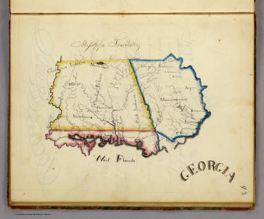
1823 Georgia. [Manuscript Map, National Atlas] Georgia. |

1823 Tennessee. [Manuscript Map, National Atlas] Tennessee. |

1823 Kentucky. [Manuscript Map, National Atlas] Kentucky. |

1807 England. World Atlas A new map of England, from the latest au … |

1823 Ohio. [Manuscript Map, National Atlas] Ohio. |

1823 Indiana. [Manuscript Map, National Atlas] Indiana. |

1887 Legend for Karte des Deutschen Reiches. National Atlas Zeichen-Erklaerung fur die Karte des Deu … |

1801 Scotland SW. World Atlas A new map of Scotland, from the latest a … |

1801 Scotland SE. World Atlas (A new map of Scotland, from the latest … |

1801 Scotland NE. World Atlas (A new map of Scotland, from the latest … |

1893 341. Juterbogk. National Atlas Sheet 341. Juterbogk. Karte des Deutsche … |

1801 Scotland NW. World Atlas (A new map of Scotland, from the latest … |