|
REFINE
Browse All : Book Map from 1858
1-11 of 11
Author
Mollhausen, Baldwin; (Lange, Henry)
Full Title
Map illustrating Baldwin Mollhausen's travel from Mississippi to the Coast of the Pacific, in the years 1853-1854. London, Longman & Co. Engraved by Edwd Weller, Duke Strt, Bloomsbury. (to accompany) Diary of a Journey from the Mississippi to the Coasts of the Pacific With a United States Government Expedition. By Baldwin Mollhausen ... In Two Volumes. Vol. I London: Longman, Brown, Green, Longmans, & Roberts. 1858. (with 2 insets).
Publisher
Brown et al. Longman.
Author
[Belly, Felix, Gamond, Thome]
Full Title
Carte d'etude dressee par Mr. Thome de Gamond pour servir a l'avant-projet du canal interoceanique de Nicaragua, par le fleuve Saint Jean et le col de Salinas en execution du traite de concession conclu le 1er mai 1858 entre les gouvernements de Nicaragua et Costa-Rica et Mr. Felix Belly. (inset) Carte de l'Amérique centrale comprenant les 5 républiques de Guatemala, San-Salvador, Honduras, Nicaragua et Costa-Rica. (with) Profil du canal des deux océans établi au tirant d'eau de huit mètre. En vente chez Goupil & Cie, boulevard montmartre editeur ... Chromolith. par Avril frères, Rue des Bernardins, 18. Lith. Lemercier, Paris. (to accompany) Carte D'Etude Pour Le Trace Et Le Profil De Canal De Nicaragua ...
Publisher
Dalmont et Dunoid, Editeurs
Author
Ives, J.C.
Full Title
Explorations and Surveys. War Department. Map No. 1. Rio Colorado of the West, explored by 1st Lieut. Joseph C. Ives, Topl. Engrs. under the direction of the Office of Explorations and Surveys. A.A. Humphreys, Capt. Topl. Engrs. in Charge, by order of the Hon. John B. Floyd, Secretary of War. 1858. Drawn by Frhr. F.W.v. Egloffstein. Topographer to the Expedition. Topography by Frhr. F.W.v. Egloffstein. Ruling by Samuel Sartain. Lettering by F. Courtenay.
Publisher
U.S.
Author
Ives, J.C.
Full Title
Explorations and Surveys. War Department. Map No. 2. Rio Colorado of the West, explored by 1st Lieut. Joseph C. Ives, Topl. Engrs. under the direction of the Office of Explorations and Surveys. A.A. Humphreys, Capt. Topl. Engrs. in Charge, by order of the Hon. John B. Floyd, Secretary of War. 1858. Drawn by Frhr. F.W.v. Egloffstein. Topographer to the Expedition. Topography by Frhr. F.W.v. Egloffstein. Ruling by Samuel Sartain. Lettering by F. Courtenay.
Publisher
U.S.
Author
Ives, J.C.
Full Title
Geological Map No. 1. Prepared by J.S. Newberry, M.D. Geologist to the Expedition. Explorations and Surveys. War Department. Map No. 1. Rio Colorado of the West, explored by 1st Lieut. Joseph C. Ives, Topl. Engrs. under the direction of the Office of Explorations and Surveys. A.A. Humphreys, Capt. Topl. Engrs. in Charge, by order of the Hon. John B. Floyd, Secretary of War. 1858. Drawn by Frhr. F.W.v. Egloffstein. Topographer to the Expedition. Topography by Frhr. F.W.v. Egloffstein. Ruling by Samuel Sartain. Lettering by F. Courtenay.
Publisher
U.S.
Author
Ives, J.C.
Full Title
Geological Map No. 2. Prepared by J.S. Newberry, M.D. Geologist to the Expedition. Explorations and Surveys. War Department. Map No. 1. Rio Colorado of the West, explored by 1st Lieut. Joseph C. Ives, Topl. Engrs. under the direction of the Office of Explorations and Surveys. A.A. Humphreys, Capt. Topl. Engrs. in Charge, by order of the Hon. John B. Floyd, Secretary of War. 1858. Drawn by Frhr. F.W.v. Egloffstein. Topographer to the Expedition. Topography by Frhr. F.W.v. Egloffstein. Ruling by Samuel Sartain. Lettering by F. Courtenay.
Publisher
U.S.
Author
[James, Henry, 1803-1877, Clarke, Alexander Ross, 1828-1914]
Full Title
(Frontispiece to) Geometrical projection of two thirds of the sphere by Lieutt. Colonel H. James, R.E. F.R.S. M.R.I.A., &c. ... Engraved at the Ordnance Map Office Southampton, 1857 from a reduction made by photography. (with 2 insets) (to accompany) (V. 2: plates) Ordnance Trigonometrical Survey. Account of Principal Triangulation. Plates. (with) (V.1: text) Ordnance trigonometrical survey of Great Britain and Ireland : Account of the observations and calculations of the principal triangulation ... London: Printed by George Edward Eyre, and William Spottiswoode. Printers to the Queens most excellent Majesty. 1858.
Publisher
[George Edward Eyre and William Spottiswoode, Ordnance Survey Map Office]
Author
Campbell, Albert
Full Title
Preliminary Map of the Central Division Ft. Kearney South Pass & Honey Lake Wagon-Road. Surveyed and worked under the Direction of F.W. Lander, Supt. by W.H. Wagner, Engr. 1857-58. T.S. Wagner's Lith. Philada. Department of the Interior, Pacific Wagon Roads. (Sen. Ex. Doc. No. 36. Ho. Ex. Doc. No. 108 - 2nd Sess. 35 Cong.)
Publisher
T.S. Wagner's Lith.
Author
Campbell, Albert
Full Title
Map No. 1 of the El Paso & Fort Yuma Wagon Road. J.B. Leach, Superintendent. Made under the direction of N.H. Hutton, Chief Engr. Assisted by G.C. Wharton, Prinl. Asst. Engr. W.D. Cress and P.G. Hume, Assts. 1857-8. Thos. S. Wagner Lith. 38 Hudson St. Philada. Dept. of the Interior, Pacific Wagon Roads. (Sen. Ex. Doc. No. 36. Ho. Ex. Doc. No. 108 - 2nd Sess. 35 Cong.)
Publisher
T.S. Wagner's Lith.
Author
Campbell, Albert
Full Title
Map No. 2 of the El Paso & Fort Yuma Wagon Road. J.B. Leach, Superintendent. Made under the direction of N.H. Hutton, Chief Engr. Assisted by G.C. Wharton, Prinl. Asst. Engr. W.D. Cress and P.G. Hume, Assts. 1857-8. Thos. S. Wagner's Lith. Philada. Dept. of the Interior, Pacific Wagon Roads. (Sen. Ex. Doc. No. 36. Ho. Ex. Doc. No. 108 - 2nd Sess. 35 Cong.)
Publisher
T.S. Wagner's Lith.
Author
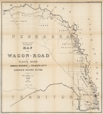
Campbell, Albert
Full Title
Map of the Wagon-Road from Platte River via Omaha Reserve and Dakota City to Running Water River. Geo. L. Sites, Supt. 1858. T.S. Wagner's Lith. Philada. Department of the Interior, Pacific Wagon Roads. (Sen. Ex. Doc. No. 36. Ho. Ex. Doc. No. 108 - 2nd Sess. 35 Cong.)
Publisher
T.S. Wagner's Lith.
1-11 of 11
|