|
REFINE
Browse All : Book Map of Minnesota
1-7 of 7
Author
Stevens, Isaac I.
Full Title
St. Paul to Riviere Des Lacs; from Explorations and Surveys made under the direction of the Hon. Jefferson Davis Secretary of War by Isaac I. Stevens, Governor of Washington Territory. 1853-4. Explorations and surveys for a railroad route from the Mississippi River to the Pacific Ocean. War Department. Route near the 47th and 49th parallels. Map No. 1.
Publisher
[A.O.P. Nicholson I-XI, T. Ford XII.]
Author
Geer, Everett S.
Full Title
Minnesota. Published Especially For Everett S. Geers' New Guide of the City of Saint Paul. Copyright, 1884, Rand McNally & Co.
Publisher
Everett S. Geer.
Author
Leahy, J.F.
Full Title
Leahy's Hotel Guide and Railway Distance Map of the State of Minnesota. Published by American Hotel Register Company. Leahy Build., 228-234 W. Ontario St., Chicago, Ill. Copyrighted by J.F. Leahy, Jan., 1934. (inset) Continuation of map.
Publisher
American Hotel register Co.
Author
Leahy, J.F.
Full Title
(Index to) Leahy's Hotel Guide and Railway Distance Maps. Minnesota.
Publisher
American Hotel register Co.
Author
Leahy, J.F.
Full Title
Leahy's Hotel Guide and Railway Distance Map of the State of Minnesota. Published by American Hotel Register Company. Leahy Build., 228-234 W. Ontario St., Chicago, Ill. Copyrighted by J.F. Leahy, Jan., 1934. (inset) Continuation of map.
Publisher
American Hotel register Co.
Author
Campbell, Albert
Full Title
Map of the Fort Ridgely & South Pass Road. To accompany the report of William H. Nobles, Superintendent, by Samuel A. Medary, Engr. 1858. T.S. Wagner's Lith., Philada. Drawn by John R. Key. (Sen. Ex. Doc. No. 36. Ho. Ex. Doc. No. 108 - 2nd Sess. 35 Cong.)
Publisher
T.S. Wagner's Lith.
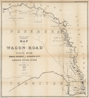
Author
Campbell, Albert
Full Title
Map of the Wagon-Road from Platte River via Omaha Reserve and Dakota City to Running Water River. Geo. L. Sites, Supt. 1858. T.S. Wagner's Lith. Philada. Department of the Interior, Pacific Wagon Roads. (Sen. Ex. Doc. No. 36. Ho. Ex. Doc. No. 108 - 2nd Sess. 35 Cong.)
Publisher
T.S. Wagner's Lith.
1-7 of 7
|