Browse All

1845 Hudson River and Vicinity Guide Book Hudson River and Vicinity. (engraved by) … |

1870 Map And Street Directory Of San Francisc … Guide Book Map Of San Francisco From the Latest Sur … |

1836 Map Of The Roads, Canals & Rail Roads of … Guide Book The Traveller's Guide or Map Of The Road … |

1836 New York Guide Book New York. (to accompany) The American Tr … |

1836 Boston Guide Book Boston. (to accompany) The American Trav … |

1836 Baltimore Guide Book Baltimore (to accompany) The American Tr … |

1836 Views: Breed's Hill And Mauch Chunk Guide Book (Views to) Breed's Hill, From Buncker Hi … |

1882 Faust's Map & Guide Of San Francisco Guide Book Faust's Map & Guide Of San Francisco. Pu … |

1920 Denver Green Guide Guide Book Clason's Guide Map Of Denver Colorado. P … |

1836 Map Of The State of New York With the La … Guide Book Map Of The State of New York With the La … |

1836 Hudson River and Vicinity. Guide Book Hudson River and Vicinity. |

1836 Miniature Plan of the City of New-York Guide Book Miniature Plan of the City of New-York. … |

1834 Map Of The Roads, Canals & Rail Roads of … Guide Book The Traveller's Guide or Map Of The Road … |

1834 Philadelphia And Environs Guide Book Philadelphia and Environs. (to accompany … |

1834 New York Guide Book New York (to accompany) The American Tra … |

1834 Boston Guide Book Boston (to accompany) The American Trave … |

1834 Baltimore Guide Book Baltimore (to accompany) The American Tr … |

1856 Reconnoissances in the Dacota Country. Exploration Book Reconnoissances in the Dacota Country By … |

1861 Map Of The Territory Of The United State … Exploration Book Map Of The Territory Of The United State … |

1874 A geological map of the Black Hills: by … Exploration Book A geological map of the Black Hills: by … |

1874 Map of a reconnaissance of the Black Hil … Exploration Book Map of a reconnaissance of the Black Hil … |

1874 Map of the Black Hills from a reconnaiss … Exploration Book Map of the Black Hills from a reconnaiss … |

1876 Judith Basin : drawn under the direction … Exploration Book Judith Basin : drawn under the direction … |

1876 Upper Geyser Basin : drawn under the dir … Exploration Book Upper Geyser Basin : drawn under the dir … |

1875 Map of a Reconnaissance From Carroll, Mo … Exploration Book Map of a Reconnaissance From Carroll, Mo … |

1879 Sketch of Black Rock and vicinity, Utah … Exploration Book Sketch of Black Rock and vicinity, Utah … |

1879 Comparative map of Great Salt Lake, Utah … Exploration Book Comparative map of Great Salt Lake, Utah … |

1878 Map of Utah territory : representing the … Exploration Book Map of Utah territory : representing the … |

1878 Map of the United States exhibiting the … Exploration Book Map of the United States exhibiting the … |

1879 Rain chart of the United States Exploration Book Rain chart of the United States : showin … |

1869 Tehuantepec Railway Company's chart of t … Survey Book Tehuantepec Railway Company's chart of t … |

1869 Map of the Isthmus of Tehuantepec: showi … Survey Book Map of the Isthmus of Tehuantepec: showi … |
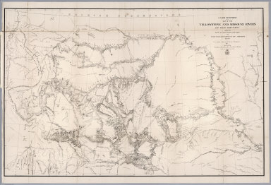
1868 Map of the Yellowstone and Missouri Rive … Exploration Book U.S. War Department : Map of the Yellows … |

1885 Plate XLIV: Post - quaternary fault line … Geology Book Post - quaternary fault lines. Julius Bi … |
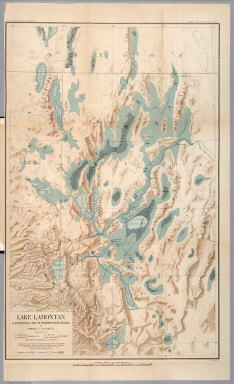
1885 Plate XLVI: Lake Lahontan : a quaternary … Geology Book Lake Lahontan : a quaternary lake of nor … |

1677 A map of New England Geography Book A map of New England, being the first th … |

1849 No. 1. World map on a Mercator Projectio … Gov't Report Book No. 1 (World map on a Mercator Projectio … |

1849 No. 2. A map of North America showing po … Gov't Report Book No. 2 ( A map of North America showing p … |

1866 No.I. General map of the American Isthmu … Survey Book No.I. General map of the American Isthmu … |

1866 No.II. Profiles of the Isthmus of Tehuan … Survey Book No.II. Profiles of the Isthmus of Tehnan … |

1866 No.III. Map of vertical section of the p … Survey Book No.III. Map of vertical section of the p … |

1866 No.IV. Map and profile of the route from … Survey Book No.IV. Map and profile of the route from … |

1866 No.V. Map of the Isthmus between Chagres … Survey Book No.V. Map of the Isthmus between Chagres … |

1866 No.VI. Central america. Panama rail road Survey Book No.VI. Panama rail road : Central Americ … |

1866 No.VII. Map and profile of the route for … Survey Book No.VII. Map and profile of the route for … |

1866 No.VIII. Isthmus of Darien Survey Book No.VIII. Isthmus of Darien. Map showing … |

1866 No.IX. Map of part of the Isthmus of Dar … Survey Book No.IX. Map of part of the Isthmus of Dar … |

1866 No.X. Map of an exploration for an inter … Survey Book No.X. Map of an exploration for an inter … |

1866 No.XI. General sketch of the survey for … Survey Book No.XI. General sketch of the survey for … |

1866 No.XII. Interoceanic ship canal via Atra … Survey Book No.XII. Interoceanic ship canal via Atra … |