Browse All

1866 No.XIII. Isthmus of Darien from 77(degre … Survey Book No.XIII. Isthmus of Darien from 77(degre … |

1837 Route of the Western railroad. West of C … Pamphlet Route of the Western railroad. West of C … |

1837 Route of the Western railroad. East of C … Pamphlet Route of the Western railroad. East of C … |

1828 Plan of a survey for the proposed Boston … Gov't Report Book Plan of a survey for the proposed Boston … |

1840 A new map of New York with its canals, r … Guide Book A new map of New York with its canals, r … |

1840 A new map of Pennsylvania with its canal … Guide Book A new map of Pennsylvania with its canal … |

1840 Profile of the Erie Canal. Profile of th … Guide Book Profile of the Erie Canal N.Y. ; Profile … |

1840 Profile of the Florida Canal ; Morris Ca … Guide Book Florida Canal ; Morris Canal N. J. ; Uni … |

1840 Map of the canals & railroads of the Uni … Guide Book Map of the canals & railroads of the Uni … |

1857 Comparison of temperatures for the tempe … Survey Book Comparison of temperatures for the tempe … |

1857 Comparison of temperatures for the tempe … Survey Book Comparison of precipitation for the temp … |

1857 Isothermal chart: Mean distribution of h … Survey Book Isothermal chart: Mean distribution of h … |

1857 Isothermal chart: Mean distribution of h … Survey Book Isothermal chart: Mean distribution of h … |

1857 Isothermal chart: Mean distribution of h … Survey Book Isothermal chart: Mean distribution of h … |

1857 Isothermal chart: Mean distribution of h … Survey Book Isothermal chart: Mean distribution of h … |

1857 Isothermal chart: Mean distribution of h … Survey Book Isothermal chart: Mean distribution of h … |

1857 Hyetal or rain chart: Mean distribution … Survey Book Hyetal or rain chart: Mean distribution … |

1857 Hyetal or rain chart: Mean distribution … Survey Book Hyetal or rain chart: Mean distribution … |

1857 Hyetal or rain chart: Mean distribution … Survey Book Hyetal or rain chart: Mean distribution … |

1857 Hyetal or rain chart: Mean distribution … Survey Book Hyetal or rain chart: Mean distribution … |

1857 Hyetal or rain chart: Mean distribution … Survey Book Hyetal or rain chart: Mean distribution … |

1846 United States and northern Mexico. Drawn … Gov't Report Book (Map, without a title, United States and … |

1861 Index map of initial levelling in Englan … Survey Book Index map of initial levelling in Englan … |

1861 Vol. 2: Tidal Stations Survey Book Tidal Stations. (to accompany) Ordnance … |

1858 Map illustrating Baldwin Mollhausen's tr … Exploration Book Map illustrating Baldwin Mollhausen's tr … |

1885 Plate I: Quaternary lakes of the Great B … Geology Book Quaternary lakes of the Great Basin. Jul … |

1885 Plate II: Routes traveled and areas surv … Geology Book Routes traveled and areas surveyed. Juli … |

1885 Plate III: Pre-Quternary fault lines Geology Book Pre-Quternary fault lines. Julius Bien & … |

1885 Plate IV: Map of Lake Lahontan Geology Book Map of Lake Lahontan : showing water are … |

1885 Plate V: Depth of Lake Lahontan at highe … Geology Book Depth of Lake Lahontan at highest water … |

1885 Plate VI: Map showing land classificatio … Geology Book Map showing land classification of Lahon … |

1885 Plate VII: Carson Desert, Nevada Geology Book Carson Desert, Nevada. Julius Bien & Co. … |

1885 Plate VIII: Springs of the Lahontan Regi … Geology Book Springs of the Lahontan Region. Julius B … |

1885 Plate IX: Pyramid and Winnemucca Lakes, … Geology Book Pyramid and Winnemucca Lakes, Nevada. W. … |

1885 Plate X: Anaho Island, Pyramid Lake, Nev … Geology Book Anaho Island, Pyramid Lake, Nevada. W.D. … |

1885 Plate XV: Walker Lake, Nevada Geology Book Walker Lake, Nevada. W.D. Johnson, Topog … |

1885 Plate XVI: Soda Lakes near Ragtown, Neva … Geology Book Soda Lakes near Ragtown, Nevada. W.D. Jo … |

1885 Plate XVIII: Gravel embarkment at west e … Geology Book Gravel embarkments at west end of Humbol … |

1885 Plate XIX: Gravel embarkments on south b … Geology Book Gravel embarkments on south border of th … |

1885 Plate XX: Gravel embarkments at Buffalo … Geology Book Gravel embarkments at Buffalo Springs, N … |

1885 Plate XXI: Gravel embarkments three mile … Geology Book Gravel embarkments three miles south of … |

1885 Plate XXIX: Present drainage areas of th … Geology Book Present drainage areas of the Lahontan R … |

1885 Plate XXXI: Water surface on Lake Lahont … Geology Book Water surface on Lake Lahontan at thinol … |

1857 Frontispiece: Geometrical projection of … Survey Book (Frontispiece to) Geometrical projection … |
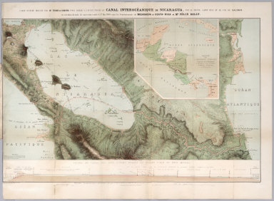
1858 Carte D'Etude Pour Le Trace Et Le Profil … Survey Book Carte d'etude dressee par Mr. Thome de G … |

1852 No.1. Map of the Isthmus of Tehuantepec Separate Map Map of the Isthmus of Tehuantepec, embra … |

1851 No.2. Plan of that part of the Isthmus o … Separate Map Plan of that part of the Isthmus of Tehu … |

1880 Map Showing Geographical Divisions of th … Exploration Book Map Showing Geographical Divisions of th … |

1819 Vincennes district. Exploration Book Vincennes district. Drawn by David Thoma … |

1893 22. Clippings. City Atlas (Clippings) Harlem lands. A stupendous m … |