Who What Where WhenWHO
|
REFINE
Browse All : Text Page and Boundaries of Alaska and British Columbia and CanadaAuthor
[Bligh, William, 1754-1817, Cook, James, 1728-1779]
Full Title
Christmas Island. Latitude 1058' N. Longitude 202028' E. Discovered in the ships Resolution and Discovery, 1777 ... (By William Bligh. London, G. Nicol and T. Cadell, 1785)
Publisher
G. Nicol and T. Cadell
Author
Cook, James, 1728-1779
Full Title
Sketch of Nootka Sound ... 1778. The writing engraved by Mw. Smith. (Copied by Lieut. Henry Roberts. London, G. Nicol and T. Cadell, 1785)
Publisher
G. Nicol and T. Cadell
Author
Cook, James, 1728-1779
Full Title
Chart of Cooks River in the N.W. part of America. Writing by W. Harrison. (Copied by Lieut. Henry Roberts. London, G. Nicol and T. Cadell, 1785)
Publisher
G. Nicol and T. Cadell
Author
[Bligh, William, 1754-1817, Cook, James, 1728-1779]
Full Title
Sketch of the harbour of Samganooda on the island Oonalaska. Harmar scr: (Copied by Lieut. Henry Roberts. London, G. Nicol and T. Cadell, 1785)
Publisher
G. Nicol and T. Cadell
Author
Cook, James, 1728-1779
Full Title
Chart of Norton Sound and of Bherings Strait made by the East Cape of Asia and the West Point of America. (Copied by Lieut. Henry Roberts. London, G. Nicol and T. Cadell, 1785)
Publisher
G. Nicol and T. Cadell
Author
[Bligh, William, 1754-1817, Cook, James, 1728-1779, Roberts, Henry, Lieut.]
Full Title
Chart of the Sandwich Islands. (with) Sketch of Karakakooa Bay. The writing by W. Harrison. (By Henry Roberts; after missing survey by William Bligh. London, G. Nicol and T. Cadell, 1785)
Publisher
G. Nicol and T. Cadell
Author
[Bligh, William, 1754-1817, Cook, James, 1728-1779]
Full Title
Plan of the Bay of Awatska on the east coast of Kamtschatka. (with) Plan of the harbour of St. Peter and St. Paul, surveyed by William Bligh, master of the Resolution. (Engraved by) W. H(arrison. London, G. Nicol and T. Cadell, 1785)
Publisher
G. Nicol and T. Cadell
Author
[Bligh, William, 1754-1817, Cook, James, 1728-1779]
Full Title
Sketch of the Typa and Macao. (Engraved by) W. H(arrison after a missing survey by William Bligh. London, G. Nicol and T. Cadell, 1785)
Publisher
G. Nicol and T. Cadell
Author
[Cook, James, 1728-1779, Roberts, Henry, Lieut.]
Full Title
A general chart: exhibiting the discoveries made by Captn. James Cook in this and his two preceding voyages, with the tracks of the ships under his command. By Lieut. Heny. Roberts of his Majesty's Royal Navy. W. Palmer sculp. (London, G. Nicol and T. Cadell, 1785)
Publisher
G. Nicol and T. Cadell
Author
Cook, James, 1728-1779
Full Title
Chart of the N.W. coast of America and N.E. coast of Asia explored in the years 1778 & 1779. The unshaded parts of the coast of Asia are taken from a MS chart received from the Russians. Writing engraved by T. Harmar. (Copied by Lieut. Henry Roberts. London, G. Nicol and T. Cadell, 1785)
Publisher
G. Nicol and T. Cadell
Author
Central Vermont Railroad Company
Full Title
Map of the White Mountains and vicinity. (Boston: Frank Wood, 1879)
Publisher
Frank Wood
Author
Central Vermont Railroad Company
Full Title
Central Vermont Railroad excursion routes. Engraved in relief by Photo-Electrotype Co., 171 Devonshire St., Boston. (inset) Railway & steam ship lines connecting with and in the provinces of Nova Scotia, New Brunswick & Prince Edward Id. (1879)
Publisher
Frank Wood
Author
Central Vermont Railroad Company
Full Title
Map of the Central Vermont Railroad and its connections. National Railway Publication Co., Phil. (1879)
Publisher
Frank Wood
Author
New York Central Railroad Company
Full Title
The heart of New York Grand Central Terminal. Only railway station on the subway, elevated and surface lines. New York Central Lines. Copyright, by Rand, McNally & Co., 1918, New York & Chicago.
Publisher
Rand McNally
Author
New York Central Railroad Company
Full Title
Map of the New York Central Lines ... The Matthews-Northrup Works, Buffalo, N.Y.
Publisher
Rand McNally
Author
[Byron, John, 1723-1786, Hawkesworth, John, 1715?-1773]
Full Title
Cordes Bay and Harbour. (with) Port Famine. (with) Woods Bay. (with) Port Gallant and Fortescue Bay. (London: printed for W. Strahan; and T. Cadell in the Strand, MDCCLXXIII)
Publisher
W. Strahan and T. Cadell
Author
[Byron, John, 1723-1786, Hawkesworth, John, 1715?-1773]
Full Title
Cape Providence with the bay and anchoring places to the N.N.E. of it. (with) St. David's Cove. (with) Island Bay. (with) Puzling Bay. (with) Cape Upright Bay. (with) Dolphin Bay. (London: printed for W. Strahan; and T. Cadell in the Strand, MDCCLXXIII)
Publisher
W. Strahan and T. Cadell
Author
[Byron, John, 1723-1786, Hawkesworth, John, 1715?-1773]
Full Title
From York Bay to Three Island Bay and Harbour. (with) Elizabeth Bay. (with) A bay under the islands opposite York Road. (with) St. Davids Bay. (London: printed for W. Strahan; and T. Cadell in the Strand, MDCCLXXIII)
Publisher
W. Strahan and T. Cadell
Author
[Byron, John, 1723-1786, Hawkesworth, John, 1715?-1773]
Full Title
A chart of Hawkins's Maidenland, discovered by Sr. Richard Hawkins in 1574 and Falkland Sound, so called by Capn. John Strong of the Farewell from London who sailed through it in 1689. Isa: Noual sculp. No. 23. [London: printed for W. Strahan; and T. Cadell in the Strand, MDCCLXXIII).
Publisher
W. Strahan and T. Cadell
Author
[Hawkesworth, John, 1715?-1773, Wallis, Samuel, 1728-1795]
Full Title
(Cocos Island called by C. Wallis Boscawen. Traitors Island called by C. Wallis Keppel. London: printed for W. Strahan; and T. Cadell in the Strand, MDCCLXXIII).
Publisher
W. Strahan and T. Cadell
Author
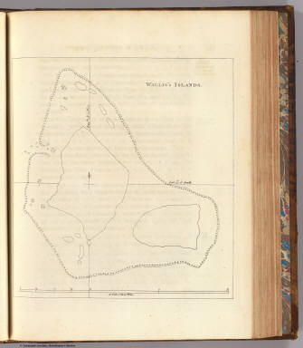
[Hawkesworth, John, 1715?-1773, Wallis, Samuel, 1728-1795]
Full Title
Wallis's Islands. (London: printed for W. Strahan; and T. Cadell in the Strand, MDCCLXXIII).
Publisher
W. Strahan and T. Cadell
Author
[Carteret, Philip, d. 1796, Hawkesworth, John, 1715?-1773]
Full Title
Queen Charlotte's Islands. Bayly sculpt. Jany. 1st, 1773. (London: printed for W. Strahan; and T. Cadell in the Strand, MDCCLXXIII).
Publisher
W. Strahan and T. Cadell
Author
[Carteret, Philip, d. 1796, Hawkesworth, John, 1715?-1773]
Full Title
A chart of Captn. Carteret's discoveries at New Britain, with part of Captn. Cooke's passage thro Endeavor Streights, & of Captn. Dampier's tract & discoveries in 1699, & 1700, at New Guinea and New Britain. Engraved by W. Whitchurch, Pleasant Row, Islington. (London: printed for W. Strahan; and T. Cadell in the Strand, MDCCLXXIII).
Publisher
W. Strahan and T. Cadell
Author
[Carteret, Philip, d. 1796, Hawkesworth, John, 1715?-1773]
Full Title
A dangerous shoal seen Septr. the 28, 1767. (with) Joseph Freewills Islands. (with) The south end of Mindanao. (London: printed for W. Strahan; and T. Cadell in the Strand, MDCCLXXIII).
Publisher
W. Strahan and T. Cadell
Author
[Carteret, Philip, d. 1796, Hawkesworth, John, 1715?-1773]
Full Title
A draught of Bonthain Bay situated about 30 leagues to the S.E. of Macassar in the Island of Celebes. Publish'd Novr. 4th, 1772. (London: printed for W. Strahan; and T. Cadell in the Strand, MDCCLXXIII).
Publisher
W. Strahan and T. Cadell
Author
[Cook, James, 1728-1779, Hawkesworth, John, 1715?-1773]
Full Title
A plan of Success Bay in Strait le Maire. A chart of the S.E. part of Terra del Fuego including Strait le Maire and part of Staten-land by Lieutenant J. Cook 1769. T. Bowen & J. Gibson sculp. (London: printed for W. Strahan; and T. Cadell in the Strand, MDCCLXXIII).
Publisher
W. Strahan and T. Cadell
Author
[Cook, James, 1728-1779, Hawkesworth, John, 1715?-1773]
Full Title
Chart of the island Otaheite, by Lieut. J. Cook, 1769. J. Cheevers sculp. (London: printed for W. Strahan; and T. Cadell in the Strand, MDCCLXXIII).
Publisher
W. Strahan and T. Cadell
Author
[Cook, James, 1728-1779, Hawkesworth, John, 1715?-1773]
Full Title
Chart of the Society Isles, discovered by Lieut. J. Cook, 1769. J. Cheevers sculpsit. (London: printed for W. Strahan; and T. Cadell in the Strand, MDCCLXXIII).
Publisher
W. Strahan and T. Cadell
Author
[Cook, James, 1728-1779, Hawkesworth, John, 1715?-1773]
Full Title
Matavia (i.e. Matavai) Bay in Otaheite. Owharre Harbour in Huaheine. Ohamaneno Harbour in Ulietea. Oopoa Harbour in Ulietea. J. Cheevers sculp. (London: printed for W. Strahan; and T. Cadell in the Strand, MDCCLXXIII).
Publisher
W. Strahan and T. Cadell
Author
Southern Pacific Company
Full Title
The Great Sunset Route. Shortest Line between the Atlantic and the Pacific Oceans... Boston Agency: 192 Washington Street 192. General Eastern Agency: New York city, 339 Broadway. (with) Map of summer & winter resorts and other places upon and near the Central & Southern Pacific railroads in California. D. Van Vleck S.F. Eng. F.T. Newbery Del. (with catalog) A List of Government And Railroad Lands in California, Open to Preemption or Homestead or to Purchase. Southern Pacific Company, New Orleans to San Francisco Via the Sunset Route. With Complements of the New York General Agency. 339 Broadway. L.H. Nutting, Eastern passenger Agent. E. Hawley, Genl. Eastern Agent.
Publisher
Southern Pacific Company
Author
Southern Pacific Company
Full Title
Map of summer & winter resorts and other places upon and near the Central & Southern Pacific railroads in California. D. Van Vleck S.F. Eng. F.T. Newbery Del. (with map)The Great Sunset Route. Shortest Line between the Atlantic and the Pacific Oceans... Boston Agency: 192 Washington Street 192. General Eastern Agency: New York city, 339 Broadway. (with catalog) A List of Government And Railroad Lands in California, Open to Preemption or Homestead or to Purchase. Southern Pacific Company, New Orleans to San Francisco Via the Sunset Route. With Complements of the New York General Agency. 339 Broadway. L.H. Nutting, Eastern passenger Agent. E. Hawley, Genl. Eastern Agent.
Publisher
Southern Pacific Company
Author
[Cook, James, 1728-1779, Hawkesworth, John, 1715?-1773]
Full Title
Chart of New-Zealand, explored in 1769 and 1770 by Lieut. I: Cook, Commander of His Majesty's Bark Endeavour. Engrav'd by I. Bayly. Publish'd as the act directs 1st Jany. 1772. (London: printed for W. Strahan; and T. Cadell in the Strand, MDCCLXXIII).
Publisher
W. Strahan and T. Cadell
Author
[Cook, James, 1728-1779, Hawkesworth, John, 1715?-1773]
Full Title
River Thames and Mercury Bay in New Zealand. (with) Bay of Islands in New Zealand. (with) Tolaga Bay in New Zealand. (London: printed for W. Strahan; and T. Cadell in the Strand, MDCCLXXIII).
Publisher
W. Strahan and T. Cadell
Author
[Cook, James, 1728-1779, Hawkesworth, John, 1715?-1773]
Full Title
Chart of Cook's Strait in New Zealand. John Ryland sculp. (London: printed for W. Strahan; and T. Cadell in the Strand, MDCCLXXIII).
Publisher
W. Strahan and T. Cadell
Author
[Cook, James, 1728-1779, Hawkesworth, John, 1715?-1773]
Full Title
A chart of New South Wales, on the east coast of New-Holland. Discovered and explored by Lieutenant J: Cook, Commander of his Majesty's Bark Endeavour, in the year MDCCLXX. Engraved by W. Whitchurch, Bartholomew Lane, Royal Exchange. (London: printed for W. Strahan; and T. Cadell in the Strand, MDCCLXXIII).
Publisher
W. Strahan and T. Cadell
Author
[Cook, James, 1728-1779, Hawkesworth, John, 1715?-1773]
Full Title
Entrance of Endeavour River in New South Wales. Botany Bay in New South Wales. J. Gibson & T. Bowen sculp. (London: printed for W. Strahan; and T. Cadell in the Strand, MDCCLXXIII).
Publisher
W. Strahan and T. Cadell
Author
[Cook, James, 1728-1779, Hawkesworth, John, 1715?-1773]
Full Title
Chart of part of the coast of New South Wales, from Cape Tribulation to Endeavour Straits, by Lieut. J. Cook, 1770. J. Cheevers sculpt. (London: printed for W. Strahan; and T. Cadell in the Strand, MDCCLXXIII).
Publisher
W. Strahan and T. Cadell
Author
Cook, James, 1728-1779
Full Title
A chart of the Southern Hemisphere; shewing the tracks of some of the most distinguished navigators: by Captain James Cook of his Majesty's Navy. Gulielmus Whitchurch, sculpsit; Anno. 1776. Published Febry. 1st., 1777 by Wm. Strahan in New Street, Shoe Lane & Thos. Cadell in the Strand, London.
Publisher
W. Strahan and T. Cadell
Author
Cook, James, 1728-1779
Full Title
Port Praya in the island St. Jago, one of the Cape de Verds. Published Feby. 1st., 1777 by Wm. Strahan in New Street, Shoe Lane & Thos. Cadell in the Strand, London. No. X.
Publisher
W. Strahan and T. Cadell
Author
Cook, James, 1728-1779
Full Title
Sketch of Dusky Bay in New Zeeland; 1773. (with) Pickersgill Harbour. W. Whitchurch sculpsit, Islington, 1776. No. XIII. Published Febry. 1st., 1777 by Wm. Strahan in New Street, Shoe Lane & Thos. Cadell in the Strand, London.
Publisher
W. Strahan and T. Cadell
Author
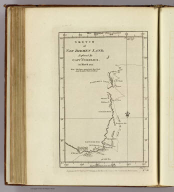
Furneaux, Tobias, 1735-1781
Full Title
Sketch of Van Diemen Land, explored by Captn. Furneaux, in March 1773. J Russell sculpt. No. VIII. Published Febry. 1st., 1777, by Wm. Strahan in New Street, Shoe Lane & Thos. Cadell in the Strand, London.
Publisher
W. Strahan and T. Cadell
Author
Cook, James, 1728-1779
Full Title
Chart of the Friendly Isles. No. XIV. Published Febry. 1st, 1777 by Wm. Strahan in New Street, Shoe Lane & Thos. Cadell in the Strand, London.
Publisher
W. Strahan and T. Cadell
Author
Cook, James, 1728-1779
Full Title
Easter Island. W. Whitchurch sculpt., 1776. Published Febry. 1st, 1777 by Wm. Strahan in New Street, Shoe Lane & Thos. Cadell in the Strand, London. No. IX.
Publisher
W. Strahan and T. Cadell
Author
Cook, James, 1728-1779
Full Title
Sketch of the Marquesas de Mendoca. (with) Resolution Bay or Port Madre de Dios. J. Russell sculpsit. No. V. Published Febry. 1st, 1777 by Wm. Strahan in New Street, Shoe Lane & Thos. Cadell in the Strand, London.
Publisher
W. Strahan and T. Cadell
Author
Cook, James, 1728-1779
Full Title
Harvey's Isle. Palmerston Isle. Turtle Isle. Savage Isle. No. XII. Published Febry. 1st, 1777 by Wm. Strahan in New Street, Shoe Lane & Thos. Cadell in the Strand, London.
Publisher
W. Strahan and T. Cadell
Author
Cook, James, 1728-1779
Full Title
Chart of discoveries made in the South Pacific Ocean in his majesty's ship Resolution under the command of Captain Cook, 1774. Published as the act directs Feby. 1st, 1776. Engraved by W. Palmer. Published Febry. 1st, 1777 by Wm. Strahan in New Street, Shoe Lane & Thos. Cadell in the Strand, London.
Publisher
W. Strahan and T. Cadell
Author
Cook, James, 1728-1779
Full Title
Port Resolution in the Isle of Tanna. (with) Port Sandwich in Mallicollo. (with) Harbour of Balade in New Caledonia. No. XI. Published Febry. 1st, 1772 by Wm. Strahan in New Street, Shoe Lane & Thos. Cadell in the Strand, London.
Publisher
W. Strahan and T. Cadell
Author
Cook, James, 1728-1779
Full Title
Norfolk Isle. No. VI. Published Febry. 1st, 1777 by Wm. Strahan in New Street, Shoe Lane & Thos. Cadell in the Strand, London.
Publisher
W. Strahan and T. Cadell
Author
Cook, James, 1728-1779
Full Title
Christmas Sound on the S.W. coast of Terra (sic) del Fuego. No. VII. Published Febry. 1st, 1777 by Wm. Strahan in New Street, Shoe Lane & Thos. Cadell in the Strand, London.
Publisher
W. Strahan and T. Cadell
Author
Disturnell, John
Full Title
Agricultural Map of the United States and Canada. To accompany "Influence of Climate" by J. Disturnell. Lthographed by Rae Smith, 120 Nassau St., N.Y.i
Publisher
D. Van Nostrand
|