Browse All

1901 Linea Divisoria Entre Mexico Y Los Estad … Regional Atlas Boundary between the United States and M … |

1901 Linea Divisoria Entre Mexico Y Los Estad … Regional Atlas Boundary between the United States and M … |

1901 Linea Divisoria Entre Mexico Y Los Estad … Regional Atlas Boundary between the United States and M … |

1901 Linea Divisoria Entre Mexico Y Los Estad … Regional Atlas Boundary between the United States and M … |

1901 Linea Divisoria Entre Mexico Y Los Estad … Regional Atlas Boundary between the United States and M … |
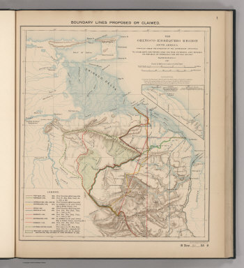
1897 Boundaries Claimed or Proposed. National Atlas Boundary Lines Proposed or Claimed. 1. S … |

1897 Forests and Savannas. National Atlas Forests and Savannas. 2. S Doc 91 55 2. … |

1818 Missouri Territory formerly Louisiana. World Atlas Missouri Territory formerly Louisiana. B … |

1878 Historical Maps of the United States. World Atlas Gray's Historical Maps of the United Sta … |