Who What Where WhenREMOVEWHERE
|
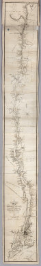
Author
Tanner, Henry S.
Full Title
The Travellers Guide or Map of the Roads, Canals & Rail Roads of The United States, With the Distances From Place to Place. By H.S. tanner 1844. Published by H.S. Tanner... Philadelphia. Entered ... 1834, by H.S. Tanner ... Pennsylvania.
Publisher
T.R. Tanner
Author
Williams, Wellington
Full Title
A New Map of the United States. Upon Which Are Delineated its Vast Works of Internal communication ... Showing also Canada and the Island of Cuba. By W. Williams. Philadelphia. Published by Lippincott, Grambo & Co. ... 1854. (to accompany) The Traveller's and Tourist's Guide Through the United States of America, Canada, etc. Containing the Routes of Travel by Railroad, Steamboat, Stage and Canal ... Accompanied by an Entirely New and Authentic Map of the United States, Including California, Oregon, etc., and a Map of the Island of Cuba. By W. Williams. Philadelphia: Lippincott, Grambo & Co. MDCCCLIV. (on verso) Entered ... 1851, by W. Williams ... Pennsylvania. Stereotyped by J.Fagan. Printed by T.K. & P.G. Collins. Includes: (4 additional inset maps).
Publisher
Lippincott, Grambo & Co.
Author
Tanner, Henry S.
Full Title
(Covers to) The American Traveller; Or Guide Through the United States. Containing Brief Notices of the Several States, Cities, Principal Towns ... Alphabetically arranged, Eighth Edition. By H.S. Tanner. Philadelphia: Published by H. Tanner, Jr. New York: T.R. Tanner. 1842. (on verso) Entered ... 1839, by H.S. Tanner ... Pennsylvania. With direct References to the accompanying Map "The Travellers Guide or Map of the Roads, Canals, and Railways of the United States. With the distances from place to place by H.S. Tanner.
Publisher
H. Tanner Jr.
Author
Tanner, Henry S.
Full Title
(Title Page to) The American Traveller; Or Guide Through the United States. Containing Brief Notices of the Several States, Cities, Principal Towns ... Alphabetically arranged, Eighth Edition. By H.S. Tanner. Philadelphia: Published by H. Tanner, Jr. New York: T.R. Tanner. 1842. (on verso) Entered ... 1839, by H.S. Tanner ... Pennsylvania. With direct References to the accompanying Map "The Travellers Guide or Map of the Roads, Canals, and Railways of the United States. With the distances from place to place by H.S. Tanner.
Publisher
H. Tanner Jr.
Author
Tanner, Henry S.
Full Title
The Travellers Guide or Map of the Roads, Canals, and Railways of the United States. With the Distances from Place to Place by H.S. Tanner. (with inset 8 inset maps). (with the accompanying guide) The American Traveller; Or Guide Through the United States. Containing Brief Notices of the Several States, Cities, Principal Towns ... Alphabetically arranged, Eighth Edition. By H.S. Tanner. Philadelphia: Published by H. Tanner, Jr. New York: T.R. Tanner. 1842. (on verso) Entered ... 1839, by H.S. Tanner ... Pennsylvania.
Publisher
H. Tanner Jr.
Author
Tanner, Henry S.
Full Title
Baltimore
Publisher
H. Tanner Jr.
Author
Tanner, Henry S.
Full Title
New York
Publisher
H. Tanner Jr.
Author
Tanner, Henry S.
Full Title
Philadelphia and Environs
Publisher
H. Tanner Jr.
Author
Tanner, Henry S.
Full Title
Manuscript Drawing
Publisher
H. Tanner Jr.
Author
Smith, J. Calvin
Full Title
(Covers to) The Illustrated Hand-Book, A New Guide for Travelers Through The United States of America... Embellished with 125 highly finished Engravings. Accompanied By A Large and Accurate Map. By J. Calvin Smith. New York: Published By Sherman & Smith, 122 Broadway, N.W. Cor. Cedar-St. 1847. Entered ...1846, by Sherman & Smith ... (with) A New Map For Travellers Through the United States of America Showing the Railroads, Canals & Stage Roads, With The Distances, by J. Calvin Smith. Published by Sherman & Smith, New-York. 1846. Entered ... 1846, by J. Calvin Smith ... (inset) Map Of Oregon Northern California Santa Fe &c. (4 additional inset maps).
Publisher
Sherman & Smith
Author
Smith, J. Calvin
Full Title
(Title Page to) The Illustrated Hand-Book, A New Guide for Travelers Through The United States of America... Embellished with 125 highly finished Engravings. Accompanied By A Large and Accurate Map. By J. Calvin Smith. New York: Published By Sherman & Smith, 122 Broadway, N.W. Cor. Cedar-St. 1847. Entered ...1846, by Sherman & Smith ... (with) A New Map For Travellers Through the United States of America Showing the Railroads, Canals & Stage Roads, With The Distances, by J. Calvin Smith. Published by Sherman & Smith, New-York. 1846. Entered ... 1846, by J. Calvin Smith ... (inset) Map Of Oregon Northern California Santa Fe &c. (4 additional inset maps).
Publisher
Sherman & Smith
Author
Smith, J. Calvin
Full Title
The Illustrated Hand-Book, A New Guide for Travelers Through The United States of America... Embellished with 125 highly finished Engravings. Accompanied By A Large and Accurate Map. By J. Calvin Smith. New York: Published By Sherman & Smith, 122 Broadway, N.W. Cor. Cedar-St. 1847. Entered ...1846, by Sherman & Smith ... (with) A New Map For Travellers Through the United States of America Showing the Railroads, Canals & Stage Roads, With The Distances, by J. Calvin Smith. Published by Sherman & Smith, New-York. 1846. Entered ... 1846, by J. Calvin Smith ... (inset) Map Of Oregon Northern California Santa Fe &c. (4 additional inset maps).
Publisher
Sherman & Smith
Author
Tanner, Henry S.
Full Title
(Covers to) The American Traveller; Or Guide Through the United States. Containing Brief Notices of the Several States, Cities, Principal Towns ... Sixth Edition. By H.S. Tanner. Philadelphia: Published by the Author, No. 309 Market Street. 1840. (on verso) Entered ... 1839, by H.S. Tanner ... Pennsylvania.
Publisher
Henry S. Tanner
Author
Tanner, Henry S.
Full Title
(Title Page to) The American Traveller; Or Guide Through the United States. Containing Brief Notices of the Several States, Cities, Principal Towns ... Sixth Edition. By H.S. Tanner. Philadelphia: Published by the Author, No. 309 Market Street. 1840. (on verso) Entered ... 1839, by H.S. Tanner ... Pennsylvania.
Publisher
Henry S. Tanner
Author
Tanner, Henry S.
Full Title
The Travellers Guide or Map of the Roads, Canals & Rail Roads of the United States, With the distances from place to place by H.S. Tanner. (with) "The American Traveller; Or Guide Through the United States. Containing Brief Notices of the Several States, Cities, Principal Towns ... Sixth Edition. By H.S. Tanner. Philadelphia: Published by the Author, No. 309 Market Street. 1840. (on verso) Entered ... 1839, by H.S. Tanner ... Pennsylvania".
Publisher
Henry S. Tanner
Author
Mitchell, Samuel Augustus
Full Title
(Covers to) Mitchell's Compendium Of The Internal Improvements Of The United States; Comprising General Notices Of All The Most Important Canals and Rail-Roads... Philadelphia: Published By Mitchell & Hinman, No. 6 North-Fifth Street. 1835. (on verso) Entered ... 1835, by Mitchell & Hinman ... Pennsylvania. Stereotyped by John Fagan ... Philadelphia. (with) Mitchell's Map Of The United States Showing the Principal Travelling, Turnpike and Common Roads ... Philadelphia: Published By S. Augustus Mitchell. 1835. Sold by Mitchell & Hinman No. 6 North Fifth Street. Entered ... 1835, by S. Augustus Mitchell... Pennsylvania. (with 8 inset maps).
Publisher
S.A. Mitchell
Author
Mitchell, Samuel Augustus
Full Title
(Title Page to) Mitchell's Compendium Of The Internal Improvements Of The United States; Comprising General Notices Of All The Most Important Canals and Rail-Roads... Philadelphia: Published By Mitchell & Hinman, No. 6 North-Fifth Street. 1835. (on verso) Entered ... 1835, by Mitchell & Hinman ... Pennsylvania. Stereotyped by John Fagan ... Philadelphia. (with) Mitchell's Map Of The United States Showing the Principal Travelling, Turnpike and Common Roads ... Philadelphia: Published By S. Augustus Mitchell. 1835. Sold by Mitchell & Hinman No. 6 North Fifth Street. Entered ... 1835, by S. Augustus Mitchell... Pennsylvania. (with 8 inset maps).
Publisher
S.A. Mitchell
Author
Mitchell, Samuel Augustus
Full Title
Mitchell's Map Of The United States Showing the Principal Travelling, Turnpike and Common Roads ... Philadelphia: Published By S. Augustus Mitchell. 1835. Sold by Mitchell & Hinman No. 6 North Fifth Street. Entered ... 1835, by S. Augustus Mitchell... Pennsylvania. (with 8 inset maps). (with text) Mitchell's Compendium Of The Internal Improvements Of The United States; Comprising General Notices Of All The Most Important Canals and Rail-Roads... Philadelphia: Published By Mitchell & Hinman, No. 6 North-Fifth Street. 1835. (on verso) Entered ... 1835, by Mitchell & Hinman ... Pennsylvania. Stereotyped by John Fagan ... Philadelphia.
Publisher
S.A. Mitchell
Author
Rand McNally and Company
Full Title
Rand McNally standard map of the United States. Copyright by Rand McNally & Company, Chicago. Made in U.S.A.
Publisher
Rand McNally
Author
W. & A.K. Johnston Limited
Full Title
Central America Showing Relation of Panama & Nicaragua Canals. Nicaragua Canal. Lima, Callao. Panama Canal.
Publisher
W. & A.K. Johnston Limited
Author
Tanner, Henry S.
Full Title
The Travellers Guide Or Map Of the Roads, Canals & Rail Roads Of The United States, With the Distances From Place To Place. By H.S. Tanner. (to accompany) The American Traveller; Or Guide Through the United States. Containing Brief Notices of the Several States, Cities, Principal Towns ... Third Edition. By H.S. Tanner. Philadelphia: Published by the Author, No. 51 South Third Street. 1837. (on verso) Entered ... 1834, by H.S. Tanner ... Pennsylvania.
Publisher
H.S. Tanner
Author
Tanner, Henry S.
Full Title
Map Of The State Of New York With the Latest Improvements. Showing All The Canals & Railroads, & c. 1845. (to accompany) The Traveller's Hand Book for the State of New York, The Province of Canada, and Parts of the Adjoining States ... By Which Every Interesting Object on the Leading Routes is Brought into View. With Maps, Etc. Third Edition. By H.S. Tanner. New York: Published at the Geographical Establishment ... 1845. (on verso) Entered ... 1843, by H.S. Tanner ... New York.
Publisher
H.S. Tanner
Author
Tanner, Henry S.
Full Title
The Traveller's Guide or Map Of The Roads, Canals & Rail Roads of the United States. With the distances from place to place by H.S. Tanner." On bottom of map: "Entered ... 1834, by H.S. Tanner ... Pennsylvania. (to accompany) The American Traveller; Or Guide Through the United States. Containing Brief Notices of the Several States, Cities, Principal Towns ... With tables of Distances, ... Second Edition. By H.S. Tanner. Philadelphia: Published by the Author, Shakespeare Buildings. 1836. (on verso) Entered ... 1836, By H.S. Tanner ... Pennsylvania.
Publisher
H.S. Tanner
Author
Tanner, Henry S.
Full Title
(Title Page to) The American Traveller; Or Guide Through the United States. Containing Brief Notices of the Several States, Cities, Principal Towns ... By H.S. Tanner. Philadelphia: Published by the Author, Shakespeare Buildings. 1834. (on verso) Entered ... 1834, by H.S. Tanner ... Pennsylvania.
Publisher
H.S. Tanner
Author
Tanner, Henry S.
Full Title
The Traveller's Guide or Map Of The Roads, Canals & Rail Roads of the United States. With the distances from place to place by H.S. Tanner. " On bottom of map: "Published by H.S. Tanner. Entered ... 1834, by H.S. Tanner ... Pennsylvania. (to accompany) The American Traveller; Or Guide Through the United States. Containing Brief Notices of the Several States, Cities, Principal Towns ... By H.S. Tanner. Philadelphia: Published by the Author, Shakespeare Buildings. 1834. (on verso) Entered ... 1834, by H.S. Tanner ... Pennsylvania.
Publisher
H.S. Tanner
Author
Smith, J. Calvin
Full Title
(Covers to) A New Map For Travelers Through the United States of America Showing the Railroads, Canals & Stage Roads, With The Distances, by J. Calvin Smith. Published by Sherman & Smith New-York. MDCCCLII. Entered ... 1846, by J. Calvin Smith ... New York. (inset) Map Of Oregon Northern California Santa Fe &c. (4 additional inset maps).
Publisher
Sherman & Smith
Author
Smith, J. Calvin
Full Title
A New Map For Travelers Through the United States of America Showing the Railroads, Canals & Stage Roads, With The Distances, by J. Calvin Smith. Published by Sherman & Smith New-York. MDCCCLII. Entered ... 1846, by J. Calvin Smith ... New York. (inset) Map Of Oregon Northern California Santa Fe &c. (4 additional inset maps).
Publisher
Sherman & Smith
Author
Smith, J. Calvin
Full Title
A New Map For Travelers Through the United States of America Showing the Railroads, Canals & Stage Roads, With The Distances, by J. Calvin Smith. Published by Sherman & Smith New-York. MDCCCLIII. Entered ... 1846, by J. Calvin Smith ... New York. (inset) Map Of Oregon Northern California Santa Fe &c. (4 additional inset maps).
Publisher
Sherman & Smith
Author
Vandewater, Robert J.
Full Title
(Covers to) The Tourist, Or Pocket Manual For Travellers On The Hudson River, The Western Canal, And Stage Road ... New-York: Printed By J. & J. Harper, No. 82 Cliff-street. 1830. (with map) An Improved Map of the Hudson River, with the Post Roads between N. York & Albany. Published by S. Mahon & Co. Drawn & Engraved Expressly For The Tourist. 1830. W. Chapin Sc.
Publisher
J. & J. Harper
Author
Vandewater, Robert J.
Full Title
An Improved Map of the Hudson River, with the Post Roads between N. York & Albany. Published by S. Mahon & Co. Drawn & Engraved Expressly For The Tourist. 1830. W. Chapin Sc. (with) The Tourist, Or Pocket Manual For Travellers On The Hudson River, The Western Canal, And Stage Road ... New-York: Printed By J. & J. Harper, No. 82 Cliff-street. 1830.
Publisher
J. & J. Harper
Author
Jocelyn, N. & S.S.
Full Title
(Covers to) Map Exhibiting the Farmington, & Hampshire & Hampden Canals, Together with the Line of their proposed continuation through the Valley of the Connecticut River, to Canada. Engraved and published by N. & S.S. Jocelyn. New Haven, 1828. Entered ... August 1st 1828 by N. & S.S. Jocelyn ... Connt. (inset) Profile of the Canals. Surveys furnished by Davis Hurd Esqr. Chief Engineer.
Publisher
N. & S.S. Jocelyn
Author
Jocelyn, N. & S.S.
Full Title
Map Exhibiting the Farmington, & Hampshire & Hampden Canals, Together with the Line of their proposed continuation through the Valley of the Connecticut River, to Canada. Engraved and published by N. & S.S. Jocelyn. New Haven, 1828. Entered ... August 1st 1828 by N. & S.S. Jocelyn ... Connt. (inset) Profile of the Canals. Surveys furnished by Davis Hurd Esqr. Chief Engineer.
Publisher
N. & S.S. Jocelyn
Author
[White, James, Canada. Department of Interior]
Full Title
Department of Interior : Atlas of Canada, No. 22 : Canals, lighthouses and sailing routes : St. Lawrence and Great Lakes. (to accompany) Department of the Interior, Canada ... 1906. (inset) Cape Breton Island.
Publisher
Department of Interior
Author
Davis, Charles Henry
Full Title
(Title Page to) Report on Interocean Railroads & Canals between the waters of the Atlantic and Pacific Oceans. {Senate} 39th Congress, 1st Session. Ex. Doc. No. 62.
Publisher
[Bowen & Co., U.S.]
Author
Davis, Charles Henry
Full Title
No.I. General map of the American Isthmuses showing the various lines proposed for Interoceanic communication, compiled by Rear Admiral C.H. Davis, U.S.N. Superintendent U.S. Naval Observatory, Washington D.C. "To accompany Report ordered by resolution of the Senate of the United States of March 19th. 1866". Drawn by Louis Waldecker, Washington. Bowen & Co. Lith. Philada.
Publisher
[Bowen & Co., U.S.]
Author
Davis, Charles Henry
Full Title
No.II. Profiles of the Isthmus of Tehnantepec : taken from surveys made under the direction of J.G. Barnard, Col. U.S. Engrs., 1851. Profile of the route from Minatitlan to La Ventosa ... Profile of the line between the Atlantic plains (Jaltepec River) and the Pacific Plains (Rancho de la Mata). Bowen & Co. Lith. Philada. "To accompany Report of Rear Admiral C.H. Davis, U.S.N., ordered by resolution of the Senate of the United States of March 19th. 1866".
Publisher
[Bowen & Co., U.S.]
Author
Davis, Charles Henry
Full Title
No.III. Map of vertical section of the proposed Honduras interoceanic railway. Located 1857 & 1858. Authorities. E.G. Squier ... J.C. Trautwine ... Com. W.N. Jefers, U.S.N. Hydrographic Eng. & Deputy Agt. Drawn by G. Thompson, June, 1866. Bowen & Co. Lith. Philada. "To accompany Report of Rear Admiral C.H. Davis, U.S.N., ordered by resolution of the Senate of the United States of March 19th. 1866". (inset) Profile.
Publisher
[Bowen & Co., U.S.]
Author
[Davis, Charles Henry, American Atlantic and Pacific Ship Canal Company]
Full Title
No.IV. Map and profile of the route from construction of a ship canal from the Atlantic to the Pacific oceans. Across the Isthmus in the State of Nicaragua, Central America. Surveyed for American Atlantic & Pacific Ship Canal Company, by O.W. Childs. 1850-51. Bowen & Co. Lith. Philada. "To accompany Report of Rear Admiral C.H. Davis, U.S.N., ordered by resolution of the Senate of the United States of March 19th. 1866".
Publisher
[Bowen & Co., U.S.]
Author
Davis, Charles Henry
Full Title
No.V. Map of the Isthmus between Chagres and Panama. By Chief Engineer Napoleon Garella, 1845 : (Panama Rail Road added.) Drawn by E. Hergesheimer. June 1866. Bowen & Co. Lith. Philada. "To accompany Report of Rear Admiral C.H. Davis, U.S.N., ordered by resolution of the Senate of the United States of March 19th. 1866". (inset) Profile of proposed canal.
Publisher
[Bowen & Co., U.S.]
Author
Davis, Charles Henry
Full Title
No.VI. Panama rail road : Central America ; surveyed by Coll. G.W. Hughes, Engineer. 1849.Bowen & Co. Lith. Philada. "To accompany Report of Rear Admiral C.H. Davis, U.S.N., ordered by resolution of the Senate of the United States of March 19th. 1866". (inset profile) Section along the rail road.
Publisher
[Bowen & Co., U.S.]
Author
[Davis, Charles Henry, McDouglas, A.]
Full Title
No.VII. Map and profile of the route for the construction of a ship canal between the Pacific and Atlantic Oceans. A.McDouglas ... C.A. Sweet ... J.E. Forman ... N. Rude. 1864. Surveyed by order of Frederick M. Kelley, Cyrus Butler, Luker T. Merrill. Bowen & Co. Lith. Philada. "To accompany Report of Rear Admiral C.H. Davis, U.S.N., ordered by resolution of the Senate of the United States of March 19th. 1866". (profile) Cordilleras, (insets) Cross section of canal near tunnel, and Cross section beyond river at tidal lock.
Publisher
U.S.
Author
Davis, Charles Henry
Full Title
No.VIII. Isthmus of Darien. Map showing the route of commander Prevost, from Rancho No. 1 on the Savana River, to Rancho No.12, beyond Prevost River, to which are added the survey and sections of the Isthmus. By Lionel Gisborne, Esqr. C.E. 1854. Bowen & Co. Lith. Philada. "To accompany Report of Rear Admiral C.H.Davis, U.S.N., ordered by resolution of the Senate of the United States of March 19th. 1866". (with 2 profiles).
Publisher
U.S.
Author
[Davis, Charles Henry, Cullen, Dr.]
Full Title
No.IX. Map of part of the Isthmus of Darien; by Dr. Cullen. Bowen & Co. Lith. Philada. "To accompany Report of Rear Admiral C.H.Davis, U.S.N., ordered by resolution of the Senate of the United States of March 19th. 1866". (inset) Bird's eye view from the junction of the proposed canal with the Savana River to the Atlantic ; by Dr. Cullen.
Publisher
[N.P., Bowen & Co.]
Author
[Davis, Charles Henry, Cullen, Dr.]
Full Title
No.X. Map of an exploration for an inter-oceanic canal by way of the Rivers Atrato and San Juan in New Granada, S.A. : laid down from observations made by John C. Trautwine, c.e., in 1852.. Bowen & Co. Lith. Philada. "To accompany Report of Rear Admiral C.H.Davis, U.S.N., ordered by resolution of the Senate of the United States of March 19th. 1866". (inset profile) Route of the line of the levels.
Publisher
[N.P., Bowen & Co.]
Author
[Davis, Charles Henry, Cullen, Dr.]
Full Title
No.XI. General sketch of the survey for an interoceanic ship canal near the Isthmus of Darien via the Rivers Atrato and Truando : made in accordance with the Act of Congress of March 3rd, 1857, under the direction of the Hon. Secretaries of War and of the Navy by Lieut. N. Michler, Top. Eng. U.S.A. ; assisted by Messrs. A.C.V. Schott, J. de la Camp, J. Schmitt, L. Daser, W.H.W. Campbell, and P. Henrick. 1858 &59. Bowen & Co. Lith. Philada. "To accompany Report of Rear Admiral C.H.Davis, U.S.N., ordered by resolution of the Senate of the United States of March 19th. 1866".
Publisher
[Bowen & Co., N.P.]
Author
[Davis, Charles Henry, Cullen, Dr.]
Full Title
No.XII. Interoceanic ship canal via Atrato and Truando Rivers. Michler. Profile along the surveyed route. Profile along along the proposed ship canal route. Bowen & Co. Lith. Philada. "To accompany Report of Rear Admiral C.H.Davis, U.S.N., ordered by resolution of the Senate of the United States of March 19th. 1866".
Publisher
[Bowen & Co., N.P.]
Author
[Davis, Charles Henry, Cullen, Dr.]
Full Title
No.XIII. Isthmus of Darien from 77(degrees) 20' to 80 (degrees) 10'. : Compiled at the U.S. Naval Observatory, from various authorities, including maps of 1764.. Bowen & Co. Lith. Philada. "To accompany Report of Rear Admiral C.H.Davis, U.S.N., ordered by resolution of the Senate of the United States of March 19th. 1866".
Publisher
[N.P., Bowen & Co.]
Author
Tanner, Henry S.
Full Title
(Covers to) A Description of the Canals and Railroads of the United States, Comprehending Notices of all the Works of Internal Improvement Throughout the Several States. By H.S. Tanner. New York: T.R. Tanner & J. Disturnell, 124 Broadway. 1840. (on verso) Entered ... 1840, by T.R. Tanner and J. Disturnell ... New York.
Publisher
T.R. Tanner & J. Disturnell
Author
Tanner, Henry S.
Full Title
(Title Page to) A Description of the Canals and Railroads of the United States, Comprehending Notices of all the Works of Internal Improvement Throughout the Several States. By H.S. Tanner. New York: T.R. Tanner & J. Disturnell, 124 Broadway. 1840. (on verso) Entered ... 1840, by T.R. Tanner and J. Disturnell ... New York.
Publisher
T.R. Tanner & J. Disturnell
|