Who What Where When |
REFINE
Browse All : Case Map from 1869
1-5 of 5
Author
U.S. General Land Office
Full Title
Map of the United States and Territories, Showing the extent of Public Surveys and other details. Constructed From the Plats and official sources of the General Land Office, Under the direction of the Hon. Jos. S. Wilson, Commissioner, by Joseph Gorlinski, Draughtsman, 1868. Ferd. Mayer & Sons, Mammoth Print, 96 & 98 Fulton St. New York. Department of the Interior General Land Office Nov. 1, 1869. Jos. S. Wilson, Commissioner.
Publisher
General Land Office
Author
Raynolds, William F.
Full Title
U.S. War Department Map Of The Yellowstone And Missouri Rivers And Their Tributaries explored by Capt. W.F. Raynolds Topl. Engrs. and 1st Lieut. H.E. Maynadier 10th Infy. Assistant. 1859-60. To accompany a report to the Bureau of Topographical Engineers. Lt. Col. Harman Bache in charge.
Publisher
Government Printing Office
Author
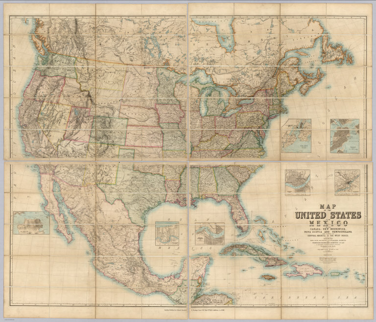
[Johnston, Alexander Keith, 1804-1871, Rogers, Henry Darwin, Stanford, Edward]
Full Title
(Covers to) Map Of The United States And Mexico With Canada, New Brunswick, Nova Scotia and Newfoundland, And Parts Of Central America & The West Indies. Constructed From State Documents & Unpublished Materials By Professor H.D. Rogers of Boston U.S. and A. Keith Johnston, F.R.S.E Geographer to the Queen. London; Published by Edward Stanford, 6 Charing Cross, S.W. May 13th. 1861. Additions to 1869.
Publisher
Edward Stanford
Author
Raynolds, William F.
Full Title
(Covers to) U.S. War Department Map Of The Yellowstone And Missouri Rivers And Their Tributaries explored by Capt. W.F. Raynolds Topl. Engrs. and 1st Lieut. H.E. Maynadier 10th Infy. Assistant. 1859-60. To accompany a report to the Bureau of Topographical Engineers. Lt. Col. Harman Bache in charge.
Publisher
Government Printing Office
Author
[Johnston, Alexander Keith, 1804-1871, Rogers, Henry Darwin, Stanford, Edward]
Full Title
(Covers to) Map Of The United States And Mexico With Canada, New Brunswick, Nova Scotia and Newfoundland, And Parts Of Central America & The West Indies. Constructed From State Documents & Unpublished Materials By Professor H.D. Rogers of Boston U.S. and A. Keith Johnston, F.R.S.E Geographer to the Queen. London; Published by Edward Stanford, 6 Charing Cross, S.W. May 13th. 1861. Additions to 1869.
Publisher
Edward Stanford
1-5 of 5
|