|
|
REFINE
Browse All : Case Map of United States and Canada
1-17 of 17
Author
Colton, J. H.
Full Title
Colton's New Railroad & County Map Of The United States, The Canadas &c. Published By J.H. Colton, No. 172 William St., New York 1862. Entered ... 1861 by J.H. Colton ... New York. (inset) Colton's Map of the United States Showing the Proposed Railroad Routes To The Pacific Ocean. (inset) Southern Part Of Florida.
Publisher
[J.H. Colton, Sampson Low, Son & Co.]
Author
Colton, J. H.
Full Title
(Composite of) Colton's New Railroad & County Map Of The United States, The Canadas &c. Published By J.H. Colton, No. 172 William St., New York 1862. Entered ... 1861 by J.H. Colton ... New York. (inset) Colton's Map of the United States Showing the Proposed Railroad Routes To The Pacific Ocean. (inset) Southern Part Of Florida.
Publisher
[J.H. Colton, Sampson Low, Son & Co.]
Author
Smith, J. Calvin
Full Title
Map Of The United States Of America Including Canada and a large portion of Texas: Showing the Base Meridian and Township Lines of the U.S. Surveys. The lands allotted to the Indian Tribes west of the Mississippi. The Various Internal Improvements &c. Compiled from Surveys of the United States Land Office, and various other authentic sources By J. Calvin Smith. New York, Published by Sherman & Smith, 135 Broadway. 1850. Revised Edition. Steel Plates. Entered ... 1843 by Geo. E. Sherman & J. Calvin Smith ... New York. Engraved and Printed by Sherman & Smith New York. (inset) Map Of North America By J. Calvin Smith. (inset) Southern Florida.
Publisher
Sherman and Smith
Author
[Colton, J. H., Smith, J. Calvin]
Full Title
Colton's Map Of The United States Of America Including Canada and a large portion of Texas: Showing the Base Meridian and Township Lines of the U.S. Surveys. The lands allotted to the Indian Tribes west of the Mississippi. The Various Internal Improvements &c. Compiled from Surveys of the United States Land Office, and various other authentic sources By J. Calvin Smith. New York, Published by J.H. Colton, 86 Cedar St. 1852. Revised Edition. Steel Plates. Entered ... 1843 by Geo. E. Sherman & J. Calvin Smith ... New York. Engraved and Printed by Sherman & Smith New York. (inset) Map Of North America By J. Calvin Smith. (inset) Southern Florida.
Publisher
J.H. Colton
Author
Stanford, Edward
Full Title
Stanford's Map Of The United States And Part Of The Dominion Of Canada. London: Published by Edward Stanford, 55 Charing Cross, September 1st 1875. (inset) Newfoundland, Nova Scotia, Cape Breton & Prince Edward Is.
Publisher
Edward Stanford
Author
[Johnston, Alexander Keith, 1804-1871, Rogers, Henry Darwin, Stanford, Edward]
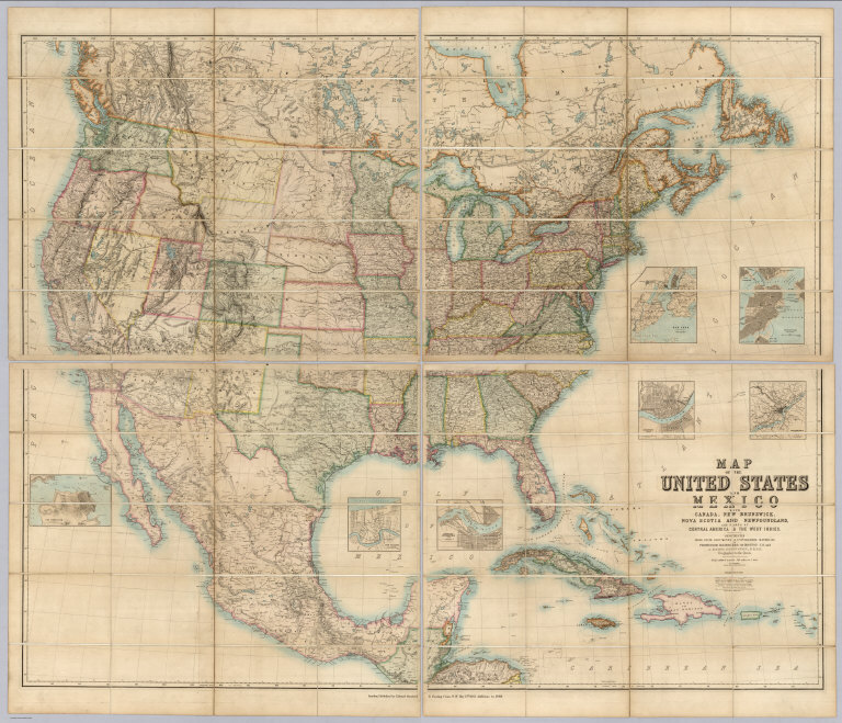
Full Title
(Covers to) Map Of The United States And Mexico With Canada, New Brunswick, Nova Scotia and Newfoundland, And Parts Of Central America & The West Indies. Constructed From State Documents & Unpublished Materials By Professor H.D. Rogers of Boston U.S. and A. Keith Johnston, F.R.S.E Geographer to the Queen. London; Published by Edward Stanford, 6 Charing Cross, S.W. May 13th. 1861. Additions to 1869.
Publisher
Edward Stanford
Author
Canada Government Railways
Full Title
Map Shewing the Railways of Canada to Accompany Annual Report on Railway Statistics. 1886. Collingwood Schreiber, Chief Engineer and General Manager of Government Railways. Office Of The Chief Engineer And General Manager Of Government Railways. Compiled by E.V. Johnson, M.C.S.C.E., In charge of Draughting Offices. Drawn by A.M. Edmonds. The Burland Lithographic Co. Montreal. (seal) Department Of Railways And Canals Canada. (in red) Railways Of Canada. In Operation And Under Construction. 31st December, 1886 ...
Publisher
Burland Lithographic Co.
Author
Watson, Gaylord
Full Title
Watson's New County and Railroad Map of the United States and the Dominion of Canada Compiled From the Latest Official Sources, 1874. Published by Gaylord Watson, 16 Beekman St., New York. Entered ... 1871, by Gaylord Watson ... Washington. (with) 5 inset maps: Routes of the Union, Central & Kansas Pacific Railroad; Vicinity of Boston; Vicinity of Philadelphia; Vicinity of New York; Lower Part of Florida.
Publisher
Gaylord Watson
Author
Watson, Gaylord
Full Title
Watson's new rail-road and distance map of the United States and Canada. Compiled from the latest official sources. Published by Gaylord Watson, 16 Beekman Street, New York. 1871. Entered ... 1868, by Gaylord Watson ... New York. Engraved by Fisk & Russell, N. York. (with) Routes Of The Union Pacific Railroads. (with) Vicinity of New York. (with) Vicinity of Philadelphia. (with) Vicinity of Boston.
Publisher
Gaylord Watson
Author
[Kensett, T., Shelton, W.]
Full Title
A Map of the United States and British Provinces of Upper and Lower Canada with other parts adjacent By Shelton & Kensett ... (above the title) To The President The Senators and Representatives of the United States This Map Of The United States Of America Is most Respectfully Dedicated by Shelton & Kensett 1816. Entered According ... October 1st, 1816 ... Connecticut. Projected by Thomas Kensett. A. Doolittle Sc.
Publisher
Shelton & Kensett
Author
Colton, J. H.
Full Title
(Covers to) Colton's New Railroad & County Map Of The United States, The Canadas &c. Published By J.H. Colton, No. 172 William St., New York 1862. Entered ... 1861 by J.H. Colton ... New York. (inset) Colton's Map of the United States Showing the Proposed Railroad Routes To The Pacific Ocean. (inset) Southern Part Of Florida.
Publisher
[J.H. Colton, Sampson Low, Son & Co.]
Author
Smith, J. Calvin
Full Title
(Covers to) Map Of The United States Of America Including Canada and a large portion of Texas: Showing the Base Meridian and Township Lines of the U.S. Surveys. The lands allotted to the Indian Tribes west of the Mississippi. The Various Internal Improvements &c. Compiled from Surveys of the United States Land Office, and various other authentic sources By J. Calvin Smith. New York, Published by Sherman & Smith, 135 Broadway. 1850. Revised Edition. Steel Plates. Entered ... 1843 by Geo. E. Sherman & J. Calvin Smith ... New York. Engraved and Printed by Sherman & Smith New York. (inset) Map Of North America By J. Calvin Smith. (inset) Southern Florida.
Publisher
Sherman and Smith
Author
Stanford, Edward
Full Title
(Covers to) Stanford's Map Of The United States And Part Of The Dominion Of Canada. London: Published by Edward Stanford, 55 Charing Cross, September 1st 1875. (inset) Newfoundland, Nova Scotia, Cape Breton & Prince Edward Is.
Publisher
Edward Stanford
Author
[Johnston, Alexander Keith, 1804-1871, Rogers, Henry Darwin, Stanford, Edward]
Full Title
(Covers to) Map Of The United States And Mexico With Canada, New Brunswick, Nova Scotia and Newfoundland, And Parts Of Central America & The West Indies. Constructed From State Documents & Unpublished Materials By Professor H.D. Rogers of Boston U.S. and A. Keith Johnston, F.R.S.E Geographer to the Queen. London; Published by Edward Stanford, 6 Charing Cross, S.W. May 13th. 1861. Additions to 1869.
Publisher
Edward Stanford
Author
Canada Government Railways
Full Title
(Covers to) Map Shewing the Railways of Canada to Accompany Annual Report on Railway Statistics. 1886. Collingwood Schreiber, Chief Engineer and General Manager of Government Railways. Office Of The Chief Engineer And General Manager Of Government Railways. Compiled by E.V. Johnson, M.C.S.C.E., In charge of Draughting Offices. Drawn by A.M. Edmonds. The Burland Lithographic Co. Montreal. (seal) Department Of Railways And Canals Canada. (in red) Railways Of Canada. In Operation And Under Construction. 31st December, 1886 ...
Publisher
Burland Lithographic Co.
Author
Watson, Gaylord
Full Title
(Covers to) Watson's New County and Railroad Map of the United States and the Dominion of Canada Compiled From the Latest Official Sources, 1874. Published by Gaylord Watson, 16 Beekman St., New York. Entered ... 1871, by Gaylord Watson ... Washington. (with) 5 inset maps: Routes of the Union, Central & Kansas Pacific Railroad; Vicinity of Boston; Vicinity of Philadelphia; Vicinity of New York; Lower Part of Florida.
Publisher
Gaylord Watson
Author
Watson, Gaylord
Full Title
(Covers to) Watson's new rail-road and distance map of the United States and Canada. Compiled from the latest official sources. Published by Gaylord Watson, 16 Beekman Street, New York. 1871. Entered ... 1868, by Gaylord Watson ... New York. Engraved by Fisk & Russell, N. York. (with) Routes Of The Union Pacific Railroads. (with) Vicinity of New York. (with) Vicinity of Philadelphia. (with) Vicinity of Boston.
Publisher
Gaylord Watson
1-17 of 17
|