Who What Where WhenWHAT
|
Author
Kiepert, Heinrich
Full Title
H. Kiepert's Neue Karte von Mittel-America ; A New Map of Central America Drawn With The Help of All Recent Surveys and Other Itinerary Materials Hitherto Published by H. Kiepert . . . 1858. Berlin, D. Reimer. Engraved on stone by Ed. Kolitz. Printed by C. Monecke, Berlin. (insets) The State of San Salvador and the Proposed Honduras Railroad from the surveys made in 1853 by E.G. Squier and W.N. Jeffers ; Isthums of Tehuantepec as surveyed for the proposed railroad, by Col. Barnard, 1851 ; The River San Juan De Nicaragua from the survey made in 1847 by von Bulow ; The Isthums and Raiload of Panama from survey Executed 1849 by G.W. Hughes ; Tract of the proposed Interoceanic Canal of the Rio Atrato surveyed in 1854 by W. Kennish of New York.
Publisher
D. Reimer
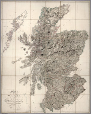
Author
Arrowsmith, Aaron
Full Title
Map of Scotland Constructed from Original Materials Obtained under The Authority of The Parliamentary Commissioners For making Roads and building Bridges In the Highlands of Scotland With whose permission it is now published By Their most obliged and obedient Servant A.Arrowsmith Hydrographer to H.R.H. the Prince of Wales. London. Published June 25th. 1807 by A. Arrowsmith 10 Soho Square
Publisher
A. Arrowsmith
Author
Arrowsmith, Aaron
Full Title
Ireland. London, Published 4th January 1811 by A.Arrowsmith, Hydrographer to H.R.H. the Prince of Wales, No. 10 Soho Square.
Publisher
A. Arrowsmith
Author
Arrowsmith, Aaron
Full Title
Map of the Hills, Rivers, Canals, and Principal Roads of England and Wales, Upon a Scale of Six Miles to an Inch. Exhibiting Most of the Places Whose Situation has been ascertained by the Stations and Intersections of the Trigonometrical Survey, Compiled by A. Arrowsmith. London, Published 29th Septr 1813, by A. Arrowsmith, Hydrographer to His Majesty, No. 10 Soho Square. Additions & Corrections to 1814, -15,-19, -20. Scale of 30 English Miles. The distances on the Roads are from the following Standards....
Publisher
A. Arrowsmith
Author
Arrowsmith, Aaron
Full Title
Sketch of the Outline and principal Rivers of India by A. Arrowsmith Hydrographer to His Majesty 1822. Note: This map is intended to shew how many sheets of this size would be required for a Map of India on a scale of Four English Miles to one Inch, any one of which may be engraved independent of another when materials offer, and may be united to the rest by keeping correctly to the lines as drawn on this Map. The sheets as far as No. 16 are already engraved on the above scale.
Publisher
A. Arrowsmith
Author
[Kinneir, J. Macdonald, Arrowsmith, Aaron]
Full Title
Map of Asia Minor Armenia and Koordistan Illustrative of the Marches of Alexander, Xenophon, Julian and Heraclius. By J. Macdonald Kinneir. Madras, May 1, 1816. London, Published 3rd Decr. 1817, by A. Arrowsmith, No 10 Soho Square, Hydrographer to H.R.H. the Prince of Wales.
Publisher
A. Arrowsmith
Author
Arrowsmith, Aaron
Full Title
(Sheet 1) Outlines of Greece, And Adjacent Countries, With Modern and Antient Names, By A. Arrowsmith. London, Published 2nd March, 1819, by A. Arrowsmith, 10 Soho Square, Hydrographer to His Majesty.
Publisher
A. Arrowsmith
Author
Arrowsmith, Aaron
Full Title
(Sheet 2) Outlines of Greece, And Adjacent Countries, With Modern and Antient Names, By A. Arrowsmith. London, Published 2nd March, 1819, by A. Arrowsmith, 10 Soho Square, Hydrographer to His Majesty.
Publisher
A. Arrowsmith
Author
Arrowsmith, Aaron
Full Title
(Sheet 3) Outlines of Greece, And Adjacent Countries, With Modern and Antient Names, By A. Arrowsmith. London, Published 2nd March, 1819, by A. Arrowsmith, 10 Soho Square, Hydrographer to His Majesty.
Publisher
A. Arrowsmith
Author
Arrowsmith, Aaron
Full Title
(Sheet 4) Outlines of Greece, And Adjacent Countries, With Modern and Antient Names, By A. Arrowsmith. London, Published 2nd March, 1819, by A. Arrowsmith, 10 Soho Square, Hydrographer to His Majesty.
Publisher
A. Arrowsmith
Author
Arrowsmith, Aaron
Full Title
(Sheet 5) Outlines of Greece, And Adjacent Countries, With Modern and Antient Names, By A. Arrowsmith. London, Published 2nd March, 1819, by A. Arrowsmith, 10 Soho Square, Hydrographer to His Majesty.
Publisher
A. Arrowsmith
Author
Arrowsmith, Aaron
Full Title
(Sheet 6) Outlines of Greece, And Adjacent Countries, With Modern and Antient Names, By A. Arrowsmith. London, Published 2nd March, 1819, by A. Arrowsmith, 10 Soho Square, Hydrographer to His Majesty.
Publisher
A. Arrowsmith
Author
Arrowsmith, Aaron
Full Title
Asia, SE section only
Publisher
A. Arrowsmith
Author
Arrowsmith, Aaron
Full Title
(Lower Left) To His Royal Highness the Duke of Cambridge, K. G. &c. This Map of the Physical Divisions of Germany, Exhibiting the Post Roads, Canals &c, Constructed from Original Materials, Is with Permission Most humbly Inscribed by His Royal Highness's Faithful & most Devoted Servant, A. Arrowsmith. J. Rowe scrt. & scrulpt. London Published 2nd. Octr. 1812 by A. Arrowsmith Hydrographer to H.R.H. the Prince of Wales, No. 10 Soho Square. Engraved by E. Jones.
Publisher
A. Arrowsmith
Author
Arrowsmith, Aaron
Full Title
(Lower Right) To His Royal Highness the Duke of Cambridge, K. G. &c. This Map of the Physical Divisions of Germany, Exhibiting the Post Roads, Canals &c, Constructed from Original Materials, Is with Permission Most humbly Inscribed by His Royal Highness's Faithful & most Devoted Servant, A. Arrowsmith. J. Rowe scrt. & scrulpt. London Published 2nd. Octr. 1812 by A. Arrowsmith Hydrographer to H.R.H. the Prince of Wales, No. 10 Soho Square. Engraved by E. Jones.
Publisher
A. Arrowsmith
Author
Arrowsmith, Aaron
Full Title
(Upper Left) To His Royal Highness the Duke of Cambridge, K. G. &c. This Map of the Physical Divisions of Germany, Exhibiting the Post Roads, Canals &c, Constructed from Original Materials, Is with Permission Most humbly Inscribed by His Royal Highness's Faithful & most Devoted Servant, A. Arrowsmith. J. Rowe scrt. & scrulpt. London Published 2nd. Octr. 1812 by A. Arrowsmith Hydrographer to H.R.H. the Prince of Wales, No. 10 Soho Square. Engraved by E. Jones.
Publisher
A. Arrowsmith
Author
Arrowsmith, Aaron
Full Title
(Upper Right) To His Royal Highness the Duke of Cambridge, K. G. &c. This Map of the Physical Divisions of Germany, Exhibiting the Post Roads, Canals &c, Constructed from Original Materials, Is with Permission Most humbly Inscribed by His Royal Highness's Faithful & most Devoted Servant, A. Arrowsmith. J. Rowe scrt. & scrulpt. London Published 2nd. Octr. 1812 by A. Arrowsmith Hydrographer to H.R.H. the Prince of Wales, No. 10 Soho Square. Engraved by E. Jones.
Publisher
A. Arrowsmith
Author
Arrowsmith, Aaron
Full Title
(Sheet 1 to) To the Honorable Court of Directors of the East India Company, This Improved Map of India, Compiled from all the Latest & Most Authentic Materials is Respectfully Dedicated by their most Obedient & most Humble Servant, A. Arrowsmith. London Published 2 Jany. 1816 by A. Arrowsmith No. 10 Soho Square Hydrographer to H.R.H. the Prince of Wales.
Publisher
A. Arrowsmith
Author
Arrowsmith, Aaron
Full Title
(Sheet 2 to) To the Honorable Court of Directors of the East India Company, This Improved Map of India, Compiled from all the Latest & Most Authentic Materials is Respectfully Dedicated by their most Obedient & most Humble Servant, A. Arrowsmith. London Published 2 Jany. 1816 by A. Arrowsmith No. 10 Soho Square Hydrographer to H.R.H. the Prince of Wales.
Publisher
A. Arrowsmith
Author
Arrowsmith, Aaron
Full Title
(Sheet 3 to) To the Honorable Court of Directors of the East India Company, This Improved Map of India, Compiled from all the Latest & Most Authentic Materials is Respectfully Dedicated by their most Obedient & most Humble Servant, A. Arrowsmith. London Published 2 Jany. 1816 by A. Arrowsmith No. 10 Soho Square Hydrographer to H.R.H. the Prince of Wales.
Publisher
A. Arrowsmith
Author
Arrowsmith, Aaron
Full Title
(Sheet 4 to) To the Honorable Court of Directors of the East India Company, This Improved Map of India, Compiled from all the Latest & Most Authentic Materials is Respectfully Dedicated by their most Obedient & most Humble Servant, A. Arrowsmith. London Published 2 Jany. 1816 by A. Arrowsmith No. 10 Soho Square Hydrographer to H.R.H. the Prince of Wales.
Publisher
A. Arrowsmith
Author
[Darton, William, Gardner, W.R.]
Full Title
New and Improved View of the Comparative Heights of the Principal Mountains and Lengths of the Principal Rivers In The World, The whole Judiciously arranged from the various Authorities Extant. By W.R. Gardner. London: William Darton, 58 Holborn Hill, 10 Mo. 23rd, 1823. W.R. Gardner Sculpt. 367 Strand.
Publisher
William Darton
Author
[Berghaus, Hermann, Stulpnagel, Fr. V.]
Full Title
Chart Of The World On Mercators Projection. Constructed By Hermann Berghaus and Fr. v. Stulpnagel.Engraved by Eberhardt and by Will. Weiler. Gotha: Justus Perthes 1863. Printed by C. Hellfarth in Gotha. (with 4 inset maps).
Publisher
Justus Perthes
Author
Rota-ray map systems, inc.
Full Title
Map of New York : Patented Jan 4, 1921, copyright 1923 by Rota-ray map systems, inc. Rochester. New York. Notice: Traveling East the adjoining section is on the bottom roller. Notice: Traveling West the adjoining section is on the top roller. The roads are numbered where it leaves the section. It comes in on the adjoining section at the same number.
Publisher
Rota-ray map systems, inc.
Author
[Faden, William, 1750?-1836, Great Britain. Ordnance Survey, Mudge, William, 1762-1820]
Full Title
General survey of England and Wales : an entirely new & accurate survey of the County of Kent, with part of the County of Essex done by the surveying drafsmen of His Majesty's Honourable Board of Ordnance ; on the basis of the trigonometrical survey carried on by their orders under the direction of Captn. W. Mudge of the Royal Artillery, F.R.S. ; Thos. Foot, engraver. London : Published by W. Faden, Geographer to His Majesty and to His Royal Highness the Prince of Wales, Charing Cross, January 1st, 1801.
Publisher
W. Faden
Author
Rota-ray map systems, inc.
Full Title
Map of New York : Patented Jan 4, 1921, copyright 1923 by Rota-ray map systems, inc. Rochester. New York. Notice: Traveling East the adjoining section is on the bottom roller. Notice: Traveling West the adjoining section is on the top roller. The roads are numbered where it leaves the section. It comes in on the adjoining section at the same number.
Publisher
Rota-ray map systems, inc.
Author
Bollmann, Hermann (1911-1970)
Full Title
(Sheet 1). Stadt Zuerich (City of Zurich). (Reproduction).
Publisher
Hans Luzius Balzer
Author
Bollmann, Hermann (1911-1970)
Full Title
(Sheet 2). Stadt Zuerich (City of Zurich). (Reproduction).
Publisher
Hans Luzius Balzer
Author
Bollmann, Hermann (1911-1970)
Full Title
(Sheet 3). Stadt Zuerich (City of Zurich). (Reproduction).
Publisher
Hans Luzius Balzer
Author
Bollmann, Hermann (1911-1970)
Full Title
(Sheet 4). Stadt Zuerich (City of Zurich). (Reproduction).
Publisher
Hans Luzius Balzer
Author
Bollmann, Hermann (1911-1970)
Full Title
(Sheet 5). Stadt Zuerich (City of Zurich). (Reproduction).
Publisher
Hans Luzius Balzer
Author
Bollmann, Hermann (1911-1970)
Full Title
(Sheet 6). Stadt Zuerich (City of Zurich). (Reproduction).
Publisher
Hans Luzius Balzer
Author
Bollmann, Hermann (1911-1970)
Full Title
(Sheet 7). Stadt Zuerich (City of Zurich). (Reproduction).
Publisher
Hans Luzius Balzer
Author
Bollmann, Hermann (1911-1970)
Full Title
(Sheet 8). Stadt Zuerich (City of Zurich). (Reproduction).
Publisher
Hans Luzius Balzer
Author
Bollmann, Hermann (1911-1970)
Full Title
(Sheet 9). Stadt Zuerich (City of Zurich). (Reproduction).
Publisher
Hans Luzius Balzer
Author
[Purdy, John, Whittle, J.]
Full Title
A Map Of Cabotia; Comprehending The Provinces Of Upper And Lower Canada, New-Brunswick, And Nova-Scotia, With Breton Island, Newfoundland, &c. And Including also The Adjacent Parts Of The United States. Compiled from a great Variety of Original Documents, By John Purdy. Published 12th October, 1814, by Jas. Whittle And Richd. Holmes Laurie, No. 53, Fleet Street, London. Engraved by Thomson & Hall, 14, Bury Str. Bloomsby. (with 10 inset maps).
Publisher
Jas. Whittle and Richd. Holmes Laurie.
Author
Howell, Reading
Full Title
A Map Of The State Of Pennsylvania. By Reading Howell MDCCXCII. To Thomas Mifflin Governor, The Senate, And House Of Representatives Of The Commonwealth Of Pennsylvania, This Map is respectfully Inscribed by the Author. Published 1 August 1792 for the Author, & Sold by James Phillips, George Yard, Lombard Street, London.
Publisher
James Phillips
Author
Wyld, James, 1812-1887
Full Title
(North Sheet) Mexico The British Possessions In North America And The United States. London. Published By Jas. Wyld, Geographer To The Queen, Charing Cross East. 1846. James Wyld, Geographer to the Queen and to H.R.H. Prince Albert, Charing Cross, East, four doors from Trafalgar Square, London ... (inset) North America. (inset) Islands in the Pacific Ocean.
Publisher
James Wyld
Author
Wyld, James, 1812-1887
Full Title
(South Sheet) Mexico The British Possessions In North America And The United States. London. Published By Jas. Wyld, Geographer To The Queen, Charing Cross East. 1846. James Wyld, Geographer to the Queen and to H.R.H. Prince Albert, Charing Cross, East, four doors from Trafalgar Square, London ... (inset) North America. (inset) Islands in the Pacific Ocean.
Publisher
James Wyld
Author
[Chace, J., Walling, H. F.]
Full Title
Map Of The State Of Maine. From Surveys made by the United States Coast Survey, from the British and American Boundary Commissioners Survey, from the State Land Surveys, the New Brunswick Provincial Surveys, and from Actual Surveys by H.F. Walling & J. Chace Jr. ... H.F. Walling. Published By J. Chace Jr. & Co. 55 Exchange St. Portland. 1862. M. Clemens, T.W. Baker, Assistant Draughtsmen. W. Hatfield, Engraver, 132 Nassau St. J. Chace Jr., Sanborn & Carter, 55 Exchange St. Portland. Bailey & Noyes, 56 & 58 Exch. St. Portland. Entered ... by H.F. Walling & J. Chace Jr. ... New York. (inset) Map Of The United States Of America By H.F. Walling, 1861. Engraved by D. Griffing Johnson, N. York. (with 28 smaller inset maps).
Publisher
J. Chace Jr. & Co.
Author
Williams, G. Washington.
Full Title
Williams' Copper - Plate Map Of The United States, Canada, Mexico, Central America, West Indies, &c. Published by John M. Atwood, 402 Locust Street, Philadelphia. Printed by F. Bourquin, 31 So. 6th Street, Phila. Copyright 1876 by G. Washington Williams.
Publisher
John M. Atwood
Author
Johnson, D. Griffing
Full Title
(Covers to) Johnson's Illustrated & Embellished Steel Plate Map of The World On Mercator's Projection, Compiled from the latest & most Authentic Sources Exhibiting the recent Arctic and Antarctic Discoveries & Explorations. Engraved & Published By D.Griffing Johnson, 80 Nassau St. New York. 1847. Entered ... 1846 by D. Griffing Johnson ... New York.
Publisher
D. Griffing Johnson
Author
Johnson, D. Griffing
Full Title
Johnson's Illustrated & Embellished Steel Plate Map of The World On Mercator's Projection, Compiled from the latest & most Authentic Sources Exhibiting the recent Arctic and Antarctic Discoveries & Explorations. Engraved & Published By D.Griffing Johnson, 80 Nassau St. New York. 1847. Entered ... 1846 by D. Griffing Johnson ... New York
Publisher
D. Griffing Johnson
Author
Smith, J. Calvin
Full Title
Map Of The United States Of America Including Canada and a large portion of Texas: Showing the Base Meridian and Township Lines of the U.S. Surveys. The lands allotted to the Indian Tribes west of the Mississippi. The Various Internal Improvements &c. Compiled from Surveys of the United States Land Office, and various other authentic sources By J. Calvin Smith. New York, Published by Sherman & Smith, 135 Broadway. 1850. Revised Edition. Steel Plates. Entered ... 1843 by Geo. E. Sherman & J. Calvin Smith ... New York. Engraved and Printed by Sherman & Smith New York. (inset) Map Of North America By J. Calvin Smith. (inset) Southern Florida.
Publisher
Sherman and Smith
Author
Walling, H. F.
Full Title
Map Of The City Of New - York And It's Environs From Actual Survey under the direction of H.F. Walling. Published By S.D. Tilden. 356, 358 & 360, Pearl Street, New York 1860.
Publisher
S.D. Tilden
Author
Holmes, J.W.
Full Title
Map Of Saint Clair County, Illinois. Published by J.W. Holmes, Civil Engineer & Map Publisher, 1863. Field Surveys Conducted by R.S. Hodgen, C.E. & Surveyor. Manufactured by R. Pearsall Smith, 517, 519, 521 Minor St. Phila, Pa. Entered ... 1863 by Joseph W. Holmes ... Illinois. (with 15 inset maps).
Publisher
Robert P. Smith
Author
Tardieu, P.F.
Full Title
United States of Nth. America. Carte des Etats-Unis de L'Amerique Septentrionale Copiee et Gravee sur celle d'Arrowsmith Corigee...
Publisher
P.F. Tardieu
Author
Hartwell, J.G.
Full Title
Map Of Nevada County, California. Compiled From The Latest Authentic Sources, Showing Towns, Villages, Roads, Streams, Mining Ditches, And U.S. Land Surveys, Quartz And Placer Mining Claims. By J.G. Hartwell, County Surveyor. 1880. Entered ... 1880, by J.G. Hartwell ... Washington, D.C. Lith. W.T. Galloway, 540 Clay St. S.F.
Publisher
W.T. Galloway, Lith.
Author
Fisher, Samuel B.
Full Title
Map Of The First And Second Anthracite Coal Field. By Samuel B. Fisher Pottsville, Pennsylvania. 1836. Watson's Lith., Philada. Lithog. by J.F. & C.A. Watson, No. 62 Walnut Street, Philadelphia.
Publisher
Watson's Lith.
Author
[Kayser, G., Worret, Charles]
Full Title
Military Map of a part of Eastn. Virginia Department of Maj: Genl: J.A. Dix Comdg 7th Army Corps completed from several Military Reconnaissances & Surveys under the Direction of Capt: Wm. Heine Topt. Engr. U.S. drawn & compiled by Lieut. Ch. Worret & G. Kayser Traced by Lieut. Ch. Worret.
Publisher
No Publisher
|