Browse All

1852 Galveston Bay, Texas. Chart Atlas Preliminary sketch of Galveston Bay, Tex … |

1853 San Francisco-San Diego. Chart Atlas Reconnaissance of the Western Coast of t … |

1853 San Diego Entrance. Chart Atlas San Diego Entrance and approaches, Calif … |

1852 Catalina Harbor. Chart Atlas Reconnaissance of Catalina Harbor and th … |

1853 Santa Barbara, Calif. Chart Atlas Preliminary sketch of Santa Barbara, Cal … |

1852 Santa Cruz, San Simeon, Coxo, San Luis O … Chart Atlas Reconnaissance of the harbors of Santa C … |

1852 Monterey Harbor, Calif. Chart Atlas Monterey Harbor, California. From a trig … |

1852 San Pedro Harbor, Calif. Chart Atlas Reconnaissance of San Pedro Harbor, Cali … |

1853 San Francisco & vicinity. Chart Atlas U.S. Coast Survey A.D. Bache, Superinten … |

1851 Mare Island Straits, Calif. Chart Atlas Mare Island Straits, California. U.S. Co … |

1852 Humboldt Bay, Calif. Chart Atlas Preliminary survey of Humboldt Bay, Cali … |

1851 Trinidad Bay, Calif. Chart Atlas Reconnaissance of Trinidad Bay, Californ … |

1853 Shoalwater Bay, Wash. Chart Atlas Preliminary survey of Shoalwater Bay, Wa … |

1853 Gray's Harbor-Admiralty Inlet. Chart Atlas Reconnaissance of the western coast of t … |

1853 Cape Flattery, Nee-ah Harbor, Wash. Chart Atlas Cape Flattery and Nee-ah Harbor, Washing … |

1853 False Dungeness Harbor, Wash. Chart Atlas False Dungeness Harbor, Washington. U.S. … |

1854 Cover: Maps and charts of the United Sta … Chart Atlas (Covers to) Maps and charts of the Unite … |

1854 Presentation page: Maps and charts of th … Chart Atlas (Presentation Page to) Maps and charts o … |

1854 Title Page: Maps and charts of the Unite … Chart Atlas (Title Page to) Maps and charts of the U … |

1854 Contents: Maps and charts of the United … Chart Atlas (Contents to) Maps and charts of the Uni … |

1852 Ocracoke Inlet, N.C. Chart Atlas Sketch of Ocracoke Inlet, North Carolina … |

1851 Beaufort Harbor, N.C. Chart Atlas Preliminary sketch of Beaufort Harbor, N … |

1852 New River & Bar, N.C. Chart Atlas Reconnaissance of New River and Bar, Nor … |

1851 Frying-Pan Shoals, Cape Fear River Chart Atlas Sketch of Frying-Pan Shoals and Cape Fea … |

1853 North Edisto River. Chart Atlas Preliminary chart of North Edisto River. … |

1884 Covers: Log Of H.M.S. "Swiftsure". [Chart Atlas, Exploration Book] (Covers to) Log Of H.M.S. "Swiftsure" Be … |

1884 Inside Front Cover: Log Of H.M.S. "Swift … [Chart Atlas, Exploration Book] (Inside Front Cover to) Log Of H.M.S. "S … |

1884 HMS Swiftsure From Rio de Janiero to San … [Chart Atlas, Exploration Book] HMS Swiftsure From Rio de Janiero to San … |
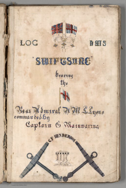
1884 Title Page: Log Of H.M.S. "Swiftsure". [Chart Atlas, Exploration Book] (Title Page) Log Of H.M.S. "Swiftsure" B … |

1884 Text: H.M.S. Swiftsure from Honolulu to … [Chart Atlas, Exploration Book] (Text Page) H.M.S. Swiftsure from Honolu … |

1884 Text: H.M.S. Swiftsure from Honolulu to … [Chart Atlas, Exploration Book] (Text Page) H.M.S. Swiftsure, Honolulu t … |

1884 Text: H.M.S. Swiftsure Moored off Esquim … [Chart Atlas, Exploration Book] (Text Page) H.M.S. Swiftsure Moored off … |

1884 View: HMS Swiftsure, plans of holds. [Chart Atlas, Exploration Book] (View) HMS Swiftsure, plans of holds. |

1884 Text: H.M.S. Swiftsure, ... Jul 21-24, 1 … [Chart Atlas, Exploration Book] (Text Page) H.M.S. Swiftsure, ... Jul 21 … |

1884 Text: H.M.S. Swiftsure, Moored off to Es … [Chart Atlas, Exploration Book] (Text Page) H.M.S. Swiftsure, Moored off … |

1884 View: HMS Swiftsure profile. [Chart Atlas, Exploration Book] (View) HMS Swiftsure profile. |

1884 Text: H.M.S. Swiftsure, Moored off Esqui … [Chart Atlas, Exploration Book] (Text Page) H.M.S. Swiftsure, Moored off … |

1884 Text: H.M.S. Swiftsure, Moored off Esqui … [Chart Atlas, Exploration Book] (Text Page) H.M.S. Swiftsure, Moored off … |

1884 Text: H.M.S. Swiftsure, Constance Cove, … [Chart Atlas, Exploration Book] (Text Page) H.M.S. Swiftsure, Constance … |

1884 Text: H.M.S. Swiftsure, Constance Cove, … [Chart Atlas, Exploration Book] (Text Page) H.M.S. Swiftsure, Constance … |

1884 Text: H.M.S. Swiftsure, Constance Cove, … [Chart Atlas, Exploration Book] (Text Page) H.M.S. Swiftsure, Constance … |

1884 HMS Swiftsure. Esquimalt to Burrard Inle … [Chart Atlas, Exploration Book] HMS Swiftsure. Esquimalt to Burrard Inle … |

1884 Text: H.M.S. Swiftsure, Constance Cove, … [Chart Atlas, Exploration Book] (Text Page) H.M.S. Swiftsure, Constance … |

1884 Text: H.M.S. Swiftsure, Esquimalt to Eng … [Chart Atlas, Exploration Book] (Text Page) H.M.S. Swiftsure, Esquimalt … |

1884 Burrand Inlet. [Chart Atlas, Exploration Book] Burrand Inlet. |

1884 Text: H.M.S. Swiftsure, Constance Cove, … [Chart Atlas, Exploration Book] (Text Page) H.M.S. Swiftsure, Constance … |

1884 Text: H.M.S. Swiftsure, Moored in Consta … [Chart Atlas, Exploration Book] (Text Page) H.M.S. Swiftsure, Moored in … |

1884 Text: H.M.S. Swiftsure, Moored off Esqui … [Chart Atlas, Exploration Book] (Text Page) H.M.S. Swiftsure, Moored off … |

1884 Text: H.M.S. Swiftsure, Moored off Esqui … [Chart Atlas, Exploration Book] (Text Page) H.M.S. Swiftsure, Moored off … |

1884 Text: H.M.S. Swiftsure, Moored off Esqui … [Chart Atlas, Exploration Book] (Text Page) H.M.S. Swiftsure, Moored off … |