Browse All

1851 Hell Gate & approaches. Chart Atlas Hell Gate and its approaches. From a tri … |

1845 New York Bay, Harbor. Chart Atlas Map of New-York Bay and Harbor and the e … |

1846 Little Egg Harbor. Chart Atlas Little Egg Harbor. Founded upon a trigon … |

1848 Delaware Bay, River 1. Chart Atlas (Map of Delaware Bay and River). Sheet n … |

1848 Delaware Bay, River 2. Chart Atlas Map of Delaware Bay and River. Sheet no. … |

1848 Delaware Bay, River 3. Chart Atlas (Map of Delaware Bay and River). Sheet n … |

1852 Coast of Delaware, Maryland, pt. of Virg … Chart Atlas Sea Coast of Delaware, Maryland and part … |

1846 Harbor of Annapolis. Chart Atlas The Harbor of Annapolis. Founded upon a … |

1849 Mouth, Chester River. Chart Atlas Mouth of Chester River. (Harbor of refug … |

1850 Pasquotank River. Chart Atlas Pasquotank River. From a trigonometrical … |

1853 Hatteras Inlet, N.C. Chart Atlas Reconnaissance of Hatteras Inlet, North … |

1851 Savannah River. Chart Atlas Savannah River. Reconnaissance of the ap … |

1852 Key-West Harbor, approaches. Chart Atlas Preliminary chart of Key-West Harbor and … |

1851 Cedar Keys, Fla. Chart Atlas Reconnoissance of vicinity of Cedar Keys … |

1852 Channel IV, Cedar-Keys, Fla. Chart Atlas Reconnaissance of Channel No. IV, Cedar- … |

1851 Entrance Mobile Bay. Chart Atlas Entrance to Mobile Bay. From a trigonome … |

1852 Mobile Bay. Chart Atlas Preliminary sketch of Mobile Bay. U.S. C … |

1853 Horn Island Pass. Chart Atlas Horn Island Pass, Mississippi Sound. U.S … |

1850 Cat & Ship Island harbors. Chart Atlas Cat and Ship Island harbors. From a trig … |

1852 Delta of the Mississippi. Chart Atlas Reconnoissance of the passes of the Delt … |

1852 Galveston Bay, Texas. Chart Atlas Preliminary sketch of Galveston Bay, Tex … |

1853 San Francisco-San Diego. Chart Atlas Reconnaissance of the Western Coast of t … |

1853 San Diego Entrance. Chart Atlas San Diego Entrance and approaches, Calif … |

1852 Catalina Harbor. Chart Atlas Reconnaissance of Catalina Harbor and th … |

1853 Santa Barbara, Calif. Chart Atlas Preliminary sketch of Santa Barbara, Cal … |

1852 Santa Cruz, San Simeon, Coxo, San Luis O … Chart Atlas Reconnaissance of the harbors of Santa C … |

1852 Monterey Harbor, Calif. Chart Atlas Monterey Harbor, California. From a trig … |

1852 San Pedro Harbor, Calif. Chart Atlas Reconnaissance of San Pedro Harbor, Cali … |

1853 San Francisco & vicinity. Chart Atlas U.S. Coast Survey A.D. Bache, Superinten … |

1851 Mare Island Straits, Calif. Chart Atlas Mare Island Straits, California. U.S. Co … |

1852 Humboldt Bay, Calif. Chart Atlas Preliminary survey of Humboldt Bay, Cali … |

1851 Trinidad Bay, Calif. Chart Atlas Reconnaissance of Trinidad Bay, Californ … |

1853 Shoalwater Bay, Wash. Chart Atlas Preliminary survey of Shoalwater Bay, Wa … |

1853 Gray's Harbor-Admiralty Inlet. Chart Atlas Reconnaissance of the western coast of t … |

1853 Cape Flattery, Nee-ah Harbor, Wash. Chart Atlas Cape Flattery and Nee-ah Harbor, Washing … |

1853 False Dungeness Harbor, Wash. Chart Atlas False Dungeness Harbor, Washington. U.S. … |

1852 Ocracoke Inlet, N.C. Chart Atlas Sketch of Ocracoke Inlet, North Carolina … |

1851 Beaufort Harbor, N.C. Chart Atlas Preliminary sketch of Beaufort Harbor, N … |

1852 New River & Bar, N.C. Chart Atlas Reconnaissance of New River and Bar, Nor … |

1851 Frying-Pan Shoals, Cape Fear River Chart Atlas Sketch of Frying-Pan Shoals and Cape Fea … |

1853 North Edisto River. Chart Atlas Preliminary chart of North Edisto River. … |
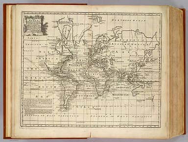
1747 Chart of the World. Geography Book A new & accurate chart of the world. Dra … |

1747 Seven United Provinces. Geography Book A new and accurate map of the Seven Unit … |

1747 N. parts of Italy. Geography Book A new and accurate map of the northern p … |

1787 A chart of the British Channel. Regional Atlas A chart of the British Channel; comprehe … |

1787 The Atlantic Ocean. Regional Atlas The Atlantic Ocean by Governor Pownall, … |

1787 Chart of the Acores (Hawks) Islands. Regional Atlas Chart of the Acores (Hawks) Islands, cal … |

1787 A chart of the Maderas and Canary Island … Regional Atlas A chart of the Maderas and Canary Island … |

1788 The Cape Verd Islands. Regional Atlas The Cape Verd Islands, laid down from th … |

1788 The Bermudas, or Summer's Islands. Regional Atlas The Bermudas, or Summer's Islands. From … |