Browse All

1800 Carta Esferica Que Comprehende La Costa … Chart Map Carta Esferica Que Comprehende La Costa … |

1825 Carta Esferica de las Costas Y Golfo De … Chart Map Carta Esferica de las Costas Y Golfo De … |

1869 Western Coast Of The United States Chart Map U.S. Coast Survey A.D. Bache, Superinten … |

1878 Tomales Bay California Chart Map Tomales Bay California. From a Trigonome … |

1853 Western Coast Of The United States Chart Map U.S. Coast Survey A.D. Bache, Superinten … |

1864 Bodega Bay, California Chart Map Bodega Bay, California. From a Trigonome … |

1900 Strait of Georgia and Strait of Juan de … Chart Map Georgia Strait And Strait Of Juan De Fuc … |

1907 San Francisco Entrance, California, 1907 Chart Map San Francisco Entrance, California. Publ … |

1903 San Francisco Entrance, California, 1903 Chart Map San Francisco Entrance, California. Publ … |

1885 Approaches To New York Chart Map North America - East Coast Approaches To … |

1854 Entrance To Umquah River, Oregon Chart Map U.S. Coast Survey A.D. Bache Supdt. Prel … |

1858 Port Townshend, Washington Teritory Chart Map Port Townshend, Washington Ter. From a T … |

1856 Port Ludlow, Washington Teritory Chart Map U.S. Coast Survey A.D. Bache Supdt. Prel … |

1858 Semi-Ah-Moo Bay, Washington Teritory Chart Map U.S. Coast Survey A.D. Bache Supdt. Reco … |

1862 Preliminary Chart Of Entrance To Koos Ba … Chart Map Preliminary Chart Of Entrance To Koos Ba … |

1853 Cape Flattery And Nee-Ah Harbor, Washing … Chart Map U.S. Coast Survey A.D. Bache Supdt. Cape … |

1856 Blakely Harbor, Washington Teritory Chart Map U.S. Coast Survey A.D. Bache Supdt. Reco … |

1856 Olympia Harbor, Washington Teritory Chart Map U.S. Coast Survey A.D. Bache Supdt. Reco … |

1856 False Dungeness Harbor, New Dungeness Ha … Chart Map U.S. Coast Survey A.D. Bache Supdt. Reco … |

1854 Smith's Or Blunt's Island, Washington Chart Map (J No. 3) U.S. Coast Survey A.D. Bache S … |

1836 Map Of The Extremity Of Cape Cod Chart Map A Map Of The Extremity Of Cape Cod Inclu … |

1836 Map Of The Extremity Of Cape Cod Chart Map A Map Of The Extremity Of Cape Cod Inclu … |

1836 Map Of The Extremity Of Cape Cod Chart Map A Map Of The Extremity Of Cape Cod Inclu … |

1836 Map Of The Extremity Of Cape Cod Chart Map A Map Of The Extremity Of Cape Cod Inclu … |

1836 Composite: Map Of The Extremity Of Cape … Chart Map (Composite of) A Map Of The Extremity Of … |

1834 Chart Of The South Atlantic Ocean Chart Map Chart Of The South Atlantic Ocean, From … |

1836 A New Chart of The Pacific Ocean (Northe … Chart Map A New Chart of The Pacific Ocean, Exhibi … |

1836 A New Chart of The Pacific Ocean (Southe … Chart Map A New Chart of The Pacific Ocean, Exhibi … |

1836 Composite: A New Chart of The Pacific Oc … Chart Map (Composite of) A New Chart of The Pacifi … |

1828 (Tasman Sea and New Zealand) Chart Map (Tasman Sea and New Zealand) (with) eigh … |
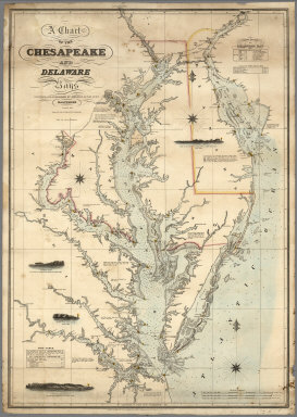
1862 A Chart of the Chesapeake And Delaware B … Chart Map A Chart of the Chesapeake And Delaware B … |

1863 San Francisco Harbour Surveyed by Lieut. … Chart Map N. America West Coast. San Francisco Har … |

1882 Charleston Harbour, from the United Stat … Chart Map America East Coast: Charleston Harbour, … |

1846 New Chart of the Windward Passages Chart Map A New Chart of the Windward Passages Con … |

1870 Chart of the Indian and Part of the Paci … Chart Map A General Chart of the Indian and Part o … |

1764 Plan de la Forteresse et Bourg, de l'Isl … Chart Atlas Plan de la Forteresse et Bourg, de l'Isl … |

1764 Carte de L'Europe Chart Atlas Carte de L'Europe. |

1764 Isles Britanniques Chart Atlas Isles Britanniques. |

1764 Carte de I'Angleterre Chart Atlas Carte de I'Angleterre. |

1764 Carte des entrees de la Tamise Chart Atlas Carte des entrees de la Tamise. |

1764 Plan de la Ville de Londres et aes Fauxb … Chart Atlas Plan de la Ville de Londres et aes Fauxb … |

1764 Carte de I'Isle de Wight Chart Atlas Carte de I'Isle de Wight. |

1764 Plan de Portsmouth et environs : Avoc le … Chart Atlas Plan de Portsmouth et environs : Avoc le … |

1764 Carto de I'isle de Portsoy et havro de P … Chart Atlas Carto de I'isle de Portsoy et havro de P … |

1764 Plan du havre de Rye et de ses Environs Chart Atlas Plan du havre de Rye et de ses Environs. |

1764 Carte de la Baye et Port de Plimouth Chart Atlas Carte de la Baye et Port de Plimouth. En … |

1764 Plan des villa et Citadelle de Plymouth Chart Atlas Plan des villa et Citadelle de Plymouth. |

1764 Plan de la Ville d'Yarmouth et Environs Chart Atlas Plan de la Ville d'Yarmouth et Environs. |

1764 Carte de I'Ecosse Chart Atlas Carte de I'Ecosse. |

1764 Carte du Golphe d'Edinburg Chart Atlas Carte de Golphe d'Edinburg. |