Who What Where WhenWHATWHERE |
REFINE
Browse All : Chart Map from 1820
1-2 of 2
Author
[Blunt, Edmund M. (Edmund March), 1770-1862, Hooker, William]
Full Title
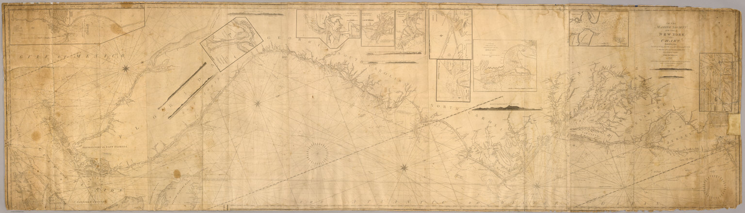
To the Marine Society of the city of New York; this chart, extending from lat. 40¦15' N. long: 72¦15' W. to Lat. 22¦35" N. long: 80¦25' W. is respectfully dedicated, by their obedient servant, Edmund M. Blunt, 1820 ... Plans engraved by Hooker, N. York.
Publisher
Wm. Hooker.
Author
[Blunt, Edmund M. (Edmund March), 1770-1862, Hooker, William]
Full Title
Books and charts published by Edmund Blunt or William Hooker, 202 Water, corner of Fulton Street, New-York, November, 1819.
Publisher
Wm. Hooker.
1-2 of 2
|