Browse All

1852 San Pablo Bay, Carquines Straits. Chart Map Chart of the Bay of San Pablo Straits Of … |

1852 General chart, San Francisco Bay. Chart Map General chart embracing surveys of the F … |

1852 Farallones, San Francisco Bay. Chart Map Chart of the Farallones and entrance to … |

1852 Suisun, Vallejo bays. Chart Map Chart of Suisun & Vallejo bays with the … |

1852 Sacramento River. Chart Map Chart of the Sacramento River from Suisu … |

1852 Carquines Straits, Vallejo Bay, other an … Chart Map Straits of Carquines and Vallejo Bay by … |

1852 No.7. Chart of the ports of La Ventosa & … Separate Map Chart of the ports of La Ventosa & Salin … |

1852 No.8. Chart of the entrance and channel … Separate Map Chart of the entrance and channel of the … |

1852 View, San Francisco from Yerba Buena Isl … Chart Map View of San Francisco from Yerba Buena I … |

1852 Entrance, San Francisco. Chart Map Entrance to San Francisco. C. Ringgold, … |

1852 View, Sacramento City. Chart Map View of Sacramento City from the west ba … |

1852 View, Benicia. Chart Map View of Benicia from the anchorage east … |

1852 Views, Mt. Diablo. Chart Map View of Monte Diablo from Garnet Island. … |

1852 Invincible buoy, Angel I., Marin Is. Chart Map Mark for Invincible buoy, Point Smith, e … |

1852 Tongue Shoal, Sacramento R. entrance. Chart Map Mark for Tongue Shoal. Entrance to the S … |

1852 Marks, Sacramento R. entering. Chart Map Marks for entering the Sacramento and it … |

1852 Cover: Series of charts, sailing directi … Chart Map (Covers to) A Series of charts, with sai … |

1852 Title Page: Series of Charts, sailing di … Chart Map (Title Page to) A Series of charts, with … |

1852 Gay Head to Cape Henlopen Chart Atlas General chart of the coast from Gay Head … |

1852 Coast of Delaware, Maryland, pt. of Virg … Chart Atlas Sea Coast of Delaware, Maryland and part … |

1852 Key-West Harbor, approaches. Chart Atlas Preliminary chart of Key-West Harbor and … |

1852 Channel IV, Cedar-Keys, Fla. Chart Atlas Reconnaissance of Channel No. IV, Cedar- … |

1852 Mobile Bay. Chart Atlas Preliminary sketch of Mobile Bay. U.S. C … |

1852 Delta of the Mississippi. Chart Atlas Reconnoissance of the passes of the Delt … |

1852 Galveston Bay, Texas. Chart Atlas Preliminary sketch of Galveston Bay, Tex … |

1852 Catalina Harbor. Chart Atlas Reconnaissance of Catalina Harbor and th … |

1852 Santa Cruz, San Simeon, Coxo, San Luis O … Chart Atlas Reconnaissance of the harbors of Santa C … |

1852 Monterey Harbor, Calif. Chart Atlas Monterey Harbor, California. From a trig … |

1852 San Pedro Harbor, Calif. Chart Atlas Reconnaissance of San Pedro Harbor, Cali … |

1852 Humboldt Bay, Calif. Chart Atlas Preliminary survey of Humboldt Bay, Cali … |

1852 Ocracoke Inlet, N.C. Chart Atlas Sketch of Ocracoke Inlet, North Carolina … |

1852 New River & Bar, N.C. Chart Atlas Reconnaissance of New River and Bar, Nor … |

1848 No.3. Mouth of the Coatzacoalcos River s … Separate Map Mouth of the Coatzacoalcos River surveye … |

1847 No.4. Sketch from the mouth of the Coatz … Separate Map Sketch from the mouth of the Coatzacoalc … |
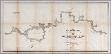
1851 No.5. Map of the Coatzacoalcos River fro … Separate Map 1851 Tehuantepec Survey, Major J.G. Barn … |

1851 No.6. Map of the River Uspanapa to the P … Separate Map Tehuantepec Survey, Maj. J.G. Barnard. U … |