Browse All

1869 Western Coast Of The United States Chart Map U.S. Coast Survey A.D. Bache, Superinten … |

1878 Tomales Bay California Chart Map Tomales Bay California. From a Trigonome … |

1864 Bodega Bay, California Chart Map Bodega Bay, California. From a Trigonome … |

1907 San Francisco Entrance, California, 1907 Chart Map San Francisco Entrance, California. Publ … |

1903 San Francisco Entrance, California, 1903 Chart Map San Francisco Entrance, California. Publ … |

1853 San Francisco & vicinity. Chart Map U.S. Coast Survey A.D. Bache, Superinten … |

1859 City Of San Francisco And Its Vicinity, … Chart Map U.S. Coast Survey A.D. Bache, Superinten … |

1874 Map exhibiting the salt marsh ... lands … [Chart Map, Wall Map] Map exhibiting the salt marsh, tide and … |
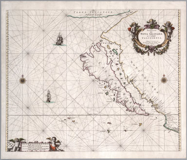
1666 Paskaerte van Nova Granada, en t'Eylandt … [Chart Map, Separate Map] Paskaerte van Nova Granada, en t'Eylandt … |

1852 San Pablo Bay, Carquines Straits. Chart Map Chart of the Bay of San Pablo Straits Of … |

1852 General chart, San Francisco Bay. Chart Map General chart embracing surveys of the F … |

1852 Farallones, San Francisco Bay. Chart Map Chart of the Farallones and entrance to … |

1852 Suisun, Vallejo bays. Chart Map Chart of Suisun & Vallejo bays with the … |

1852 Sacramento River. Chart Map Chart of the Sacramento River from Suisu … |

1852 Carquines Straits, Vallejo Bay, other an … Chart Map Straits of Carquines and Vallejo Bay by … |

1859 Entrance to San Francisco Bay California … Chart Map Entrance to San Francisco Bay California … |

1905 San Francisco entrance, California. Chart Map San Francisco entrance, California. Publ … |

1926 United States - West Coast. San Francisc … Chart Map United States - West Coast. San Francisc … |

1828 Cote NO, l'Amerique 1. Chart Atlas Cote nord-ouest de l'Amerique. Reconnue … |

1828 Cote NO, l'Amerique 2. Chart Atlas Cote nord-ouest de l'Amerique. Reconnue … |

1826 Californie, cotes, Golfe du. Chart Atlas Carte reduite des cotes et du Golfe du C … |

1797 Port de St. Francois. Chart Atlas Plan du Port de St. Francois, situe sur … |

1797 Monterey, Baie de. Chart Atlas Plan de la Baie de Monterey. Situe dans … |

1797 St. Diego, St. Blas. Chart Atlas Plan du Port de St. Diego en Californie … |

1798 The Coast of N.W. America Chart Atlas A chart shewing part of the Coast of N.W … |

1799 Chart of Part of the North West Coast of … Exploration Book Chart of Part of the North West Coast of … |

1799 Chart of the North West Coast of America … Exploration Book Chart of the North West Coast of America … |

1799 Port of San Francisco. Exploration Book Plan of the Port of St. Francisco in Cal … |

1799 Port of San Diego; Port of San Blas. Exploration Book (Two charts) Plan of the Port of S. Dieg … |

1853 San Francisco-San Diego. Chart Atlas Reconnaissance of the Western Coast of t … |

1853 San Diego Entrance. Chart Atlas San Diego Entrance and approaches, Calif … |

1852 Catalina Harbor. Chart Atlas Reconnaissance of Catalina Harbor and th … |

1853 Santa Barbara, Calif. Chart Atlas Preliminary sketch of Santa Barbara, Cal … |

1852 Santa Cruz, San Simeon, Coxo, San Luis O … Chart Atlas Reconnaissance of the harbors of Santa C … |

1852 Monterey Harbor, Calif. Chart Atlas Monterey Harbor, California. From a trig … |

1852 San Pedro Harbor, Calif. Chart Atlas Reconnaissance of San Pedro Harbor, Cali … |

1853 San Francisco & vicinity. Chart Atlas U.S. Coast Survey A.D. Bache, Superinten … |

1851 Mare Island Straits, Calif. Chart Atlas Mare Island Straits, California. U.S. Co … |

1852 Humboldt Bay, Calif. Chart Atlas Preliminary survey of Humboldt Bay, Cali … |

1851 Trinidad Bay, Calif. Chart Atlas Reconnaissance of Trinidad Bay, Californ … |

1798 The Coast of N.W. America. Chart Atlas A Chart shewing part of the Coast of N.W … |

1852 View, San Francisco from Yerba Buena Isl … Chart Map View of San Francisco from Yerba Buena I … |

1852 Entrance, San Francisco. Chart Map Entrance to San Francisco. C. Ringgold, … |

1852 View, Sacramento City. Chart Map View of Sacramento City from the west ba … |

1852 View, Benicia. Chart Map View of Benicia from the anchorage east … |

1852 Views, Mt. Diablo. Chart Map View of Monte Diablo from Garnet Island. … |

1852 Invincible buoy, Angel I., Marin Is. Chart Map Mark for Invincible buoy, Point Smith, e … |

1852 Tongue Shoal, Sacramento R. entrance. Chart Map Mark for Tongue Shoal. Entrance to the S … |

1852 Marks, Sacramento R. entering. Chart Map Marks for entering the Sacramento and it … |

1852 Cover: Series of charts, sailing directi … Chart Map (Covers to) A Series of charts, with sai … |