Who What Where WhenWHOShow More |
REFINE
Browse All : Chart Map of Maryland
1-6 of 6
Author
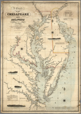
Lucas, Fielding Jr.
Full Title
A Chart of the Chesapeake And Delaware Bays Compiled And Published By Fielding Lucas Junr. Baltimore. Corrected_1862. Engraved by John and William W. Warr Philadelphia. Sold by Lucas Brothers. Drawn by F. Lucas Jr. Entered ... 1852 by Fielding Lucas Jr. ... Maryland.
Publisher
Fielding, Lucas Jr.
Author
Lucas, Fielding Jr.
Full Title
A Chart of the Chesapeake And Delaware Bays Compiled And Published By Fielding Lucas Junr. Baltimore Corrected_1840. Engraved by John and William Warr Philadelphia. Entered ... 1832 by Fielding Lucas Jr. ... Maryland.
Publisher
Fielding Lucas Jr.
Author
Bache, A. D.
Full Title
Sea Coast of Delaware, Maryland and part of Virginia. From a trigonometrical survey under the direction of A.D. Bache, Superintendent of the Survey of the Coast of the United States. Triangulation by J. Farley, E. Blunt & J.E. Johnstone, Capt. Top. Engrs., assistants. Topography by J.J.S. Hassler & G.D. Wise, assts. & W.M. Johnson, sub. asst. Hydrography by the parties under the command of T.R. Gedney, Lieuts. G.M. Bache, S.P. Lee, R. Bache & J.J. Almy, U.S. Navy, assistants U.S. Coast Survey. Published in 1852.
Publisher
U.S.
Author
Bache, A. D.
Full Title
The Harbor of Annapolis. Founded upon a trigonometrical survey under the direction of A.D. Bache, Superintendent of the Survey of the Coast of the United States. Triangulation by James Ferguson and Ferd. H. Gerdes, assistants. The hydrography under the direction of George M. Bache, Lieutenant, U.S. Navy. Topography by F.H. Gerdes, assistant. Published in 1846. Final reduction for engraving by R.D. Cutts, assistant. Topography engd. by J.H. Young, Phila. & the views by O. Lawson, Washn. Electrotype copy no. 1 by G. Mathiot, U.S.C.S. (with logo) U.S. Coast Survey Depot.
Publisher
U.S.
Author
Bache, A. D.
Full Title
Mouth of Chester River. (Harbor of refuge no.). From a trigonometrical survey under the direction of A.D. Bache, Superintendent of the Survey of the Coast of the United States. Triangulation by J. Ferguson and J.E. Johnston(e), Capt. Topl. Engrs., assistants. Topography by H.L. Whiting, R.D. Cutts and J.C. Neilson, assts. Hydrography by the party under the command of W.P. McArthur, Lieutenant, U.S. Navy. Published in 1849. Final reduction for engraving by Wm. Luce and C. Mahon, draughtsmen. Engraving by F. Dankworth, O.A. Lawson, W. Smith and S.T. Pettit. Printed by H. Benner. Electrotype copy no. 2 by G. Mathiot, U.S.C.S. (with logo) U.S. Coast Survey Office.
Publisher
U.S.
1-6 of 6
|