Who What Where WhenREMOVE |
REFINE
Browse All : Chart Map of United States
1-20 of 20
Author
[Blunt, Edmund M. (Edmund March), 1770-1862, Hooker, William]
Full Title
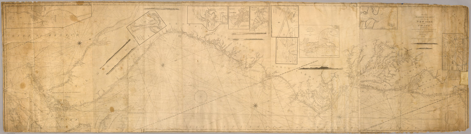
To the Marine Society of the city of New York; this chart, extending from lat. 40¦15' N. long: 72¦15' W. to Lat. 22¦35" N. long: 80¦25' W. is respectfully dedicated, by their obedient servant, Edmund M. Blunt, 1820 ... Plans engraved by Hooker, N. York.
Publisher
Wm. Hooker.
Author
[British Admiralty, Alden, James]
Full Title
N. America West Coast. San Francisco Harbour Surveyed by Lieut. James Alden U.S. Navy 1856. London. Published at the Admiralty 20th. Oct. 1860, under the Superintendence of Captn. Washington, R.N., F.R.S. Hydrographer. Corrections to Augt. 63 ... Engraved by J. & C. Walker. (with 4 profile views). (on lower right margin) 591.
Publisher
British Admiralty
Author
La Perouse, Jean-Francois de Galaup, comte de, 1741-1788
Full Title
(Two charts). Chart of the Parts of the Sandwich Islands visted March 1786 by the Boussole and the Astrolabe, corrected by the Observations made on board the two ships. Chart of the Sandwich Islands .... Published as the Act directs Novr. 1st 1798, by G.G. & J. Robinson, Paternoster Row. S.J. Neele sculpt., Strand. No. 13.
Publisher
G.G. & J. Robinson.
Author
La Perouse, Jean-Francois de Galaup, comte de, 1741-1788
Full Title
Chart of Part of the North West Coast of America Explored by the Boussole & Astrolabe laid down conformally to the position of the Boussole every day at noon as determinined Astronomically by Mr. Dagelet. Published as the Act directs Novr. 1st 1798, by G.G. & J. Robinson, Paternoster Row. S. Neele, sculpt, Strand. No. 16.
Publisher
G.G. & J. Robinson.
Author
La Perouse, Jean-Francois de Galaup, comte de, 1741-1788
Full Title
Chart of Part of the Northwest Coast of America. Explored by the Boussole & Astrolabe lin 1787. Ist Sheet. Published as the Act directs Novr. 1st 1798, by G.G. & J. Robinson, Paternoster Row. No. 17.
Publisher
G.G. & J. Robinson.
Author
La Perouse, Jean-Francois de Galaup, comte de, 1741-1788
Full Title
Plan of the Entrance of the Port of Bucarelli on the North West Coast of America, in 55 dgrees 15 minutes of Latitidue North & 136 degrees 15 minutes of Longitude West of Paris:* Discovered in 1775 by the Spanish Schooner la Senora Commanded by D. Juan Fco. de la Quadra & D. Franco. Alto. Maurelle; and more amply explored in the Expedition of 1779 .... Published as the Act directs Novr. 1st 1798, by G.G. & J. Robinson, Paternoster Row, London. Neele, sc. Strand. No. 26.
Publisher
G.G. & J. Robinson.
Author
La Perouse, Jean-Francois de Galaup, comte de, 1741-1788
Full Title
Chart of the North West Coast of America. Explored by the Boussole & Astrolabe in 1786. 2nd. Sheet. Published as the Act directs Novr. 1st 1798, by G.G. & J. Robinson, Paternoster Row, London. Neele sc. Strand. No. 29.
Publisher
G.G. & J. Robinson.
Author
La Perouse, Jean-Francois de Galaup, comte de, 1741-1788
Full Title
Chart of the North West Coast of America. Explored by the Boussole & Astrolabe in 1786. 3d. Sheet. Published as the Act directs Novr. 1st 1798, by G.G. & J. Robinson, Paternoster Row, London. No. 31.
Publisher
G.G. & J. Robinson.
Author
La Perouse, Jean-Francois de Galaup, comte de, 1741-1788
Full Title
Plan of the Port of St. Francisco in California. Point de Reyes in 37 degrees 59 minutes of Latitude North & 124 degrees, 54 minutes Longitude - West. Published as the Act directs Novr. 1st 1798, by G.G. & J. Robinson, Paternoster Row, London. Neele, sculpt., Strand. No. 33.
Publisher
G.G. & J. Robinson.
Author
La Perouse, Jean-Francois de Galaup, comte de, 1741-1788
Full Title
(Two charts) Plan of the Port of S. Diego in California. Situate in in 32 degrees 39 minutes 0 seconds of Latitude North & 12 degrees, 4 minutes 0 seconds West of St. Blas from a Survey in 1782 .... Plan of the Port and Department of S. Blas, Situate 21 degrees 30 minutes of Latitude Nth. & 88 degrees 15 minutes 0 seconds _ West of Tenefriffe and 107 degrees 15 minutes 0 seconds _ West of Paris from a Survey in november 1877. Published as the Act directs Novr. 1st 1798, by G.G. & J. Robinson, Paternoster Row, London. S. Neele, sculpt., Strand. No. 35.
Publisher
G.G. & J. Robinson.
Author
[Blunt, Edmund M. (Edmund March), 1770-1862, Hooker, William]
Full Title
Books and charts published by Edmund Blunt or William Hooker, 202 Water, corner of Fulton Street, New-York, November, 1819.
Publisher
Wm. Hooker.
Author
Bellin, Jacques Nicolas, 1703-1772
Full Title
La Louisiane et Pays Voisins
Publisher
J.N. Bellin
Author
Vancouver, George, 1757-1798
Full Title
A Chart Shewing part of the Coast of N.W. America, With the Tracks of His Majesty's Sloop Discovery and Armed Tender Chatham; Commanded by George Vancouver Esqr. and prepared from the foregoing Surveys under his immediate inspection by Lieut. Edwd. Roberts in which the Continental Shore has been correctly Traced and Determined From Lat. 29¼54'N. and Long. 244¼33'E. to Cape Douglas in Lat. 58¼52'N and Longd. 207¼20'E. during the Summers of 1792, 1793, and 1794. 14. Warner Sculp. London: Published May 1st 1798, by J. Edwards Pall Mall & G. Robinson Paternoster Row.
Publisher
G.G. & J. Robinson
Author
Jefferys, Thomas
Full Title
The Western Coast of Louisiana and the Coast of New Leon. By Thos. Jefferys, Geographer to His Majesty. London, printed for Robt. Sayer, Map & Printseller, no. 53 Fleet Street, as the Act directs 20th Feby. 1775.
Publisher
Sayer and Bennett
Author
Jefferys, Thomas
Full Title
The Coast of West Florida and Louisiana. By Thos. Jefferys, Geographer to His Majesty. (London, printed for Robt. Sayer, Map & Printseller, no. 53 Fleet Street, as the Act directs 20th Feby. 1775)
Publisher
Sayer and Bennett
Author
Jefferys, Thomas
Full Title
The Peninsula and Gulf of Florida or Channel of Bahama with the Bahama Islands. By Thos. Jefferys, Geographer to His Majesty. London, printed for Robt. Sayer, Map & Printseller, no. 53 in Fleet Street, as the Act directs 20 Feby. 1775.
Publisher
Sayer and Bennett
Author
Jefferys, Thomas
Full Title
The Island of Cuba with part of the Bahama Banks & the Martyrs. By Thos. Jefferys, Geographer to his Majesty. London, printed for Robt. Sayer, Map & Printseller, no. 53 in Fleet Street, as the Act directs 20 Feby. 1775.
Publisher
Sayer and Bennett
Author
[Cook, James, 1728-1779, Delarochette, Louis Stanislas d'Arcy, Faden, William, 1750?-1836, Roberts, Henry, Lieut.]
Full Title
Chart of the N.W. coast of America and the N.E. coast of Asia, explored in the years 1778 and 1779. Prepared by Lieutt. Heny. Roberts, under the immediate inspection of Capt. Cook. Engraved by W. Palmer, no. 128 Chancery Land. London: published by Wm. Faden, geographer to the King, Charing-Cross, July 24, 1784. 2d. edition, published January 1st, 1794. January 1st, 1808.
Publisher
William Faden
Author
[Dagelet, Joseph Lepaute, La Perouse, Jean-Francois de Galaup, comte de, 1741-1788]
Full Title
Carte generale d'une partie de la cote du nord-ouest de l'Amerique reconnue par les Fregates Francaises la Boussole et l'Astrolabe. Assujettie au point journalier de la Fregate la Boussole determine astronomiquement par M. Dagelet. Bouclet sculp. Herault scrip. Atlas du Voyage de la Perouse no. 16. (Paris: L'Imprimerie de la Republique, An V, 1797)
Publisher
L'Imprimerie de la Republique
Author
Jefferys, Thomas
Full Title
An exact chart of the River St. Laurence, from Fort Frontenac to the Island of Anticosti, shewing the soundings, rocks, shoals &c. with views of the lands and all necessary instructions for navigating that river to Quebec. To the Rt. Honble. Jno. Montagu, El. of Sandwich, First Lord Commissioner, to the other Honble. Commissioners for executing the office of Lord High Admiral of Great Britain, this chart is most humbly inscribed by their most obedient, most devoted, humble servt. Thos. Jefferys. London, printed for Robt. Sayer, Map & Printseller, no. 53, Fleet Street, as the Act directs, 25 May 1775.
Publisher
Robert Sayer
1-20 of 20
|