Browse All

1902 Monatsmittle der Bewolkung und der nebel … [Chart Atlas, Regional Atlas] Monatsmittle der Bewolkung und der nebel … |

1902 Monatsmittle der Bewolkung und der nebel … [Chart Atlas, Regional Atlas] Monatsmittle der Bewolkung und der nebel … |

1968 World Climate; Agriculture. World Precip … [School Atlas, World Atlas] World Climate; Agriculture. World Precip … |

1968 North America Thematic Maps. [School Atlas, World Atlas] North America Thematic Maps. |

1968 South America Thematic Maps. [School Atlas, World Atlas] South America Thematic Maps. |

1968 Europe (not including U.S.S.R.) Thematic … [School Atlas, World Atlas] Europe (not including U.S.S.R.) Thematic … |

1968 Union of Soviet Socialist Republics Them … [School Atlas, World Atlas] Union of Soviet Socialist Republics Them … |

1968 Asia Thematic Maps. [School Atlas, World Atlas] Asia Thematic Maps. |

1968 Africa Thematic Maps. [School Atlas, World Atlas] Africa Thematic Maps. |

1968 Oceania Thematic Maps. [School Atlas, World Atlas] Oceania Thematic Maps. |

1851 19. Karte der Jahres-Isothermen, Isother … Physical Atlas 19. Karte der Jahres-Isothermen, Isother … |

1851 20. Karte der Isobaren und Oscillationen … Physical Atlas 20. Karte der Isobaren und Oscillationen … |

1907 Temperatures. Statistical Atlas January, July, Mean Annual Temperatures. |

1907 Rainfall. Winds. Climatic Diseases. Statistical Atlas Mean Annual Rainfall. Prevailing Winds. … |
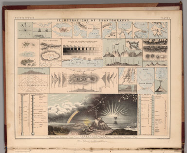
1852 Frontispiece: Illustrations of Chartogra … Physical Atlas (Frontispiece) Illustrations of Chartogr … |

1852 Climatological Chart, Showing by Lines & … Physical Atlas Climatological Chart, Showing by Lines & … |

1852 Winds and the Regions visited by Storms … Physical Atlas The Distribution of Constant Periodical … |

1852 Distribution of Rain and Snow over the G … Physical Atlas The Distribution of Rain and Snow over t … |

1852 Distribution of the Most Important Trees … Physical Atlas The Distribution of the Most Important T … |

1867 Climatological Map of North America. Survey Book Climatological Map of North America. Ent … |

1838 Text Page: Climatology World Atlas (Text Page to) Climatology. (to accompan … |

1871 Climatol. Massachusetts. State Atlas Climatological map of Massachusetts show … |

1872 Penn. climatological map. State Atlas Climatological map of Pennsylvania showi … |

1873 Climatological Map of the United States. World Atlas Gray's Atlas Climatological Map of the U … |

1884 Climatological Map of the United States. National Atlas Climatological Map of the United States … |

1921 Europe School Atlas Europe. 1. Isothermes de Janvier. 2. Iso … |

1921 Climats School Atlas Climats. Glaciers Actuels et Extension G … |

1921 Climats School Atlas Climats. Kartographia Winterthur S.A. Co … |

1895 NY rainfall, population, elevation, temp … State Atlas Map of the state of New York showing the … |

1853 63. Croquis d'une Carte des Regions Clim … World Atlas 63. Croquis d'une Carte des Regions Clim … |

1849 Alexander von Humboldt's System Der Isot … World Atlas Alexander von Humboldt's System Der Isot … |

1838 Die Isothermkurven Der Nordlichen Halbku … World Atlas Die Isothermkurven Der Nordlichen Halbku … |

1837 Karte Von Europa. World Atlas Karte Von Europa. Zur Ubersicht der Warm … |

1849 Die Hauptmomente Der Temperatur Auf Dem … World Atlas Die Hauptmomente Der Temperatur Auf Dem … |

1849 Graphische Darstellung des Ganges der Te … World Atlas Graphische Darstellung des Ganges der Te … |

1839 Ubersicht Der Mittleren Barometerstande … World Atlas Ubersicht Der Mittleren Barometerstande … |

1839 Windkarte der Erde. World Atlas Windkarte der Erde. 1ste. Abtheilung: Me … |

1849 Die Luftstromungen auf dem Nordatlantish … World Atlas Die Luftstromungen auf dem Nordatlantish … |

1841 Hyetographische Karte der Erde. World Atlas Hyetographische Karte der Erde. 1ste. Ab … |

1849 Karte Von Europa. World Atlas Karte von Europa Zur Ubersicht der Regen … |

1849 Ubersicht der Meteorologischen Stationen … World Atlas Ubersicht der Meteorologischen Stationen … |

1967 Atmoshperic Pressure, Thunderstorms, and … World Atlas Atmoshperic Pressure, Thunderstorms, and … |

1967 Precipitation, Insolation, Evaporation. … World Atlas Precipitation, Insolation, Evaporation. … |

1948 Climates. Vegetation, Ocean Currents. Te … World Atlas Climates of the World. Natural Vegetatio … |

1948 World, Europe, and Australia and New Zea … World Atlas Iron. Coal. Petroleum. Tin and Copper. T … |

1923 Location of Meteorological Stations. Atl … National Atlas Location of Meteorological Stations. Atl … |

1923 Summer Temperatures. Atlas of American A … National Atlas Average Summer Temperature, June-August, … |

1928 Winter Temperatures. Atlas of American A … National Atlas Average Winter Temperature, December - F … |

1928 Monthly Temperature Maps: January. Febru … National Atlas (Monthly Temperature Maps:) January. Feb … |

1928 Annual March of Significant Temperatures … National Atlas Annual March of Significant Temperatures … |