Who What Where WhenREMOVEWHATShow Less |
REFINE
Browse All : Composite Map of Europe
1-17 of 17
Author
Kitchin, Thomas
Full Title
(Composite of) Europe divided into its empires, kingdoms, states, republics, &c. By Thos. Kitchin, Hydrographer to the King, with many additions and improvements from the latest surveys and observations. London, published by Robt. Sayer, Fleet Street, as the Act directs, Jany. 1st, 1787.
Publisher
Robert Sayer
Author
Arrowsmith, Aaron
Full Title
(Composite map of) Map of Europe Drawn from all the Best Surveys, and Rectified by Astronomical Observations by A. Arrowsmith, Geographer. Charles Street, Soho, London. To the Right Hon.ble Sir Joseph Banks Bart. K.B. One of his Majesty's most Honorable Privy Council, and President of the Royal Society, This Map is Respectfully Dedicated by His much obliged Humble Sertv.t, A. Arrowsmith
Publisher
A. Arrowsmith
Author
Brue, Adrien Hubert, 1786-1832
Full Title
(Composite of) Carte encyprotype de l'Europe. Dediee et presentee a Monsieur. Par H. Brue, Ingenieur-Geographe de S.A. Royale. Dirigee par H. Brue. A Paris, Chez Desray ... (et) Goujon ..., 1816.
Publisher
Desray, Libraire-Editeur
Author
Herisson, Eustache, b. 1759
Full Title
(Composite of) Carte geographique et administrative du Royaume de France. Comprenant en outre le Royaume des Pays Bas, l'Allemagne, l'Empire d'Autriche, la Suisse, les Etats du Roi de Sardaigne sur le continent, des duches de Parme et de Toscane, l'Etat de l'Eglise, de l'Ile d'Elbe, les Sept.-Iles Ioniennes en supplement et une partie de l'Empire Turc, des Royaumes de Prusse, de Naples, d'Angleterre, d'Espagne jusqu'a Madrid. (with) Departement de La Seine par H. Brue. Dessinee par Herisson, Ingenieur-Geographe. Troisieme edition. Revue et augmentee par H. Brue, Ingr. Geogphe. de S.A.R. Monsieur. A Paris, Chez Desray ... (et) J. Goujon ..., 1816.
Publisher
Desray, Libraire-Editeur
Author
Thomson, John
Full Title
(Composite of) Europe after the Congress of Vienna. Neele sculpt., 352 Strand, London. Drawn & engraved for Thomson's New general atlas, 1816.
Publisher
[Baldwin, Cradock, and Joy, John Cumming, John Thomson]
Author
Lisle, Guillaume de, 1675-1726
Full Title
(Composite of) Carte de Moscovie. Dressee par Guillaume De l'Isle de l'Academie royale des Sciences a Son Excellence Monseigneur Andre Artemonides de Matueof Ministre d'Etat de sa Majeste Csarienne l'Empereur des Russes, son Lieutenant gnal. en la Principaute de Jaroslavie ... Par son tres humble et tres obeisst. Serviteur De l'Isle. A Paris, chez l'Auteur sur le Quai de l'Horologe, avec Privilege, 1706. Grave par Liebaux le fils.
Publisher
Guillaume DeLisle, Quai de l'Horloge
Full Title
(Composite of) Europe. Exhibiting its present political divisions. (Published by John Hamilton, successor to Daniel Lizars; et. al. 1831?)
Publisher
[John Hamilton, W. Curry, Jun. & Co., Whittaker, Treacher & Co.]
Author
[Bartholomew, J. G. (John George), 1860-1920, John Bartholomew and Son]
Full Title
(Composite of) Section maps of Central Europe. The Edinburgh Geographical Institute, John Bartholomew & Son, Ltd. "The Times" atlas. (London: The Times, 1922)
Publisher
The Times
Author
[Anville, Jean Baptiste Bourguignon d, 1697-1782, Kitchin, Thomas, Robert Laurie & James Whittle]
Full Title
(Composite of) Europe divided into its empires, kingdoms, states, republics, &c. By Thos. Kitchin, Hydrographer to the King, with many additions and improvements from the latest surveys and observations of Mr. d'Anville. London, Published by Laurie & Whittle, No. 53, Fleet Street, 12th May, 1795.
Publisher
Laurie & Whittle
Author
[Delarochette, Louis Stanislas d'Arcy, Robert Laurie & James Whittle]
Full Title
(Composite of) Map of the Empire of Germany, including all the states comprehended under that name: with the Kingdom of Prussia, &c. By L. Delarochette. London, Published by Laurie & Whittle, No. 53, Fleet Street, 12th May, 1794. T. Kitchin sculpt.
Publisher
Laurie & Whittle
Author
[Bartholomew, J. G. (John George), 1860-1920, John Bartholomew and Son]
Full Title
(Composite of) Western, Eastern Europe - communications. The Edinburgh Geographical Institute, John Bartholomew & Son, Ltd. "The Times" atlas. (London: The Times, 1922)
Publisher
The Times
Author
Stieler, Adolf
Full Title
(Composite of) Ost-Europa In 6 Blattern, Enthalten
Publisher
Justus Perthes
Author
Stieler, Adolf
Full Title
(Composite of) Frankreich In 4 Blattern, Blatt 1. C. Vogel. Gestochen: Schrift von H. Eberhardt. Terrain von W. Weiler. Gotha: Justus Perthes. 1875.
Publisher
Justus Perthes
Author
[Woerl, Joseph Edmund, Herder, Benjamin]
Full Title
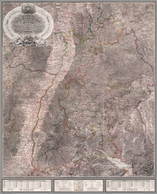
(Composite of) Sheets 1 - 12 Das Koenigreich Wuerttemberg Das Grossherzogthum Baden und die Fuurstenthuumer Hohenzollern : entworfen und bearbeitet im Maasstabe 1:200 000 in 12 Blaettern von I.E. Woerl.
Publisher
Herder'sche Kunst- u. Buchhandlung
Author
Stieler, Adolf
Full Title
(Composite of) Sud-West Deutschland Und Schweiz. Bearbeitet von C. Vogel. Gestochen: Situation & Schrift v. H. Eberhardt. Terrain von Wilhelm Weiler. Gotha: Justus Perthes. 1871-1872.
Publisher
Justus Perthes
Author
Arrowsmith, A.
Full Title
(Composite Map) Map Exhibiting the Great Post Roads, Physical and Political Divisions of Europe from Original Materials Collected from the Different Countries Delineated by A. Arrowsmith MDCCCX. London Published 2nd. Jany. 1810, by A. Arrowsmith No. 10 Soho Square, Hydrographer to H.R.H. The Prince of Wales.
Publisher
A. Arrowsmith
Author
Delarochette, Louis Stanislas d'Arcy
Full Title
(Composite of) Map of the Empire of Germany, including all the states comprehended under that name: with the Kingdom of Prussia, &c. By L. Delarochette. T. Kitchin, sculpt. London, printed for Robt. Sayer, Map & Print Seller, opposite Fetter Lane in Fleet Street, (1790?)
Publisher
Robert Sayer
1-17 of 17
|