Who What Where WhenREMOVE |
REFINE
Browse All : Composite Map of West Indies
1-10 of 10
Author
Bartholomew, John
Full Title
(Composite of) Plates 113, 114, Mexico, Central America, West Indies, Vol. 5.
Publisher
[Houghton Mifflin Co., John Bartholomew & Son LTD.]
Author
Tanner, Henry S.
Full Title
(Composite Map) South America and West Indies. With Improvements to 1821. Engraved & Published by H.S. Tanner, Philadelphia. Entered ... 8th day of June, 1818, by Tanner, Vallance, Kearney & Co. ... Pennsylvania. American Atlas.
Publisher
Henry Tanner
Author
Colton, G.W. & C.B.
Full Title
(Composite of) Colton's Map Of The United States Of America, The British Provinces, Mexico and the West Indies. Showing the Country from the Atlantic to the Pacific Ocean. Engraved, Printed & Published by G.W. & C.B. Colton & Co. New York. 1885. Entered ... 1884 by G.W. & C.B. Colton & Co. ... Washington.
Publisher
G.W. & C.B. Colton
Author
Jefferys, Thomas
Full Title
(Composite of) Compleat chart of the West Indies ... London, printed for Robt. Sayer, Map & Printseller, no. 53 in Fleet Street, as the Act directs 20th. Feby. 1775.
Publisher
Sayer and Bennett
Author
[Stieler, Adolf, Petermann, A.]
Full Title
(Composite of) Stieler's Hand-Atlas No. 79, 80, 81, 82. West-Indien in 4 Blattern.
Publisher
Justus Perthus
Author
Tanner, Henry S.
Full Title
(Composite of) A Map of North America, Constructed According To The Latest Information: by H.S. Tanner. Engraved & Published by H.S. Tanner. Philadelphia. 1822. American Atlas.
Publisher
Henry Tanner
Author
Tanner, Henry S.
Full Title
(Composite Map) South America and West Indies. 1818. Drawn, Engraved & Published by Tanner, Vallance, Kearney & Co. Philadelphia. Entered ... 8th day of June, 1818, by Tanner, Vallance, Kearney & Co. ... Pennsylvania. American Atlas.
Publisher
Henry Tanner
Author
Arrowsmith, Aaron
Full Title
(Composite of) Chart of the West Indies and Spanish Dominions in North America. By A. Arrowsmith. 1803. Hydrographer to H.R.H. the Prince of Wales. Additions to 1810. London, Published June 1st, 1803 by A. Arrowsmith, 10 Soho Square. Jones, Smith & Co. sc., Beaufort Buildgs., Strand.
Publisher
A. Arrowsmith
Author
Tanner, Henry S.
Full Title
(Composite Map) South America and West Indies. 1818. Drawn, Engraved & Published by Tanner, Vallance, Kearney & Co. Philadelphia. Entered ... 8th day of June, 1818, by Tanner, Vallance, Kearney & Co. ... Pennsylvania. American Atlas.
Publisher
Henry Tanner
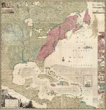
Author
Popple, Henry
Full Title
(Composite Map of) A Map of the British Empire in America with the French and Spanish Settlements adjacent thereto. by Henry Popple.
Publisher
Willm. Henry Toms & R.W. Seale
1-10 of 10
|