Who What Where WhenREMOVEWHOShow MoreWHEN
|
Author
American Atlas Company
Full Title
(Composite Map) City of Niles.
Publisher
American Atlas Company
Author
King, Clarence
Full Title
(Composite of) Geological Maps I-V, 40th Parallel Survey.
Publisher
Julius Bien
Author
King, Clarence
Full Title
(Composite of) Topographical Maps I-V, 40th Parallel Survey.
Publisher
Julius Bien
Author
[Collot, George Henri Victor, Tardieu, P.F.]
Full Title
(Composite of) A General Map Of The River Ohio, From its source to its mounth (sic): containing the names of the Towns Villages and Farms established at present on its banks: together with its soundings, and courses. (Plates one through four.) Grave par Tardieu l'aine. PL. 8-11.
Publisher
Arthus Bertrand
Author
Dutton, Clarence E. (Clarence Edward), 1841-1912
Full Title
(Composite) Map Of The Uinkaret Plateau. North and South Half. Atlas Sheets VII and VIII. Geology by C.E. Dutton. Julius Bien & Co. lith. U.S. Geological Survey, Geology of the Grand Canon District.
Publisher
Bien, Julius & Co.
Author
Dutton, Clarence E. (Clarence Edward), 1841-1912
Full Title
(Composite) Geologic Map Of The Southern Part Of The Kaibab Plateau. [Parts I-IV.] Atlas Sheets XI-XIV. Geology by C.E. Dutton. Julius Bien & Co. lith. U.S. Geological Survey, Geology of the Grand Canon District.
Publisher
Bien, Julius & Co.
Author
[Dutton, Clarence E. (Clarence Edward), 1841-1912, Holmes, William Henry, 1846-1933]
Full Title
(Composite) Panorama From Point Sublime. [Parts I-III.] W.H. Holmes. Atlas Sheets XV-XVII. Julius Bien & Co. lith. U.S. Geological Survey, Geology of the Grand Canon District.
Publisher
Bien, Julius & Co.
Author
Dutton, Clarence E. (Clarence Edward), 1841-1912
Full Title
(Composite) Geologic Map Sheets XX-XXIII. Geology by C.E. Dutton. Julius Bien & Co. lith. U.S. Geological Survey, Geology of the Grand Canon District.
Publisher
Bien, Julius & Co.
Author
Tanner, Henry S.
Full Title
(Composite Map) South America and West Indies. 1818. Drawn, Engraved & Published by Tanner, Vallance, Kearney & Co. Philadelphia. Entered ... 8th day of June, 1818, by Tanner, Vallance, Kearney & Co. ... Pennsylvania. American Atlas.
Publisher
Henry Tanner
Author
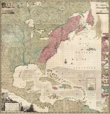
Popple, Henry
Full Title
(Composite Map of) A Map of the British Empire in America with the French and Spanish Settlements adjacent thereto. by Henry Popple.
Publisher
Willm. Henry Toms & R.W. Seale
Author
Rizzi Zannoni, Giovanni Antonio Bartolomeo, 1736-1814
Full Title
(Composite of) Mapa dos Reynos de Portugal e Algarve. Feita sobre as Memorias topografica de D. Vasque de Cozuela as do P. Lacerda e varias outras. Por D. J.AB. Rizzi Zannoni da Sociedade Real de Gottinga, professor da geograf. A Paris, en Caza de M. Lattre, Rua de S. Thiago a la Ciudad de Bordeaux. Marillier, in. Berthault, sculp. (178-?)
Publisher
Lattre & Delalain
Author
Rizzi Zannoni, Giovanni Antonio Bartolomeo, 1736-1814
Full Title
(Composite of) L'Italie divisee en ses differens etats. Dressee d'apres les meilleures cartes appuyee sur les observations astronom? Par M. Rizzi Zannoni de la Societe Royale de Gottingue. A Paris, chez Lattre graveur, rue S. Jacques, a la Ville de Bordeaux. Avec priv. du Roy. (178-?)
Publisher
Lattre & Delalain
Author
Rizzi Zannoni, Giovanni Antonio Bartolomeo, 1736-1814
Full Title
(Composite of) Carte de l'Empire d'Alemagne avec les Etats de Boheme. Dressee d'apres la carte de l'Academie Royale de Berlin et d'apres plusieurs autres. Par Mr. Rizzi Zannoni de l'Acad. Rle. des Sc. et Belles Let. de Gottingue. A Paris, Chez Lattre, Rue St. Jacques a la Ville de Bordeaux. Avec priv. du Roi. (178-?) Dediee et presentee a S.E. Monseigneur J.D. Almoreau Tiepolo, Ambassadeur Ordinaire pour la Serenissime Republique de Venise a la Cour de France. Par son tres humble et tres obeissant serviteur J.A.B. Rizzi Zannoni.
Publisher
Lattre & Delalain
Author
Bonne, Rigobert, 1727-1794
Full Title
(Composite of) Carte hydro-geo-graphique des Indes Orientales en deca et au dela du Gange avec leur archipel. Dressee et assujettie aux observations astronomiques, par M. Bonne, Hydrographe du Roi. A Paris, Chez Lattre, Graveur, ord. de M. Le Dauphin, rue S. Jacq. a la Ville de Bordeaux. Avec priv. du Roi. 1771. Indes ... feuille.
Publisher
Lattre & Delalain
Author
Bonne, Rigobert, 1727-1794
Full Title
(Composite of) Carte de la Guinee, contenant les Isles du Cap Verd, le Senegal, la Cote de Guinee proprement dite, les Royaumes de Loango, Congo, Angola et Benguela, avec les pays voisins autant qu'ils sont connus. Projettee et assujettie aux observations. Par M. Bonne, Hydrog(raph)e du Roi. A Paris, chez Lattre, rue St. Jacques, a la Ville de Bordeaux, avec priv. du R., 1781.
Publisher
Lattre & Delalain
Author
Alaskan Boundary Tribunal
Full Title
(Composite of) Sheets No. 1-24. Alaskan Boundary Tribunal. (Volume 3). Atlas of Award. Julius Bien & Co. Photo. Lith. N.Y.
Publisher
Government Printing Office
Author
Bonne, Rigobert, 1727-1794
Full Title
(Composite of) Partie de l'Amerique Septentrionale, qui comprend le Canada, la Louisiane, le Labrador, le Groenland, les Etats-Unis et la Floride. Projettee et assujettie aux observations. Par Mr. Bonne. A Paris, chez Lattre, rue St. Jacques, a la Ville de Bordeaux. Avec priv. du Roy. Revue et corrigee 1783.
Publisher
Lattre & Delalain
Full Title
(Composite) Coal Fields of Netherlands India. Overzichtskaart van den Indischen Archipel. Coal Resources of the World. (inset) Gouvt. Atjeh en Onderhoorigheden. (inset) Gouvt. Sumatra's Westkust en de Residentie Tapanoeli. (inset) Het Noordelijk Deel van de Residentie Oostkust van Sumatra. (inset) Java en Madoera.
Publisher
Morang & Co.
Author
[Lisle, Guillaume de, 1675-1726, Lisle, Joseph Nicolas de, 1688-1768]
Full Title
(Composite of) Terrae Sanctae tabula e Scripturae Sacrae, Flavii Josephi, Eusebii et Divi Hieronymi ... Opus postimum Guillelmi de L'Isle, primarii Regis Geographi, ex Archivo Geographico Rei navalis Galliae erutum, et editum a Josepho Nicolao de l'Isle, auctoris fratre, Rei navalis Astronomo Geographo. Anno M.DCCLXXXII. Sub auspiciis illustr. D.D. Ducis de Choiseul, summi rei navalis et bellieae administri. Marillier, inv. Berthault, sculp. A Paris, chez Lattre Graveur, Rue St. Jacques, pres la Fontaine S. Severin a la Ville de Bordeaux. Sous la privilege de l'Academie. Grave par Lattre.
Publisher
Lattre & Delalain
Author
Wheeler, G.M.
Full Title
(Composite map of) All Wheeler Topographical Atlas Sheets
Publisher
U.S.
Author
Wheeler, G.M.
Full Title
(Composite map of) Index to all Wheeler Topographical Atlas Sheets
Publisher
U.S.
Author
Wheeler, G.M.
Full Title
(Composite map of) All Wheeler Geological Atlas Sheets
Publisher
U.S.
Author
Wheeler, G.M.
Full Title
(Composite map of) Index of all Wheeler Geological Atlas Sheets
Publisher
U.S.
Author
Wheeler, G.M.
Full Title
(Composite map of) All Wheeler Land Classification Atlas Sheets
Publisher
U.S.
Author
Wheeler, G.M.
Full Title
(Composite map of) Index of all Wheeler Land Classification Atlas Sheets
Publisher
U.S.
Author
Smith, J. Calvin
Full Title
(Composite of) United States. Special-Karte Der Vereinicten Staaten Von Nord-Amerika. von J. Calvin Smith. Zweite verbesserte Auflage. Map Of The United States of America By J. Calvin Smith. Cassel, Druck und Verlag von Theodor Fischer.
Publisher
Theodor Fischer
Author
Pissis, Aime, 1812-1889
Full Title
(Composite of) Mapa de la Republica de Chile. (1-8). Desde el rio Loa hasta el cabo de Hornos, por A. Pissis. Lit. P. Cadot i Ca., Huerfanos, 25, (1884)
Publisher
P. Cadot.
Author
Pissis, Aime, 1812-1889
Full Title
(Composite of) (Mapa de la Republica de Chile. 9-15. Desde el rio Loa hasta el cabo de Hornos, por A. Pissis) Lit. P. Cadot i Ca., Huerfanos, 25, (1884)
Publisher
P. Cadot.
Author
[Marschner, Francis J., Marbut, Curtis F.]
Full Title
(Composite of) Soil Map of the United States by Curtis F. Marbut and Associates in the Soil Survery, U.S. Department of Agriculture, F.J. Marschner, Cartographer and Associate in Compilation. 1931. Soils, Plate 5, (Sections 1-12). Lith. A. Hoen & Co., Inc. Atlas of American Agriculture.
Publisher
U.S. Department of Agriculture
Author
Rand McNally and Company
Full Title
(Composite of) Commercial Atlas of America. Black and White Mileage Map of the United States.
Publisher
Rand McNally and Company
Author
Rand McNally and Company
Full Title
(Composite of) Commercial Atlas of America. Rand McNally Standard Map of Brazil, Paraguay, and Uruguay.
Publisher
Rand McNally and Company
Author
Rand McNally and Company
Full Title
(Composite of) Commercial Atlas of America. Rand McNally Standard Map of Chile, Bolivia, Peru, Ecuador, Uruguay, Paraguay, and the Argentine Republic (southern part). (with) Detail Map of Southern Part of the Argentine Republic and Chile.
Publisher
Rand McNally and Company
Author
Anville, Jean Baptiste Bourguignon d, 1697-1782
Full Title
(Composite of) Afrique. Publiee sous les auspices de Monseigneur le Duc d'Orleans, Premier Prince du Sang. Par le Sr. d'Anville, M DCC XLIV. Avec Privilege. Grave par Guill. Delahaye. A Paris, ches l'Auteur aux Galeries du Louvre.
Publisher
J.B.B. D'Anville.
Author
Anville, Jean Baptiste Bourguignon d, 1697-1782
Full Title
(Composite of) Amerique Septentrionale. Publiee sous les auspices de Monseigneur le Duc d'Orleans, Premier Prince du Sang. Par le Sr. d'Anville, M DCC XLVI (i.e., 1763?) Avec Privilege. Gravee par Guill? Delahaye. A Paris, chez l'Auteur, aus Galeries du Louvre.
Publisher
J.B.B. D'Anville.
Author
Anville, Jean Baptiste Bourguignon d, 1697-1782
Full Title
(Composite of) Amerique Meridionale. Publiee sous les auspices de Monseigneur le Duc d'Orleans, Premier Prince du Sang. Par le Sr. d'Anville, M DCC XLVIII Avec Privilege. Grave par Guill? Delahaye. A Paris, chez l'Auteur, aux Galeries du Louvre.
Publisher
J.B.B. D'Anville.
Author
[Mitchell, John, Raynal, G.T., Zatta, Antonio]
Full Title
(Composite Map of) Le Colonie Unite dell' America Settentrle. di Nuova Projezione Ass. Ee. Li Signori Riformatori dello Studio di Padova. Venezia 1778, Presso Antonio Zatta, con Privilegio dell' Eccellentissimo Senato. (Fogl. I-XI and title page.)
Publisher
Antonio Zatta
Author
Cary, John, ca. 1754-1835
Full Title
(Composite of) (Cary's New Map of England And Wales, With Part Of Scotland).
Publisher
John Cary
Author
Johnston, Alexander Keith
Full Title
(Composite) England and Wales. By Keith Johnston, F.R.S.E. Keith Johnston's General Atlas. Engraved, Printed, and Published by W. & A.K. Johnston, Edinburgh & London.
Publisher
W.& A.K. Johnston
Author
Johnston, Alexander Keith
Full Title
(Composite of) Scotland. By Keith Johnston, F.R.S.E. Keith Johnston's General Atlas. Engraved, Printed, and Published by W. & A.K. Johnston, Edinburgh & London.
Publisher
W.& A.K. Johnston
Author
Johnston, W. & A.K.
Full Title
(Composite of) India. (with) South-Eastern Provinces of India, (Hindu-Chinese Countries of further India). Keith Johnston's General Atlas. May 11. Engraved, Printed, and Published by W. & A.K. Johnston, Limited, Edinburgh & London.
Publisher
W.& A.K. Johnston
Author
Johnston, Alexander Keith
Full Title
(Composite of) Scotland. By Keith Johnston, F.R.S.E. Keith Johnston's General Atlas. Engraved, Printed, and Published by W. & A.K. Johnston, Edinburgh & London.
Publisher
W.& A.K. Johnston
Author
Johnston, Alexander Keith
Full Title
(Composite of) Austro-Hungarian Monarchy. By Keith Johnston, F.R.S.E. Keith Johnston's General Atlas. Engraved, Printed, and Published by W. & A.K. Johnston, Edinburgh & London.
Publisher
W.& A.K. Johnston
Author
Johnston, Alexander Keith
Full Title
(Composite of) India. (with) South-Eastern Provinces of India, (Hindu-Chinese Countries of further India). By Keith Johnston, F.R.S.E. Keith Johnston's General Atlas. Engraved, Printed, and Published by W. & A.K. Johnston, Edinburgh & London.
Publisher
W.& A.K. Johnston
Author
Johnston, Alexander Keith
Full Title
(Composite of) South America. By Keith Johnston, F.R.S.E. Keith Johnston's General Atlas. Engraved, Printed, and Published by W. & A.K. Johnston, Edinburgh & London.
Publisher
W.& A.K. Johnston
Author
Campbell, Robert, Lieutenant
Full Title
(Composite of) A new and correct map of Scotland or North Britain, with the post and military roads, divisions &ca. Drawn from the most approved surveys, illustrated with many additional improvements, and regulated by the latest astronomical observations by Lieut. Campbell. London, printed for Robt. Sayer, no. 53 Fleet Street, as the Act directs 10 Jany. 1790.
Publisher
Robert Sayer
Author
Rocque, John
Full Title
(Composite map) A map of the Kingdom of Ireland, divided into provinces, counties and baronies. Southern section. Shewing the archbishopricks, bishopricks, cities, boroughs, market towns, villages, barracks, mountains, lakes, bays, rivers, bridges, ferries, passes, also the great, the branch & the by post roads together with the inland navigation, by J. Rocque, Chorographer to His Majesty. London, printed for Robt. Sayer, opposite Fetter Lane, Fleet Street, (1790?)
Publisher
Robert Sayer
Author
Delarochette, Louis Stanislas d'Arcy
Full Title
(Composite of) Map of the Empire of Germany, including all the states comprehended under that name: with the Kingdom of Prussia, &c. By L. Delarochette. T. Kitchin, sculpt. London, printed for Robt. Sayer, Map & Print Seller, opposite Fetter Lane in Fleet Street, (1790?)
Publisher
Robert Sayer
Author
Kitchin, Thomas
Full Title
(Composite of) Asia and its islands according to d'Anville; divided into empires, kingdoms, states, regions, &ca. with the European possessions and settlements in the East Indies and an exact delineation of all the discoveries made in the eastern parts by the English under Captn. Cook. (By Thomas Kitchin). London, printed for Robert Sayer, Fleet Street as the Act directs, 6 Jany. 1787.
Publisher
Robert Sayer
Author
Jefferys, Thomas
Full Title
(Composite of) The East Indies, with the roads. By Thomas Jefferys, Geographer to the King. MDCCLXVIII. The second edition. London, published according to Act of Parliament, 30th Apr. 1768 by Robt. Sayer, no. 53 in Fleet Street.
Publisher
Robert Sayer
Author
Boulton, S.
Full Title
(Composite of) Africa, with all its states, kingdoms, republics, regions, islands, &ca. Improved and inlarged from D'Anville's map; to which have been added a particular chart of the Gold coast, wherein are distinguished all the European forts and factories. By S. Boulton, and also a summary description relative to the trade and natural produce, manners and customs of the African continent and islands. London, printed for Robert Sayer, Fleet Street, as the Act directs, 6 Jany. 1787
Publisher
Robert Sayer
|