Browse All

1872 Yonkers and East Chester, Westchester Co … County Atlas Town and City of Yonkers, Westchester Co … |

1872 Southern Part of Yonkers, and Portion of … County Atlas Southern Part of Yonkers, and Portion of … |

1872 Parts of the 1st Ward of the City of Yon … County Atlas Parts of the 1st Ward of the City of Yon … |

1872 Portions of 1st, 2nd, 3rd Wards of the C … County Atlas Portions of 1st, 2nd, 3rd Wards of the C … |

1872 Portions of 2nd, 3rd and 4th Wards of th … County Atlas Portions of 2nd, 3rd and 4th Wards of th … |

1872 Mount Vernon, Town of East Chester, West … County Atlas Mount Vernon, Town of East Chester, West … |

1872 Greenburgh, Westchester County, New York … County Atlas Town of Greenburgh, Westchester Co., N.Y … |

1872 Hastings upon Hudson. Dobbs' Ferry. Irvi … County Atlas Hastings upon Hudson. Dobbs' Ferry. Irvi … |

1872 Tarrytown, Westchester County, New York. County Atlas Plan of a Portion of Tarrytown, Town of … |

1872 North Tarrytown and Tarrytown, Westchest … County Atlas Plan of North Tarrytown, Town of Mt. Ple … |

1872 Town of Mount Pleasant, Westchester Coun … County Atlas Town of Mount Pleasant, Westchester Co., … |

1872 Tarrytown Heights Land Company. County Atlas Tarrytown Heights Land Company, Plan of … |

1872 Town of Ossining, Westchester County, Ne … County Atlas Town of Ossining, Westchester Co. N.Y. ( … |

1872 Singsing (Sparta), New York. County Atlas Singsing (Sparta), Town of Ossining, Wes … |

1872 Town of Cortlandt, Westchester County, N … County Atlas Town of Cortlandt, Westchester Co. N.Y. … |

1872 Peekskill, Westchester County, New York. … County Atlas Plan of Peekskill, Westchester Co. N.Y. … |

1872 Town of Westchester, Westchester County, … County Atlas Town of Westchester, Westchester Co., N. … |

1872 Unionport, Westchester and Schuylerville … County Atlas Unionport, Westchester, Schuylerville, N … |

1872 Wakefield, New York. (inset) Bronxdale. County Atlas Wakefield. (inset) Bronxdale. |

1872 Town of New Rochelle,and Pelham, Westche … County Atlas Towns of New Rochelle and Pelham, Westch … |

1872 Part of New Rochelle, Westchester County … County Atlas Part of New Rochelle, Westchester Co., N … |

1872 Part of New Rochelle, Westchester County … County Atlas Part of New Rochelle, Westchester Co., N … |

1872 Town of Mamaroneck, Westchester County, … County Atlas Town of Mamaroneck, Westchester Co. N.Y. … |

1872 Marmaroneck and Ryeneck, New York. County Atlas Mamaroneck, Westchester Co., N.Y. Ryenec … |

1872 Towns of Harrison and Rye, Westchester C … County Atlas Town of Harrison, Westchester Co., N.Y. … |

1872 Port Chester, New York. County Atlas Port Chester, Town of Rye, Westchester C … |

1872 Rye, New York. Village of Harrison, New … County Atlas Rye, Town of Rye, Westchester Co. N.Y. M … |

1872 Towns of White Plains and Scarsdale, Wes … County Atlas Town of White Plains, Westchester Co., N … |

1872 White Plains, New York. County Atlas White Plains, Westchester Co., N.Y. |

1872 Town of North Castle, Westchester County … County Atlas Town of North Castle, Westchester Co., N … |

1872 Westchester County, New York. (insets) N … County Atlas Town of Newcastle, Westchester Co. N.Y. … |
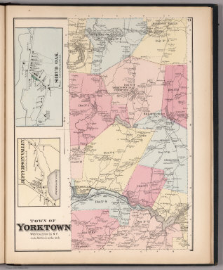
1872 Town of Yorktown, Westchester County, Ne … County Atlas Town of Yorktown, Westchester Co. N.Y. ( … |

1872 Town of Somers, Westchester County, New … County Atlas Town of Somers, Westchester Co. N.Y. (in … |

1872 Town of Bedford, Westchester County, New … County Atlas Town of Bedford, Westchester Co. N.Y. |

1872 Bedford. Bedford Station. Katonah and Wh … County Atlas Bedford. Bedford Station. Katonah and Wh … |

1872 Town of Poundridge, Westchester County, … County Atlas Town of Poundridge, Westchester Co., N.Y … |

1872 Town of Lewisboro, Westchester County, N … County Atlas Town of Lewistown, Westchester Co. N.Y. … |

1872 Town of North Salem, Westchester County, … County Atlas Town of North Salem, Westchester Co., N. … |

1891 R.15-16E T.15-16S. County Atlas Range 15 East, Range 16 East, Township 1 … |

1891 R.17-18E T.15-16S. County Atlas Range 17 East, Range 18 East, Township 1 … |

1891 R.19E T.15S. County Atlas Township 15 South, Range 19 East. (Compi … |

1891 R.20E T.15S. County Atlas Township 15 South, Range 20 East. (Compi … |

1891 Washington Colony. County Atlas Washington Colony. (with) Map of La Vina … |

1882 Sedgwick County, Kansas. County Atlas Edwards Township. Map of Sedgwick County … |

1882 Township 25 South Range 1 East, Sedgwick … County Atlas Township 25 South Range 1 East. |

1882 Edwards Map of the City of Wichita, Kans … County Atlas Edwards Map of the City of Wichita, Kans … |

1882 Township 28 South Range 1 East, Sedgwick … County Atlas Township 28 South Range 1 East. |

1882 Mulvane, Kansas. County Atlas Mulvane. |

1882 Township 25 South Range 1 West, Sedgwick … County Atlas Township 25 South Range 1 West. |

1882 Township 28 South Range 2 West, Sedgwick … County Atlas Township 28 South Range 2 West. |