Browse All

1882 Posey Township, Franklin County, Indiana … County Atlas Map of Posey Township. Andersonville (Fo … |

1882 Laurel, Indiana. County Atlas Laurel. |

1882 Salt Creek Township, Franklin County, In … County Atlas Map of Salt Creek Township. |

1882 Ray Township. Oldenburg. Enochsburg. Hun … County Atlas Map of Ray Township. Oldenburg. Enochsbu … |

1882 Butler Township. County Atlas Map of Butler Township. |

1882 Highland Township. Village and Catholic … County Atlas Map of Highland Township. Village and Ca … |

1882 Map of White Water Township, Franklin Co … County Atlas Map of White Water Township. |
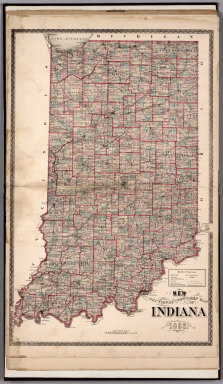
1882 Sectional and Township Map of Indiana. 1 … County Atlas Sectional and Township Map of Indiana. 1 … |

1882 New Railroad Map of the United States. County Atlas New Railroad Map of the United States. |

1882 Western Hemisphere. Eastern Hemisphere. County Atlas Western Hemisphere. Eastern Hemisphere. |

1897 Saint Croix County, Wisconsin County Atlas Outline Map of Saint Croix County, Wisco … |

1897 Cady, Saint Croix County, Wisconsin. County Atlas Plat of Cady. |

1897 Springfield, Saint Croix County, Wiscons … County Atlas Plat of Springfield. |

1897 Glenwood, Saint Croix County, Wisconsin. County Atlas Plat of Glenwood. |

1897 Forest, Saint Croix County, Wisconsin. County Atlas Plat of Forest. |

1897 Eau Galle, Saint Croix County, Wisconsin … County Atlas Plat of Eau Galle. |

1897 Baldwin, Saint Croix County, Wisconsin. County Atlas Plat of Baldwin. |

1897 Emerald, Saint Croix County, Wisconsin. County Atlas Plat of Emerald. |

1897 Cylon, Saint Croix County, Wisconsin. County Atlas Plat of Cylon. |

1897 Pleasant Valley. Rush River, Saint Croix … County Atlas (Plat of) Pleasant Valley. (Plat of) Rus … |

1897 Hammond, Saint Croix County, Wisconsin. County Atlas Plat of Hammond. |

1897 Erin, Saint Croix County, Wisconsin. County Atlas Plat of Erin. |

1897 Stanton, Saint Croix County, Wisconsin. County Atlas Plat of Stanton. |

1897 Kinnickinnic, Saint Croix County, Wiscon … County Atlas Plat of Kinnickinnic. |

1897 Warren, Saint Croix County, Wisconsin. County Atlas Plat of Warren. |

1897 Hudson, Wisconsin. County Atlas City of Hudson, Saint Croix Co. |

1897 Richmond, Saint Croix County, Wisconsin. County Atlas Plat of Richmond. |

1897 Star Prairie, Saint Croix County, Wiscon … County Atlas Plat of Star Prairie. |

1897 Saint Joseph, Saint Croix County, Wiscon … County Atlas Plat of Saint Joseph. North Hudson. Whal … |

1897 Troy, Saint Croix County, Wisconsin. County Atlas Plat of Troy. |

1897 Hudson, Saint Croix County, Wisconsin. County Atlas Plat of Hudson. |

1897 Somerset, Saint Croix County, Wisconsin. … County Atlas Plat of Somerset. Cylon. Downing. |

1897 Glenwood, Wisconsin. County Atlas City of Glenwood. |

1897 Jewett Mills. New Saratoga Springs. New … County Atlas Jewett Mills. New Saratoga Springs. New … |

1897 New Richmond. Star Prairie. Roberts, Wis … County Atlas City of New Richmond. Star Prairie. Robe … |

1897 Houlton. Deer Park. Huntington. Wilson, … County Atlas Houlton. Deer Park. Huntington. Wilson. |

1897 River Falls. Emerald. Boardman, Wisconsi … County Atlas River Falls. Emerald. Boardman. |

1897 Somerset. Hersey, Wisconsin. County Atlas Somerset. Hersey. |

1897 Hammond. Pleasant Valley, Wisconsin. County Atlas Hammond. Pleasant Valley P.O. |

1897 Baldwin. Woodville, Wisconsin. County Atlas Baldwin. Woodville. |

1897 Wisconsin. County Atlas Wisconsin. (inset) Vicinity of Milwaukee … |

1897 United States. County Atlas Gray's New Map of the United States By F … |

1897 Principal Meridians and Base Lines in th … County Atlas Map Showing the Principal Meridians and … |

1874 Ohio. County Atlas Map of Ohio. Published by H.H. Hardesty, … |

1874 Ottawa County, Ohio. County Atlas Outline Map of Ottawa County, Ohio. |

1874 Sectional Map of Elkhart County, Indiana … County Atlas Sectional Map of Elkhart County, Indiana … |

1874 City of Goshen. (View) M.E. Church. Jno. … County Atlas City of Goshen. (View) M.E. Church. Jno. … |

1874 Elkhart Township, Elkhart County, Indian … County Atlas Elkhart. |

1874 Middlebury Township, Elkhart County, Ind … County Atlas Middlebury. |

1874 Jefferson Township, Elkhart County, Indi … County Atlas Jefferson. |