Browse All

1876 Santa Clara Co. County Atlas Map of Santa Clara Co., California. (Tho … |

1876 Santa Clara Co. 1. County Atlas (Farm) map number one (Santa Clara Co., … |

1876 Santa Clara Co. 2. County Atlas (Farm) map number two (Santa Clara Co., … |

1876 Santa Clara Co. 3. County Atlas (Farm) map number three (Santa Clara Co. … |

1876 Santa Clara Co. 4. County Atlas (Farm) map no. four (Santa Clara Co., Ca … |

1876 Santa Clara Co. 5. County Atlas (Farm) map number five (Santa Clara Co., … |

1876 Santa Clara Co. 6. County Atlas (Farm) map number six (Santa Clara Co., … |

1876 San Jose 1st ward. County Atlas City of San Jose, first ward. (Thompson … |

1876 San Jose 2nd ward. County Atlas City of San Jose, second ward. (Thompson … |

1876 San Jose 3rd ward. County Atlas City of San Jose, third ward. (with) Hay … |

1876 San Jose 4th ward. County Atlas City of San Jose, fourth ward. (Thompson … |

1876 Santa Clara. County Atlas Plat of Santa Clara. Compiled from offic … |

1876 Santa Clara Co. 7. County Atlas (Farm) map number seven (Santa Clara Co. … |

1876 Santa Clara Co. 8. County Atlas (Farm) map number eight (Santa Clara Co. … |

1876 Santa Clara Co. 9. County Atlas (Farm) map number nine (Santa Clara Co., … |

1876 Gilroy. County Atlas City of Gilroy. (Thompson & West, San Fr … |

1876 Santa Clara Co. 11. County Atlas (Farm) map number eleven (Santa Clara Co … |

1876 Poplar City. County Atlas "Poplar City" connecting the cities of S … |

1876 Santa Clara Co. 12. County Atlas (Farm) map number twelve (Santa Clara Co … |

1876 Santa Clara Co. 10. County Atlas (Farm) map number ten (Santa Clara Co., … |

1878 Fairfield, Suisun. County Atlas Map of Fairfield and Suisun, Solano Coun … |

1878 Dixon. County Atlas Map of Dixon, Solano Co., Cal. (Publishe … |

1868 New York & vicinity. County Atlas Map of New York and vicinity accompanyin … |

1868 New York, Brooklyn. County Atlas Plan of New York and Brooklyn. (Atlas of … |

1868 W. Farms, Morrisania. County Atlas West Farms and Morrisania. (Atlas of New … |

1868 Tremont, W. Farms. County Atlas Tremont, Town of West Farms. (Atlas of N … |

1868 Fordham. County Atlas Fordham. (Atlas of New York and vicinity … |

1868 West Farms. County Atlas West Farms, Westchester Co., N.Y. (Atlas … |

1868 Westchester, N.Y. County Atlas Town of Westchester, Westchester Co., N. … |

1868 Wakefield, Bronxdale. County Atlas Wakefield, Town & County of Westchester, … |

1868 Unionport, Westchester, Schuylerville. County Atlas Unionport, Westchester, Schuylerville, T … |

1868 Woodlawn Cemetery. County Atlas Map of the Woodlawn Cemetery, incorporat … |

1868 Yonkers, Town. County Atlas Town of Yonkers, Westchester Co., N.Y. ( … |

1868 Yonkers, N.Y. County Atlas Yonkers, Westchester Co., N.Y. (Atlas of … |

1868 Yonkers, N.Y. County Atlas Yonkers, Westchester Co., N.Y. (Atlas of … |

1868 Yonkers, N.Y. County Atlas Yonkers, Westchester Co., N.Y. (Atlas of … |

1868 Yonkers N pt. County Atlas Northern part of Town of Yonkers adjacen … |

1868 Hastings on Hudson, Dobbs Ferry, Irvingt … County Atlas Hastings upon Hudson ... Dobbs' Ferry .. … |

1868 Tarrytown, vicinity. County Atlas Plan of Tarrytown and vicinity, Westches … |

1868 Greenburgh, Town. County Atlas Town of Greenburgh, Westchester Co., N.Y … |
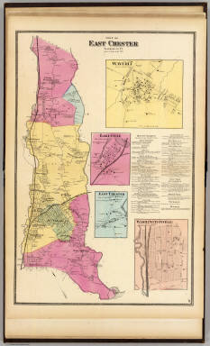
1868 E. Chester, Town. County Atlas Town of East Chester, Westchester Co., N … |

1868 Mt. Vernon, N.Y. County Atlas Mount Vernon, Westchester Co., N.Y. (Atl … |

1868 City I., Pelham, Town. County Atlas City Island, Pelham Township, Westcheste … |

1868 New Rochelle, Town; Pelhamville. County Atlas Town of New Rochelle, Westchester Co., N … |

1868 New Rochelle. County Atlas New Rochelle, Westchester Co., N.Y. (Atl … |

1868 White Plains, Scarsdale towns. County Atlas Towns of White Plains and Scarsdale, Wes … |

1868 White Plains, N.Y. County Atlas White Plains, Westchester Co., N.Y. (wit … |

1868 Mamaroneck Town, Orienta. County Atlas Town of Mamaroneck, Westchester Co., N.Y … |

1868 Mamaroneck, Rye Neck. County Atlas Mamaroneck, Rye Neck, Westchester Co., N … |

1868 Harrison, Rye towns. County Atlas Towns of Harrison and Rye, Westchester C … |