Who What Where WhenREMOVEWHERE
|
Full Title
Storrs. (with) Cheviot, Green Township. (with) Plainville, Columbia Township. (1869)
Publisher
C.O. Titus
Full Title
Springfield. (1869)
Publisher
C.O. Titus
Full Title
Glendale, Springfield Township. (with) Hartwell, Springfield Township. (with) Pleasant Ridge. (1869)
Publisher
C.O. Titus
Full Title
Lockland. Reading. (with) O'Bryonville, Spencer Township. (with) Pendleton, Spencer Township. (with) Camp Dennison, Symmes Township. (1869)
Publisher
C.O. Titus
Full Title
Columbia. (with) Camden City, Columbia Township. (with) Oakley, Columbia Township. (with) Montauk, Columbia Township. (1869)
Publisher
C.O. Titus
Full Title
Symmes. (with) Mount Pleasant, Springfield Township.(1869)
Publisher
C.O. Titus
Full Title
Spencer. Madisonville, Columbia Township. (with) Sharpsburg, Columbia Township. (1869)
Publisher
C.O. Titus
Full Title
Columbia, Spencer Township. (with) Mount Washington. (1869)
Publisher
C.O. Titus
Full Title
Mill Creek. (with) Winton Place. (with) St. Peters, Lick Run, Mill Creek Township, Weaversburg. (1869)
Publisher
C.O. Titus
Full Title
Avondale, Mill Creek township. (with) Newton, Anderson Township. (with) Montgomery, Sycamore Township. (1869)
Publisher
C.O. Titus
Full Title
Cumminsville, Mill Creek Township. (with) Carthage, Mill Creek Township. (with) New Burlington, Springfield Township. (1869)
Publisher
C.O. Titus
Full Title
Corryville, Mill Creek Township (1869)
Publisher
C.O. Titus
Full Title
Clifton, Mill Creek Township. (with) St. Bernard, Mill Creek Township. (1869)
Publisher
C.O. Titus
Full Title
Walnut Hills, Mill Creek Township. (with) California, Anderson Township. (1869)
Publisher
C.O. Titus
Full Title
Camp Washington and Clifton Heights. (1869)
Publisher
C.O. Titus
Full Title
College Hill, Mill Creek Tp. (with) Sharon. (1869)
Publisher
C.O. Titus
Full Title
Fairmount, Mt. Harrison & vicinity, Mill Creek Township. (1869)
Publisher
C.O. Titus
Full Title
Outline map of Cincinnati. Accompanying Atlas of Cincinnati & Hamilton Co. (1869)
Publisher
C.O. Titus
Full Title
Cincinnati part I embracing 16th wards. (1869)
Publisher
C.O. Titus
Full Title
Cincinnati part II embracing 6th, 8th & 15th wards. (1869)
Publisher
C.O. Titus
Full Title
Cincinnati part VI embracing 2nd, 4th & 14th wards. (1869)
Publisher
C.O. Titus
Full Title
Cincinnati part V embracing 1st & 3d wards. (1869)
Publisher
C.O. Titus
Full Title
Cincinnati part VI embracing 9th & 13th wards. (1869)
Publisher
C.O. Titus
Full Title
Cincinnati part VII embracing 17th & part of 20th wards. (1869)
Publisher
C.O. Titus
Full Title
Cincinnati part VIII embracing part of 20th ward. Cincinnati part III embracing 5th, 7th & 10th wards. (1869)
Publisher
C.O. Titus
Full Title
Cincinnati part IX embracing 11th & 19th wards. (1869)
Publisher
C.O. Titus
Full Title
Cincinnati part X embracing 12th & 18th wards. (1869)
Publisher
C.O. Titus
Author
Titus, Clarence O.
Full Title
Titus' railroad & township map of the state of Ohio. (with view) State Capitol at Columbus. Published by C.O. Titus, 320 Chestnut St., Philadelphia, Pa. (1869)
Publisher
C.O. Titus
Author
Titus, Clarence O.
Full Title
Outline & rail road map of the United States of America. Published by C.O. Titus, 320 Chestnut St., Philadelphia, Pa. (1869)
Publisher
C.O. Titus
Full Title
Longview Asylum near Cincinnati, Ohio. Longview Asylum, colored. (1869)
Publisher
C.O. Titus
Author
Beers, Frederick W.
Full Title
(Covers to) Atlas Of Bennington Co. Vermont. From actual surveys by and under the direction of F.W. Beers, assisted by Geo. P. Sanford & others. Published By F.W. Beers, A.D. Ellis & G.G. Soule. Assistants, W.T. Comstock, A.M., Jno. A. Cline, A.J. Bingham, G.H. Jones, W. Homer Hubbell, 95 Maiden Lane New York. 1869. Engd. by Worley & Bracher, 320 Chestnut St. Philada. Printed by James McGuigan, Cor. 3d & Dock Sts. Phila. Entered ... 1869 by Beers, Ellis & Soule ... New York.
Publisher
Beers, Ellis & Soule
Author
Beers, Frederick W.
Full Title
(Title Page to) Atlas Of Bennington Co. Vermont. From actual surveys by and under the direction of F.W. Beers, assisted by Geo. P. Sanford & others. Published By F.W. Beers, A.D. Ellis & G.G. Soule. Assistants, W.T. Comstock, A.M., Jno. A. Cline, A.J. Bingham, G.H. Jones, W. Homer Hubbell, 95 Maiden Lane New York. 1869. Engd. by Worley & Bracher, 320 Chestnut St. Philada. Printed by James McGuigan, Cor. 3d & Dock Sts. Phila. Entered ... 1869 by Beers, Ellis & Soule ... New York.
Publisher
Beers, Ellis & Soule
Author
Beers, Frederick W.
Full Title
(Table of Contents) Index.
Publisher
Beers, Ellis & Soule
Author
Beers, Frederick W.
Full Title
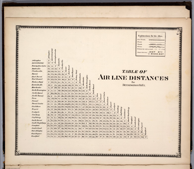
(Text Page) Table of Airline Distances for Bennington Co. Vt.
Publisher
Beers, Ellis & Soule
Author
Beers, Frederick W.
Full Title
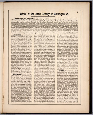
(Text Page) Sketch of the Early History of Bennington Co.
Publisher
Beers, Ellis & Soule
Author
Beers, Frederick W.
Full Title
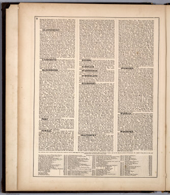
(Text Page) Sketch of the Early History of Bennington Co. (continued).
Publisher
Beers, Ellis & Soule
Author
Beers, Frederick W.
Full Title
Map of Vermont.
Publisher
Beers, Ellis & Soule
Author
Beers, Frederick W.
Full Title
Plan of Bennington County, Vermont.
Publisher
Beers, Ellis & Soule
Author
Beers, Frederick W.
Full Title
Rupert. Rupert.
Publisher
Beers, Ellis & Soule
Author
Beers, Frederick W.
Full Title
Dorset.
Publisher
Beers, Ellis & Soule
Author
Beers, Frederick W.
Full Title
East Dorset. North Dorset. South Dorset.
Publisher
Beers, Ellis & Soule
Author
Beers, Frederick W.
Full Title
Peru & Landgrove. Clarksville.
Publisher
Beers, Ellis & Soule
Author
Beers, Frederick W.
Full Title
Sandgate.
Publisher
Beers, Ellis & Soule
Author
Beers, Frederick W.
Full Title
Manchester.
Publisher
Beers, Ellis & Soule
Author
Beers, Frederick W.
Full Title
Manchester. Dorset. Peru. West Rupert. Factory Point.
Publisher
Beers, Ellis & Soule
Author
Beers, Frederick W.
Full Title
Winhall. Bondville.
Publisher
Beers, Ellis & Soule
Author
Beers, Frederick W.
Full Title
Arlington. Arlington.
Publisher
Beers, Ellis & Soule
|