Browse All

1899 Covers: Illustrated Standard Atlas Of Gi … County Atlas (Covers) An Illustrated Standard Atlas O … |

1899 Title Page: Illustrated Standard Atlas O … County Atlas (Title Page) An Illustrated Standard Atl … |

1899 Table of Contents: Illustrated Standard … County Atlas (Table of Contents to) An Illustrated St … |

1899 Portrait: (Gibson) County Officials. County Atlas (Portrait) County Officials. |

1899 Portrait: Old Settlers Of Gibson Co., In … County Atlas (Portrait) Old Settlers Of Gibson Co., I … |

1899 Advertisement: (Display Ads), Gibson Co. … County Atlas (Advertisement) (Display Ads). |

1899 Text: List of Patrons of the Atlas of Gi … County Atlas (Text Page) List of Patrons of the Atlas … |

1899 Portrait: Old Settlers Of Gibson Co., In … County Atlas (Portrait) Old Settlers. Heybach-Bush Co … |

1899 View: Public Buildings, Gibson County, I … County Atlas (View) St. Joseph Catholic Church and Re … |

1899 Text: Instruction in Land Description. County Atlas (Text Page) Instruction in Land Descript … |

1899 Gibson County, Indiana. County Atlas Gibson County, Indiana. |

1899 White River Township, Gibson County, Ind … County Atlas Map of the White River Twp., Gibson Co. … |

1899 Patoka, White River Township, Gibson Cou … County Atlas Map of Patoka, White River Twp. |

1899 Washington Township, Gibson County, Indi … County Atlas Map of Washington Twp., Gibson Co. |

1899 Wabash Township, Gibson County, Indiana. County Atlas Map of Wabash Twp., Gibson Co. |

1899 North Part of Montgomery Township, Gibso … County Atlas North Part of Montgomery Twp., Gibson Co … |

1899 South Part of Montgomery Township, Gibso … County Atlas South Part of Montgomery Twp., Gibson Co … |

1899 North Part of Princeton, Gibson County, … County Atlas Map of Princeton, North Part. |

1899 Princeton, South Part. Map of Owensville … County Atlas Map of Princeton, South Part. Map of Owe … |

1899 Patoka Township, Gibson County, Indiana. County Atlas Patoka Twp., Gibson Co. |

1899 South Part of Patoka Township, Gibson Co … County Atlas South Part of Patoka Twp., Gibson County … |

1899 Center Township, Gibson County, Indiana. County Atlas Map of Center Twp., Gibson Co. |

1899 Columbia Township, Gibson County, Indian … County Atlas Map of Columbia Twp., Gibson Co. |

1899 Oakland City, Columbia Township, Gibson … County Atlas Map of Oakland City, Columbia Twp. Haubs … |

1899 Barton Township, Gibson County, Indiana. … County Atlas Map of Barton Twp., Gibson Co. (inset) M … |

1899 Johnson Township, Gibson County, Indiana … County Atlas Map of Johnson Twp., Gibson Co. |

1899 Fort Branch, Johnson Township, Gibson Co … County Atlas Fort Branch, Johnson Twp. Map of Francis … |

1899 Indiana. County Atlas Indiana. Copyright, 1899, by Geo. F. Cra … |

1899 United States. County Atlas United States. |

1899 World on Mercator's Projection. County Atlas Chart of The World on Mercator's Project … |

1899 Covers: Atlas And Directory Of Trumbull … County Atlas (Covers to) Atlas And Directory Of Trumb … |

1899 Title: Atlas And Directory Of Trumbull C … County Atlas (Title Page) Atlas And Directory Of Trum … |

1899 Index Page: Table of Contents. County Atlas (Index Page) Table of Contents. |

1899 Index Map: Outline Map of Trumbull Count … County Atlas (Index Map) Outline Map of Trumbull Coun … |

1899 Hubbard, Trumbull County, Ohio. County Atlas Map of Hubbard. |

1899 Brookfield, Trumbull County, Ohio. County Atlas Map of Brookfield. |

1899 Hartford, Trumbull County, Ohio. County Atlas Map of Hartford. |

1899 Vernon, Trumbull County, Ohio. County Atlas Map of Vernon. |

1899 Kinsman, Trumbull County, Ohio. County Atlas Map of Kinsman. |

1899 Liberty, Trumbull County, Ohio. County Atlas Map of Liberty. |
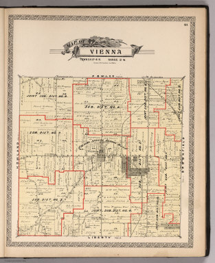
1899 Vienna, Trumbull County, Ohio. County Atlas Map of Vienna. |

1899 Fowler, Trumbull County, Ohio. County Atlas Map of Fowler. |

1899 Johnston, Trumbull County, Ohio. County Atlas Map of Johnston. |

1899 Gustavus, Trumbull County, Ohio. County Atlas Map of Gustavus. |

1899 Weathersfield, Trumbull County, Ohio. County Atlas Map of Weathersfield. |

1899 Howland, Trumbull County, Ohio. County Atlas Map of Howland. |

1899 Bazetta, Trumbull County, Ohio. County Atlas Map of Bazetta. |

1899 Mecca, Trumbull County, Ohio. County Atlas Map of Mecca. |

1899 Greene, Trumbull County, Ohio. County Atlas Map of Greene. |

1899 Lordstown, Trumbull County, Ohio. County Atlas Map of Lordstown. |