Who What Where WhenREMOVEWHERE
|
Author
Hayden, F.V.
Full Title
(Covers to) Department Of The Interior. United States Geological And Geographical Surveys Of The Territories. Geological And Geographical Atlas Of Colorado And Portions Of Adjacent Territory By F.V. Hayden, U.S. Geologist In Charge. Corrected To Date And Printed In Accordance With An Act Of Congress Approved February 9th 1881. Julius Bien, Lith.
Publisher
Department of The Interior. United States Geological and Geographical Surveys of the Territories.
Author
[Dutton, Clarence E. (Clarence Edward), 1841-1912, Geographical and Geological Survey of the Rocky Mountain Region (U.S.)]
Full Title
(covers to) Topographical and geological atlas of the district of the high plateaus of Utah to accompany the report of Capt. C.E. Dutton, U.S. Ordnance Corps, assistant geologist. Julius Bien, Lith., New York, 1879.
Publisher
U.S. Geographical and Geological Survey of the Rocky Mountain Region
Author
Walling, H. F.
Full Title
(Covers to) Atlas of the State of Michigan, including statistics and descriptions of its topography, hydrology, climate, natural and civil history, railways, educational institutions, material resources, etc. By Alexander Winchell, LL.D. ... Hon. C.I. Walker, Oramel Hosford, Esq., Henry M. Utley, Esq., and Ray Haddock, Esq. Drawn, compiled, and edited by H.F. Walling, C.E. ... Published by R.M. & S.T. Tackabury, Detroit, Mich. (on verso) Entered ... 1873, by H.F. Walling ... Washington. The Claremont Manufacturing Company, Claremont, N.H., Book Manufacturers.
Publisher
R.M. & S.T. Tackabury
Author
Raisz, Erwin
Full Title
(Covers to) Atlas of Florida by Erwin Raisz and associates with text by John R. Dunkle. Prepared in the Department of Geography, University of Florida. University of Florida Press, Gainesville, 1964. (on verso) 1964 Board of Commissioners of State Institutions of Florida. (inside back cover stated) The Atlas Of Florida ... Cover Lithoprinted by Paramount Press, Inc., Jacksonville, Florida. Text Lithoprinted by Rose Printing Co., Tallahassee, Florida. Bound in Dobbs Manufactures, St. Augustine, Florida.
Publisher
Un. Of Florida Press
Author
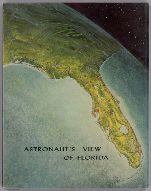
Raisz, Erwin
Full Title
(Covers to) Astronaut's View Of Florida. (to accompany) Atlas of Florida by Erwin Raisz and associates with text by John R. Dunkle. Prepared in the Department of Geography, University of Florida. University of Florida Press, Gainesville, 1964. (on verso) 1964 Board of Commissioners of State Institutions of Florida.
Publisher
Un. Of Florida Press
Author
Andreas, A. T. (Alfred Theodore), 1839-1900
Full Title
(Covers to) A.T. Andreas' illustrated historical atlas of the State of Iowa. 1875. (7th Congressional District ed.). Published by the Andreas Atlas Co., Lakeside Building, Chicago, Ills. Engraved & printed by Chas. Shober & Co., Props. of Chicago Lithographing Co.
Publisher
Andreas Atlas Co.
Author
Asher & Adams
Full Title
(Covers to) Asher & Adams' New Topographical Atlas And Gazetteer Of New York, Comprising A Topographical View Of The Several Counties Of The State ... Including a Fine Copper Plate Railroad Map of the United States And Territories, Drawn on the Polyconic Projection, Expressly for this Work. Compiled From The Latest Astronomical Observations, Official Surveys And Records Of The United States And Territories, And The Several States, As Well As From Counties, Towns And Personal Observations. Engraved on Copper Plate, and Lithographed from Original Drawings. New York: Asher & Adams, 335 Broadway, Indianapolis, Ind. Asher, Adams & Higgins.
Publisher
Asher & Adams
Author
[Meacham, J.H. & Co., Allen, C.R.]
Full Title
(Covers to) Illustrated Historical Atlas Of The Province Of Prince Edward Island. From Surveys made under the direction of C.R. Allen, C.E. Dedicated by Special Permission to His Excellency Sir John Douglas Sutherland Campbell K.T., K.M., K.G., Gov. General &c. By J.H. Meacham & Co. Publishers. 1880. Eng. by Worley & Bracher. 27 So. Sixth St. Phila. Pa. Printed by F. Bourquin. 31 So. Sixth St. Phila. Pa.
Publisher
J.H. Meacham & Co.
Author
[Lloyd, H.H., Warner & Beers]
Full Title
(Covers to) Atlas of Whiteside Co. and the State of Illinois To Which Is Added An Atlas Of The United States, Maps of The Hemispheres &c. &c. &c. Warner & Beers. Publishers 62 & 64 West Lake Street, Chicago. 1872. Union Lith. & Printg. Co. Chicago. Assistants: Jos. H. Cox, W.H. Bishop, G.R. Hoffman, L.W. Wight, A.D. Miner, E.C. Moore ... H.R. Belden, John I. Moore, Chas. H. Sharp, R.T. Higgins, Wm. H. Beers, Frank W. Rorh. Entered ... 1872 by Warner & Beers ... Washington D.C.
Publisher
Warner & Beers
Author
Andreas, A. T. (Alfred Theodore), 1839-1900
Full Title
(Covers to) An illustrated historical atlas of the State of Minnesota. Published by A.T. Andreas, Lakeside Building, Chicago, Ills. 1874. Chas. Shober & Co. Proprietors of Chicago Lith. Co.
Publisher
A.T. Andreas
Author
[Walling, H.F., Hitchcock, C.H.]
Full Title
(Covers to) Atlas Of The State Of New Hampshire Including Statistics And Descriptions Of Its Topography, Geology, River Systems, Climatology, Railroads, Educational Institutions, Agricultural And Botanical Productions, Mechanical And Manufacturing Interests, Etc. The Topographical Work Under THe Direction Of H.F. Walling, C.E. ... The Descritive Matter Compiled And Edited By Charles H. Hitchcock, Ph.D. ... Published By Comstock & Cline, 27 Warren Street, New York. (verso) Entered ... 1877, by Julius Bien ... Washington. Engraved And Printed By Julius Bien, 16 & 18 Park Place, New York.
Publisher
Comstock & Cline (Bien)
Author
[Beers, J.B. & Co., H.W. Burgett and Company]
Full Title
(Covers to) Illustrated topographical and historical atlas of the State of Vermont. Published by H.W. Burgett & Co. 36 Vesey Street, New-York. 1876. Entered ... 1876 by H.W. Burgett & Co. ... Washington D.C. Engraved & printed by J.B. Beers & Co. 36 Vesey St. N.Y.
Publisher
H.W. Burgett & Co.
Author
Hopkins, G.M.
Full Title
(Covers to) Atlas Of The County Of Montgomery and the State of Pennsylvania From actual surveys & official records, Compiled & Published By G.M. Hopkins & Co. 320 Walnut St, Philadelphia. 1871. Assistant Surveyors: H.W. Hopkins, W.S. MacCormac, Edward Vansciver, Weston R. Smith, Samuel Huff, Robert Foust, L. Cunningham. Assistant Publishers: Richard Clark, M.S. Converse, S.T.C. Bell, L.J. Richards, J.C. Martin, W.G. Carter, Isaac Borneman, James Wilson, A.R. Whipple. Engraved by Edward Busch, 320 Walnut St. F. Bourquin Lith 104 Hudson St. Phila. Entered ... 1871, by G.M. Hopkins ... Washington, D.C.
Publisher
G.M. Hopkins & Co.
Author
Geological Survey (U.S.)
Full Title
(Covers to) Topographical atlas of the state of Rhode Island and Providence Plantations, by the United States Geological Survey, in cooperation with the state. 1891. U.S. Geological Survey. J.W. Powell, Director. Henry Gannett, Chief Geographer. Marcus Baker, geographer in charge. State of Rhode Island. David W. Hoyt, John W. Ellis, Winslow Upton, commissioners. Triangulation and topography by the U.S. Geological and the U.S. Coast & Geodetic surveys. Surveyed 1885-1888. For sale by J.C. Thompson, 269 Westminster St., Providence, R.I. Under the direction of the commission. (Printed by) Geo. H. Walker & Co., Boston & N.Y.
Publisher
J.C. Thompson
Author
D.H. Hurd & Co.
Full Title
(Covers to) Town and city atlas of the state of Connecticut. Compiled from government surveys, county records and personal investigations. D.H. Hurd & Co., Boston. 1893. Copyright 1893, by D.H. Hurd & Co., Boston.
Publisher
D.H. Hurd & Co.
Author
Davis, Ellis Arthur
Full Title
(Covers to) Davis' new commercial encyclopedia, the Pacific Northwest: Washington, Oregon and Idaho. Published by Ellis A. Davis. Berkeley, Cal. Seattle. 1909.
Publisher
E.A. Davis
Author
Hawaii. Governor
Full Title
(Title Page to) Report of the Governor of the Territory of Hawaii to the Secretary of the Interior. 1906.
Publisher
Government Printing Office
Author
Beers, D. G.
Full Title
(Covers to) Atlas of the state of Delaware. From actual surveys by and under the direction of D.G. Beers. Published by Pomeroy & Beers, 320 Chestnut St., Philadelphia, 1868. Entered ... 1867 by Pomeroy & Beers ... Pennsylvania. Engraved by Worley & Bracher, 320 Chestnut St., Phila. Printed by Fred. Bourquin, 320 Chestnut St., Phila.
Publisher
Pomeroy & Beers
Author
[Asher, Adams & Higgins, Higgins & Ryan]
Full Title
(Covers to) New topographical atlas and gazetteer of Indiana: comprising a topographical view of the several counties of the state, together with a railroad map of Ohio, Indiana, and Illinois, an alphabetical gazetteer giving a concise description and the location of cities, villages, post-offices, railroad stations, landings, etc., and a brief history of Indiana. Including complete maps of the United States, Europe, and the world, drawn on the polyconic projection, expressly for this work. Compiled from the latest astronomical observations, official surveys and records of the United States and territories, and the several states, as well as from counties, towns, and personal observations. Engraved on copper-plate, and lithographed from original drawings. Indianapolis: Higgins & Ryan.
Publisher
Higgins & Ryan
Author
Mitchell, Samuel Augustus
Full Title
(Covers to) Maps of Maine, New Hampshire and Vermont, Massachusetts & Rhode Island, Connecticut, New York, and New York City. Published by S. Augustus Mitchell, North East corner of Market and Seventh streets, Philadelphia. 1846. Evans, Printer. Fourth below Chestnut.
Publisher
S.A. Mitchell
Author
Roe Brothers (Firm)
Full Title
(Covers to) Atlas of the Maritime Provinces of the Dominion of Canada, with historical and geological descriptions. Drawn on the Rectangular polyconic projection, from the British Admiralty charts, the National Boundary Survey, official plans, railway surveys, latest and most reliable maps, and new surveys made by the authors. Drawn and published by Roe Brothers, (A.D. & W.B. Roe). St. John, N.B. 1878. Eng. by Worley & Bracher, 27 South Sixth Street, Philada. Printed by F. Bourquin, 31 South Sixth St., Philada.
Publisher
Roe Brothers
Author
[J.H. Stuart & Co., Stuart, J. H.]
Full Title
(Covers to) Stuart's atlas of the state of Maine. Including statistics and descriptions of its history, educational system, geology, rail roads, natural resources, summer resorts and manufacturing interests, compiled and drawn from official plans and actual surveys and published by J.H. Stuart & Co. South Paris, Maine. 9th edition. Copyright secured by J.H. Stuart, 1890. Eng. by Balliet & Volk, 27 So. Sixth St., Phila., Pa. Printed by F. Bourquin, 31 So. Sixth St., Phila. (1894)
Publisher
J.H. Stuart & Co.
Author
[Colby, George N., George N. Colby & Co.]
Full Title
(Covers to) Atlas of the state of Maine. Including statistics and descriptions of its history, educational system, geology, rail roads, natural resources, summer resorts and manufacturing interests. Compiled and drawn from official plans and actual surveys and published by George N. Colby. Houlton, Maine. 1885. Assisted by H.E. Halfpenny, C.E. & J.H. Stuart, C.E. Copyright secured by Geo. N. Colby & Co. 1884. Eng. by Wm. Bracher, 27 So. Sixth St. Phila. Printed by F. Bourquin, 31 So. Sixth St. Phila.
Publisher
George N. Colby
Author
[Andreas, A. T. (Alfred Theodore), 1839-1900, Baskin, Forster and Company]
Full Title
(Covers to) Illustrated historical atlas of the State of Indiana. Published by Baskin, Forster & Co. Lakeside Building Chicago, Ills. 1876. Engraved & Printed by Chas. Shober & Co. Props. of Chicago Lithographing Co.
Publisher
Baskin, Forster & Co.
Author
[Gray, Ormando Willis, Lloyd, H.H., Walling, H. F.]
Full Title
(Covers to) New topographical atlas of the State of Ohio. With descriptions historical, scientific, and statistical, together with maps of the Untied States and territories. By H.F. Walling, and O.W. Gray, civil and topographical engineers. Published by Stedman, Brown & Lyon, Cincinnati. 1872. Entered ... 1872, by H.F. Walling, and O.W. Gray, and H.H. Lloyd & Co. ... Washington.
Publisher
Stedman, Brown & Lyon
Author
[Price, T. T., Rose, Theodore F., Woolman, H. C.]
Full Title
(Covers to) Historical and biographical atlas of the New Jersey coast. Proposed, arranged and illustrated by T.F. Rose. Surveys by H.C. Woolman. History and statistics by T.T. Price, M.D. Philadelphia, Woolman & Rose, 1878.
Publisher
Woolman & Rose
Author
[Everts & Co., L.H. Everts & Co.]
Full Title
(Covers to) The official state atlas of Kansas compiled from government surveys, county records and personal investigations. Philadelphia. L.H. Everts & Co. 1887.
Publisher
L.H. Everts & Co.
Author
Mills, Robert
Full Title
(Covers to) Atlas Of The State Of South Carolina, Made Under The Authority Of The Legislature; Prefaced With A Geographical, Statistical And Historical Map Of The State. By Robert Mills, Of South Carolina, P.A. ... Published by F. Lucas Jr. Baltimore for Mills' Atlas.
Publisher
Tanner/Lucas
Author
[Walker, G.H., Walker, O.W.]
Full Title
(Covers to) Atlas Of Massachusetts. Compiled Under The Direction Of O.W. Walker, C.E. Assistance rendered by more than One Hundred prominent Civil Engineers and Surveyors, referred to on Page 3. Published By Geo. H. Walker & Co. 160 Tremont St. Boston, Mass. Copyright 1891, by Geo. H. Walker & Co., Boston. (in fountain ink) 1891.
Publisher
Geo.H. Walker & Co.
Author
Hopkins, G.M.
Full Title
(Covers to) Combined Atlas Of The State Of New Jersey and the County of Hudson from actual Survey, Official records & Private Plans, by and under the Direction of G.M. Hopkins, Civil Engineer, Author of all the Maps made for the Late Geological Survey Of New Jersey. Published By G.M. Hopkins & Co. 320 Walnut St. Philadelphia. 1873. Assistant Surveyors: H.W. Hopkins, L. Cunningham, George Bromley, Robt. Foust, Horace Goodchild, Godfrey Laudeman. Assistant Publishers: M.S. Converse, S.T.C. Bell, A.R. Whipple, G.B. Vandervoort, C.A. Force, J. Brown, J.P. Brown. Engraved by Edward Busch, 320 Walnut St. Entered ... 1873, by G.M. Hopkins ... Washington D.C.
Publisher
G.M. Hopkins & Co.
Author
[Gamble, William H., Miller, M. A. (Matthew Amos), White, M. Wood]
Full Title
(Covers to) White's new county and district atlas of the state of West Virginia. Comprising fifty-four counties; three hundred and twenty-seven township districts; and two thousand five hundred and sixty-seven school districts. From the most recent surveys and authentic sources. Maps drawn by William H. Gamble, Philadelphia, Penna. Examined and corrected by M.A. Miller, top. eng., Staunton, Virginia. Grafton, West Virginia: M. Wood White. Philadelphia: S.A. Mitchell. 1873. Entered ... 1873 by M. Wood White ... at Washington.
Publisher
M.W. White
Author
[Gray, Ormando Willis, Lloyd, H.H., Martenet, Simon J., Walling, H. F.]
Full Title
(Covers to) New topographical atlas of the State of Maryland and the District of Columbia. With descriptions historical, scientific, and statistical, together with maps of the United States and Territories. By S.J. Martenet, H.F. Walling, and O.W. Gray, civil and topographical engineers. Published by Stedman, Brown & Lyon, Baltimore. 1873. (on verso ot title page) Entered ... 1872, by H.F. Walling, and O.W. Gray, and Simon J. Martenet ... Washington.
Publisher
Stedman, Brown & Lyon
Author
Everts & Kirk
Full Title
(Covers to) The official state atlas of Nebraska. Compiled from government surveys, county records and personal investigations. Philadelphia, Everts & Kirk, 1885. (on verso) Copyright, 1885, Everts & Kirk.
Publisher
Everts & Kirk
Author
D.H. Hurd & Co.
Full Title
(Covers to) Town and city atlas of the state of New Hampshire. Compiled from government surveys, county records and personal investigations. D.H. Hurd & Co., Boston. 1892.
Publisher
D.H. Hurd & Co.
Author
[Campbell, R.A., Mitchell, Samuel Augustus, Walling, H. F.]
Full Title
(Covers to) Mitchell's new general atlas, containing maps of the various countries of the World, plans of cities, etc., embraced in sixty-three quarto maps, forming a series of one hundred maps and plans, together with valuable statistical tables. Philadelphia: published by S. Augustus Mitchell, Jr., No. 31 South Sixth Street. 1870. Entered ... 1870, by S. Augustus Mitchell, Jr. ... Pennsylvania. (with) Campbell's new atlas of the state of Illinois ... Maps drawn by R.A. Campbell, C.E., and Prof. H.F. Walling ... Chicago: R.A. Campbell, 131 South Clark Street. Philadelphia: S. Augustus Mitchell, Jr. 1870. Entered ... 1870 by R.A. Campbell ... Illinois.
Publisher
[R.A. Campbell, S.A. Mitchell, Jr.]
Author
California Department of Transportation (CALTRANS)
Full Title
(Covers to) California State Highway System Beginning 1918 (-1990).
Publisher
California Department of Transportation (CALTRANS)
Author
California Division of Highways
Full Title
(Covers to) California Highway Transportation Survey, 1934.
Publisher
California Division of Highways
Author
California Division of Highways
Full Title
(Covers to) Appendix A. California Highway Transportation Survey, 1934.
Publisher
California Division of Highways
Author
California Division of Highways
Full Title
(Covers to) California Highway Transportation Survey, 1934. Appendix B. Tabulation of Field Count by Cities and Counties.
Publisher
California Division of Highways
Author
Greenleaf, Moses, 1777-1834
Full Title
(Covers to) Atlas accompanying Greenleaf's map and statistical survey of Maine ... Portland -- Shirley & Hyde Publishers, (1829)
Publisher
Shirley & Hyde
Author
[Thomas Bros., Thomas Brothers]
Full Title
(Covers to) Thomas Bros. Recreational and Statistical Atlas, California.
Publisher
Thomas Bros.
Author
[Gray, Ormando Willis, Walling, H. F.]
Full Title
(Covers to) Official topographical atlas of Massachusetts, from astronomical, trigonometrical and various local surveys; compiled and corrected by H.F. Walling & O.W. Gray, 102 Chauncy St., Boston. Published by Stedman, Brown & Lyon, 1871.
Publisher
Stedman, Brown & Lyon
Author
[Gray, Ormando Willis, Walling, H. F.]
Full Title
(Covers to) New topographical atlas of the state of Pennsylvania with descriptions historical, scientific and statistical. Together with a map of the United States and territories. By Professor Henry F. Walling, Lafayette College, Easton, Pa. and O.W. Gray, Civil & Top'l. Engineer, 10 North Fifth Street, Philadelphia. Published by Stedman, Brown & Lyon, Philadelphia, 1872.
Publisher
Stedman, Brown & Lyon
Author
Beers, F. W. (Frederick W.)
Full Title
(Covers to) State atlas of New Jersey based on State Geological Survey and from additional surveys by and under the direction of F.W. Beers. Published by Beers, Comstock & Cline, 36 Vesey Street, New York. 1872. Lithogc. Power Press Printg. of Charles Hart, 36 Vesey St., N.Y. Engraved on stone by Louis E. Neuman, 36 Vesey St., N.Y.
Publisher
Beers, Comstock & Cline
Author
Geological Survey of New Jersey
Full Title
(Covers to) Atlas of New Jersey. Geological Survey of New Jersey. Julius Bien & Co., New York. (1888)
Publisher
Julius Bien
Author
Geological Survey (U.S.)
Full Title
(Covers to) Topographical atlas of the state of Connecticut by the United States Geological Survey in co-operation with the state. 1893. U.S. Geological Survey, J.W. Powell, Director. State of Connecticut, commissioners: William H. Brewer, James H. Chapin, John W. Bacon. For sale by the State Librarian, Hartford Conn., under the direction of the commissioners.
Publisher
for sale by the State Librarian
Author
[Geological Survey (U.S.), Massachusetts. Topographical Survey Commission]
Full Title
(Covers to) Atlas of Massachusetts from topographical surveys made in co-operation by the United States Geological Survey and the Commissioners of the Commonwealth 1884-1888. United States Geological Survey. J.W. Powell, Director. Commonwealth of Massachusetts. Francis A. Walker, Henry L. Whiting, N.S. Shaler, Commissioners. Preliminary edition, subject to correction. Published by the Commission at its office, 11 Mt. Vernon St., Boston. Forbes Co., Boston & N.Y.
Publisher
Topographical Survey Commission
Author
Cummins Map Co.
Full Title
(Covers to) Atlas Of Province Of Prince Edward Island Canada And The World. Published by Cummins Map Co. M.S. Arniel, Manager. 70 Lombard Street, Toronto, Ont. Copyrighted. (Bound with) The New International Atlas Of The World ... Profusely Illustrated By George Wharton James and Alan H. Burgoyne ... And Elmore Elliott Peake ... Publishers Cummins Map Co. ...
Publisher
Cummins Map Co.
Author
Bien, Joseph Rudolf
Full Title
(Covers to) Atlas of the state of New York. Prepared under the direction of Joseph R. Bien, E.M., civil and topographical engineer from original surveys and various local surveys revised and corrected. Published by Julius Bien & Company, New York, 1895.
Publisher
Julius Bien & Co.
Author
Burr, David H., 1803-1875
Full Title
(Covers to) An atlas of the State of New York, containing a map of the State and of the several counties ... under the superintendance & direction of Simeon DeWitt, Surveyor General, pursuant to an Act of the Legislature, and also the physical geography of the State & of the several counties & statistical tables of the same, by David H. Burr. New York, published by David H. Burr. 1829. Engravd. by Rawdon, Clark & Co. Albany & Rawdon, Wright & Co., New York.
Publisher
D.H. Burr
|