Who What Where WhenWHO
WHEN |
REFINE
Browse All : Covers from 1846
1-20 of 20
Author
[Mitchell, Samuel Augustus, Thomas, Cowperthwait & Co.]
Full Title
(Covers to) Geographical Description Of The State Of Texas; Also, Of That Part Of The West Coast Of North America, Which Includes Oregon, And Upper California. With Maps. Philadelphia: Thomas, Cowperthwait & Co. 1846. (on verso) Entered ... 1846, by Thomas, Cowperthwait & Co. ... Pennsylvania. (with) Map Of That Part Of The West Coast Of North America Comprising Oregon And Upper California. (with) Map Of The State Of Texas With Portions Of The Adjoining Regions.
Publisher
Thomas, Cowperthwait & Co.
Author
Tanner, Henry S.
Full Title
(Covers to) The Traveller's Guide Or Map Of The Roads, Canals & Rail Roads of the United States With the distances from place to place. By H.S. Tanner 1846. Published by H.S Tanner, 144 Chestnut St. Philadelphia. Entered ... 1844, by H.S. Tanner ... Pennsylvania. (with 11 inset maps).
Publisher
H.S. Tanner
Author
Tanner, Henry S.
Full Title
(Covers to) Massachusetts And Rhode Island: By H.S. Tanner. Published by C.S. Williams ... Philadelphia. 1846. Entered ... in the year 1841, by H.S. Tanner in the ... Eastern District of Pennsylvania. (inset map) Boston.
Publisher
C.S. Williams
Author
Tanner, Henry S.
Full Title
(Covers to) A Map Of The United States Of Mexico, As organized and defined by the several Acts of the Congress of that Republic. Constructed from a great variety of Printed and Manuscript Documents by H.S. Tanner. Third Edition, 1846. Published by H.S. Tanner. Entered ... 1846, by H.S. Tanner ... New York. (inset) Map Of The Roads &c. From Vera Cruz & Alvarado To Mexico.
Publisher
H.S. Tanner
Author
Smith, George G.
Full Title
(Covers to) Plan Of Boston Comprising a Part of Charlestown and Cambridge. Published by George G. Smith, Engraver, Corner of Washington & Franklin Sts. Boston. 1846. (inset) Plan Of East Boston from actual Survey by R.H. Eddy. (inset) Plan Of South Boston From a Drawing by S.P. Fuller.
Publisher
George G. Smith, Engraver
Author
Sinclair, Thomas
Full Title
(Covers to) Map of Mexico Showing the Seat of War. Lith. of T. Sinclair, 79 So. 3rd St. Philadelphia.
Publisher
Thomas Sinclair
Author
Tanner, Henry S.
Full Title
(Covers to) Mexico & Guatemala: By H.S. Tanner. (with) Guatemala. (with) Valley of Mexico. Published by C.S. Williams, N.E. corner of Market & 7th Street, Philadelphia, 1846. Entered ... 1834, by H.S. Tanner ... Pennsylvania.
Publisher
C.S. Williams
Author
Disturnell, John
Full Title
(Covers to) Mapa de los Estados Unidos de Mejico, segun lo organizado y definido por las varias actas del Congreso de dicha Republica ... Lo Publican J. Disturnell, 102 Broadway. Nueva York. 1846.
Publisher
J. Disturnell
Author
Disturnell, John
Full Title
(Text Page to) Mapa de los Estados Unidos de Mejico, segun lo organizado y definido por las varias actas del Congreso de dicha Republica ... Lo Publican J. Disturnell, 102 Broadway. Nueva York. 1846.
Publisher
J. Disturnell
Author
Bouchette, Joseph
Full Title
(Covers to) Map Of The Provinces Of Canada, New Brunswick, Nova Scotia, Newfoundland and Prince Edward Island. With A Large Section Of The United States And Exhibiting The Boundary Of The British Dominions in North America. According To The Treaties Of 1842 & 1846. Compiled from the latest and most approved Astronomical observations, Authorities and recent Surveys. By Joseph Bouchette Depy. Survr. Genl. L.C. 1846. Entered ... 1846, by Joseph Bouchette ... Canada. Entered ... 1846 by Joseph Bouchette ... New York. Engraved by Sherman & Smith New York. (with 5 inset maps).
Publisher
Sherman & Smith
Author
Mitchell, Samuel Augustus
Full Title
(Covers to) Maps of Maine, New Hampshire and Vermont, Massachusetts & Rhode Island, Connecticut, New York, and New York City. Published by S. Augustus Mitchell, North East corner of Market and Seventh streets, Philadelphia. 1846. Evans, Printer. Fourth below Chestnut.
Publisher
S.A. Mitchell
Author
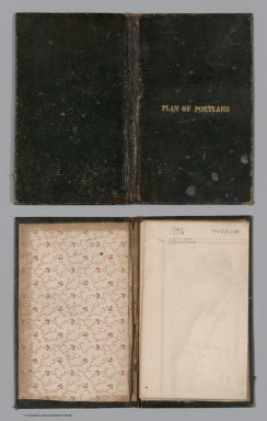
Colesworthy, S.H.
Full Title
(Covers to) A Plan Of Portland, Engraved As A Directory. Pub. By S.H. Colesworthy. 1846.
Publisher
S.H. Colesworthy
Author
Morrison, Thomas
Full Title
(Covers to) Morrison's North River Traveller's Companion: Containing a Map of the Hudson or North River, with a Description of the adjoining Country ... C.A. Elliott, Printer, Philada. (above title) The Traveller's Companion. (with map on same sheet) A Map Of The Hudson River, Published By Thomas Morrison, 175, Pine Street, Philadelphia.
Publisher
T. Morrison
Author
Tanner, Henry S.
Full Title
(Covers to) The American Traveller, or Tourists' and Emigrants' Guide Through the United States. Containing Brief Notices of the Several States, Cities, Principal Towns ... Tenth Edition. With Several Additional Routes, and a Map, in which the various routes described in the work, are represented by appropriate lines. By H.S. Tanner. New York: Published at the Map Establishment, No. 237 Broadway. 1846. (on verso) Entered ... 1846, By H.S. Tanner ... New York.
Publisher
The Map Establishment
Author
Lapham, I.A.
Full Title
(Covers to) Wisconsin, a Sectional Map With the Most Recent Surveys, by I.A. Lapham, 1846. Scale, 10 miles to an inch. Published by P.C. Hale, Milwaukee, Wisconsin. J.H. Bufford & Cos Lithog Boston. Entered ... 1846 by P.C. Hale ... Territory of Wisconsin.
Publisher
P.C. Hale
Author
Mitchell, Samuel Augustus
Full Title
(Covers to) A New Map of Texas Oregon and California With The Regions Adjoining. Compiled from the most recent authorities. Philadelphia Published by S. Augustus Mitchell N.E. Corner Of Market & Seventh Streets. 1846. Entered ... 1845 by H.N. Burroughs ... Pennsylvania.
Publisher
S.A. Mitchell
Author
Mitchell, Samuel Augustus
Full Title
(Covers to) A New Map Of The Western States From The Latest Authorities. Philadelphia: Published by S. Augustus Mitchell, N.E. Corner Of Market & Seventh Streets, 1846. Entered ... 1845 by S. Augustus Mitchell ... Pa. (inset) Vicinity Of The Falls Of Niagara.
Publisher
S. Augustus Mitchell
Author
Thomas, Cowperthwait & Co.
Full Title
(Covers to) Description Of The Republic Of Mexico, ... Illustrated By A Map, In Which Is Included Smaller Maps Of The Valley Of Mexico, And The Fields Of Palo Alto, And Resaca De La Palma. Philadelphia: Thomas, Cowperthwait & Co. 1846. (on verso) Entered ... 1846, by Thomas, Cowperthwait & Co. ... Pennsylvania. (with) Map Of Mexico Including Yucatan. Entered... 1846, by Thomas, Cowperthwait & Co. ... Pennsylvania. (with two insets).
Publisher
Thomas, Cowperthwait & Co.
Author
Wyld, James, 1812-1887
Full Title
(Covers to) Mexico The British Possessions In North America And The United States. London. Published By Jas. Wyld, Geographer To The Queen, Charing Cross East. 1846. James Wyld, Geographer to the Queen and to H.R.H. Prince Albert, Charing Cross, East, four doors from Trafalgar Square, London ... (inset) North America. (inset) Islands in the Pacific Ocean.
Publisher
James Wyld
Author
Mitchell, Samuel Augustus
Full Title
(Covers to) A New Universal Atlas Containing Maps of the various Empires, Kingdoms, States and Republics Of The World. With a special map of each of the United States, Plans of Cities &c. Comprehended in seventy sheets and forming a series of One Hundred And Seventeen Maps, Plans And Sections ... Philadelphia, Published By S. Augustus Mitchell, N.E. corner of Market & 7th Streets. 1846. Entered ... 1846, by H.N. Burroughs ... Pennsylvania. (title page by) J. Knight Sc.
Publisher
S.A. Mitchell
1-20 of 20
|