Who What Where WhenREMOVEWHO
WHEN
|
Author
Howell, Reading
Full Title
(Covers to) A Map Of The State Of Pennsylvania By Reading Howell MDCCCXI. Engraved by J. Vallance. To The Governor and Legislature Of The Commonwealth of Pennsylvania this Map is Respectfully inscribed by the Author. Philada. Published by Kimber & Conrad & Johnson & Warner.
Publisher
Kimber, Conrad, Johnson & Warner
Author
[Bromley, George Washington, Bromley, Walter Scott, G.W. Bromley & Co.]
Full Title
(Covers to) Atlas of the city of New York 23rd & 24th wards. From actual surveys and official plans by George W. and Walter S. Bromley, civil engineers. Published by G.W. Bromley and Co. 222 S. Fifth St. Philadelphia. 1893.
Publisher
G.W. Bromley and Co.
Author
Hyde & Company
Full Title
(Covers to) Map of the greater portion of Westchester County, New York and the towns of Greenwich and Stamford, Conn. Hyde & Company, 97 Liberty Street, Brooklyn, New York. Library form. 1900.
Publisher
Hyde & Company
Author
Hyde, E. Belcher
Full Title
(Covers to) Atlas of the rural country district north of New York City embracing the entire Westchester County, New York, also a portion of Connecticut. Greenwich, Stamford, New Canaan, Darien, Wilton and Ridgefield. Compiled from maps on file and surveyors notes and data, maps from actual surveys furnished by individual owners & final field observations by our own Corps of Engineers. Published by E. Belcher Hyde, No. 5 Beekman Street, Manhattan, and No. 97 Liberty Street, Brooklyn. 1908. Entered ... 1908 by E. Belcher Hyde.
Publisher
E. Belcher Hyde
Author
Chevalier, August
Full Title
(Covers to) The commercial, pictorial and tourist map of San Francisco. Copyrighted by Aug. Chevalier, Publisher, 331 Kearny Street. 1st edition 1904.
Publisher
Aug. Chevalier
Author
[Campbell, R.A., Mitchell, Samuel Augustus, Walling, H. F.]
Full Title
(Covers to) Mitchell's new general atlas, containing maps of the various countries of the World, plans of cities, etc., embraced in sixty-three quarto maps, forming a series of one hundred maps and plans, together with valuable statistical tables. Philadelphia: published by S. Augustus Mitchell, Jr., No. 31 South Sixth Street. 1870. Entered ... 1870, by S. Augustus Mitchell, Jr. ... Pennsylvania. (with) Campbell's new atlas of the state of Illinois ... Maps drawn by R.A. Campbell, C.E., and Prof. H.F. Walling ... Chicago: R.A. Campbell, 131 South Clark Street. Philadelphia: S. Augustus Mitchell, Jr. 1870. Entered ... 1870 by R.A. Campbell ... Illinois.
Publisher
[R.A. Campbell, S.A. Mitchell, Jr.]
Author
Mitchell, Samuel Augustus
Full Title
(Covers to) Mitchell's new general atlas, containing maps of the various countries of the World, plans of cities, etc., embraced in ninety-three quarto maps. Forming a series of one hundred and forty-seven maps and plans. Together with valuable statistical tables. Also, a list of post-offices of the United States and territories, and census of 1860 and 1870. Philadelphia: Published by S. Augustus Mitchell, No. 815 Arch Street. 1880. Entered ... 1879, by S. Augustus Mitchell ... Washington.
Publisher
S.A. Mitchell
Author
Argentina. Direccion General de Ferrocarriles.
Full Title
(Covers to) Mapa de los ferrocarriles en explotacion. Republica Argentina, Ministerio de Obras Publicas, Direccion General de Ferrocarriles. Ano 1924. Impreso en Los Talleres Graficos del Ministerio de Obras Publicas. Septiembre 1924. (with) Ferrocarriles de acceso a Buenos Aires y La Plata. (with 6 additional inset maps of regions surrounding Tucuman, Mendoza, Bahia-Blanca, Cordova, Rosario de Santa Fe, and Santa-Fe.)
Publisher
Direccion General de Ferrocarriles
Author
[Bromley, George Washington, Bromley, Walter Scott, G.W. Bromley & Co.]
Full Title
(Covers to) Atlas of Westchester County, New York. From actual surveys and official records by G.W. Bromley & Co., Civil Engineers. Published by Geo. W. & Walter S. Bromley. 243 Broadway, New York. 1881. Engraved by A.H. Mueller, 530 Locust St., Phila. Printed by F. Bourquin, 31 So. 6th St., Phila. Entered ... 1881, by G.W. Bromley & Co. ... Washington.
Publisher
G.W. & W.S. Bromley
Author
[Kiser, Ellis, Mueller, A. H.]
Full Title
(Covers to) Atlas of the city of Yonkers, Westchester County, New York. Also embracing north-west section of the borough of Bronx. Compiled from official records, private plans and actual surveys, by Ellis Kiser, C.E. Under the direct management and supervision of A.H. Mueller, Publisher, 530 Locust Street, Philadelphia, Pa., 1907. A.H. Mueller, Lithographer, 530 Locust St., Philadelphia. Copyright, A.D. 1907, by A.H. Mueller.
Publisher
A.H. Mueller
Author
Jefferys, Thomas
Full Title
(Covers to) The natural and civil history of the French dominions in North and South America. Giving a particular account of the climate, soil, minerals, animals, vegetables, manufactures, trade, commerce, and languages ... Illustrated by maps and plans of the principal places, collected from the best authorities, and engraved by T. Jefferys, Geographer to his Royal Highness the Prince of Wales. Part I. Containing a description of Canada and Louisiana. London, Printed for Thomas Jefferys at Charing-Cross. MDCCLX.
Publisher
Thomas Jefferys
Author
Bruyset, Jean-Marie
Full Title
(Covers to) Atlas des enfans, ou nouvelle methode pour apprendre la geographie, avec un nouveau traite de la Sphere, et XXIV cartes enluminees. Nouvelle edition, corrigee & augmentee. A Lyon, Chez Jean-Marie Bruyset, Pere & Fils. M.DCC.LXXXIV.
Publisher
Jean-Marie Bruyset
Author
Fer, Nicolas de
Full Title
(Covers to) Introduction a la geographie avec une description historique sur toutes les parties de la Terre. Par N. de Fer, Geographe de sa Majeste Catholique. A Paris: Chez le Sr. Danet -- gendre de l'Auteur sur le Pont Notre Dame a la Sphere Royale avec P. du R. M.DCC.XVII. Seconde edition, augmentee des longitudes et latitudes des principales villes suivant les dernieres observations.
Publisher
Danet
Author
[Brudin, J. L., Stieler, Adolf]
Full Title
(Covers to) Skol-atlas ofver jordens alla delar i 24 illuminerade kartor. Efter Stielers Hand-Atlas. Stockholm, J.L. Brudin, 1852.
Publisher
J.L. Brudin
Author
[Fenner, Rest., Thomas, Joseph, publisher]
Full Title
(Covers to) Thomas's library atlas, embodying a complete set of maps, illustrative of modern & ancient geography ... London, Joseph Thomas, 1, Finch Lane, 1835. Sold by Simpkin & Marshall, Stationers Court.
Publisher
Joseph Thomas
Author
Greenleaf, Jeremiah
Full Title
(Covers to) A New Universal Atlas; Comprising Separate Maps Of all the Principal Empires, Kingdoms & States Throughout the World: and forming a distinct Atlas Of The United States. Carefully Compiled from the best Authorities Extant by Jeremiah Greenleaf. a new edition revised and corrected to the present time. 1840. Printed by G.R. French Brattleboro Vt.
Publisher
G.R. French
Author
[Bromley, George Washington, Bromley, Walter Scott, G.W. Bromley & Co.]
Full Title
(Covers to) Atlas of Westchester County, New York. Volume one. From actual surveys and official plans by George W. and Walter S. Bromley, civil engineers. Published by G.W. Bromley and Co. 147 N. Fifth St., Philadelphia. 1910.
Publisher
Bromley & Co.
Author
G.W. Bromley & Co.
Full Title
(Covers to) Atlas of Westchester County, N.Y. Pocket, desk and automobile edition. Volume I. Mt. Vernon, Pelham, New Rochelle, Mamaroneck, Rye, Harrison, White Plains, Scarsdale and Eastchester. 1914. G.W. Bromley & Co., 34 Pine Street, New York. Copyright 1914.
Publisher
G.W. Bromley & Co.
Author
[Isaacs, John D., Bascom]
Full Title
(Covers to) Preliminary Report on Harbors, Havens, and Anchorages of the Pacific Coast from San Francisco to the Straits of Juan de Fuca.
Publisher
Department of Engineering, University of California
Author
Carey, Mathew
Full Title
(Covers to) Carey's General Atlas ... Philadelphia: Published By M. Carey. April, 1811. (Price Ten Dollars Plain - Twelve Dollars Coloured.) N.B. The maps marked with a star, are not in any London Atlas.
Publisher
M. Carey
Author
Lyon, Lucius, 1800-1851
Full Title
(Case to) (Michigan and Indiana Border Survey 1828-1835. Manuscript survey maps and notes)
Publisher
Manuscript
Author
Lyon, Lucius, 1800-1851
Full Title
(Covers to) (Michigan and Indiana Border Survey 1828-1835. Manuscript survey maps and notes)
Publisher
Manuscript
Author
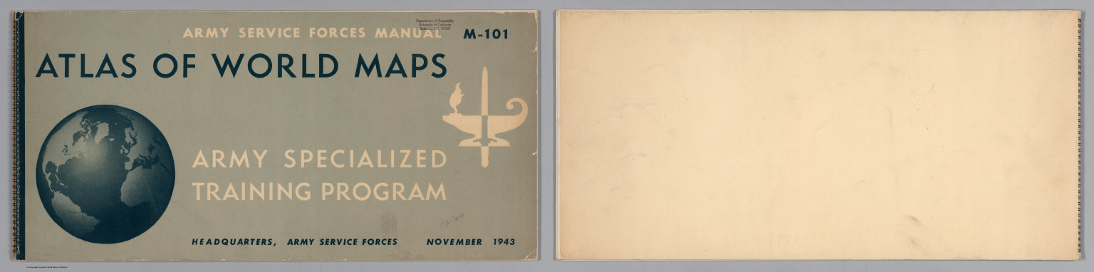
United States Army Service Forces
Full Title
(Covers to) Atlas of World Maps for the Study of Geography in the Army Specialized Training Program. Army Services Forces Manual. M-101. Headquarters, Army Service Forces. November, 1943.
Publisher
United States Army Service Forces
Author
Pacific Coast Steamship Co.
Full Title
(Covers to) Pacific Coast Steamship Co. February to May 1896, Inc. ... Goodall Perkins & Co. General Agents, 10 Market Street, San Francisco, Cal. Ticket Office 4 New Montgomery St. Palace Hotel, San Francisco, Cal.
Publisher
Rand McNally
Author
Southern Pacific Company
Full Title
(Covers to) "Sunset Route" The Southern Pacific Company Atlantic System. West. Poole Bros. Printers and Engravers, Chicago. (1884)
Publisher
Poole Brothers.
Author
Stieler, Adolf
Full Title
(Covers to) Hand - Atlas Uber Alle Theile Der Erde nach dem neuesten Zustande Und Uber Das Weltgebaude. Herausgegebenn von Adolf Stieler, berbeitet von Demselben, so wie von F.v. Stulpnagel, H. Berghaus u. I.C. Bar. Gotha bei Justus Perthes. (title page only) gez. v. Bar. gest. v. Edler in Gotha.
Publisher
Justus Perthes
Author
[Northern Pacific Railroad Company, Rand McNally and Company]
Full Title
(Covers to) Black Hills, Montana, Upper Missouri and Yellowstone Rivers, Northern Dakota and Minnesota, the Northern Pacific Rail Road in connection with the Northwestern Express, Stage & Transp'n Co. ... During season of navigation of 1879 ... July, 1879. Rand, McNally & Co., Printers, 77 and 79 Madison Street, Chicago.
Publisher
Rand McNally
Author
Great Northern Railway Company (U.S.)
Full Title
(Covers to) Das Red River Thal in Minnesota und Nord-Dakota. Das beste und fruchtbarste Land in America. Die Getreidekammer der Welt. Ein gutes Heim und Reichthum fur Deutsche Landwirthe.
Publisher
Great Northern Eisenbahn
Author
Cincinnati, New Orleans & Texas Pacific Railway Company
Full Title
(Covers to) Queen & Crescent Route. Cincinnati, New Orleans & Texas Pacific Railway ... Between Ohio River and the Gulf direct trunk line. September 15th, 1885. The A.H. Pugh Printing Co.
Publisher
The A.H. Pugh Printing Co.
Author
[Missouri Pacific Railway Company, Rand McNally and Company]
Full Title
(Covers to) Missouri Pacific Railway. For Kansas City and all points west. Chair cars free ... Rand, McNally & Co., Printers, Chicago.
Publisher
Rand McNally
Author
[Rand McNally and Company, St. Louis, Iron Mountain, and Southern Railway Company]
Full Title
(Covers to) Iron Mountain Route. Arkansas and Texas. St. Louis to San Francisco with but one change every day in the year. Times Eng. ... Form 1.-10-1-'86-C.D. Rand, McNally & Co., Printers, Chicago.
Publisher
Rand McNally
Author
St. Louis-San Francisco Railway Company
Full Title
(Covers to) St. Louis and San Francisco Railway befordert Fracht und Passagiere zu den billigsten Preisen! nach allen Punkten in Sud-West Missouri, dem Sudlichen Kansas und Texas ... Woodward, Tiernan & Hale, Printers, St. Louis.
Publisher
Woodward, Tiernan & Hale
Author
St. Paul, Minneapolis & Manitoba Railway Company.
Full Title
(Covers to) St. Paul, Minneapolis & Manitoba Ry. Red River Valley Line through the park region ... 2 +87. Matthews, Northrup & Co., Art-Printing Works, Buffalo, N.Y.
Publisher
Matthews, Northrup & Co.
Author
Louisville and Nashville Railroad Company
Full Title
(Covers to) South via the L&N Louisville & Nashville R.R. The L&N is unrivaled in speed, safety, construction and equipment. October, 1886. Courier Journal Eng. Courier-Journal Job Printing.
Publisher
Courier-Journal
Author
Chicago, Milwaukee, and St. Paul Railway Company
Full Title
(Covers to) Chicago Milwaukee and St. Paul Railway. 1-9-85.
Publisher
Matthews, Northrup & Co.
Author
[Great Britain. Ordnance Survey, Mudge, William (1762-1820), Colby, Thomas, Baker, Benjamin, Great Britain. Board of Ordnance]
Full Title
(Covers to) Ordnance Survey of Great Britain. Old Series or First Edition, One-Inch Map of England and Wales.
Publisher
[W. Mudge; Ordnance Survey, Thomas Colby (1784-1852)]
Author
Chicago, Milwaukee, and St. Paul Railway Company
Full Title
(Covers to) Chicago Milwaukee and St. Paul Railway. Chicago, Milwaukee, St. Paul & Minneapolis ... Electric-lighted and steam-heated vestibuled trains. Rand, McNally & Co., Printers, Chicago.
Publisher
Rand McNally
Author
Wabash, St. Louis, and Pacific Railway Company
Full Title
(Covers to) Take the Great Wabash Route for St. Louis, Kansas City, Omaha, and all parts of the West ... July-86. Rand, McNally & Co., Printers and Engravers, Chicago.
Publisher
Rand McNally
Author
Chicago, Rock Island and Pacific Railway Company
Full Title
(Covers to) Good luck to all who travel via the Chicago, Rock Island and Pacific Rw. Great mid-continental link between the Atlantic and Pacific ... Autumn, 1885. Cameron, Amberg & Co., Printers, Chicago.
Publisher
Cameron, Amberg & Co.
Author
St. Paul, Minneapolis & Manitoba Railway Company.
Full Title
(Covers to) St. Paul, Minneapolis & Manitoba Ry. Red River Valley Line through the park region to the New Northwest. March, 1886. Matthews, Northrup & Co., Art-Printing Works, Buffalo, N.Y.
Publisher
Matthews, Northrup & Co.
Author
Chesapeake and Ohio Railway Company
Full Title
(Covers to) Chesapeake & Ohio Ry. The grand scenic route to the sea. Matthews-Northrup, Buffalo, N.Y.
Publisher
Matthews, Northrup & Co.
Author
Chicago & Alton Railroad Company
Full Title
(Covers to) Chicago and Alton R.R. No change of cars of any class between Chicago and Kansas City ... Palace dining cars meals 75 Cents. Pullman Palace Sleeping Cars ... September, 1885. Rand, McNally & Co., Printers, Chicago.
Publisher
Rand McNally
Author
Chicago & Alton Railroad Company
Full Title
(Covers to) Chicago and Alton R.R. No change of cars of any class between Chicago and Kansas City ... Palace dining cars meals 75 Cents. Pullman Palace Sleeping Cars ... January, 1884. Rand, McNally & Co., Printers, Chicago.
Publisher
Rand McNally
Author
Lake Shore & Michigan Southern Railway
Full Title
(Covers to) Time tables and map, Lake Shore and Michigan Southern Ry. Fast express trains ... reliable through connections with eastern and New England lines, and with all express trains of the New-York Central & Hudson River Railroad, and New-York, Lake Erie & Western R.R. Only route of the Fast Mail to the Western States ... Matthews, Northrup & Co., "Morning Express" Printing House, Buffalo, N.Y.
Publisher
Matthews, Northrup & Co.
Author
Chicago, Burlington & Quincy Railroad Company
Full Title
(Covers to) Burlington Route C.B. & Q.R.R. From Chicago, St. Louis, Peoria to the northwest, west, southwest. June, 1893 ... Knight, Leonard & Co. Printers, Chicago.
Publisher
Knight, Leonard & Co.
Author
Chicago, Burlington & Quincy Railroad Company
Full Title
(Covers to) Burlington Route C.B. & Q.R.R. Chicago, Peoria or St. Louis direct to Denver. Fall edition 1885 ... Nov., 1885. Rand, McNally & Co., Printers and Engravers, Chicago.
Publisher
Rand McNally
Author
Bradstreet Company
Full Title
(Covers to) Bradstreet's Pocket Atlas Of The United States. Published Exclusively for Macullar, Parker & Company, Boston, Massachusetts ... New York: The Bradstreet Company, 1885. (on verso) Entered ... 1879, by The Bradstreet Company ... Washington.
Publisher
Bradstreet Co.
Author
Piedmont Air Line Railroad Company
Full Title
(Covers to) New York, shortest and quickest, Piedmont Air Line, New Orleans, Washington, Lynchburg, Danville, Charlotte and Atlanta. Sept. 15th, 1885 ... C.G. Crawford, Printer and Stationer, 49 & 51 Park Place, N.Y.
Publisher
C.G. Crawford
Author
Tanner, Henry S.
Full Title
(Covers to) A New American Atlas Containing Maps Of The Several States of the North American Union, Projected and drawn on a Uniform Scale from Documents found in the public Offices of the United States and State Governments, and other Original and Authentic Information, By Henry S. Tanner ... Philadelphia: Published By H.S. Tanner. 1823. (title page only) Writing Drawn and Engraved by Joseph Perkins. Barralet del. Humphrys sc.
Publisher
Henry Tanner
Author
Tanner, Henry S.
Full Title
(Covers to) A New American Atlas Containing Maps Of The Several States of the North American Union, Projected and drawn on a Uniform Scale from Documents found in the public Offices of the United States and State Governments, and other Original and Authentic Information, By Henry S. Tanner ... Philadelphia: Published By H.S. Tanner. 1825. (title page only). Barralet del. Humphrys sc. Joseph Perkins, Philadelphia.
Publisher
Henry Tanner
|