Who What Where WhenREMOVEWHO
WHEN
|
Author
Melish, John
Full Title
(Covers to) A Military and Topographical Atlas of the United States; including The British Possessions & Florida ... To Which Is Added, A List Of The Military Districts, A Register Of The Army, And A List Of The Navy Of The United States. By John Melish. Philadelphia, Printed By G. Palmer. November, 1813.
Publisher
John Melish
Author
Carey, Mathew
Full Title
(Covers to) The General Atlas For Carey's Edition Of Guthrie's Geography improved ... Philadelphia: Published By Mathew Carey. May 1, 1795.
Publisher
Mathew Carey
Author
[Bowen, Emanuel, Gibson, John]
Full Title
(Covers to) Atlas Minimus or a New Set of Pocket Maps of the Several Empires, Kingdoms and States of the Known World, with Historical Extracts relative to each. Drawn and Engraved by J. Gibson from the Best Authorities, Revis'd, Corrected and Improv'd by Eman: Bowen Geographer to His Majesty.
Publisher
J. Newberry
Author
[Andree, Richard, Scobel, Albert]
Full Title
(Covers to) Andrees Allgemeiner Handatlas in 139 Haupt- und 161 Nebenkarten nebst vollstandigem alphabetischem Namenverzeichnis. Funfte, vollig neubearbeitete und vermehrte Auflage. Jubilaumsausgabe. Herausgegeben von A. Scobel. Bielefeld Und Leipzig, Verlag Von Velhagen & Klasing, 1906.
Publisher
Velhagen & Klasing
Author
Carey, Mathew
Full Title
(Covers to) Carey's General Atlas ... Philadelphia: Published By Mathew Carey. May 1, 1796.
Publisher
Mathew Carey
Author
Northern Pacific Railroad Company
Full Title
(Covers to) Map showing surveyed portion of land grant of Northern Pacific Railroad Company from Jamestown, North Dakota, to Montana boundary line ... (1895)
Publisher
The Evening Wisconsin Co.
Author
Rand McNally and Company
Full Title
(Covers to) Pocket railroad map and business guide for Philadelphia, Pa., 1883, 1884.
Publisher
Rand McNally & Co.
Author
Metsker, Charles Frederick, 1881-
Full Title
(Covers to) Metsker's map of Modoc County, state of California. Compiled by Chas. F. Metsker ... It pays to have a few good maps. Buy the best of "Metsker the Map Man" ... Copyrighted By Chas. F. Metsker ... Printing by "Metsker the Map Man". (1952?)
Publisher
Charles F. Metsker
Author
[E.P. Noll & Co., J.K. Gill Company]
Full Title
(Covers to) Map of the state of Oregon. Published by the J.K. Gill Company, Portland, Oregon. Copyright, 1911, the J.K. Gill Company. E.P. Noll & Co. Map Publishers, Phila, Pa.
Publisher
J.K. Gill Company
Author
[Central Pacific Railroad Company, Union Pacific Railroad Company]
Full Title
(Covers to) Union and Central Pacific Railroad Line. The Great American Over-land Route. Rand, McNally & Co., Printers, Engravers and Electrotypers, 77 and 79 Madison Street, Chicago.
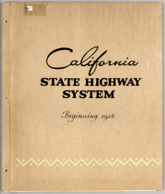
Author
California Department of Transportation (CALTRANS)
Full Title
(Covers to) California State Highway System Beginning 1918 (-1990).
Publisher
California Department of Transportation (CALTRANS)
Author
[New York Central Railroad Company, Rand McNally and Company]
Full Title
(Covers to) Map of the United States showing the New York Central Lines and connections ... Copyright, Rand McNally & Company. (with 2 inset maps). (1929)
Publisher
Rand McNally
Author
Mendenhall, C. S.
Full Title
(Covers to) Mendenhall's guide and road map of Connecticut showing main touring routes, good roads, common roads, railroads, etc. Published by C.S. Mendenhall, Map Publisher, Cincinnati, O. Copyright 1909 by C.S. Mendenhall.
Publisher
C.S. Mendenhall
Author
M. & R. Burgheim (Firm)
Full Title
(Covers to) Map of Cincinnati and suburbs and Covington & Newport. Bellevue, Dayton, Ludlow & Bromley, [Ky]. Entered ... by M. & R Burgheim, Cincinnati, O. ... Washington, D.C. Published by M. & R. Burgheim, Publishers, Importers & Booksellers, 484 Vine Street, corner of Mercer Street, Cincinnati, O. Krebs Lithographing Company, Cincinnati. (1880?)
Publisher
M. & R. Burgheim
Author
Gallup Map & Supply Company
Full Title
(Covers to) Gallup's map of greater Kansas City and suburbs. Compiled and published by the Gallup Map & Supply Co. Kansas City, Mo. "Everything in Maps," blue printing, photo prints, drawing materials and supplies. Phones - Harrison 8205 - Harrison 8206. Copyrighted by Gallup Map & Supply Co., Kansas City, Mo. (192-?)
Publisher
Gallup Map & Supply Co.
Author
[Woerl, Joseph Edmund, Herder, Bartholomew]
Full Title
(Covers to)Karte der Schweiz, von Dr. I. Woerl. Lithographie von B. Herder in Freiburg im Breisgau. Mitglied der köngl. Avcademie der Kriegswissenscaften in Schweden, der königl. Geographischen Socitaeten zu London und Paris, der Historischen Gesellschaft zu Freiburg i. B. etc.
Publisher
B. Herder
Author
Bevan, G. Phillips
Full Title
(Covers to) The Statistical Atlas of England, Scotland and Ireland. By G. Phillips Bevan, F.S.S., F.G.S., Etc. Containing 45 Maps with Text. W. & A.K. Johnston, Edinburgh and London, MDCCCLXXXII.
Publisher
W. &. A.K. Johnston
Author
Northern Pacific Railroad Company
Full Title
(Covers to) Map showing land grant of the Northern Pacific Railroad Co. in Western Washington and Northern Oregon. Corrected up to August 20, 1888 ... Matthews, Northrup & Co., Art-Printing Works, Buffalo, N.Y.
Publisher
Matthews, Northrup & Co.
Author
Rand McNally and Company
Full Title
(Covers to) Map of Alabama. One of the new double page maps in Rand, McNally & Co.'s New indexed business atlas. This map is worth 35 cents. Keep it. Rand, McNally & Co.'s New business atlas map of Alabama. Copyright, 1892, by Rand, McNally & Co.
Publisher
Rand McNally
Author
[H.M. Gousha Company, Standard Oil Company of California]
Full Title
(Covers to) 1935 road map Oregon. Prepared exclusively for Standard Oil Company of California. Copyrighted by the H.M. Gousha Company, Chicago, Ill. Made in U.S.A. Standard unsurpassed gasoline ...
Publisher
The H.M. Gousha Company
Author
[Johnston, Alexander Keith, 1804-1871, Rogers, Henry Darwin]
Full Title
(Covers to) Atlas Of The United States Of North America, Canada, New Brunswick, Nova Scotia, Newfoundland, Mexico, Central America, Cuba, And Jamaica. On A Uniform Scale. From The Most Recent State Documents, Marine Surveys, And Unpublished Materials. With Plans Of The Principal Cities And Sea-Ports, And An Introductory Essay On The Physical Geography, Products, And Resources Of North America. By Professor Henry Darwin Rogers, Of Boston, U.S., And A. Keith Johnston, F.R.S.E., F.R.G.S., F.G.S., Geographer To The Queen. London: Edward Stanford, 6, Charing Cross, S.W. [The Authors Reserve The Right Of Translation.] (on verso) Entered at Stationers' Hall, London ... 1857 by H.D. Rogers ... Massachusetts.
Publisher
Edward Stanford
Author
Blaist, G.W.
Full Title
(Covers to) Baist's Real Estate Atlas of Surveys of Los Angeles, Cal. Complete in One Volume. Compiled and Published from Official Records, Private Plans, Actual Surveys. By G. W. Baist, Surveyor. Wm. E. & H.V. Baist, Asst. Surveyors. 306 Walnut St., Philadelphia. Copyrighted 1921, by G.Wm. Baist.
Publisher
G. W. Baist
Author
Akademiia nauk SSSR
Full Title
(Covers to:) Plan stolichnago goroda Sanktpeterburga s izobraheniem znatiieshikh onago prospektov, izdannyi trudami Imperatorskoi Akademii nauk i khudozhestv. Plan de la ville de St. Petersbourg avec ses principales vues dessine & grave sous la direction de l'Academie imperiale des sciences et des arts.
Publisher
Imperatorskoi Akademii nauk i khudozhestv
Author
[Codazzi, Agustín, 1793-1859, Paz, Manuel María, 1820-1902]
Full Title
(Covers to) Atlas geografico e historico de la Republica de Colombia (Antigua Nueva Granada) : el cual comprende las repuublicas de Venezuela y Ecuador con arreglo a los trabajos geograficos del general de ingenieros Agustin Codazzio ejecutados en Venezuela y Nueva Granada. Construida la parte cartografica por Manuel M. Paz, Miembro de la Sociedad de Geografia de Paris. y redactado el texto explicativo por el doctor Felipe Perez. Todo de orden del Gobierno Nacional de Colombia. Paris - 1889, Imprenta A. Lahure, Calle de Fleures, 9.
Publisher
A. Lahure
Author
[Missouri Pacific Railway Company, Rand McNally and Company]
Full Title
(Covers to) Missouri Pacific Ry. ... Rand, McNally & Co., Printers and Engravers, Chicago.
Publisher
Rand McNally
Author
[Scovel, James L., O'Brien, Emmett J]
Full Title
(Covers to) Atlas of Landforms. James L Scovel; Emmett J O'Brien; J C McCormack, (Major); R.B. Chapman; Department of Earth, Space and Grafic Sciences; United States Military Academy, West Point, New York. John Wiley and Sons Inc., New York. London. Sydney.
Publisher
John Wiley & Sons Inc.
Author
Rizzi Zannoni, Giovanni Antonio (1736-1814)
Full Title
(Covers to) Atlante geografico del regno di Napoli compito e rettificato sotto I felici auspicj di Giuseppe Napoleone I, re di Napoli, e di Sicilia, Principe francese e grand' elettore dell' impero da Gio. Antonio Rizzi-Zannoni Direttore del Gabinetto Topografico della M.S. Nel 1808. Gius. Guerra inc. Nap. 1806. (with) Untitled map of northern Italy. (and) Carta del' itinerarj militari da Bologna a tutto il Regno di Napoli ordinata da S.M Giuseppe Napoleone I. diretta dal Gen. Div. Parisi costruita da P. Colletta Ten. Cotto del Genio'. Leop. Laperuta, dis. Gius. Guerra inc.
Publisher
Giuseppe Guerra
Author
[Key System Transit Lines (Calif.), Sunderland, Clyde H.]
Full Title
(Covers to) Key System Transit Lines: Aerial System Maps.
Publisher
Clyde H. Sunderland Photographs
Author
Mitchell, Samuel Augustus
Full Title
(Covers to) A New Universal Atlas Containing Maps of the various Empires, Kingdoms, States and Republics Of The World. With a special map of each of the United States, Plans of Cities &c. Comprehended in eighty four sheets and forming a series of One Hundred And Forty Five Maps, Plans And Sections ... Philadelphia, Charles Desilver, 1229 Chesnut Street,1864. Entered ... 1859, by Charles Desilver ... Pennsylvania. (title page by) Barralet del. Humphreys, sc. J. Knight Sc.
Publisher
Charles Desilver.
Author
U.S. Office of War Information
Full Title
(Covers to) A War Atlas for Americans. Prepared with the Assistance of the Office of War Information. Published for Council on Books in Wartime by Simon and Schuster. New York. 1944.
Publisher
Simon and Schuster
Author
William P. Humphreys & Co.
Full Title
(Covers to) Atlas of the city and county of San Francisco from actual surveys and official records. Compiled and published by Wm. P. Humphreys & Co., A.B. Holcombe, W.C. Kewen. Eng. by Worley & Bracher ... Phila, Pa. Printed by F. Bourquin ... Phila, Pa. 1876.
Publisher
W. Humphreys
Author
Debenham, Frank
Full Title
(Cover to) The global atlas; a new view of the world from space. By Frank Debenham, Professor Emeritus of Geography, University of Cambridge. Introduction by Bertrand Russell. Produced by Geographical Project Ltd., London. (Published by): Simon and Schuster, New York. (verso of title page) Copyright 1958, Adprint Ltd., London. Printed in the U.S.A. by Western Printing and Lithographing Company. Published by Simon and Schuster, Inc., Rockefeller Center, New York 20, N.Y.
Publisher
Simon and Schuster
Author
Scarborough Company
Full Title
(Covers to) Complete Road Atlas, Massachusetts And Rhode Island. Published By The Scarborough Company, Boston, Mass. 144 Essex St. Copyright, 1905, By The Scarborough Company, Boston, Mass. ...
Publisher
The Scarborough Company
Author
[Beers, F.W. (Frederick W.), Cramer, Louis H.]
Full Title
(Covers to) Combination Atlas Of Saratoga And Ballston From Recent And Actual Surveys And Records Under the Superintendence of F.W. Beers And Louis H. Cramer, Published By J.B. Beers & Co. 36 Vesey Street, New York. 1876. Entered ... 1876 by J.W. Beers & Co. ... Washington. Printed by Charles Hart, 36 Vesey St. N.Y. Engraved by L.E. Neuman 36 Vesey St. N.Y.
Publisher
J.B. Beers & Co.
Author
Egloffstein, Baron F.W. von
Full Title
(Covers to) Contributions to the Geology and the Physical Geography of Mexico, including a Geological and Topographical Map, with profiles, Of some of the principal Mining Districts; together with a graphic description of an ascent of The Volcano Popocatepetl. Edited by Baron F.W. von Egloffstein. New York: D. Appleton & Company, 443 & 445 Broadway. 1864. (on verso) Entered ... 1864, by F.W. von Egloffstein ... New York.
Publisher
D. Appleton & Company.
Author
[Matthews-Northrup Division, J.W. Clement Co.]
Full Title
(Covers to) The New Matthews-Northrup Global atlas of the World at War. Cartography and manufacturing by J. W. Clement Co., Matthews-Northrup Works, Buffalo, N.Y. Copyright, 1943, by the World Publishing Company. (on verso) Published in the United States of America.
Publisher
World Publishing Company
Author
Rand McNally & Company
Full Title
(Covers to) Rand McNally World Atlas. European War Edition. (on verso) Copyright, 1939, by Rand McNally & Company, Chicago. Printed in U.S.A.
Publisher
Rand McNally & Company
Author
California Division of Highways
Full Title
(Covers to) California Highway Transportation Survey, 1934.
Publisher
California Division of Highways
Author
Johnston, Alexander Keith, 1804-1871
Full Title
(Covers to) The physical atlas of natural phenomena by Alexander Keith Johnston, F.R.S.E., F.R.G.S., F.G.S. ... A new and enlarged edition. William Blackwood and Sons, Edinburgh and London, MDCCCLVI. [The Author reserves the right of translation]
Publisher
William Blackwood & Sons
Author
California Division of Highways
Full Title
(Covers to) Appendix A. California Highway Transportation Survey, 1934.
Publisher
California Division of Highways
Author
[Gunnison, J.W., Preuss, C., Stansbury, Howard]
Full Title
(Covers to maps of the) Exploration and Survey of the Valley of the Great Salt Lake of Utah, including a Reconnoissance of a new Route through the Rocky Mountains. By Howard Stansbury ... Philadelphia: Lippincott, Grambo & Co. 1852.
Publisher
Ackerman Lith.
Author
California Division of Highways
Full Title
(Covers to) California Highway Transportation Survey, 1934. Appendix B. Tabulation of Field Count by Cities and Counties.
Publisher
California Division of Highways
Author
[Carey, Mathew, Guthrie, W.]
Full Title
(Covers to) A New System of Modern Geography: or, A Geographical, Historical, and Commercial Grammar; and Present State of the Several Nations of the World. ... By William Guthrie, Esq. ... In two volumes. Volume I. The First American Edition, Corrected, Improved, and Greatly Enlarged. Philadelphia: Printed by Mathew Carey. April 27. M.DCC.XCV.
Publisher
M. Carey
Author
[Carey, Mathew, Guthrie, W.]
Full Title
(Covers to) A New System of Modern Geography: or, A Geographical, Historical, and Commercial Grammar; and Present State of the Several Nations of the World. ... By William Guthrie, Esq. ... In two volumes. Volume II. The First American Edition, Corrected, Improved, and Greatly Enlarged. Philadelphia: Printed by Mathew Carey. April 27. M.DCC.XCV.
Publisher
M. Carey
Author
[Rand McNally and Company, State Farm Insurance Companies Travel Bureau]
Full Title
(Covers to) State Farm Road Atlas: United States, Canada, Mexico,Central and South America. Copyright 1940 by Rand McNally & Company, Chicago, Ill. Cover title: State Farm Road Atlas: United States, Canada, Mexico, South America, Central America. Hotel and cabin camp guide and complete touring information. The State Farm Insurance Companies Travel Bureau, Bloomington, Illinois.
Publisher
State Farm Insurance Companies Travel Bureau
Author
Schubert, Friedrich Theodor
Full Title
(Covers to) Kriegsstrassen Karte eines Theiles von Russland und der angraenzenden laender; nach der unter der Leitung des Russ. kaiserlichen Generalstabes vom General Major Schubert im Masstabe von 1/1680000 im Jahre 1829 herausgegebenen Karte auf das Mass von 1/1400000 vergrossert, von dem k.k. osterr. Generalquartiermeisterstabe herausgegeben im Jahre 1837.
Publisher
Generalquartiermeisterstab
Author
Schubert, Friedrich Theodor
Full Title
(Covers to) I. Uibersicht der provinzial eintheilung fur den bereich der karte. (to accompany) Kriegsstrassen Karte eines Theiles von Russland.
Publisher
Generalquartiermeisterstab
Author
Schubert, Friedrich Theodor
Full Title
(Covers to) II. Weisses Meer. (to accompany) Kriegsstrassen Karte eines Theiles von Russland.
Publisher
Generalquartiermeisterstab
Author
Schubert, Friedrich Theodor
Full Title
(Covers to) III. Titel und zeichenerklarung. (to accompany) Kriegsstrassen Karte eines Theiles von Russland.
Publisher
Generalquartiermeisterstab
|