Who What Where WhenREMOVEWHAT
|
Author
Asher & Adams
Full Title
(Covers to) Asher & Adams' new commercial, topographical, and statistical atlas and gazetteer of the United States: with maps showing the Dominion of Canada, Europe and the World ... Compiled, drawn, and engraved under the supervision of the publishers ... New York: Asher & Adams, 59 Beekman St. (on verso) Entered ... One Thousand Eight Hundred and Seventy-four, by Asher & Adams ... Washington. Electrotyped at the Franklin Type Foundry, Cincinnati.
Publisher
Asher and Adams
Author
Schonberg & Co.
Full Title
(Covers to) Schonberg's Standard Atlas Of The World. New York, Schonberg And Company. 1865. Boston: Benj. B. Russell, 515 Washington St. Chicago: R.R. Landon, Agent, 88 Lake St. (on verso) ... Entered ... 1863, by Schonberg & Co. ... New York.
Publisher
Schonberg & Co.
Author
Phelps & Watson
Full Title
(Covers to) Phelps & Watson's Historical And Military Map Of The Border & Southern States. Published By Phelps & Watson, 18 Beekman St. New York, 1863 ... Entered ... 1862 by Phelps & Watson ... New York.
Publisher
Phelps & Watson
Author
Sanborn-Perris Map Company, Limited
Full Title
(Covers to San Francisco Sanborn Insurance Maps.) Volume Five Insurance Maps. San Francisco, California. Published by Sanborn-Perris Map Co. Limited, 115 Broadway, New York. 1900. Scale, 50 Ft. to an Inch. Copyright 1900, by the Sanborn-Perris Map Co. Limited.
Publisher
Sanborn-Perris Map Company, Limited
Author
Sanborn-Perris Map Company, Limited
Full Title
(Covers to San Francisco Sanborn Insurance Maps.) Volume Six Insurance Maps. San Francisco, California. Published by Sanborn-Perris Map Co. Limited, 115 Broadway, New York. 1900. Scale, 50 Ft. to an Inch. Copyright 1900 by the Sanborn-Perris Map Co. Limited.
Publisher
Sanborn-Perris Map Company, Limited
Author
Rand McNally and Company
Full Title
(Covers to) Rand McNally Junior Road Map New England. Copyright By Rand McNally & Co. Chicago Ill. Made In U.S.A. ...
Publisher
Rand McNally & Co.
Author
Rand McNally and Company
Full Title
(Covers to) Rand, McNally & Co.'s Quebec. (untitled inset of Gulf of St. Lawrence region). (with 24 page index) Rand, McNally & Co.'s Indexed Map Of The Province Of Quebec, Canada ... Chicago: Rand, McNally & Co., Printers And Engravers, 77 and 79 Madison Street. (on verso) Entered ... 1878, by Rand, McNally & Co. ... Washington.
Publisher
Rand McNally & Co.
Author
Rand McNally and Company
Full Title
(Covers to) Rand McNally 1926 Detailed Auto Road Map of Los Angeles And Vicinity. (on verso) Rand McNally Junior Road Map California Nevada. Copyright By Rand McNally & Co. Chicago, Ill. Made In U.S.A. (with map) City Of Santa Ana, Orange County, California. 1923 Clyde D. Butler, Lic. Sur. Revised 1925, Nat. H. Neff, City Engineer.
Publisher
Rand McNally and Company
Author
Rand McNally and Company
Full Title
(Covers to) The Rand McNally New Library Atlas Map Of North America. Rand, McNally & Co., Map Publishers and Engravers, Chicago. 1914. Rand, McNally & Co.'s Indexed Atlas of the World Map of North America ... Copyright, 1892 ...
Publisher
Rand McNally & Co.
Author
Rand McNally and Company
Full Title
(Covers to) Rand, McNally & Co.'s South Dakota. Rand, McNally & Co., Map Publishers and Engravers, Chicago, 1906. Copyright, 1906, ... 1898, ... 1895 ...
Publisher
Rand McNally & Co.
Author
Rand McNally and Company
Full Title
(Covers to) Rand, McNally & Co.'s Texas. Rand, McNally & Co.'s New Business Atlas Map of Texas. Rand, McNally & Co., Map Publishers and Engravers, Chicago, 1902. Copyright 1902, ... 1898, ... 1895 ... (inset) Southern Portion Of Texas On Same Scale.
Publisher
Rand McNally & Co.
Author
Rand McNally and Company
Full Title
(Covers to) Mexico. Rand, McNally & Co.'s Mexico. Rand, McNally & Co., Map Publishers and Engravers, Chicago, Ill. ... Copyright, 1898, ... 1891 ... (inset) Map Of The Valley Of Mexico. (with 61 page index) Rand, McNally & Co.'s Indexed Map Of Mexico ... Chicago And New York: Rand, McNally & Co. ... (on verso) Copyright, 1899, by Rand, McNally & Co., Chicago.
Publisher
Rand McNally & Co.
Author
Rand McNally and Company
Full Title
(Covers to) Rand McNally & Co.'s Dakota. Copyright, 1882, by Rand, McNally & Co., Map Publishers, Chicago, Ill. Rand, McNally & Co., Engr's. Chicago. (with 15 page index) Rand McNally & Co.'s Indexed County And Township Map Of Dakota... Chicago, U.S.A.: Rand, McNally & Co. ... (on verso) Entered ... 1882, by Rand, McNally & Co. ... Washington.
Publisher
Rand McNally & Co.
Author
Rand McNally and Company
Full Title
(Covers to) Mexico. Rand, McNally & Co.'s Mexico. Copyright, 1881, by Rand, McNally & Co., Chicago, Ill. ... (with 16 page index) Rand, McNally & Co.'s Indexed Map Of Mexico Showing The Railroads, States And Territories, Lakes and Rivers ... Chicago: Rand, McNally & Co., Map Publishers And Engravers, 148 to 154 Monroe Street. (on verso) Entered ... 1881, by Rand, McNally & Co. ... Washington.
Publisher
Rand McNally & Co.
Author
Rand McNally and Company
Full Title
(Covers to) Rand McNally & Co.'s Alabama. Copyright, 1883, by Rand, McNally & Co., Map Publishers, Chicago ... (with 31 page index) Rand McNally & Co.'s Indexed County And Township Map Of Alabama ... Chicago, U.S.A.: Rand, McNally & Co. ... (on verso) Entered ... 1883, by Rand, McNally & Co. ... Washington.
Publisher
Rand McNally & Co.
Author
Rand McNally and Company
Full Title
(Covers to) Rand McNally & Co.'s Georgia. Copyright, 1883, by Rand, McNally & Co., Map Publishers, Chicago ... (with 33 page index) Rand McNally & Co.'s Indexed County And Township Map Of Georgia... Chicago, U.S.A.: Rand McNally & Co. ... (on verso) Entered ... 1883, by Rand McNally & Co. ... Washington.
Publisher
Rand McNally & Co.
Author
Rand McNally and Company
Full Title
(Covers to) Rand McNally & Co.'s Idaho. Rand, McNally & Co., Map Publishers and Engravers, Chicago, 1890 ... (with 13 page index) Rand McNally & Co.'s Indexed County And Railroad Pocket Map And Shippers' Guide Of Idaho ... Chicago And New York: Rand, McNally & Co. ... (on verso) Entered ... 1890, by Rand, McNally & Co. ... Washington.
Publisher
Rand McNally & Co.
Author
Rand McNally and Company
Full Title
(Covers to) Rand McNally & Co.'s New Map Of West Virginia. Rand, McNally & Co., Map Publishers and Engravers, Chicago, 1890. Copyright, 1888, by Rand, McNally & Co. ... (inset) Northern Portion Of West Virginia. (above the neat line) Rand McNally & Co.'s West Virginia. (with 34 page index) Rand McNally & Co.'s Indexed County And Railroad Pocket Map And Shippers' Guide Of West Virginia ... Chicago And New York: Rand, McNally & Co. ... (on verso) Entered ... 1890, by Rand, McNally & Co ... Washington.
Publisher
Rand McNally & o.
Author
Rand McNally and Company
Full Title
(Title Page to) Rand McNally & Co.'s New Map Of West Virginia. Rand, McNally & Co., Map Publishers and Engravers, Chicago, 1890. Copyright, 1888, by Rand, McNally & Co. ... (inset) Northern Portion Of West Virginia. (above the neat line) Rand McNally & Co.'s West Virginia. (with 34 page index) Rand McNally & Co.'s Indexed County And Railroad Pocket Map And Shippers' Guide Of West Virginia ... Chicago And New York: Rand, McNally & Co. ... (on verso) Entered ... 1890, by Rand, McNally & Co ... Washington.
Publisher
Rand McNally & o.
Author
Rand McNally and Company
Full Title
(Covers to) Rand McNally Official 1925 Auto Trails Map Arizona New Mexico. Copyright by Rand McNally & Company Chicago, Ill. Made in U.S.A.
Publisher
Rand McNally & Co.
Author
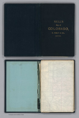
Nell, Louis
Full Title
(Covers to) Nell's Topographical Map Of The State Of Colorado. E.Besly & Co. Publishers, Denver. 1889. Copyright by Louis Nell, Washington D.C. 1887. Photo-Lith., Century Lith. Co. Phila. Pa.
Publisher
E. Besly
Author
[Gill, J.K., Galvani, W.H.]
Full Title
(Covers to) J.K. Gill & Cos. Map of Oregon & Washington. Portland Ogn. 1884. New Sectional Township & County Map Of Oregon & Washington. Published by J.K. Gill & Co. Booksellers & Stationers, Portland Oregon. Compiled and drawn from all United States and Railroad Surveys made previous to March 1st 1884 by W.H. Galvani, Civil Engineer, Portland Or. ... Entered ... 1884 by J.K. Gill & Co. ... Washington. Lith. by L.M. Snyder & Co. 79 Dearborn St. Chicago, Ill.
Publisher
J.K. Gill & Co.
Author
[Gibbes, C.D., Holt, Warren]
Full Title
(Covers to) Map of the States Of California And Nevada. Carefully Compiled from the Latest Authentic Sources. By Chas. Drayton Gibbes, C.E. Comprising Information obtained from the U.S. Coast And Land Surveys ... And Others. Published by Warren Holt. No. 607 Clay Street, San Francisco, Cal. 1873. Entered ... 1873 by Warren Holt ... Washington. S. Blinton Formerly of the U.S. Coast Survey Draughtsman & Lithographer. 148-1/2 S. Fourth Street, Philadelphia, Pa.
Publisher
Warren Holt
Author
[Mitchell, Samuel Augustus, Drake, Ira S.]
Full Title
(Covers to) Mitchell's New Traveller's Guide Through The United States, Containing The Principal Cities, Towns &c. ... Illustrated By An Accurate Map Of The United States. Philadelphia: Thomas, Cowperthwait & Co. 1849. (on verso) Entered ... 1848, by Thomas, Cowperthwait & Co. ... Pennsylvania. Stereotyped by J. Fagan. Printed by Smith & Peters. (with map) Mitchell's New Traveller's Guide Through The United States, Showing the Rail Roads, Canals, Stage Roads &c. ... Drawn and Engraved by Ira S. Drake. Philadelphia 1849 Published by Thomas, Cowperthwait & Co. Entered ... 1848, by Thomas, Cowperthwait, & Co. ... Pennsylvania. (with 5 inset maps).
Publisher
Thomas, Cowperthwait & Co.
Author
Thayer, H. L.
Full Title
(Covers to) Thayer's Map Of Colorado. Published By H.L. Thayer, Denver, Col. 1880. Note. From Surveys of the General Land Office, used by permission, revised & corrected to date by the Publisher. Photo lith & print by Julius Bien 16 & 18 Park Place N.Y.
Publisher
H.L. Thayer
Author
[Gill, J.K., Habersham, Robert A.]
Full Title
(Covers to) J.K. Gill & Cos. Map of Oregon & Washington Ter. Portland Ogn. 1878. Showing all surveys made previous to January 1st 1878. Compiled by Robt. A. Habersham, Civil Engineer. Entered ... 1878 by J.K. Gill & Co. ... Washington. Lith. by A.M. Askevold, Ashland Block, Chicago.
Publisher
J.K. Gill & Co.
Author
[Gill, J.K., Habersham, Robert A., Colton, G.W. & C.B.]
Full Title
(Covers to) Habersham's Sectional and County Map Of Oregon. Compiled from the most recent U.S. Government Maps & Surveys. Published by J.K. Gill & Co. Booksellers And Engravers Portland, Ogn. 1874. Engraved & Printed by G.W. & C.B. Colton & Co. New York. Entered ... 1874 by Robt. A. Habersham ... Washington.
Publisher
J.K. Gill & Co.
Author
[Colton, J. H., Warren, Gouverneur Kemble, 1830-1882, Redpath, James, Hinton, Richard J]
Full Title
(Covers to) Hand Book To Kansas Territory And The Rocky Mountains' Gold Region; Accompanied By Reliable Maps and a Preliminary Treatise on the Pre-emption Laws of the United States. By James Redpath and Richard J. Hinton, of Kansas. New York: J.H. Colton, Publisher, 172 William Street. 1859. (on verso) Entered ... in the year 1859, (Published) by J.H. Colton ... New York.
Publisher
J. H. Colton.
Author
Nell, Louis
Full Title
(Covers to) Nell's Topographical Map Of The State Of Colorado. The Kendrick Book & Stationery Co. Denver, 1906. C.A. Kendrick, Pres. H.E. Bellamy, Vice Pres. Copyright by Louis Nell, Denver, Colo. 1903. The Friedenwald Co. Photo-Lith. Balto.
Publisher
Kendrick Book & Stationery Co.
Author
Williams, Alexander
Full Title
(Covers to) Telegraph and Rail Road Map of the New England States, by Alex. Williams. 1855. Redding & Co. Publishers, 8 State Street, Boston. Entered ... 1854 by Alexander Williams ... Massachusetts. (with inset map) Map of Boston Showing the entrance of the Rail Roads, by Alexr. Williams. Boynton Sc.
Publisher
Redding & Co.
Author
Southern Pacific Company
Full Title
(Covers to) San Francisco And Vicinity Issued By The Southern Pacific. Copyright, 1914, By Southern Pacific Company. The Matthews-Northrup Works,. Buffalo, N.Y. (with) Inset map of San Francisco And Adjacent Territory. (with) Small map on verso entitled "Southern Pacific And Connections".
Publisher
The Matthews-Northrup Works.
Author
[Mitchell, Samuel Augustus, Young, James H., Drake, Ira S., Hazzard, John L.]
Full Title
(Covers to) Mitchell's New Traveller's Guide Through The United States and the Canadas, Containing The Principal Cities And Towns ... Illustrated By An Accurate Map Of The United States ... Philadelphia: Charles Desilver, 253 Market Street. 1856. (on verso) Entered ... 1855, by Charles Desilver ... Pennsylvania. (with) A New Map Of The United States of America. By J.H. Young. Philadelphia. Published by Charles Desilver ... Entered ... 1856, by Charles Desilver ... Pennsylvania (with 2 inset maps). (with map) Mitchell's New Traveller's Guide Through The United States ... Drawn and Engraved by I.S. Drake & J.L. Hazzard. Philadelphia 1856. Published by Charles Desilver ... Entered ... 1856 by Charles Desilver... Pennsylvania (with 5 inset maps).
Publisher
Charles Desilver
Author
Rand McNally and Company
Full Title
(Covers to) Rand, McNally & Co.'s Montana.
Publisher
Rand McNally & Co.
Author
Rand McNally and Company
Full Title
(Covers to) Rand, McNally & Co.'s Nebraska. Copyright, 1879, by Rand, McNally & Co., Chicago, Ill.
Publisher
Rand McNally & Co.
Author
Rand McNally and Company
Full Title
(Covers to) (California and Nevada). (with index titled) Rand McNally & Co.'s Indexed Maps Of California And Nevada ... Chicago: Rand, McNally & Co., Printers And Engravers, 77 and 79 Madison Street. (on verso) Entered ... 1878, by Rand, McNally & Co. ... Washington.
Publisher
Rand McNally & Co.
Author
Tanner, Henry S.
Full Title
(Covers to) The Traveller's Guide Or Map Of The Roads, Canals & Rail Roads of the United States With the distances from place to place. By H.S. Tanner 1846. Published by H.S Tanner, 144 Chestnut St. Philadelphia. Entered ... 1844, by H.S. Tanner ... Pennsylvania. (with 11 inset maps).
Publisher
H.S. Tanner
Author
Tanner, Henry S.
Full Title
(Covers to) A Map Of Philadelphia And Adjacent Country. Published by H.S. Tanner, Philadelphia, 1826.
Publisher
H.S. Tanner
Author
Tanner, Henry S.
Full Title
(Covers to) Map Of Pennsylvania And New Jersey. By H.S. Tanner. 1830. Published by H.S. Tanner, Philadelphia. Entered ... 20th day of August 1823, by H.S. Tanner ... Pennsylvania. Engraved by H.S. Tanner & Assistants.
Publisher
H.S. Tanner
Author
Tanner, Henry S. Jun'r.
Full Title
(Covers to) A New Guide To The Public Buildings ... Of The City of Philadelphia, And Adjoining Districts: With A Brief Description And A Plan Of The City And Environs. Philadelphia: H. Tanner, Jun'r. No. 32 South Sixth Street. 1840. (on verso) Entered ... 1840, By H. Tanner, Jr. ... Pennsylvania. (with map) Philadelphia 1840. Published by H.S. Tanner, Phiadelphia. Entered .. 1836 by Henry S. Tanner ... Pennsylvania. (above neat line) Tanner's Universal Atlas.
Publisher
H. Tanner, Jun'r.
Author
Tanner, Henry S. Jun'r.
Full Title
(Title Page to) A New Guide To The Public Buildings ... Of The City of Philadelphia, And Adjoining Districts: With A Brief Description And A Plan Of The City And Environs. Philadelphia: H. Tanner, Jun'r. No. 32 South Sixth Street. 1840. (on verso) Entered ... 1840, By H. Tanner, Jr. ... Pennsylvania. (with map) Philadelphia 1840. Published by H.S. Tanner, Phiadelphia. Entered .. 1836 by Henry S. Tanner ... Pennsylvania. (above neat line) Tanner's Universal Atlas.
Publisher
H. Tanner, Jun'r.
Author
Tanner, Henry S.
Full Title
(Covers to) New Hampshire & Vermont: By H.S. Tanner. Published by H.S. Tanner Philadelphia. Tanner & Disturnell, 124 Broadway, New York. Entered ... 1840, by H.S. Tannerr ... Pennsylvania. Engraved by J. & W.W. Warr. (above the neat line) Tanner's Universal Atlas.
Publisher
[H.S. Tanner;, Tanner & Disturnell]
Author
[Disturnell, John, Smith, J. Calvin, Tanner, T.R.]
Full Title
(Covers to) A Guide To The City Of New-York; Containing An Alphabetical List Of Streets, &c. Accompanied By A New And Correct Map. New-York: Published By Tanner & Disturnell. 1840. (on verso) Entered ... 1839, by Tanner & Disturnell ... New-York. Sackett & Sargent, Printers, No. 1 Nassau-street, corner of Wall. (with) New Map of the City Of New York, With Brooklyn & Parts Of Williamsburgh; By J. Calvin Smith. Engraved on steel by Stiles, Sherman & Smith. Published By Tanner & Disturnell. No. 124 Broadway. 1840. Entered ... 1839 by J. Disturnell ... New York.
Publisher
Tanner & Disturnell
Author
Rand McNally and Company
Full Title
(Covers to) Rand, McNally & Co.'s Michigan. (with) Rand, McNally & Co.'s Northern Michigan. (with 34 page index) Rand, McNally & Co.'s Indexed Map Of Michigan Showing The Railroads In The State ... Chicago: Rand, McNally & Co., Printers And Engravers 77 and 79 Madison Street. (on verso) Entered ... 1877, by Rand, McNally & Co. ... Washington.
Publisher
Rand McNally & Co.
Author
Tanner, Henry S.
Full Title
(Covers to) A Brief Description Of The Canals And Rail Roads Of Pennsylvania And New Jersey, Comprehending Notices Of All The Most Important Works Of Internal Improvements, In Those States. By H.S. Tanner. Philadelphia: Published By The Author, November, 1834. (on verso) Entered ... 1834, by H.S. Tanner ... Pennsylvania. Joseph & William Kite, Printers. (with) A Map Of The Canals & Rail Roads Of Pennsylvania And New Jersey And The Adjoining States. By H.S. Tanner. Published by H.S. Tanner ... Entered ... 1833, by H.S. Tanner ... Pennsylvania. Engraved by H.S. Tanner & Assistants.
Publisher
H.S. Tanner
Author
Tanner, Henry S.
Full Title
(Title Page to) A Brief Description Of The Canals And Rail Roads Of Pennsylvania And New Jersey, Comprehending Notices Of All The Most Important Works Of Internal Improvements, In Those States. By H.S. Tanner. Philadelphia: Published By The Author, November, 1834. (on verso) Entered ... 1834, by H.S. Tanner ... Pennsylvania. Joseph & William Kite, Printers. (with) A Map Of The Canals & Rail Roads Of Pennsylvania And New Jersey And The Adjoining States. By H.S. Tanner. Published by H.S. Tanner ... Entered ... 1833, by H.S. Tanner ... Pennsylvania. Engraved by H.S. Tanner & Assistants.
Publisher
H.S. Tanner
Author
Rand McNally and Company
Full Title
(Covers to) Rand McNally & Co's Historical Description And Guide Map Of Chicago ... Chicago: Rand, McNally & Co., Printers And Engravers, 77 and 79 Madison Street. (on verso) Entered ... 1879, by Rand, McNally & Co. ... Washington. (with) Map Showing The Boulevards And Park System And Twelve Miles of Lake Frontage Of The City Of Chicago. Engraved By Rand, McNally & Co. ... Entered ... 1879, by Rand, McNally & Co. ... Washington, D.C. ...
Publisher
Rand McNally & Co.
Author
Tanner, Henry S.
Full Title
(Covers to) Ohio And Indiana. By H.S. Tanner. 1827. Engraved & Published by H.S. Tanner, Philadelphia. Entered ... 24th day of May 1819, by Tanner, Vallance, Kearny & Co. ... Pennsylvania.
Publisher
H.S. Tanner
Author
Thompson & West
Full Title
(Covers to) Historical atlas map of Solano County, California. Compiled, drawn and published from personal examinations and surveys by Thompson & West. San Francisco, Cala. 1878. Thos. Hunter, Pr. Phila. N. Friend, Engr. Philad. C.L. Smith, Del.
Publisher
Thompson & West
Author
Tanner, Henry S.
Full Title
(Covers to) A Map Of The Canals & Rail Roads Of Pennsylvania And New Jersey And The Adjoining States. By H.S. Tanner. Published by H.S. Tanner, Philadelphia ... Entered ... 1839, by H.S. Tanner ... Pennsylvania. Engraved by H.S. Tanner & Assistants.
Publisher
H.S. Tanner
Author
Tanner, Henry S.
Full Title
(Covers to) Illinois And Missouri. By H.S. Tanner. 1836. Published by H.S. Tanner, Philadelphia. Entered ... 1836, by H.S. Tanner ... Pennsylvania. Engraved by H.S. Tanner & Assistants.
Publisher
H.S. Tanner
|