Who What Where WhenWHERE
|
Author
Thompson & West
Full Title
(Covers to) Official and historical atlas map of Alameda County, California. Compiled, drawn and published from personal examinations and surveys by Thompson & West. Oakland, Cala. 1878. Thos. Hunter Pr. Phila. N. Friend, Engr. Philad. C.L. Smith, Del.
Publisher
Thompson & West
Author
Perrine, Charles O.
Full Title
(Covers to) Perrine's New Topographical War Map Of The Southern States. Taken from the latest Government Surveys and Official Reports. E.R. Jewett & Co., Engravers, Buffalo, N.Y. Entered ... 1863, by C.O. Perrine ... Indiana. (inset) Southern Part Of Florida.
Publisher
Chas 0. Perrine.
Author
Mitchell, Samuel Augustus
Full Title
(Covers to) Map of Maine New Hampshire And Vermont, Compiled From The Latest Authorities. Published by S. Augustus Mitchell Philadelphia. 1834. J.H. Young Sc. (inset) North Part of Maine.
Publisher
S. Augustus Mitchell
Author
Tanner, Henry S.
Full Title
(Covers to) Map Of The States Of Maine, New Hampshire, Vermont, Massachusetts, Connecticut & Rhode Island. By H.S. Tanner 1847. Engraved & Published by H.S. Tanner, Philadelphia.
Publisher
H.S. Tanner
Author
Brown & Parsons
Full Title
(Covers to) Map Of Maine, New Hampshire And Vermont From the most authentic Sources. Published by Brown & Parsons Hartford Ct. 1838. (inset) North Part of Maine.
Publisher
Brown & Parsons.
Author
[Mitchell, Samuel Augustus, Young, James H.]
Full Title
(Covers to) Mitchell's Traveller's Guide Through The United States, Containing The Principal Cities, Towns, &c. ... Illustrated By An Accurate Map Of The United States. Philadelphia: Thomas, Cowperthwait, & Co. 253 Market Street. (on verso) Entered ... 1836, by Mitchell & Hinman ... Pennsylvania. Stereotyped by John Fagan ... Philadelphia. (with map) Mitchell's Travellers Guide Through The United States. A Map Of The Roads, Distances, Steam Boat & Canal Routes &c. By J.H. Young. Philadelphia. Published by S. Augustus Mitchell. 1843. Engraved On Steel By J.H. Young And D. Haines. Entered ... 1834 by S. Augustus Mitchell ... Pennsylvania. (with 8 inset maps).
Publisher
Thomas, Cowperthwait & Co.
Author
Finley, Anthony
Full Title
(Covers to) Map of Maine, New Hampshire and Vermont, Compiled From The Latest Authorities. (inset) North Part of Maine.
Publisher
Anthony Finley
Author
Colton, J. H.
Full Title
(Covers to) Maine. 1855. Published By J.H. Colton. No. 172 William St. New York. Entered ... 1853 by J.H. Colton ... New York.
Publisher
J.H. Colton.
Author
Rand McNally and Company
Full Title
(Covers to) Rand McNally Special Auto Road Map Maine. Copyright By Rand McNally & Company, Chicago, Ill. Made In U.S.A. ...
Publisher
Rand McNally and Company.
Author
Finley, Anthony
Full Title
(Covers to) (Pocket Atlas Of The New England States And New York). (with 7 maps) Connecticut. New York. Maine. New Hampshire. Vermont. Massachusetts. Rhode Island. Published by A. Finley Philada. Young & Delleker Sc.
Publisher
Anthony Finley
Author
Ream, Robert L.
Full Title
(Covers to) Sectional Map Of Nebraska Territory Compiled from the Field Notes in the Surveyor General's Office, by Robert L. Ream. Showing the Counties, Townships, Sections, Topography, Cities, Villages, and all Internal Improvements &c. Published by E. Mendenhall, at his General Map Establishment, Walnut Street, Cincinnati, O. 1857. Middleton Wallace & Co. Lithographers, Cincinnati, O. Entered ... 1857 by Robert L. Ream ... Ohio.
Publisher
E. Mendenhall.
Author
Drew, Columbus
Full Title
(Covers to) Drew's New Map Of The State Of Florida Showing the Townships by the U.S. Surveys, the Completed & Projected Railroads, The Different Railroad Stations And Growing Railroad Towns, The New Towns on the Rivers and interior, and the New Counties, up to the Year 1876. Published by C. Drew, Bookseller & Stationer, Jacksonville, Fla. Entered ... 1873, by Columbus Drew ... Washington.
Publisher
C. Drew
Author
Finley, Anthony
Full Title
(Covers to) Maine. Published by A. Finley Philada. Young & Delleker Sc.
Publisher
Anthony Finley
Author
Perrine, Charles O.
Full Title
(Covers to) Perrine's New Military Map Illustrating The Seat of War. Entered according to Act of Congress, in the year 1862, by C. O. Perrine, in the Clerk's Office of the District Court of the State of Indiana. (with) Inset map of Southern Part of Florida.
Publisher
Mumford & Co.
Author
Sanborn-Perris Map Company, Limited
Full Title
(Covers to San Francisco Sanborn Insurance Maps.) Volume One Insurance Maps. San Francisco, California. Published by Sanborn-Perris Map Co. Limited, 115 Broadway, New York. 1899. Scale, 50 Ft. to an Inch. Copyright 1899, by the Sanborn-Perris Map Co. Limited.
Publisher
Sanborn-Perris Map Company, Limited
Author
Sanborn-Perris Map Company, Limited
Full Title
(Covers to San Francisco Sanborn Insurance Map.) Volume Two Insurance Maps. San Francisco, California. Published by Sanborn-Perris Map Co. Limited, 115 Broadway, New York. 1899. Scale, 50 Ft. to an Inch. Copyright 1899, by the Sanborn-Perris Map Co. Limited.
Publisher
Sanborn-Perris Map Company, Limited
Author
[Burr, David H., 1803-1875, Colton, J. H.]
Full Title
(Covers to) Texas.
Publisher
J.H. Colton & Co.
Author
Sanborn-Perris Map Company, Limited
Full Title
(Covers to San Francisco Sanborn Insurance Maps.) Volume Three Insurance Maps. San Francisco, California. Published by Sanborn-Perris Map Co. Limited, 115 Broadway, New York. 1899. Scale, 50 Ft. to an Inch. Copyright 1899, by the Sanborn-Perris Map Co. Limited.
Publisher
Sanborn-Perris Map Company, Limited
Author
Sanborn-Perris Map Company, Limited
Full Title
(Covers to San Francisco Sanborn Insurance Map.) Volume Four Insurance Maps. San Francisco, California. Published by Sanborn-Perris Map Co. Limited, 115 Broadway, New York. 1899. Scale, 50 Ft. to an Inch. Copyright 1899, by the Sanborn-Perris Map Co. Limited.
Publisher
Sanborn-Perris Map Company, Limited
Author
Rumble, A. C.
Full Title
(Covers to) Second grand excursion to, and monster auction sale of lots and blocks in Park Place, a subdivision of the famous Laundry Farm, By Bovee, Toy & Co., on Saturday, September 8th, 1888. (to accompany) Map showing A Portion Of Park Place, Formerly Known As "Laundry Farm" Adjoining Mills Seminary On The Line Of The Alameda County Railway : Alameda County, Cal. Scale 200'=1". Surveyed July, 1888 A.C. Rumble, C.E. Lith. Britton & Rey, S.F. Shaded Lots are Sold. (map on verso) Relative Position of Park Place, Laundry Farm With Oakland & Vicinity. Britton & Rey Lith. S.F.
Publisher
Britton & Rey
Author
Snyder & Gillis
Full Title
(Covers to) Free carriage to and from the tract. Map of the Roberts and Wolfskill Tract... To be sold at private sale at the office of Snyder & Gillis ... Cubery & Co., Electric Power Printers, S.F. (to accompany) Roberts & Wolfskill Tract. The Roberts And Wolfskill Tract, For Sale By Snyder & Gillis, 467 Ninth Street, Oakland, Cal. Cubery & co., Electric Power Printers, 415 Market St. S.F. (on verso) Location map, and (inset map) San Francisco.
Publisher
Curbey & Co.
Author
Chapin, William
Full Title
(Covers to) Plan of the City Of New York For The Use Of Strangers. Drawn By Wm. Chapin. Published by S. Mahon, N.Y. Entered ... 1831, by S. Mahon ... New York.
Publisher
S. Mahon
Author
[Emmons, S.F., Geological Survey (U.S.)]
Full Title
(Covers to) Map of Alaska Showing Known Gold-Bearing Rocks With Descriptive Text Containing Sketches of the Geography, Geology, and Gold Deposits and Routes to the Gold Fields. 55th Congress, 2d Session, Senate Doc. 195. Prepared in accordance with Public Resolution No. 3 of the Fifty-fifth Congress Second Session, Approved January 20, 1898. Printed in the Engraving and Printing Division of the United States Geological Survey, Washington, D.C. 1898.
Publisher
U.S.
Author
Bradley, Abraham Junior
Full Title
(Covers to)Map of the United States, Exhibiting the Post-Roads, the situations, connexions and distances of the Post-Offices, Stage Roads, Counties & Principal Rivers By Abraham Bradley Junr. Entered ... 2nd day of June1804, by Abraham Bradley Junr. of the District of Columbia. (inset) Map Of North America.
Publisher
Abraham Bradley
Author
U.S. War Department
Full Title
(Covers to) Engineer Bureau, War Department. Map Of The States Of Kansas And Texas And Indian Territory, With Parts Of The Territories Of Colorado And New Mexico. From the most recent official surveys and explorations and other authentic information. 1867. J. Bien, Lith. 24 Vesey St. N.Y.
Publisher
J. Bien
Author
Walling, H. F.
Full Title
(Covers to) Atlas of the State of Michigan, including statistics and descriptions of its topography, hydrology, climate, natural and civil history, railways, educational institutions, material resources, etc. By Alexander Winchell, LL.D. ... Hon. C.I. Walker, Oramel Hosford, Esq., Henry M. Utley, Esq., and Ray Haddock, Esq. Drawn, compiled, and edited by H.F. Walling, C.E. ... Published by R.M. & S.T. Tackabury, Detroit, Mich. (on verso) Entered ... 1873, by H.F. Walling ... Washington. The Claremont Manufacturing Company, Claremont, N.H., Book Manufacturers.
Publisher
R.M. & S.T. Tackabury
Author
Deutschland. Reichs-Eisenbahn-Amt.
Full Title
(Covers to) Uebersichts-Karte der Eisenbahnen Deutschlands bearbeitet im Reichs-Eisenbahn-Amt. Berlin, 1893. Lith. v. Wilhelm Greve, Kgl. Hof-Lith. buch U. Steien-Druckerei. (am 1. Mai). Massstab 1:1000000. Verlag v. Max Pasch, Kgl. Hofb. Berlin SW.
Publisher
Max Pasch
Author
Becker, George F.
Full Title
(Covers to) Department Of The Interior, United States Geological Survey, Clarence King Director. Atlas To Accompany The Monograph On The Geology Of The Comstock Lode And The Washoe District By George F. Becker. Washington 1882. Julius Bien & Co. Lith. New York.
Publisher
Julius Bien & Co.
Author
[Lea, I., Carey, H.C.]
Full Title
(Covers to) New York. Drawn by F. Lucas, Jr. Engd. by J. Yeager. (inset) Profile of Levels of the Grand Canal.
Publisher
H.C. Carey & I. Lea.
Author
Mitchell, Samuel Augustus
Full Title
(Covers to) A New Universal Atlas Containing Maps of the various Empires, Kingdoms, States and Republics Of The World. With a special map of each of the United States, Plans of Cities &c. Comprehended in seventy five sheets and forming a series of One Hundred And Twenty Two Maps, Plans And Sections ... Philadelphia, Thomas, Cowperthwait & Co. No. 253 Market Street. 1853. Entered ... 1850, by Thomas, Cowperthwait & Co. ... Pennsylvania. (title page by) J. Wissler delr. Chromolith. of P.S. Duval, Philada.
Publisher
Thomas, Cowperthwait & Co.
Author
Mitchell, Samuel Augustus Jr.
Full Title
(Covers to) Mitchell's New Atlas Of The United States And Territories, Together With Plans Of The Principal Cities. Designed To Accompany And Illustrate The Centennial Gazetteer Of The United States. Published By Ziegler & McCurdy, Philadelphia, Pa., Cincinnati, O., Chicago, Ill., St. Louis, Mo., And Springfield, Mass. Entered ... 1874, by S. Augustus Mitchell ... Washington.
Publisher
Ziegler & McCurdy
Author
Bartholomew, John
Full Title
(Covers to)The Times Atlas of the World. Mid-Century Edition, Edited by John Bartholomew, M.C., LL.D. Cartographer by Royal Appointment of the late King George V, Gold Medalist of the Royal Scottish Geographical Society. Volume 1, The World, Australasia & East Asia, containing maps showing various aspects of the world entire; also Australia, New Zealand, Antarctica, New Guinea, Japan, China, Korea, Mongolia, Indo-China, Thailand, Philippines, Burma, S-W Pacific, Indonesia, Malaya etc. With an Index-Gazetteer. Boston, Houghton Mifflin Company, The Riverside Press Cambridge, 1958.
Publisher
[Houghton Mifflin Co., John Bartholomew & Son LTD.]
Author
Temple, J.G.
Full Title
(Covers to) Map Of The New Alaska Gold Fields Showing The Kougrock, Bluestone, Council City, Nome And Copper River Districts. Compiled By J.G. Temple, From Field Notes Made On The Ground, From The Latest Government Surveys, And From The Most Reliable Authorities. Jan., 1901. Entered ... 1901, by J.G. Temple... Notice To Publishers And Others: Any Infringement Of This Map Will Be Prosecuted. Issued By The Seattle Daily Times Seattle, Washington. Price 50 (cents). (inset) Map Of Copper River And Vicinity. Jan. 1901. C.F. Oliver, 1901.
Publisher
The Seattle Daily Times
Author
Raisz, Erwin
Full Title
(Covers to) Atlas of Global Geography. By Erwin Raisz. Lectures in Cartography, Institute Of Geographical Exploration, Harvard University, Cambridge, Mass. ... Global Press Corporation, Publishers. New York, N.Y. Sole Distributors: Harper & Brothers, New York. (on verso) Copyright 1944, by Global Press Corporation. (on verso of dust jacket) "The map on the cover of this jacket is a reduced reproduction of "The Transparent Globe," a Global Press Wall Map of The World, Size 40x27 inches." (on verso of dust jacket) Map of Africa.
Publisher
Global Press Corp.
Author
Raisz, Erwin
Full Title
(Covers to) Atlas of Florida by Erwin Raisz and associates with text by John R. Dunkle. Prepared in the Department of Geography, University of Florida. University of Florida Press, Gainesville, 1964. (on verso) 1964 Board of Commissioners of State Institutions of Florida. (inside back cover stated) The Atlas Of Florida ... Cover Lithoprinted by Paramount Press, Inc., Jacksonville, Florida. Text Lithoprinted by Rose Printing Co., Tallahassee, Florida. Bound in Dobbs Manufactures, St. Augustine, Florida.
Publisher
Un. Of Florida Press
Author
Garnier, F. A., 1803-1863
Full Title
(Covers to) Atlas spheroidal et universel de geographie dresse a l'aide des documents officiels, recemment publies en France et a l'etranger par M.F.A. Garnier, Membre de la Societe de Geographie, etc. Paris, Veuve Jules Renouard, Libraire, Editeur de A. Balbi, Abrege de Geographie; A. Guibert, Dictionnaire de Geographie; Dufour et Jomard, Le Globe, etc. Rue de Tournon, 6, Faubourg Saint-Germain. MDCCCLXII.
Publisher
Veuve Jules Renouard, Libraire
Author
Thayer, H. L.
Full Title
(Covers to) Thayer's Map Of Colorado. Published by Richards & Co. Denver, Colorado. 1873. Third Edition. Rufus Blanchard Engraver.
Publisher
Richards & Co.
Author
Tanner, Henry S.
Full Title
(Covers to) A Map Of The United States Of Mexico, As organized and defined by the several Acts of the Congress of that Republic. Constructed from a great variety of Printed and Manuscript Documents by H.S. Tanner. Third Edition, 1846. Published by H.S. Tanner. Entered ... 1846, by H.S. Tanner ... New York. (inset) Map Of The Roads &c. From Vera Cruz & Alvarado To Mexico.
Publisher
H.S. Tanner
Author
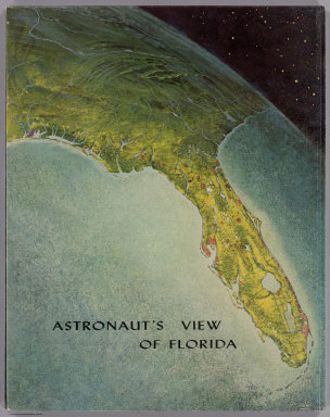
Raisz, Erwin
Full Title
(Covers to) Astronaut's View Of Florida. (to accompany) Atlas of Florida by Erwin Raisz and associates with text by John R. Dunkle. Prepared in the Department of Geography, University of Florida. University of Florida Press, Gainesville, 1964. (on verso) 1964 Board of Commissioners of State Institutions of Florida.
Publisher
Un. Of Florida Press
Author
Harrison, Richard Edes
Full Title
(Covers to) Look At The World: The Fortune Atlas For world Strategy. By Richard Edes Harrison. Text by Editor of Fortune. New York: Alfred A. Knopf 1944. (on verso) Copyright 1944 by Time Incorporated. Atlas exhibiting large scale maps, drawn from the point of view of the air age. Dust Cover showing a relief map of japan in full color. (on verso of dust cover) Text containing a short description of the atlas, biography and picture of Richard. E. Harrison. Atlas, Contains full color, and black and white maps and plans. Drawn By Richard Edes Harrison. With Geographical, Statistical, And Historical Descriptions.
Publisher
A. A. Knopf
Author
Woodbridge, William C.
Full Title
(Covers to) Modern Atlas On A New Plan; To Accompany The System Of Universal Geography, By William Channing Woodbridge ... Exhibiting In Connection With The Outlines Of Countries, The Prevailing Religions, Forms Of Government, And Degrees Of Civilization; The Comparative Size Of Towns, Rivers And Mountains; And The Climates And Productions Of The Earth ... District Of Connecticut, ss. Be It Remembered, That on the twenty-second day of June, in the forty-eighth year of the Independence of the United States of America, William Channing Woodbridge ... and Emma Willard ... have deposited in this Office the title of a book ... Charles A. Ingersoll, Clerk of the District of Connecticut. Hartford: Oliver D. Cooke & Sons, Publishers.
Publisher
Oliver D. Cooke & Sons
Author
Snow, William Parker, 1817-1895.
Full Title
(Covers to) Official map of the Territory of Montana. Drawn for the use of the Territorial schools. By William P. Snow, 1886. George E. Boos & Co. Helena, Montana. Engraved and manufactured by G.W. & C.B. Colton & Co., New York. Copyright 1885 by William P. Snow.
Publisher
[G.W. & C.B. Colton & Co., George E. Boos & Co.]
Author
Gibbes, C.D.
Full Title
(Covers to) A New Map Of California. By Charles Drayton Gibbes From his own and other Recent Surveys and Explorations. MDCCCLII. Published by C.D. Gibbes, Stockton, Cal. Sherman & Smith, New York. Entered ... 1852 by Sherman & Smith ... New York. (inset) Map Of The United States Of America, Mexico, Central America, Cuba &c.
Publisher
C.D. Gibbes
Author
Johnson, A.J.
Full Title
(Covers to) Johnson's New Illustrated (Steel Plate) Family Atlas, With Physical Geography, And With Descriptions Geographical, Statistical, And Historical ... By Richard Swainson Fisher, M.D. ... Maps Compiled, Drawn, And Engraved Under The Supervision Of J.H. Colton And A.J. Johnson. New York: Johnson And Ward, Successors To Johnson And Browning (Successors To J.H. Colton And Company,) No. 113 Fulton Street. 1864. Entered ... One Thousand Eight Hundred and Sixty-four, by A.J. Johnson ... New York.
Publisher
Johnson and Ward
Author
Thayer, H. L.
Full Title
(Covers to) Thayer's Map of Denver Colorado. Located to Tp. Nos 3&4 South Range No. 68 West Arapahoe County. Published by H.L Thayer. Real Estate Mining And Loan Agent Denver. 1879. Thayer's Map Publishing House ... No. 354-1/2 Lawrence Street. Entered ... 1878, by H.L. Thayer ... Washington.
Publisher
H.L. Thayer
Author
Mitchell, Samuel Augustus
Full Title
(Covers to) A New Universal Atlas Containing Maps of the various Empires, Kingdoms, States and Republics Of The World. With a special map of each of the United States, Plans of Cities &c. Comprehended in seventy five sheets and forming a series of One Hundred And Twenty Nine Maps, Plans And Sections ... Philadelphia, Thomas, Cowperthwait & Co. No. 253 Market Street. 1855. Entered ... 1850 by Thomas, Cowperthwait & Co. ... Pennsylvania. (title page by) J. Wissler delr. Chromolith. of P.S. Duval & Co. Phila.
Publisher
Cowperthwait, Desilver & Butler
Author
[Rollandet, Edward, Thayer, H. L.]
Full Title
(Covers to) Thayer's New Map Of The State of Colorado Compiled From Official Surveys And Explorations. Published by H.L. Thayer, Denver Col. 1880. Established in 1871. Drawn By Edward Rollandet. Entered ... 1878 by H.L Thayer ... Washington.
Publisher
H.L. Thayer
Author
Townsend & Dale
Full Title
(Covers to) Map of the Oil Region of Pennsylvania. Published by Townsend & Dale. Meadville, Pa. 1865. Otto Krebs, lith. Pittsburgh. Copy Right Secured according to Act of Congress, 1865.
Publisher
Townsend & Dale.
Author
Beers, F.W.
Full Title
(Covers) Illustrated Atlas of the City of Richmond, Published for the Southern and Southwestern Surveying and Pub. Co. by F.W. Beers, C.E. J.A. Enslow, Jr., J.P. Brown, Business Managers ... Entered ... 1876 by F.W. Beers ... Washington ...
Publisher
F.W. Beers
|