Who What Where WhenREMOVEWHO
WHEN
|
Author
MacCormac, Walter S.
Full Title
(Covers to) Map Of The Peninsula, Embracing Delaware And The Eastern Shore Of Maryland And Virginia, Compiled from U.S. Coast, and other Actual Surveys, and recent information obtained from various sources. By Walter S. MacCormac, Civ. Eng. Published by Smith & Stroup, Nos. 52 & 54 North Sixth Street, Philadelphia. 1879. Entered ... 1878, by E.W Smith ... Washington.
Publisher
Smith & Stroup
Author
Dearborn, Nathaniel
Full Title
(Covers to) New Map Of Massachusetts Compiled from The Latest and Best Authorities And Corrected by Permission From the Survey ordered by the Legislature in 1830. Carefully Revised And Additions Made In 1839. Boston. 3d. Edition Published By Nathl. Dearborn, Engraver & Printer, 53 Washington St. 1840. (inset) Boston. (4 additional inset maps).
Publisher
N. Dearborn
Author
Cooke, D.B & Co.
Full Title
(Covers to) D.B. Cooke & Co.'s Great Western Railway Guide. Exhibiting All Stations With Distances From Each other. Chicago, 1856. Entered ... 1856 by D.B. Cooke & Company. Middleton Wallace & Co. Lith. Cincinnati.
Publisher
Cooke, D.B & Co.
Author
Lloyd, J.T.
Full Title
(Covers to) Lloyd's Official Map Of The State Of Kentucky Compiled from Actual Surveys and Official Documents, Showing Every Rail Road & Rail Road Station with the distances between each station ... 1863. New York J.T. Lloyd, Publisher, 164 Broadway. Price. 50 Cents each, colored in sheets. Entered ... 1862 by J.T. Lloyd ...
Publisher
J.T. Lloyd
Author
Lloyd, J.T.
Full Title
(Covers to) Lloyd's Official Map Of The State Of Kentucky Compiled from Actual Surveys and Official Documents, Showing Every Rail Road & Rail Road Station with the distances between each station ... 1863. New York, J.T. Lloyd, Publisher, 164 Broadway. Entered ... 1862 by J.T. Lloyd... New York.
Publisher
J.T. Lloyd
Author
Farmer, John
Full Title
(Covers to) Map Of The Surveyed Part Of Michigan, By John Farmer. Published by J.H. Colton & Co. New-York. 1837. Engraved by S. Stiles & Co. New-York. Entered ... 1836, by J.H. Colton & Co ... New York. (inset) The Unsurveyed Part Of Michigan. (inset) Map Of The Straits Of Mackinaw. From Actual Survey. (inset) Map Of Mackinaw Isle.
Publisher
J.H. Colton & Co.
Author
Dodge, J.R.
Full Title
(Covers to) Township and Railroad Map Of New Hampshire, Compiled from the best authorities ... 1854. Published by J.R. Dodge, Nashua, N.H. L.H. Bradford & Co.'s Boston. Entered ... 1854 by J.R. Dodge ... New Hampshire.
Publisher
J.R. Dodge
Author
[Colton, G.W. & C.B., Howland, S.A.]
Full Title
(Covers to) Commercial Map of New England. Worcester Mass. S.A. Howland 1871. G.W. & C.B. Colton & Co. New York. (inset) The Northern Portion Of Maine. (with an 18 page index) Commercial Travelers' Pocket Map Of New England, Eastern New York And Long Island, Together With A Complete Census Of The New England States In 1860 and 1870. Worcester, Mass., Published By S.A. Howland. 1871. Entered ... 1871, by S.A. Howland, of Massachusetts ...
Publisher
S.A. Howland
Author
Dawson, James
Full Title
(Covers to) Nova Scotia, And Prince Edward's Island. 1847. Published By James Dawson Pictou N.S. W. Nichol & Co. Lithogrs. Edinr.
Publisher
James, Dawson
Author
[Hunter, C.M., Pleasant Hill Land Association]
Full Title
(Covers to) Plan Of Building Lots Of The Pleasant Hill Land Asso. 23rd Ward Philada, Pa. C.M. Hunter, Map Publisher 2326 Master St. Philada. (In: Pleasant Hill Land Association Receipt Book and Terms of Sale).
Publisher
C.M. Hunter
Author
Mackinlay, A. & W.
Full Title
(Covers to) Mackinlay's map of the Province of Nova Scotia, including the island of Cape Breton. Compiled from actual & recent surveys. Published By A. & W. Mackinlay, No. 10 Granville Street, Halifax, N.S. Engraved by G. Philip & Son, Liverpool. Drawn by W.A. Hendry.
Publisher
A. & W. Mackinlay.
Author
[Strauch, Geo. B., Cochran, A.B.]
Full Title
(Covers to) The Anthracite Coal Fields Of Pennsylvania With Their Outlets To Market. By Geo. B. Strauch And A.B. Cochran, Mining Engineers, Pottsville, Pa. 1878. Entered ... 1878 by Strauch & Cochran ... Washington D.C. T. Sinclair & Son. lith. Phila. (inset) Anthracite Coal Fields And Their Outlets To Market. Strauch & Cochran 1878
Publisher
T. Sinclair & Son Lith.
Author
Farmer, John
Full Title
(Covers to) Map Of The Surveyed Part Of Michigan, By John Farmer. Published By J.H. Colton. New-York. 1852. Engraved by S. Stiles & Co. New York. Entered ... 1852 by J.H. Colton & Co. ... New York. (inset) Northern Part of Michigan. (inset) Map Of The Straits Of Mackinaw From Actual Survey. (inset) Map of Mackinaw Isle.
Publisher
J.H Colton & Co.
Author
Farmer, John
Full Title
(Covers to) Map Of The Southern Part Of Michigan, By John Farmer. Published By J.H. Colton And Co. New-York. 1856. Engraved by S. Stiles & Co. New-York. Entered ... 1855 by J.H. Colton & Co. ... New York. (inset) Northern Part of Michigan. (inset) Map Of The Straits Of Mackinaw From Actual Survey. (inset) Map of Mackinaw Isle.
Publisher
J.H Colton & Co.
Author
Farmer, John
Full Title
(Covers to) Map Of The State Of Michigan And the Surrounding Country Exhibiting the Sections and the latest surveys. Compiled From Authentic Sources By John Farmer. Detroit. 23rd edition. Entered ... 1844 by John Farmer of Detroit. Entered ... by John Farmer of Detroit ... 1849. Reentered ... 1858 by John Farmer ... (inset) Plat of the Copper District on L. Superior. Engraved by John Farmer.
Publisher
John Farmer
Author
Farmer, John
Full Title
(Covers to) Colton's Sectional Map Of Michigan, By John Farmer. Published By J.H. Colton, New-York, 1865. (untitled inset map of Michigan and the Great Lakes).
Publisher
J.H. Colton
Author
[Farmer, John, Farmer, Silas]
Full Title
(Covers to) Farmer's Rail Road & Township Map Of Michigan And Chart Of The Lakes From U.S. Surveys & Other Authentic Sources. Drawn And Engraved By John Farmer, C.E. Silas Farmer & Co. (Successors To The Late John Farmer,) Publishers Of Sectional And Township Maps Of Michigan, Wisconsin, Lake Superior, Wayne County, Mich. &c. 35 Monroe Avenue, Detroit. 1868. Entered ... at Detroit ... 1857, by John Farmer...
Publisher
Silas Farmer & Co.
Author
[Frey, A.C., Nell, Louis]
Full Title
(Covers to) Frey & Nell's New England. Railroad, Topographical & Township Map of the States of Connecticut, Rhode Island, Massachusetts, Vermont, New Hampshire and Maine. New York, H.H. Lloyd & Co. Publishers, 21 John St. Concord, N.H. D.L. Guernsey & Co. 1867 ... American Photo-Lithographic Co. N. York. Osborne's Process. Entered ... 1867, by Frey & Nell ... New York. (untitled inset of Maine).
Publisher
[D.L. Guernsey & Co., H.H. Lloyd & Co.]
Author
Tanner, Henry S.
Full Title
(Covers to) Plan of the City of Philadelphia and Adjoining Districts Compiled from Original Documents by William Allen
Publisher
H.S. Tanner.
Author
Thayer, H. L.
Full Title
(Covers to) Thayer's Map of the Black Hills & Big Horn Country. Published By H.L Thayer Denver, Colorado. Carefully prepared from the Official Maps of the General Land Office. Explorations of Capt. Wm. Ludlow and from latest Maps of the routes of General Custer and other Officers of the Army, furnished by Capt. W.S. Stanton Chief Engr. Dept. of the Platte and from the Engineer Dept. at Washington. Entered ... 1877 by H.L. Thayer ... Washington. Edward Rollandet, Draftsman.
Publisher
H.L. Thayer
Author
[Mitchell, Samuel Augustus, Young, James H., Drake, Ira S., Hazzard, J.L.]
Full Title
(Covers to) Mitchell's New Traveller's Guide Through The United States and the Canadas, Containing The Principal Cities And Towns ... Illustrated By An Accurate Map Of The United States ... Philadelphia: Charles Desilver, No. 714 Chestnut Street, Opposite The Masonic Hall. 1860. (on verso) Entered ... 1859, by Charles Desilver ... Pennsylvania. (with) A New Map Of The United States of America. By J.H. Young. Philadelphia. Published By Charles Desilver ... Entered ... 1859, by Charles Desilver ... Pennsylvania (with 2 inset maps). (with map) Mitchell's New Traveller's Guide Through The United States ... Drawn and Engraved by J.L. Hazzard & I.S. Drake. Philadelphia. Published by Charles Desilver ... 1860. Entered ... 1848 by Charles Desilver ... Pennsylvania (with 5 inset maps).
Publisher
Charles Desilver
Author
Faust, H.W.
Full Title
(Covers to) Faust's Map Of City And County Of San Francisco California. Published By H.W. Faust. Latest Edition 1903. Copyrighted by H.W. Faust, 1903. Galloway Litho. Co. S.F. (inset) General View Of San Francisco Bay.
Publisher
H.W. Faust
Author
Thomas Bros.
Full Title
(Covers to) Thomas Bros. New Map Of City And County Of San Francisco. Published By Thomas Bros. Map Publishers, 461 Market Street, San Francisco ... 361 7th Street, Oakland ... Copyrighted By Thomas Bros. (on verso) New Map Of Oakland, Berkeley, Alameda, San Leandro, Piedmont, Emeryville, Albany ...
Publisher
Thomas Bros.
Author
Thayer, H.L.
Full Title
(Covers to) Thayer's Map Of The Leadville Mines California Mining District Lake County Colorado. ... Compiled From The United States Surveys And County Records. Published by H.L. Thayer, Leadville, Colorado. Julius Bien, Photo-Lith. N.Y.
Publisher
H.L. Thayer
Author
Tanner, Henry S.
Full Title
(Covers to) The American Traveller, or Tourists' and Emigrants' Guide Through the United States. Containing Brief Notices of the Several States, Cities, Principal Towns ... Tenth Edition. With Several Additional Routes, and a Map, in which the various routes described in the work, are represented by appropriate lines. By H.S. Tanner. New York: Published at the Map Establishment, No. 237 Broadway. 1846. (on verso) Entered ... 1846, By H.S. Tanner ... New York.
Publisher
The Map Establishment
Author
[Smith, J.L., Smith, A. DW.]
Full Title
(Covers to) General Map Of The Anthracite Coal Fields Of Pennsylvania And Adjoining Counties Showing The Position Of Each Colliery. By A. DW. Smith, Mining Engineer. Wilkes-Barre, Penna. Published by J.L. Smith, Map Publisher, 27 S. 6th St., Philadelphia 1899. Copyrighted 1899 By A. DW. Smith. (inset) Map Showing The Railroad Outlets Of The Anthracite Coal Regions Of Pennsylvania.
Publisher
J.L. Smith
Author
[McMurray, William, Layne, J.P.]
Full Title
(Covers to) Map Of White Pine District Lander Co. Nev. Showing The Principal Mines. Made For J.P. Layne Esq. By Wm. Mc.Murray, C.E. Septr. 1868. Lith. Britton & Rey, S.F. (with profile) Section Through A.B. Treasure Mountain.
Publisher
Britton & Rey
Author
Ferris, Jacob
Full Title
The States and Territories of The Great West; including Ohio, Indiana, Illinois, Missouri, Michigan, Wisconsin, Iowa, Minesota (sic), Kansas, and Nebraska ... Giving a Table of Distances ... with a Map and Numerous Illustrations. By Jacob Ferris. New York and Auburn: Miller, Orton, and Mulligan. Buffalo: E.F. Beadle. 1856. (on verso) Entered ... 1856, By E.F. Beadle ... New York.
Publisher
Miller, Orton, and Mulligan
Author
[Norman, B.M., Moellhausen, Henry]
Full Title
(Covers to) Norman's New Orleans and Environs: Containing a Brief Historical Sketch of the Territory and State of Louisiana, and the City of New Orleans, From the Earliest Period to the Present Time ... With a Correct and Improved Plan of the City ... New Orleans: Published by B.M. Norman. ... 1845. (on verso) Entered ... 1845, by B.M. Norman ... New York.
Publisher
B.M. Norman
Author
Mackinlay, A. & W.
Full Title
(Covers to) Mackinlay's map of the Province of Nova Scotia, including the island of Cape Breton. Compiled from actual & recent surveys. Published By A. & W. Mackinlay, No. 10 Granville Street, Halifax, N.S. Engraved by G. Philip & Son, Liverpool. Drawn by W.A. Hendry.
Publisher
A. & W. Mackinlay.
Author
Sherwood, Adiel
Full Title
(Covers to) A Gazetteer of the State of Georgia. By Adiel Sherwood. Second Edition. Philadelphia: Printed by J.W. Martin and W.K. Boden. 1829. (on verso) ... on the twenty-fourth day of April ... one thousand eight hundred and twenty-six ... Rene Fitzpatrick, Esq. ... has deposited ... a Book ... Georgia.
Publisher
J.W. Martin and W.K. Boden
Author
Webster, James
Full Title
(Covers to) Travellers Guide and Statistical View of the United States. Published by J.W. Webster, New York. Entered ... 1834, by J.W. Webster ... New-York. (with) Map of the United States Published by J. Webster, New York, 1836. Entered ... the 26th day of March 1833 by James Webster ... New York.
Publisher
James Webster.
Author
Tanner, Henry S.
Full Title
(Covers to) A Brief Description of the Canals and Railroads of the United States; Comprehending notices of all the most important works of Internal Improvement throughout the Several States. By H.S. Tanner. Philadelphia: Published by the Author. November, 1834.
Publisher
Henry Tanner
Author
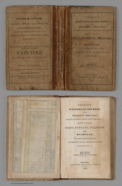
Steele, Oliver G.
Full Title
(Covers to) Steele's Western Guide Book, And Emigrant's Directory, Containing Different Routes Through The States Of New-York, Ohio, Indiana, Illinois And Michigan, With Short Descriptions Of The Climate, Soil, Productions, Prospects, &c. Fifth Edition. Greatly Improved And Enlarged. Buffalo: Published By Oliver G. Steele, 1836. (on verso) Entered ... in the year 1836 ... Press of O.G. Steele. (with) Steele's Map Of Ohio Indiana Illinois & Michigan From the Latest Authorities. Buffalo 1836. Entered ... 1835 by O.G. Steele ... Engraved by J.G. Darby, Buffalo N.Y. (inset) The Southern Part of Illinois.
Publisher
Oliver G. Steele.
Author
Melish, John
Full Title
(Covers to) Information and Advice to Emigrants to the United States: and from the Eastern to the Western States: Illustrated by A Map of the United States, and A Chart of the Atlantic Ocean. By John Melish. Philadelphia: Printed for and Published by John Melish, No. 121, Chesnut Street. 1819. (on verso) ...on the nineteenth day of June ... 1819, John Melish ... hath deposited ... a book ... Pennsylvania.
Publisher
John Melish
Author
[Smith, J. Calvin, Colton, J.H.]
Full Title
(Covers to) The Western Tourist Or Emigrant's Guide Through The States of Ohio, Michigan, Indiana, Illinois, And Missouri, And The Territories Of Wisconsin And Iowa ... Accompanied with a Correct Map, showing the Township lines of the United States' Surveys ... New York: Published by J.H. Colton, 86 Cedar-Street. 1845. (on verso) Entered ... 1839, by J.H. Colton ... New-York.
Publisher
J.H. Colton
Author
Taintor Brothers
Full Title
(Covers to) The City Of New York. A Complete Guide. With Descriptive Sketches Of Objects And Places Of Interest. With Map. Entered ... 1867, by Taintor Brothers & Co. ... New York. New York: Taintor Brothers, 678 Broadway. (with map) New Map Of The Great Metropolis, Including The Cities Of New York, Brooklyn, Jersey City, Hoboken, & Co., Published By Taintor Brothers, 758 Broadway.
Publisher
Taintor Brothers
Author
Tanner, Henry S.
Full Title
(Covers to) The American Traveller, or Tourists' and Emigrants' Guide Through the United States. Containing Brief Notices of the Several States, Cities, Principal Towns ... Ninth Edition, with several additional routes, and A New Map ... By H.S. Tanner. New York: Published by T.R. Tanner, 153 Broadway. 1844. (on verso) Entered ... 1844, by H.S. Tanner ... New York.
Publisher
T.R. Tanner
Author
[Smith, J. Calvin, Colton, J.H.]
Full Title
(Covers to)The Western Tourist And Emigrant's Guide Through The States of Ohio, Michigan, Indiana, Illinois, Missouri, Iowa and Wisconsin, And The Territories Of Minnesota, Missouri, and Nebraska ... Accompanied with a large and minute map, exhibiting the Township lines of the United States' Surveys ... New York: Published by J.H. Colton, No. 86 Cedar Street. 1851. (on verso) Entered ... 1850, by J.H. Colton ... New York.
Publisher
J.H. Colton
Author
[Smith, J. Calvin, Colton, J.H.]
Full Title
(Covers to) The Western Tourist and Emigrant's Guide, With a Compendious Gazetteer Of The States of Ohio, Michigan, Indiana, Illinois, And Missouri, And The Territories Of Wisconsin And Iowa ... Accompanied with a correct Map, showing the lines of the United States' Surveys. By J. Calvin Smith. New York: Published by J.H. Colton, No. 124 Broadway. 1839. (on verso) Entered ... 1839, by J.H. Colton ... New York.
Publisher
J.H. Colton
Author
Colton, J.H.
Full Title
(Covers to) The Emigrant's Hand-Book; Or, A Directory and Guide For Persons Emigrating to the United States of America. ... Accompanied with a Correct Travelling Map of the United States. New York: Published by J.H. Colton, No. 86 Cedar Street. 1848. (on verso) Entered ... 1848, by J.H. Colton ... New York.
Publisher
J.H. Colton
Author
[Smith, J. Calvin, Colton, J.H.]
Full Title
(Covers to) The Western Tourist And Emigrant's Guide Through The States of Ohio, Michigan, Indiana, Illinois, Missouri, Iowa and Wisconsin, And The Territories Of Minnesota, Missouri, and Nebraska ... Accompanied with a large and minute map, exhibiting the Township lines of the United States' Surveys ... New York: Published by J.H. Colton and Company, No. 172 William Street. 1855. (on verso) Entered ... 1850, by J.H. Colton ... New York.
Publisher
J.H. Colton and Co.
Author
Mitchell, Samuel Augustus
Full Title
(Covers to) Map Of Florida according to the Latest Authorities. Published by S. Augustus Mitchell Philadelphia. 1834. The West Indies from the Best Authorities. Published by S. Augustus Mitchell Philadelphia. 1834.
Publisher
S. Augustus Mitchell
Author
[Smith, J. Calvin, Colton, J.H.]
Full Title
(Covers to) The Western Tourist And Emigrant's Guide Through The States of Ohio, Michigan, Indiana, Illinois, Missouri, Iowa and Wisconsin, And The Territories Of Minnesota, Missouri, and Nebraska ... Accompanied with a large and minute map, exhibiting the Township lines of the United States' Surveys. New York: Published by J.H. Colton, No. 86 Cedar-Street. 1853. (on verso) Entered ... 1850, by J.H. Colton ... New York.
Publisher
J.H. Colton
Author
[Mitchell, Samuel Augustus, Young, James H.]
Full Title
(Covers to) Mitchell's Traveller's Guide Through The United States, Containing The Principal Cities, Towns, &c.... Illustrated By An Accurate Map Of The United States. Philadelphia: Thomas, Cowperthwait, & Co. 253 Market Street. (on verso) Entered ... 1836, by Mitchell & Hinman ... Pennsylvania. Stereotyped by John Fagan ... Philadelphia. (with map) Mitchell's Travellers Guide Through The United States. A Map Of The Roads, Distances, Steam Boat & Canal Routes &c. By J.H. Young. Philadelphia. Published by S. Augustus Mitchell. 1844. Engraved On Steel By J.H. Young And D. Haines. Entered ... 1834 by S. Augustus Mitchell ... Pennsylvania. (with 8 inset maps).
Publisher
Thomas, Cowperthwait & Co.
Author
[Page, H.R. & Co., Blake, J.A]
Full Title
(Covers to) Blake's New Map Of Colorado. 1881. J.A. Blake, Publisher, 294 Fifteenth Street, Denver. Copyrighted 1880 by H.R. Page. A. Loehnes.
Publisher
J.A. Blake
Author
[Mitchell, Samuel Augustus, Young, James H.]
Full Title
(Covers to) Mitchell's Traveller's Guide Through The United States, Containing The Principal Cities, Towns, &c. ... Illustrated By An Accurate Map Of The United States. Philadelphia: Hinman & Dutton, No. 6 North Fifth Street. 1836. (on verso) Entered ... 1836, by Mitchell & Hinman ... Pennsylvania. Stereotyped by John Fagan ... Philadelphia. (with map) Mitchell's Travellers Guide Through The United States. A Map Of The Roads, Distances, Steam Boat & Canal Routes &c. By J.H. Young Philadelphia. Published by S. Augustus Mitchell. 1836. Engraved On Steel By J.H. Young & D. Haines. Entered ... 1834 by S. Augustus Mitchell ... Pennsylvania. (with 9 inset maps).
Publisher
Mitchell & Hinman
Author
[Smith, J. Calvin, Colton, J.H.]
Full Title
(Covers to) Colton's Traveler & Tourist's Guide-Book Through The Western States and Territories ... Compiled by Richard S. Fisher, M.D. ... Accompanied by a Map, Exhibiting the Township lines of the U.S. Surveys ... New York: J.H. Colton and Company, No. 172 William Street. 1857. (on verso) Entered ... J.H. Colton and Company ... New York. Davies & Roberts, Stereotypers, N.Y. Pudney & Russell, Printers.
Publisher
J.H. Colton & Co.
Author
[Mitchell, Samuel Augustus, Drake, Ira S.]
Full Title
(Covers to) Mitchell's New Traveller's Guide Through The United States, Containing The Principal Cities, Towns &c. ... Illustrated By An Accurate Map Of The United States. Philadelphia: Thomas, Cowperthwait & Co. 1850. (on verso) Entered ... 1848, by Thomas, Cowperthwait & Co. ... Pennsylvania. Stereotyped by J. Fagan. Printed by Smith & Peters. (with map) Mitchell's New Traveller's Guide Through The United States, Showing the Rail Roads, Canals, Stage Roads &c. ... Drawn and Engraved by Ira S. Drake. Philadelphia 1849 Published by Thomas, Cowperthwait & Co. (with 5 inset maps).
Publisher
Thomas, Cowperthwait & Co.
Author
Mackinlay, A. & W.
Full Title
(Covers to) Mackinlay's map of the Province of Nova Scotia, including the island of Cape Breton. Compiled from actual & recent surveys. Published By A. & W. Mackinlay, No. 10 Granville Street, Halifax, N.S. Engraved by G. Philip & Son, Liverpool. Drawn by W.A. Hendry. (1868)
Publisher
A. & W. Mackinlay.
|