Who What Where WhenREMOVE |
REFINE
Browse All : Exploration Book and Book Map of Nebraska
1-5 of 5
Author
Hayden, F.V.
Full Title
U.S. War Department Map Of The Yellowstone And Missouri Rivers And Their Tributaries explored by Capt. W.F. Raynolds Topl. Engrs. and 1st Lieut. H.E. Maynadier 10th Infy. Assistant. 1859-60. To accompany a report to the Bureau of Topographical Engineers. Lt. Col. Harman Bache in charge. Engraved in the Engineer Bureau War Dept. Prepared to accompany the Geological Report of F.V. Hayden M.D. ... Printed by Julius Bien, N.Y.
Publisher
Government Printing Office
Author
Warren, Gouverneur Kemble, 1830-1882
Full Title
Reconnoissances in the Dacota Country By G.K. Warren, Lieut: Topl. Engrs. U.S.A. ... P.S. Duval & Co. Lith. Philada. (profile) Profile Of Route From Fort Pierre To Fort Kearney ... 1855.
Publisher
A.O.P. Nicholson, Senate Printer
Author
Campbell, Albert
Full Title
Map of the Fort Ridgely & South Pass Road. To accompany the report of William H. Nobles, Superintendent, by Samuel A. Medary, Engr. 1858. T.S. Wagner's Lith., Philada. Drawn by John R. Key. (Sen. Ex. Doc. No. 36. Ho. Ex. Doc. No. 108 - 2nd Sess. 35 Cong.)
Publisher
T.S. Wagner's Lith.
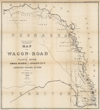
Author
Campbell, Albert
Full Title
Map of the Wagon-Road from Platte River via Omaha Reserve and Dakota City to Running Water River. Geo. L. Sites, Supt. 1858. T.S. Wagner's Lith. Philada. Department of the Interior, Pacific Wagon Roads. (Sen. Ex. Doc. No. 36. Ho. Ex. Doc. No. 108 - 2nd Sess. 35 Cong.)
Publisher
T.S. Wagner's Lith.
1-5 of 5
|