Who What Where WhenREMOVEWHO
WHEN
|
Author
Duflot de Mofras, Eugene
Full Title
(Title Page to) Exploration Du Territoire De L'Oregon, Des Californies Et De La Mer Vermeille, Executee Pendant Les Annees 1840, 1841 Et 1842, Par M. Duflot De Mofras, Attache A La Legation De France A Mexico. Ouvrage Publie Par Ordre Du Roi, Sous Les Auspices De M. Le Marechal Soult, Duc De Dalmatie, President du Conseil, Et De M. Le Ministre Des Affaires Etrangeres. Tome Premier. Paris, Arthus Bertrand, Editeur, Libraire De La Societe De Geographie, Rue Hautefeuille, No. 23. 1844. Paris. - Typographie de Firmin Didot Freres, rue Jacob, 56 ... Tome Second ... Atlas (with map) Carte De La Cote De L'Amerique Sur L'Ocean Pacifique Septentrional comprenant Le Territoire De L'Oregon, Les Californies, La Mer Vermeille ...
Publisher
Arthus Bertrand
Author
Emory, William H.
Full Title
(Title Page to) Notes of a Military Reconnoissance, From Fort Leavenworth, In Missouri, To San Diego, In California, Including Part of the Arkansas, Del Norte, and Gila Rivers. By W.H. Emory, Brevet Major, Corps Topographical Engineers. Made in 1846-7, with the Advanced Guard of the "Army of the West." Washington: Wendell and van Benthuysen, Printers. 1848. [Senate] 30th Congress, 1st Session. Executive, No. 7.
Publisher
Wendell and Van Benthuysen
Author
Emory, William H.
Full Title
(Title Page to) Report on the United States and Mexican Boundary Survey, Made Under The Direction of the Secretary of the Interior, By William H. Emory, Major First Cavalry And United States Commissioner ... Washington: Cornelius Wendell, Printer. 1857. House of Representatives, 34th Congress, 1st Session. Ex. Doc. No. 135. (Two volumes.)
Publisher
Cornelius Wendell
Author
Fremont, J.C.
Full Title
(Title Page to) Report of The Exploring Expedition to The Rocky Mountains in the Year 1842, and to Oregon and North California in the Years 1843-'44.
Publisher
Blair and Rives
Author
Fremont, J.C.
Full Title
(Title Page to) Geographical Memoir upon Upper California In Illustration of His Map of Oregon and California, by John Charles Fremont: Addressed to the Senate of the United States. Washington: Wendell and Van Benthuysen, Printers. 1848. [Senate.] 30th Congress, 1st Session. Miscellaneous. No. 148.
Publisher
Wendell and Van Benthuysen
Author
Hayden, F.V.
Full Title
(Title Page to) Geological Report of the Exploration of the Yellowstone and Missouri Rivers by Dr. F.V. Hayden, Assistant, under the direction of Captain (now Lieut. Col. and Brevet Brig. Gen.) W.F. Raynolds, Corps of Engineers, 1859-'60. Washington: Government Printing Office. 1869.
Publisher
U.S.
Author
Macomb, J.N.
Full Title
(Title Page to) Report of the Exploring Expedition From Santa Fe, New Mexico, To The Junction of the Grand and Green Rivers of the Great Colorado of the West, In 1859, Under the Command of Capt. J.N. Macomb, Corps of Topographical Engineers (Now Colonel of Engineers); With A Geological Report by Prof. J.S. Newberry, Geologist of the Expedition. Washington: Government Printing Office. 1876.
Publisher
Washington: U.S.
Author
Mullan, John
Full Title
(Title Page to) Miners and Travelers' Guide to Oregon, Washington, Idaho, Montana, Wyoming, and Colorado. Via the Missouri and Columbia Rivers. Accompanied by a General Map of the Mineral Region of the Northern Sections of the Rocky Mountains. Prepared by Captain John Mullan ... New York: Published by Wm. M. Franklin, (for the author), 24 Vesey Street, 1865. (on verso) Entered ... 1865, by H. Stern ... New York.
Publisher
Wm. M. Franklin
Author
[Dutton, Clarence E. (Clarence Edward), 1841-1912, Geographical and Geological Survey of the Rocky Mountain Region (U.S.)]
Full Title
(Title Page to) Topographical and geological atlas of the district of the high plateaus of Utah to accompany the report of Capt. C.E. Dutton, U.S. Ordnance Corps, assistant geologist. Julius Bien, Lith., New York, 1879.
Publisher
U.S. Geographical and Geological Survey of the Rocky Mountain Region
Author
Nicollet, J. N. (Joseph Nicolas), 1786-1843
Full Title
(Title Page to) Report Intended To Illustrate A Map Of The Hydrographical Basin of the Upper Mississippi River, Made by I.N. Nicollet ... February 16, 1841. Washington: Blair and Rives, Printers. 1843. [Senate.] 26th Congress, 2d Session. [237].
Publisher
Blair and Rives
Author
[Colton, J. H., Warren, Gouverneur Kemble, 1830-1882, Redpath, James, Hinton, Richard J]
Full Title
(Title Page to) Hand Book To Kansas Territory And The Rocky Mountains' Gold Region; Accompanied By Reliable Maps and a Preliminary Treatise on the Pre-emption Laws of the United States. By James Redpath and Richard J. Hinton, of Kansas. New York: J.H. Colton, Publisher, 172 William Street. 1859. (on verso) Entered ... in the year 1859, (Published) by J.H. Colton ... New York.
Publisher
J. H. Colton.
Author
Ives, J.C.
Full Title
(Title Page to) Report Upon The Colorado River of the West, Explored in 1857 and 1858 By Lieutenant Joseph C. Ives, Corps Of Topographical Engineers, Under The Direction Of The Office Of Explorations And Surveys, A.A. Humphreys, Captain Topographical Engineers, In Charge. By Order Of The Secretary Of War. Washington: Government Printing Office. 1861. Senate. 36th Congress, 1st Session. Ex. Doc.
Publisher
U.S.
Author
Wheeler, G.M.
Full Title
(Title Page to) Report upon United States Geographical Surveys West of the One Hundredth Meridian, in charge of Capt. Geo. M. Wheeler, Corps of Engineers, U.S. Army ... In seven volumes and one supplement, accompanied by one topographic and one geologic atlas. Vol. III--Geology. Washington: Government Printing Office, 1875.
Publisher
U.S.
Author
Wheeler, G.M.
Full Title
(Title Page to) Report upon United States Geographical Surveys West of the One Hundredth Meridian, in charge of Capt. Geo. M. Wheeler, Corps of Engineers, U.S. Army ... In seven volumes and one supplement, accompanied by one topographic and one geologic atlas. Vol. III--Supplement--Geology. Washington: Government Printing Office, 1881.
Publisher
U.S.
Author
Wheeler, G.M.
Full Title
(Title Page to) Report upon United States Geographical Surveys West of the One Hundredth Meridian, in charge of Capt. Geo. M. Wheeler, Corps of Engineers, U.S. Army ... In seven volumes and one supplement, accompanied by one topographic and one geologic atlas. Vol. IV--Paleontology. Washington: Government Printing Office, 1877.
Publisher
U.S.
Author
Wheeler, G.M.
Full Title
(Title Page to) Report upon United States Geographical Surveys West of the One Hundredth Meridian, in charge of Capt. Geo. M. Wheeler, Corps of Engineers, U.S. Army ... In seven volumes and one supplement, accompanied by one topographic and one geologic atlas. Vol. V--Zoology. Washington: Government Printing Office, 1875.
Publisher
U.S.
Author
Wheeler, G.M.
Full Title
(Title Page to) Report upon United States Geographical Surveys West of the One Hundredth Meridian, in charge of Capt. Geo. M. Wheeler, Corps of Engineers, U.S. Army ... In seven volumes and one supplement, accompanied by one topographic and one geologic atlas. Vol. VI--Botany. Washington: Government Printing Office, 1878.
Publisher
U.S.
Author
Wheeler, G.M.
Full Title
(Title Page to) Report upon United States Geographical Surveys West of the One Hundredth Meridian, in charge of Capt. Geo. M. Wheeler, Corps of Engineers, U.S. Army ... In seven volumes and one supplement, accompanied by one topographic and one geologic atlas. Vol. VII--Archaeology. Washington: Government Printing Office, 1879.
Publisher
U.S.
Author
[United States Exploring Expedition (1838-1842), Wilkes, Charles, 1798-1877]
Full Title
(Title Page to) Narrative of the United States Exploring Expedition During the Years 1838, 1839, 1840, 1841, 1842. By Charles Wilkes, U.S.N. Commander of the Expedition, member of the American Philosophical Society, etc. In Five Volumes, and an atlas. Vol. I. Philadelphia: Lea & Blanchard. 1845. (on verso) Entered ... 1844, By Charles Wilkes ... District of Columbia.
Publisher
Lea & Blanchard
Author
[United States Exploring Expedition (1838-1842), Wilkes, Charles, 1798-1877]
Full Title
(Title Page to) Narrative of the United States Exploring Expedition During the Years 1838, 1839, 1840, 1841, 1842. By Charles Wilkes, U.S.N. Commander of the Expedition, member of the American Philosophical Society, etc. In Five Volumes, and an atlas. Vol. II. Philadelphia: Lea & Blanchard. 1845. (on verso) Entered ... 1844, By Charles Wilkes ... District of Columbia.
Publisher
Lea & Blanchard
Author
[United States Exploring Expedition (1838-1842), Wilkes, Charles, 1798-1877]
Full Title
(Title Page to) Narrative of the United States Exploring Expedition During the Years 1838, 1839, 1840, 1841, 1842. By Charles Wilkes, U.S.N. Commander of the Expedition, member of the American Philosophical Society, etc. In Five Volumes, and an atlas. Vol. III. Philadelphia: Lea & Blanchard. 1845. (on verso) Entered ... 1844, By Charles Wilkes ... District of Columbia.
Publisher
Lea & Blanchard
Author
[United States Exploring Expedition (1838-1842), Wilkes, Charles, 1798-1877]
Full Title
(Title Page to) Narrative of the United States Exploring Expedition During the Years 1838, 1839, 1840, 1841, 1842. By Charles Wilkes, U.S.N. Commander of the Expedition, member of the American Philosophical Society, etc. In Five Volumes, and an atlas. Vol. IV. Philadelphia: Lea & Blanchard. 1845. (on verso) Entered ... 1844, By Charles Wilkes ... District of Columbia.
Publisher
Lea & Blanchard
Author
[United States Exploring Expedition (1838-1842), Wilkes, Charles, 1798-1877]
Full Title
(Title Page to) Narrative of the United States Exploring Expedition During the Years 1838, 1839, 1840, 1841, 1842. By Charles Wilkes, U.S.N. Commander of the Expedition, member of the American Philosophical Society, etc. In Five Volumes, and an atlas. Vol. V. Philadelphia: Lea & Blanchard. 1845. (on verso) Entered ... 1844, By Charles Wilkes ... District of Columbia.
Publisher
Lea & Blanchard
Author
[Pacific Railroad Survey, Warren, Gouverneur Kemble, 1830-1882]
Full Title
(Title Page to) Memoir to accompany the Map of the territory of the United States from the Mississippi River to the Pacific Ocean, giving a brief account of each of the exploring expeditions since A.D. 1800, with a detailed description of the method adopted in compiling the general map. By Lieut. Gouverneur K. Warren, Corps of Topographical Engineers, U.S.A. 1859.
Publisher
[A.O.P. Nicholson I-XI, T. Ford XII.]
Author
Powell, John Wesley, 1834-1902
Full Title
(Title Page to) Canyons of the Colorado by J.W. Powell, Ph.D., LL.D., ... With many illustrations. Meadville, Pa. Flood & Vincent. The Chautauqua-Century Press, M DCCC XCV. (with frontispiece: Portrait of) J.W. Powell. (on verso) Copyright, 1895 By Flood & Vincent.
Publisher
Flood & Vincent
Author
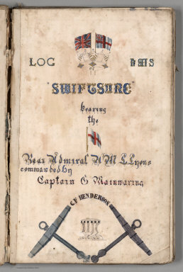
[Mainwaring, C., Henderson, C.F.]
Full Title
(Title Page) Log Of H.M.S. "Swiftsure" Bearing the (flag of) Rear Admiral H.M.L. Lyons commanded by Captain C. Mainwaring. C.F. Henderson.
Publisher
N.P: Manuscript
Author
[Pownall, Thomas, 1722-1805, Evans, Lewis, 1700?-1756, Almon, John, 1737-1805, Turner, James, d. 1759, Gist, Christopher, d. 1750]
Full Title
(Title page to) A Topographical Description of Such Parts of North America as are Contained in the (Annexed) Map of the Middle British Colonies, in North America.
Publisher
John Almon
Author
[U.S. Northern Boundary Commission, Campbell, A.]
Full Title
(Title Page) Joint Maps Of The Northern Boundary Of The United States, From The Lake Of The Woods To The Summit Of The Rocky Mountains. United States Northern Boundary Commission, Archibald Campbell Esq. Commissioner. W.J. Twining, Capt. of Engrs, U.S.A. Chief Astronomer. Her Majesty's North American Boundary Commission, D.R. Cameron, Maj. Royal Art. Commissioner. S. Anderson, Capt. Royal Engrs. Chief Astronomer.
Publisher
U.S.
Author
[Geographical and Geological Survey of the Rocky Mountain Region (U.S.), Jenney, Walter Proctor, 1849-1921, Newton, Henry, 1845-1877]
Full Title
(Title Page to) Topographical and Geological Atlas of the Black Hills of Dakota to accompany the report of Henry Newton, E.M., assistant geologist. Department of the Interior, United States Geographical and Geological Survey of the Rocky Mountain Region, J.W. Powell, in charge. Julius Bien, Lith. New York, 1879.
Publisher
Julius Bien
Author
Warren, Gouverneur Kemble, 1830-1882
Full Title
(Title Page to) Explorations in the Dacota Country, in the Year 1855. By Lieut. G.K. Warren, Topographical Engineer of the "Sioux Expedition." Senate. 34th Congress, 1st Session. Ex. Doc. No. 76. Washington: A.O.P. Nicholson, Senate Printer. 1856. (with map) Reconnoissances in the Dacota Country By G.K. Warren, Lieut: Topl. Engrs. U.S.A. ... P.S. Duval & Co. Lith. Philada. (profile) Profile Of Route From Fort Pierre To Fort Kearney ... 1855.
Publisher
A.O.P. Nicholson, Senate Printer
Author
[Pacific Railroad Survey, Warren, Gouverneur Kemble, 1830-1882]
Full Title
(Title Page to) Reports of Explorations and Surveys, to Ascertain the Most Practicable and Economical Route for a Railroad From the Mississippi River to the Pacific Ocean. Made Under the Direction of the Secretary of War, In 1853-56, According to Acts of Congress of March 3, 1853, May 31, 1854, and August 5, 1854. Volume XI. Washington: George W. Bowman, Printer. 1861. 36th Congress, 2d Session, Senate, Ex. Doc.
Publisher
[A.O.P. Nicholson I-XI, T. Ford XII.]
Author
[Pacific Railroad Survey, Warren, Gouverneur Kemble, 1830-1882]
Full Title
(Title Page to) Topographical maps, profiles, and sketches to illustrate the various Reports of Surveys for railroad routes from the Mississippi River to the Pacific Ocean. Washington, D.C., 1861.
Publisher
[A.O.P. Nicholson I-XI, T. Ford XII.]
Author
[U.S. Northern Boundary Commission, Campbell, Archibald, Twining, W.J.]
Full Title
(Title Page) Reports upon the Survey of the Boundary Between the Territory of the United States and the Possessions of Great Britain from the Lake of the Woods to the Summit of the Rocky Mountains, authorized by an Act of Congress Approved March 19, 1872. Archibald Campbell, Esq., (and) Captain W.J. Twining ... Published in accordance with an Act of Congress Approved March 3, 1877. Washington: Government Printing Office. 1878.
Publisher
Government Printing Office
Author
[Ludlow, William, 1843-1901, United States. Army. Corps of Engineer]
Full Title
(Title Page to) Engineering Department, U.S. Army. Report of a reconnaissance of the Black Hills of Dakota, made in the summer of 1874. By William Ludlow, Captain of Engineers, Bvt. Lieut. Colonel, U. S. Army; Chief Engineer Department of Dakota. Washington : Government Printing Office. 1875.
Publisher
Government Printing Office
Author
Ludlow, William
Full Title
(Title Page to) Report of a Reconnaissance From Carroll, Montana Territory, on the Upper Missouri, to the Yellowstone National Park, and Return Made in the Summer of 1875, by William Ludlow ... Washington: Government Printing Office. 1876.
Publisher
[N. Peters, Government Printing Office]
Author
Powell, John Wesley, 1834-1902.
Full Title
(Title Page to) Report on the Lands of the Arid Region of the United States, with a More Detailed Account of the Lands of Utah. With Maps. By J.W. Powell. Second edition. Washington: Government Printing Office. 1879.
Publisher
Government Printing Office
Author
Raynolds, W.F.
Full Title
(Title Page to) Report of the Secretary of War, communicating ... the report of Brevet Brigadier General W.F. Raynolds, on the exploration of the Yellowstone and the country drained by that river. (Senate. 40th Congress, 2nd session, Ex. Doc. No. 77.) July 19, 1867. - Read; ordered to lie on the table.
Publisher
War Dept.
Author
Mollhausen, Baldwin; (Lange, Henry)
Full Title
(Title Page to) Diary of a Journey from the Mississippi to the Coasts of the Pacific With a United States Government Expedition. By Baldwin Mollhausen Topographical Draughtsman and Naturalist to the Expedition. With An Introduction by Alexander von Humboldt and Illustrations in Chromo-Lithography. Translated by Mrs. Percy Sinnett. In Two Volumes. Vol. I London: Longman, Brown, Green, Longmans, & Roberts. 1858.
Publisher
Brown et al. Longman.
Author
Mollhausen, Baldwin; (Lange, Henry)
Full Title
(Title Page to) Diary of a Journey from the Mississippi to the Coasts of the Pacific With a United States Government Expedition. By Baldwin Mollhausen Topographical Draughtsman and Naturalist to the Expedition. With An Introduction by Alexander von Humboldt and Illustrations in Chromo-Lithography. Translated by Mrs. Percy Sinnett. In Two Volumes. Vol. II London: Longman, Brown, Green, Longmans, & Roberts. 1858.
Publisher
Brown et al. Longman.
Author
[King, Clarence, U.S. Geological Survey]
Full Title
(Title Page to) First Annual Report of the United States Geological Survey. To the Hon. Carl Schurz, Secretary of the Interior. By Clarence King, Director. Washington: Government Printing Office. 1880.
Publisher
Government Printing Office
Author
Thomas, David, 1776-1859
Full Title
(Title Page to) Travels through the western country in the summer of 1816. Including notices of the natural history, antiquities, topography, agriculture, commerce and manufactures. With a map of the Wabash country, now settling. By David Thomas. Auburn, N.Y. Printed by David Rumsey. 1819.
Publisher
David Rumsey
Author
Wheeler, G.M.
Full Title
(Title Page to) Report upon United States Geographical Surveys West of the One Hundredth Meridian, in charge of Capt. Geo. M. Wheeler, Corps of Engineers, U.S. Army ... In seven volumes and one supplement, accompanied by one topographic and one geologic atlas. Vol. I--Geographical report. Washington: Government Printing Office, 1889.
Publisher
U.S.
Author
Wheeler, G.M.
Full Title
(Title Page to) Report upon United States Geographical Surveys West of the One Hundredth Meridian, in charge of Capt. Geo. M. Wheeler, Corps of Engineers, U.S. Army ... In seven volumes and one supplement, accompanied by one topographic and one geologic atlas. Vol. II--Astronomy and barometric hypsometry. Washington: Government Printing Office, 1877.
Publisher
U.S.
Author
Egloffstein, Baron F.W. von
Full Title
(Title Page to) Contributions to the Geology and the Physical Geography of Mexico, including a Geological and Topographical Map, with profiles, Of some of the principal Mining Districts; together with a graphic description of an ascent of The Volcano Popocatepetl. Edited by Baron F.W. von Egloffstein. New York: D. Appleton & Company, 443 & 445 Broadway. 1864. (on verso) Entered ... 1864, by F.W. von Egloffstein ... New York.
Publisher
D. Appleton & Company.
Author
[Gunnison, J.W., Preuss, C., Stansbury, Howard]
Full Title
(Title Page to) Exploration and Survey of the Valley of the Great Salt Lake of Utah, including a Reconnoissance of a new Route through the Rocky Mountains. By Howard Stansbury ... (with view) Fort Utah on the Timpanogas - Valley of the Great Salt Lake. Philadelphia: Lippincott, Grambo & Co. 1852.
Publisher
Lippincott, Grambo & Co.
Author
[United States Exploring Expedition (1838-1842), Wilkes, Charles, 1798-1877]
Full Title
(Title page to) Atlas. Narrative of the United States Exploring Expedition During the Years 1838, 1839, 1840, 1841, 1842. By Charles Wilkes, U.S.N. Commander Of The Expedition, Member Of The American Philosophical Society, Etc. In Five Volumes, And An Atlas. Philadelphia: Lea & Blanchard. 1845. (on verso) Entered ... 1844, By Charles Wilkes ... District of Columbia.
Publisher
Lea & Blanchard
Author
[Cook, James, 1728-1779, King, James]
Full Title
(Title Page to) Voyage to the Pacific Ocean, undertaken by the Command of His Majesty, for making discoveries in the Northern Hemisphere. Performed under the direction of Captains Cook, Clerke and Gore, in His Majesty's ships the Resolution and Discovery , in the years 1776, 1777, 1778, 1779 and 1780. In three volumes. Vol. I. and II. written by Captain James Cook, F.R.S. Vol. III. by Captain James King, LL.D. and F.R.S. ... The second edition. London: Printed by H. Hughs, For G. Nicol, Bookseller to his Majesty, in the Strand; and T. Cadell, in the Strand. M.DCC.LXXXV.
Publisher
G. Nicol and T. Cadell
Author
[Banks, Joseph, Sir, 1743-1820, Byron, John, 1723-1786, Cook, James, 1728-1779, Hawkesworth, John, 1715?-1773]
Full Title
(Title Page to) An account of the voyages undertaken by the order of His present Majesty for making discoveries in the Southern Hemisphere, and successively performed by Commodore Byron, Captain Wallis, Captain Carteret, and Captain Cook, in the Dolphin, the Swallow, and the Endeavor. Drawn up from the journals which were kept by the several commanders, and from the papers of Joseph Banks, Esq; by John Hawkesworth, LL.D. In three volumes. Illustrated with cuts, and a great variety of charts and maps relative to countries now first discovered, or hitherto but imperfectly known. London: printed for W. Strahan; and T. Cadell in the Strand, MDCCLXXIII.
Publisher
W. Strahan and T. Cadell
Author
[Cook, James, 1728-1779, Furneaux, Tobias, 1735-1781, Hodges, William, 1744-1797]
Full Title
(Title Page to) A voyage towards the South Pole, and round the World. Performed in His Majesty's ships the Resolution and Adventure, in the years 1772, 1773, 1774, and 1775. Written by James Cook, Commander of the Resolution ... In two volumes illustrated with maps and charts ... The second edition. (with portrait) Captain James Cook, F.R.S. Painted by Wm. Hodges. Engraved by J. Basire, 1777. London: Printed for W. Strahan; and T. Cadell in the Strand. MDCCLXXVII.
Publisher
W. Strahan and T. Cadell
|