Who What Where WhenREMOVEWHO
|
Author
[USGS (U.S. Geological Survey), Walcott, Charles D., Ayers, H.B.]
Full Title
(View) Plate V. A. Head of North Fork of Sun River, Against Wall of Continental Divide. B. Severe Burn on Mountain Side.
Publisher
Government Printing Office
Author
[USGS (U.S. Geological Survey), Walcott, Charles D., Ayers, H.B.]
Full Title
(View) Plate VI. A. Burnt Mountainside not Restocked. B. Hannon's Ranch and Valley of Storehouse Creek.
Publisher
Government Printing Office
Author
[USGS (U.S. Geological Survey), Walcott, Charles D., Ayers, H.B.]
Full Title
(View) Plate VII. A. Mission Range, from Holland's Ranch. B. Yellow (Ponderosa) Pine, near Holland's Ranch, Upper Swan River Valley.
Publisher
Government Printing Office
Author
[USGS (U.S. Geological Survey), Walcott, Charles D., Ayers, H.B.]
Full Title
Plate VIII. Lewis and Clark Forest Reserve, Montana, by H.B. Ayers, 1899. Julius Bien & Co, N.Y.
Publisher
Government Printing Office
Author
[USGS (U.S. Geological Survey), Walcott, Charles D., Ayers, H.B.]
Full Title
(View) Plate IX. A. Upper Swan River Valley. B. Yellow (Ponderosa) Pine on Shore of Placid Lake.
Publisher
Government Printing Office
Author
[USGS (U.S. Geological Survey), Walcott, Charles D., Ayers, H.B.]
Full Title
(View) Plate X. A. Mountain Side, Looking East from Camp Creek Pass. B. Opening in Yellow-Pine (Ponderosa) Forest on Jocko Trail, 1 Mile North of Placid Lake.
Publisher
Government Printing Office
Author
[USGS (U.S. Geological Survey), Walcott, Charles D., Ayers, H.B.]
Full Title
(View) Plate XI. A. Larch, Yellow Pine and Red Fir, with Sparse Seedlings. B. Yellow Pine Frequently and Lightly Burnt.
Publisher
Government Printing Office
Author
[USGS (U.S. Geological Survey), Walcott, Charles D., Ayers, H.B.]
Full Title
(View) Plate XII. A. Mill on Smith Creek, Southwest of Haystack Butte. B. Deadwood Partly Cut, South Fork of Teton Creek.
Publisher
Government Printing Office
Author
[USGS (U.S. Geological Survey), Walcott, Charles D., Ayers, H.B.]
Full Title
(View) Plate XIII. A. Cutting and Skidding on Placid Creek. B. Burn of 1889, Upper Dearborn River.
Publisher
Government Printing Office
Author
[USGS (U.S. Geological Survey), Walcott, Charles D., Ayers, H.B.]
Full Title
Plate XIV. Lewis and Clark Forest Reserve, Montana, Showing distribution of cedar, hemlock, white pine and silver fir ... by H.B. Ayers. Julius Bien & Co. N.Y.
Publisher
Government Printing Office
Author
[USGS (U.S. Geological Survey), Walcott, Charles D., Ayers, H.B.]
Full Title
(View) Plate XV. A. Dam across Outlet of Placid Lake. B. Nut Pine (Pinus albicaulus) Killed by Fire, South End of White Ridge, Middle Fork of Sun River.
Publisher
Government Printing Office
Author
[USGS (U.S. Geological Survey), Walcott, Charles D., Ayers, H.B.]
Full Title
(View) Plate XVI. A. Lodgepole Pine following Larch and Yellow Pine, Killed by Fire. B. Group of Red Fir (Pseudosuga taxifolia) Probably Killed by Drought.
Publisher
Government Printing Office
Author
[USGS (U.S. Geological Survey), Walcott, Charles D., Ayers, H.B.]
Full Title
(View) Plate XVII. A Effect of Repeated Fires. B. East Shore of Swan Lake, near Bond's.
Publisher
Government Printing Office
Author
[USGS (U.S. Geological Survey), Walcott, Charles D., Ayers, H.B.]
Full Title
(View) Plate XVIII. A. House of Squatter on the Reserve. B. Colony of Half-breed Woodcutters on South Fork of Teton Creek.
Publisher
Government Printing Office
Author
[USGS (U.S. Geological Survey), Walcott, Charles D., Ayers, H.B.]
Full Title
(View) Plate XIX. A. Holland's Ranch, Upper Swan River Valley. B. Cutting Lodgepole Pine.
Publisher
Government Printing Office
Author
[USGS (U.S. Geological Survey), Walcott, Charles D., Ayers, H.B.]
Full Title
(View) Plate XX. A. Continental Divide from Head of Little Badger Creek. B. Debris from Burnt Mountain Valley Tributary to Dearborn River.
Publisher
Government Printing Office
Author
[USGS (U.S. Geological Survey), Walcott, Charles D., Ayers, H.B.]
Full Title
(View) Plate XXI. A. Mill on South Fork of Teton Creek. B. Looking Up Valley of North Fork of Sun River.
Publisher
Government Printing Office
Author
[USGS (U.S. Geological Survey), Walcott, Charles D., Ayers, H.B.]
Full Title
(View) Plate XXII. A. Valley of North Fork of Sun River, Looking Southward toward Junction of North and Middle Forks. B. Head of Middle Fork of Flathead River.
Publisher
Government Printing Office
Author
[USGS (U.S. Geological Survey), Walcott, Charles D., Ayers, H.B.]
Full Title
(View) Plate XXIII. A. Homestead Cabin. B. Natural Thinning among Lodgepole Pine, Upper Swan River Valley.
Publisher
Government Printing Office
Author
[USGS (U.S. Geological Survey), Walcott, Charles D., Ayers, H.B.]
Full Title
(View) Plate XXIV. Engelmann Spruce on Mountain Side, South of Upper Montour Creek. B. Stump Land Unburnt, Adjoining Reserve on South.
Publisher
Government Printing Office
Author
[USGS (U.S. Geological Survey), Walcott, Charles D., Ayers, H.B.]
Full Title
(View) Plate XXV. A. Swan Lake, Looking Southward from Point 3 Miles above Outlet. B. Looking toward McDonald Peak from Swan-Clearwater Pass.
Publisher
Government Printing Office
Author
[USGS (U.S. Geological Survey), Walcott, Charles D., Ayers, H.B.]
Full Title
(View) Plate XXVI. A. Mixed Forest of Yellow Pine, Lodgepole Pine, and Larch. B. Yellow Pine and Larch, Upper Swan River Valley.
Publisher
Government Printing Office
Author
[USGS (U.S. Geological Survey), Walcott, Charles D., Ayers, H.B.]
Full Title
Plate XXVII. Lewis and Clark Forest Reserve, Montana, Showing distribution of yellow pine, white-bark pine, and limber pine ... by H.B.Ayers. 1899.
Publisher
Government Printing Office
Author
[USGS (U.S. Geological Survey), Walcott, Charles D., Ayers, H.B.]
Full Title
(View) Plate XXVIII. A. Large Yellow Pine, 2 Miles North of Holland's Ranch, Upper Swan River Valley. B. Line of Burn of 1889 in Lodgepole Pine.
Publisher
Government Printing Office
Author
[USGS (U.S. Geological Survey), Walcott, Charles D., Ayers, H.B.]
Full Title
(View) Plate XXIX. A. Effect of Moderate Fires: Surviving Larch with Undergrowth of Lodgepole Pine, Red Fir, and Larch. B. Large Yellow Pine, Subordinate Lodgepole, Jocko Trail, near Placid Lake.
Publisher
Government Printing Office
Author
[USGS (U.S. Geological Survey), Walcott, Charles D., Ayers, H.B.]
Full Title
(View) Plate XXX. A. Stump Land in T. 26 N., R. 19 W., Restocked Densely with Red Fir. B. Larch and Lodgepole Pine on Burn of 1889.
Publisher
Government Printing Office
Author
[USGS (U.S. Geological Survey), Walcott, Charles D., Ayers, H.B.]
Full Title
(View) Plate XXXI. A. Moderate Burn in Lodgepole Pine and Larch, Mountain Ridge West of North End of Elbow Lake. B. Young Larch and Lodgepole Coming in after Fire under Surviving Larch, North of Holland Lake, Looking East toward Gordon Pass.
Publisher
Government Printing Office
Author
[USGS (U.S. Geological Survey), Walcott, Charles D., Ayers, H.B.]
Full Title
(View) Plate XXXII. A. Mixed Yellow Pine and Red Fir in T. 26 N., R. 19 W. B. Burnt Mountain Side, South Fork of Birch Creek.
Publisher
Government Printing Office
Author
[USGS (U.S. Geological Survey), Walcott, Charles D., Plummer, Fred G.]
Full Title
(Section Title Page) Mount Rainier Forest Reserve, Washington, by Fred Plummer.
Publisher
Government Printing Office
Author
[USGS (U.S. Geological Survey), Walcott, Charles D., Plummer, Fred G.]
Full Title
(Table of Contents for) Mount Rainier Forest Reserve, Washington, by Fred Plummer.
Publisher
Government Printing Office
Author
[USGS (U.S. Geological Survey), Walcott, Charles D., Plummer, Fred G.]
Full Title
(Table of Contents) Illustrations.
Publisher
Government Printing Office
Author
[USGS (U.S. Geological Survey), Walcott, Charles D., Plummer, Fred G.]
Full Title
Plate XXXIII. Mount Rainier Forest Reserve, Washington, Showing Classification of Lands, by Fred G. Plummer. 1899.
Publisher
Government Printing Office
Author
[USGS (U.S. Geological Survey), Walcott, Charles D., Plummer, Fred G.]
Full Title
(View) Plate XXXIV. A. Mount Rainier and Longmire Springs. B. Mount Rainier.
Publisher
Government Printing Office
Author
[USGS (U.S. Geological Survey), Walcott, Charles D., Plummer, Fred G.]
Full Title
(View) Plate XXXV. A. Naraga Falls, Paradise Park. B. Ice Caves.
Publisher
Government Printing Office
Author
[U.S. Geological Survey, Schmidt, Robert G., Shaw, Herbert R.]
Full Title
Magma and Lava.
Publisher
U.S. Geological Survey
Author
[U.S. Geological Survey, Schmidt, Robert G., Shaw, Herbert R.]
Full Title
Magmatic Differentiation.
Publisher
U.S. Geological Survey
Author
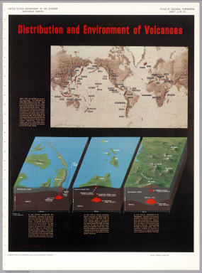
[U.S. Geological Survey, Schmidt, Robert G.]
Full Title
Distribution and Environment of Volcanoes.
Publisher
U.S. Geological Survey
Author
[U.S. Geological Survey, Schmidt, Robert G.]
Full Title
Shield Volcanoes.
Publisher
U.S. Geological Survey
Author
[U.S. Geological Survey, Schmidt, Robert G.]
Full Title
Cinder Cones.
Publisher
U.S. Geological Survey
Author
[U.S. Geological Survey, Schmidt, Robert G.]
Full Title
Composite Volcanoes.
Publisher
U.S. Geological Survey
Author
[U.S. Geological Survey, Schmidt, Robert G.]
Full Title
Volcanic Domes.
Publisher
U.S. Geological Survey
Author
[U.S. Geological Survey, Schmidt, Robert G.]
Full Title
Evolution and Erosion of a Composite Volcano.
Publisher
U.S. Geological Survey
Author
[U.S. Geological Survey, Schmidt, Robert G., Bailey, Roy A.]
Full Title
Calderas.
Publisher
U.S. Geological Survey
Author
[U.S. Geological Survey, Schmidt, Robert G., Smith, Robert L.]
Full Title
Ash Flows.
Publisher
U.S. Geological Survey
Author
[U.S. Geological Survey, Fiske, Richard S.]
Full Title
Flood Basalts of the Columbia River Plateau.
Publisher
U.S. Geological Survey
Author
[U.S. Geological Survey, Fiske, Richard S.]
Full Title
Submarine Volcanoes.
Publisher
U.S. Geological Survey
Author
[U.S. Geological Survey, Schmidt, Robert G., Hearn Jr., B. Carter]
Full Title
Maars, Diatremes and Cryptovolcanic Structures.
Publisher
U.S. Geological Survey
Author
[U.S. Geological Survey, Schmidt, Robert G., Hearn Jr., B. Carter]
Full Title
Development of a Diatreme.
Publisher
U.S. Geological Survey
Author
[U.S. Geological Survey, White, Donald E.]
Full Title
Geyers, Solfataras and Hot Springs.
Publisher
U.S. Geological Survey
|