|
REFINE
Browse All : Geology and Separate Map
1-12 of 12
Author
Rogers, Henry Darwin
Full Title
A Geological Map of New Jersey, by Henry D. Rogers, Prof. of Geology in Univ. of Penna. (To accompany the Report on the Geology of N. Jersey,) Jan. 1839. P.S. Duval, Lith. Philada. On Stone by J. Probst.
Publisher
P.S. Duval litho.
Author
[Whitney, J.D., Foster, J.W.]
Full Title
Carte geologique du Lac Superieur. Etat De Michigan. Drefsee par M.rs J.W. Fosters et J.D. Whitney geologues des Etats Unia. Annales des Mines, 5e Serie, Tome VII, pages 173 et suivantes. Lemaitre sc. Voyage au Lac Superieur. Geologie. Pl. VI.
Publisher
Lemaitre
Author
[U.S. Geological and Geographical Survey of the Territories, Hayden,Ferdinand Vandeveer]
Full Title
Parts of Western Wyoming and Southeastern Idaho. U.S. Geological and Geographical Survey of the Territories ; F.V. Hayden, U.S. Geologist in Charge. O. St. John, Geological Assistant. Gustavus R Bechler; Fred A Clark; Topographical Assistants. Surveyed in 1877 & 78.
Publisher
U.S. Geological and Geographical Survey of the Territories
Author
[U.S. Geological and Geographical Survey of the Territories, Hayden,Ferdinand Vandeveer]
Full Title
Preliminary Geological Map of the Yellowstone National Park. Department of the Interior, U.S. Geological and Geographical Survey of the Territories ; F.V. Hayden, U.S. Geologist in Charge ; W.H. Holmes, Geological Assistant ; Primary Triangulation by A.D. Wilson ; Secondary Triangulation and Topography by Henry Gannett. Surveyed in 1878. Julius Bien, Lith.
Publisher
Department of the Interior, U.S. Geological and Geographical Survey of the Territories
Author
[U.S. Geological and Geographical Survey of the Territories, Hayden,Ferdinand Vandeveer]
Full Title
Geological Map of Portions of Wyoming, Idaho and Utah. Department of the Interior, U.S. Geological and Geographical Survey of the Territories ; F.V. Hayden, U.S. Geologist in Charge ; Geology by A C Peale; Orestes St John; F.M. Endlich. Julius Bien, Lith., N.Y.
Publisher
Department of the Interior, U.S. Geological and Geographical Survey of the Territories
Author
[Hayden, F.V., U.S. Geological and Geographical Survey of the Territories]
Full Title
Part of Central Wyoming, U.S. Geological and Geographical Survey of the Territories ; F.V. Hayden, U.S. Geologist in Charge. F.M. Endlich , Geological Assistant. George B. Chittenden, C. F. Topographical Assistant. Surveyed in 1877.
Publisher
U.S. Geological and Geographical Survey of the Territories
Author
[Heezen, Bruce C., Tharp, Marie]
Full Title
Physiographic Diagram, Atlantic Ocean (Sheet 1).
Author
Time Inc.
Full Title
The New Portrait of our Planet. Life.
Publisher
Time Inc.
Author
Harrison, Richard Edes
Full Title
The Floor of the World Ocean.
Publisher
Association of American Geographers
Author
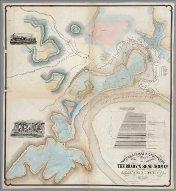
[Franks, Theo., Brady's Bend Iron Co.]
Full Title
Topographical & Geological Map Of The Property Belonging To The Brady's Bend Iron Co. Located In Armstrong County Pa. by Theo. Franks Civil Engineer. From Plan drawn by R. Jennings, Brady's Bend. Wm Schuchman, lith. 3d St, Pittsburgh, Pa. (inset) Geological Section From Notes By Prof. Shepherd.
Publisher
Wm. Schuchman lith.
Author
Loader, T. B.
Full Title
Under the patronage of His Majesty, T.B. Loader's scientific and commercial map of England and Wales in which are delineated the canals, rail-roads, & navigable rivers : the extent of the navigation of each river, with the elevations of the canals, together with the geology, and principal situations of the mineral productions. 1834. Published by T.B. Loader, 31 Bedford, St. Covent Garden. Mounted & colored by G. Cross, 98 Dean St. Soho.
Publisher
T.B. Loader
1-12 of 12
|