Who What Where WhenREMOVE |
Author
Colton, G.W.
Full Title
(Half Title Page to) Colton's Atlas Of The World, Illustrating Physical And Political Geography. By George W. Colton. Accompanied By Descriptions Geographical, Statistical, And Historical, By Richard Swainson Fisher, M.D. Complete In One Volume. New York: J.H. Colton And Company, No. 172 William, Corner Beekman Street. London: Trubner And Company, No. 12 Paternoster Row. 1856. Entered ... One Thousand Eight Hundred and Fifty-five, by J.H. Colton And Company ... New York.
Publisher
J.H. Colton
Author
Duflot de Mofras, Eugene
Full Title
(Half Title Page to) Exploration Du Territoire De L'Oregon, Des Californies Et De La Mer Vermeille, Executee Pendant Les Annees 1840, 1841 Et 1842, Par M. Duflot De Mofras, Attache A La Legation De France A Mexico. Ouvrage Publie Par Ordre Du Roi, Sous Les Auspices De M. Le Marechal Soult, Duc De Dalmatie, President du Conseil, Et De M. Le Ministre Des Affaires Etrangeres. Tome Premier. Paris, Arthus Bertrand, Editeur, Libraire De La Societe De Geographie, Rue Hautefeuille, No. 23. 1844. Paris. - Typographie de Firmin Didot Freres, rue Jacob, 56 ... Tome Second ... Atlas (with map) Carte De La Cote De L'Amerique Sur L'Ocean Pacifique Septentrional comprenant Le Territoire De L'Oregon, Les Californies, La Mer Vermeille ...
Publisher
Arthus Bertrand
Author
Humboldt, Alexander von, 1769-1859
Full Title
(Half Title Page to) Atlas Geographique Et Physique Du Royaume De La Nouvelle-Espagne, Fonde Sur Des Observations Astronomiques, Des Mesures Trigonometriques Et Des Nivellemens Barometriques. Par Al. De Humboldt. Paris, Chez F. Schoell, Rue Des Fosses-Saint-Germain-L'Auxerrois, No. 29. 1811. De L'Imprimerie De J.H. Stone.
Publisher
F. Schoell
Author
Johnston, Alexander Keith, 1804-1871
Full Title
(Half Title Page to) The royal atlas of modern geography, exhibiting, in a series of entirely original and authentic maps, the present condition of geographical discovery and research in the several countries, empires, and states of the world by Alexander Keith Johnston ... With a special index to each map. William Blackwood and Sons, Edinburgh and London. MDCCCLXI.
Publisher
William Blackwood & Sons
Author
Bartholomew, John
Full Title
(Half Title Page to)The Times Atlas of the World. Mid-Century Edition, Edited by John Bartholomew, M.C., LL.D. Cartographer by Royal Appointment of the late King George V, Gold Medalist of the Royal Scottish Geographical Society. Volume 1, The World, Australasia & East Asia, containing maps showing various aspects of the world entire; also Australia, New Zealand, Antarctica, New Guinea, Japan, China, Korea, Mongolia, Indo-China, Thailand, Philippines, Burma, S-W Pacific, Indonesia, Malaya etc. With an Index-Gazetteer. Boston, Houghton Mifflin Company, The Riverside Press Cambridge, 1958.
Publisher
[Houghton Mifflin Co., John Bartholomew & Son LTD.]
Author
Garnier, F. A., 1803-1863
Full Title
(Half Title Page to) Atlas spheroidal et universel de geographie dresse a l'aide des documents officiels, recemment publies en France et a l'etranger par M.F.A. Garnier, Membre de la Societe de Geographie, etc. Paris, Veuve Jules Renouard, Libraire, Editeur de A. Balbi, Abrege de Geographie; A. Guibert, Dictionnaire de Geographie; Dufour et Jomard, Le Globe, etc. Rue de Tournon, 6, Faubourg Saint-Germain. MDCCCLXII.
Publisher
Veuve Jules Renouard, Libraire
Author
Johnson, A.J.
Full Title
(Half Title Page to) Johnson's New Illustrated (Steel Plate) Family Atlas, With Physical Geography, And With Descriptions Geographical, Statistical, And Historical ... By Richard Swainson Fisher, M.D. ... Maps Compiled, Drawn, And Engraved Under The Supervision Of J.H. Colton And A.J. Johnson. New York: Johnson And Ward, Successors To Johnson And Browning (Successors To J.H. Colton And Company,) No. 113 Fulton Street. 1864. Entered ... One Thousand Eight Hundred and Sixty-four, by A.J. Johnson ... New York.
Publisher
Johnson and Ward
Author
Andreas, A. T. (Alfred Theodore), 1839-1900
Full Title
(Half Title Page to) A.T. Andreas' illustrated historical atlas of the State of Iowa. 1875. (7th Congressional District ed.). The Lakeside Press, Clark and Adams Streets, Chicago. (Published by the Andreas Atlas Co., Lakeside Building, Chicago, Ills. Engraved & printed by Chas. Shober & Co., Props. of Chicago Lithographing Co.)
Publisher
Andreas Atlas Co.
Author
Bartholomew, John
Full Title
(Half Title Page to) The Times Atlas of the World. Mid-Century Edition, Edited by John Bartholomew, M.C., LL.D. Cartographer by Royal Appointment of the late King George V, Gold Medalist of the Royal Scottish Geographical Society. Volume II, South-West Asia & Russia, containing Afghanistan, Arabia, Arctic Ocean, Ceylon, Greenland, India, Indian Ocean, Iraq, Israel, Jordan, Lebanon, Pakistan, Syria, Turkey, and the Union of Soviet Socialist Republic, etc. With an Index-Gazetteer. Boston, Houghton Mifflin Company, The Riverside Press Cambridge, 1959.
Publisher
[Houghton Mifflin Co., John Bartholomew & Son LTD.]
Author
Bartholomew, John
Full Title
(Half Title Page to) The Times Atlas of the World. Mid-Century Edition, Edited by John Bartholomew, M.C., M.A. Cartographer by Royal Appointment of the late King George V, Gold Medalist of the Royal Scottish Geographical Society. Volume IV southern Europe and Africa, Containing: Spain, Portugal, Italy, Danube Lands, Greece, Egypt, Mediterranean Islands, North, west, Central and East Africa, South Africa, The Atlantic Ocean. With an Index-Gazetteer. Boston, Houghton Mifflin Company, The Riverside Press Cambridge, 1956.
Publisher
[Houghton Mifflin Co., John Bartholomew & Son LTD.]
Author
Bartholomew, John
Full Title
(Half Title Page to) The Times Atlas of the World, Mid-Century Edition. Edited by John Bartholomew, M.C., M.A. Cartographer by Royal Appointment of the late King George V. Volume III, Northern Europe, Containing: Iceland, Scandinavia, British Isles, Netherlands, Belgium, Poland, Czechoslovakia, Austria, Germany, Switzerland, France. With an Index-Gazetteer.Boston, Houghton Mifflin Company, 1955.
Publisher
[Houghton Mifflin Co., John Bartholomew & Son LTD.]
Author
[Bayer, Herbert, Container Corporation of America]
Full Title
(Half Title Page) World Geo-graphic Atlas.
Publisher
Container Corporation of America
Author
[California Geological Survey, Whitney, J.D.]
Full Title
(Half Title Page to) The Yosemite Guide-Book: A Description of the Yosemite Valley and the Adjacent Region of the Sierra Nevada, and of the Big Trees of California, Illustrated With Maps and Woodcuts. Geological Survey of California. J.D. Whitney, State Geologist. Published by Authority of the Legislature. 1869.
Publisher
University Press
Author
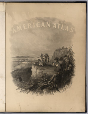
Tanner, Henry S.
Full Title
(Half Title Page to) A New American Atlas Containing Maps Of The Several States of the North American Union, Projected and drawn on a Uniform Scale from Documents found in the public Offices of the United States and State Governments, and other Original and Authentic Information, By Henry S. Tanner ... Philadelphia: Published By Henry S. Tanner. 1825.
Publisher
Henry Tanner
Author
Asher & Adams
Full Title
(Title Page Verso to) Asher & Adams' New Columbian Rail Road Atlas and Pictorial Album of American Industry, Comprising a Series of New Copper Plate Maps Exhibiting the Thirty-Seven States ... Together With Illustrations and Descriptions of Mercantile and Manufacturing Establishments, Machinery, Works of Art, Mechanism, Trade-Marks, Etc., Etc. ... Compiled, Written, Drawn and Engraved Under the Supervision Of The Publishers, By Their Own Corps of Editors, Engineers, Topographers, and Artists.... New York: Asher & Adams, No. 59 Beekman Street. 1875
Publisher
Asher & Adams.
Author
Stanford, Edward
Full Title
(Half Title Page to) Stanford's London atlas of universal geography exhibiting the physical and political divisions of the various countries of the world. Folio edition. One hundred maps, with a list of latitudes and longitudes. Second issue, revised and enlarged. London, Edward Stanford, Geographer to Her Majesty, 12, 13 & 14 Long Acre, W.C. 1901.
Publisher
Edward Stanford
Author
[United States Exploring Expedition (1838-1842), Wilkes, Charles, 1798-1877]
Full Title
(Half Title Page to) Narrative of the United States Exploring Expedition During the Years 1838, 1839, 1840, 1841, 1842. By Charles Wilkes, U.S.N. Commander of the Expedition, member of the American Philosophical Society, etc. In Five Volumes, and an atlas. Vol. I. Philadelphia: Lea & Blanchard. 1845. (on verso) Entered ... 1844, By Charles Wilkes ... District of Columbia.
Publisher
Lea & Blanchard
Author
[United States Exploring Expedition (1838-1842), Wilkes, Charles, 1798-1877]
Full Title
(Half Title Page to) Narrative of the United States Exploring Expedition During the Years 1838, 1839, 1840, 1841, 1842. By Charles Wilkes, U.S.N. Commander of the Expedition, member of the American Philosophical Society, etc. In Five Volumes, and an atlas. Vol. II. Philadelphia: Lea & Blanchard. 1845. (on verso) Entered ... 1844, By Charles Wilkes ... District of Columbia.
Publisher
Lea & Blanchard
Author
[United States Exploring Expedition (1838-1842), Wilkes, Charles, 1798-1877]
Full Title
(Half Title Page to) Narrative of the United States Exploring Expedition During the Years 1838, 1839, 1840, 1841, 1842. By Charles Wilkes, U.S.N. Commander of the Expedition, member of the American Philosophical Society, etc. In Five Volumes, and an atlas. Vol. III. Philadelphia: Lea & Blanchard. 1845. (on verso) Entered ... 1844, By Charles Wilkes ... District of Columbia.
Publisher
Lea & Blanchard
Author
[United States Exploring Expedition (1838-1842), Wilkes, Charles, 1798-1877]
Full Title
(Half Title Page to) Narrative of the United States Exploring Expedition During the Years 1838, 1839, 1840, 1841, 1842. By Charles Wilkes, U.S.N. Commander of the Expedition, member of the American Philosophical Society, etc. In Five Volumes, and an atlas. Vol. IV. Philadelphia: Lea & Blanchard. 1845. (on verso) Entered ... 1844, By Charles Wilkes ... District of Columbia.
Publisher
Lea & Blanchard
Author
[United States Exploring Expedition (1838-1842), Wilkes, Charles, 1798-1877]
Full Title
(Half Title Page to) Narrative of the United States Exploring Expedition During the Years 1838, 1839, 1840, 1841, 1842. By Charles Wilkes, U.S.N. Commander of the Expedition, member of the American Philosophical Society, etc. In Five Volumes, and an atlas. Vol. V. Philadelphia: Lea & Blanchard. 1845. (on verso) Entered ... 1844, By Charles Wilkes ... District of Columbia.
Publisher
Lea & Blanchard
Author
[Gannett, Henry, 1846-1914, Hewes, Fletcher W.]
Full Title
(Half Title Page to) Scribner's statistical atlas of the United States showing by graphic methods their present condition and their political, social and industrial development. By Fletcher W. Hewes and Henry Gannett, Chief Geographer of the United States Geological Survey. Formerly Geographer of the tenth census of the United States. New York, Charles Scribner's Sons, 743 and 745 Broadway. (verso) Copyright 1883 by Charles Scribner's Sons. Struthers, Servoss & Co., Engravers, Nos. 32 and 34 Frankfort Street, New York. J.J. Little & Co., Printers, Nos. 10 to 20 Astor Place, New York. Haddon & Co., Binders, Nos. 139 to 143 Centre Street, New York.
Publisher
Charles Scribner's Sons
Author
Vivien de Saint-Martin, M.
Full Title
(Half Title Page to) Atlas dresse pour l'Histoire de la geographie et des decouvertes geographiques depuis les temps les plus recules jusqu'a nos jours par M. Vivien de Saint-Martin ... Contenant 13 cartes. Paris, Librairie Hachette et Cie, 79 Boulevard Saint-Germain, 79. 1874. Droits de propriete et de traduction reserves.
Publisher
Hachette & Cie.
Author
[Carey, Mathew, Lavoisne, M.]
Full Title
(Half Title Page to) A Complete Genealogical, Historical, Chronological, And Geographical Atlas; Being A General Guide To History, Both Ancient And Modern ... According To The Plan Of Le Sage, Greatly Improved. The Whole Forming A Complete System Of History And Geography. By M. Lavoisne. From The Last London Edition, Improved by C. Gros, of the University of Paris, and J. Aspin ... First American Edition, Carefully Revised And Corrected. Enlarged By The Addition Of Several New Maps Of American History And Geography Which are brought down to the beginning of the Year 1820. Philadelphia: Published By M. Carey And Son. 1820. Printed by T.H. Palmer, on the Ruthven Press, and on J. & T. Gilpin's Machine Paper. (Price Thirty Dollars, Half Bound.)
Publisher
M. Carey and Son
Author
Colton, G.W.
Full Title
(Half Title Page to) Colton's Advertising Atlas Of America. Colton's Atlas Of America. Illustrating The Physical And Political Geography Of North And South America And The West India Islands, By George W. Colton. Accompanied By Descriptions Geographical, Statistical, And Historical, By Richard Swainson Fisher, M.D. New York: J.H. Colton And Company, No. 172 William, Corner Beekman Street. 1857. Entered ... One Thousand Eight Hundred and Fifty-five, by J.H. Colton And Company ... New York.
Publisher
J.H. Colton
Author
Houze, Antoine Philippe
Full Title
(Half Title Page to) Atlas universel historique et geographique compose de cent une cartes, donnant les differentes divisions et modifications territoriales des diverses nations aux principales epoques de leur histoire, avec une notice sur tous les faits importants, et l'indication des lieux ou ils se sont passes; destine a faciliter la lecture et l'intelligence de tous les ouvrages historiques, et redige d'apres les meilleures sources par A. Houze, membre de la Societe de Geographie, auteur de la Geographie universelle. Paris, Chez P. Dumenil, editeur, rue des Beaux-Arts, 10. 1844.
Publisher
Chez P. Dumenil
Author
[Götz, Antonín, Československá akademie věd., Czechoslovakia. Ústřední správa geodézie a kartografie.]
Full Title
(Half Title Page) Atlas Ceskoslovenske Socialisticke Republiky. (Atlas of the Czechoslovakian Socialist Republic).
Publisher
Czechoslovakia. Ústřední správa geodézie a kartografie.
Author
Vandermaelen, Philippe, 1795-1869
Full Title
(Half Title Page to) Atlas universel de geographie physique, politique, statistique et mineralogique, sur l'echelle de 1/1641836 ou d'une ligne par 1900 toises, dresse par Ph. Vandermaelen, Membre de la Societe de Geographie de Paris, d'apres les meilleures cartes, observations astronomiques et voyages dans les divers Pays de la Terre; Lithographie par H. Ode, Membre de la Societe de Geographie de Paris. Premier partie. - Europe. Bruxelles. 1827.
Publisher
Ph. Vandermaelen
Author
Vandermaelen, Philippe, 1795-1869
Full Title
(Half Title Page to) Atlas universel de geographie physique, politique, statistique et mineralogique, sur l'echelle de 1/1641836 ou d'une ligne par 1900 toises, dresse par Ph. Vandermaelen, Membre de la Societe de Geographie de Paris, d'apres les meilleures cartes, observations astronomiques et voyages dans les divers Pays de la Terre; Lithographie par H. Ode, Membre de la Societe de Geographie de Paris. Deuxieme partie. - Asie. Bruxelles. 1827.
Publisher
Ph. Vandermaelen
Author
Vandermaelen, Philippe, 1795-1869
Full Title
(Half Title Page to) Atlas universel de geographie physique, politique, statistique et mineralogique, sur l'echelle de 1/1641836 ou d'une ligne par 1900 toises, dresse par Ph. Vandermaelen, Membre de la Societe de Geographie de Paris, d'apres les meilleures cartes, observations astronomiques et voyages dans les divers Pays de la Terre; Lithographie par H. Ode, Membre de la Societe de Geographie de Paris. Troisieme partie. - Afrique. Bruxelles. 1827.
Publisher
Ph. Vandermaelen
Author
Vandermaelen, Philippe, 1795-1869
Full Title
(Half Title Page to) Atlas universel de geographie physique, politique, statistique et mineralogique, sur l'echelle de 1/1641836 ou d'une ligne par 1900 toises, dresse par Ph. Vandermaelen, Membre de la Societe de Geographie de Paris, d'apres les meilleures cartes, observations astronomiques et voyages dans les divers Pays de la Terre; Lithographie par H. Ode, Membre de la Societe de Geographie de Paris. Cinquieme partie. - Amer. merid. Bruxelles. 1827.
Publisher
Ph. Vandermaelen
Author
Vandermaelen, Philippe, 1795-1869
Full Title
(Half Title Page to) Atlas universel de geographie physique, politique, statistique et mineralogique, sur l'echelle de 1/1641836 ou d'une ligne par 1900 toises, dresse par Ph. Vandermaelen, Membre de la Societe de Geographie de Paris, d'apres les meilleures cartes, observations astronomiques et voyages dans les divers Pays de la Terre; Lithographie par H. Ode, Membre de la Societe de Geographie de Paris. Sixieme partie. - Oceanique. Bruxelles. 1827.
Publisher
Ph. Vandermaelen
Author
Johnson, A.J.
Full Title
(Half Title Page to) Johnson's New Illustrated (Steel Plate) Family Atlas, With Descriptions, Geographical, Statistical, And Historical. Compiled, Drawn, and Engraved Under The Supervision Of J.H. Colton And A.J. Johnson. New York: Johnson And Browning, Formerly (Successors To J.H. Colton And Company,) No. 133 Nassau Street. 1860. Entered ... One Thousand Eight Hundred and Sixty, by Johnson & Browning ... Virginia.
Publisher
Johnson and Browning
Author
[Tardieu, Ambroise, Vuillemin, A., Duvotenay, Erhard, Testarode, E.]
Full Title
(Half Title Page) Atlas Universel De Geographie Ancienne et Moderne.
Publisher
Furne Et Cie
Author
Brue, Adrien Hubert, 1786-1832
Full Title
(Half Title Page to) Grand atlas universel, ou collection de cartes encyprotypes, generales et detaillees des cinq parties du monde; dediees a monsieur, par H. Brue, Ingenieur-Geographe de S.A. Royale. A Paris, Chez Desray, Libraire-Editeur, rue Hautefeuille, no. 4. M DCCC XVI.
Publisher
Desray, Libraire-Editeur
Author
[Dower, John, Higgins, W.M.]
Full Title
(Half Title Page) A General Descriptive Atlas Of The Earth.
Publisher
[W.S. Orr, Chambers, W. & R.]
Author
[Bory de Saint-Vincent, M. (Jean Baptiste GeneviFve Marcellin), 1778-1846, Desmarest, Nicolas, 1725-1815, Vincent]
Full Title
(Half Title Page to) Atlas encyclopedique contenant les cartes et les planches relatives a la geographie physique. Par M. Desmarest, de l'Academie des Sciences; et par M. le Colonel Bory de St.-Vincent ... A Paris, Chez Mme. veuve Agasse, Imprimeur-Libraire, rue des Poitevins, no. 6. M.DCCCXXVII.
Publisher
Veuve Agasse
Author
[Lapie, Alexandre Emile, Lapie, M. (Pierre), 1779-1850]
Full Title
(Half Title Page to) Atlas universel de geographie ancienne et moderne, precede d'un abrege de geographie physique et historique. Par M. Lapie ... et M. Lapie fils. Dedie au Roi. Paris. Emery, Fruger et Cie, Libraires-Editeurs, rue Mazarine, no. 30. 1829. (1833)
Publisher
Eymery Fruger et Cie
Author
[Covens et Mortier, Lisle, Guillaume de, 1675-1726]
Full Title
(Illustrated Title Page to) Atlas nouveau, contenant toutes les parties su Monde, ou sont exactement remarquees les empires, monarchies, royaumes, etats, republiques, &c. Par Guillaume de l'Isle. Premier Geographe de sa Majeste. A Amsterdam, Chez Jean Covens & Corneille Mortier, sur le Vygendam. (Has title) Atlas novus ad usum serenissimi Burgundiae Ducis. Atlas Francois a l'usage de Monseigneur le Duc de Bourgogne. Contenant les cartes et (erased) des empires, monarchies, royaumes et etats du Monde. R. de Hooghe, C.R. et J.U.D. inv. f. er. A Amsterdam, chez Jean Covens et Corneille Mortier, avec privil. (1742)
Publisher
Covens & Mortier
Author
Touring club italiano
Full Title
(Half Title Page to) Atlante internazionale del Touring club italiano. (3. ed.). Centosettanta tavole principali, centrotrenta carte parziali e di suiluppo. Opera redatta ed eseguita nell'Ufficio cartografico del T.C.I. sotto la direzione di L.V. Bertarelli, O. Marinelli, P. Corbellini. Milano: Touring club italiano. MDCCCCXXIX/VII.
Publisher
Touring club italiano
Author
Touring club italiano
Full Title
(Text Page to) Atlante internazionale del Touring club italiano. (3. ed.). Centosettanta tavole principali, centrotrenta carte parziali e di suiluppo. Opera redatta ed eseguita nell'Ufficio cartografico del T.C.I. sotto la direzione di L.V. Bertarelli, O. Marinelli, P. Corbellini. Milano: Touring club italiano. MDCCCCXXIX/VII.
Publisher
Touring club italiano
Author
Tanner, Henry S.
Full Title
(Half Title Page to) A New American Atlas Containing Maps Of The Several States of the North American Union, Projected and drawn on a Uniform Scale from Documents found in the public Offices of the United States and State Governments, and other Original and Authentic Information, By Henry S. Tanner ... Philadelphia: Published By H.S. Tanner. 1823. (title page only) Writing Drawn and Engraved by Joseph Perkins. Barralet del. Humphrys sc.
Publisher
Henry Tanner
Author
Tanner, Henry S.
Full Title
(Half Title Page to) A New American Atlas Containing Maps Of The Several States of the North American Union, Projected and drawn on a Uniform Scale from Documents found in the public Offices of the United States and State Governments, and other Original and Authentic Information, By Henry S. Tanner ... Philadelphia: Published By H.S. Tanner. 1825. (title page only). Barralet del. Humphrys sc. Joseph Perkins, Philadelphia.
Publisher
Henry Tanner
Author
Bevan, G. Phillips
Full Title
(Half Title Page) The Statistical Atlas of England, Scotland and Ireland. By G. Phillips Bevan, F.S.S., F.G.S., Etc. Containing 45 Maps with Text. W. & A.K. Johnston, Edinburgh and London, MDCCCLXXXII.
Publisher
W. &. A.K. Johnston
Author
Tanner, Henry S.
Full Title
(Half Title Page to) A New American Atlas Containing Maps Of The Several States of the North American Union, Projected and drawn on a Uniform Scale from Documents found in the public Offices of the United States and State Governments, and other Original and Authentic Information, By Henry S. Tanner ... Philadelphia: Published By H.S. Tanner. 1825. (title page only) Writing Drawn and Engraved by Joseph Perkins. Barralet del. Humphrys sc.
Publisher
Henry Tanner
Author
[Great Britain. Ordnance Survey, James, Henry]
Full Title
(Half title Page to) Report on the Ordnance Survey of the United Kingdom for 1855-56. (Signed) Henry James, Lieutenant-Colonel Royal Engineers. (with) Ordnance Survey. Treasury minute, dated 18 May 1855, and previous papers, relating to the Ordnance Survey. (Presented to Parliament by Her Majesty's Command.) Session 1856.
Publisher
Ordnance Survey
Author
[Taylor, Frank J., White, Ruth Taylor]
Full Title
(Half Title Page) Our U.S.A., A Gay Geography.
Publisher
Little, Brown, and Company
Author
Dussieux, L.
Full Title
(Half Title Page) Atlas General De Geographie Physique, Politique Et Historique.
Publisher
Jacques Lecoffre et Comp.
Author
Burr, David H., 1803-1875
Full Title
(Half Title Page to) An atlas of the State of New York, containing a map of the State and of the several counties ... under the superintendance & direction of Simeon DeWitt, Surveyor General, pursuant to an Act of the Legislature, and also the physical geography of the State & of the several counties & statistical tables of the same, by David H. Burr. New York, published by David H. Burr. 1829. Engravd. by Rawdon, Clark & Co. Albany & Rawdon, Wright & Co., New York.
Publisher
D.H. Burr
Author
Tanner, Henry S.
Full Title
(Half Title Page to) A New American Atlas Containing Maps Of The Several States of the North American Union, Projected and drawn on a Uniform Scale from Documents found in the public Offices of the United States and State Governments, and other Original and Authentic Information, By Henry S. Tanner ... Philadelphia: Published By H.S. Tanner. 1823. (title page only) Writing Drawn and Engraved by Joseph Perkins. Barralet del. Humphrys sc.
Publisher
Henry Tanner
|