Who What Where WhenREMOVEWHEREShow More |
Full Title
Carte de l'adjonction progressive des divers etats au territoire et a l'union constitutionnelle des Etats-Unis de l'Amerique du Nord. 1825.
Publisher
J. Carez
Author
Levasseur, Victor.
Full Title
Europe. Atlas Universel Illustre. Ancien Continent. Geographie et Statistique par V. Levasseur, Ingenieur Geographe. Grave par Laguillermie, Rue St. Jacques, No. 82. Illustre par Raimond Bonheur, peintre. Impie. De Lemercier. Paris. A Paris, chez A. Combette, Editeur, rue de la Parcheminerie, 15. (1856)
Publisher
A. Combette
Author
Levasseur, Victor.
Full Title
Afrique. Atlas Universel Illustre. Ancien Continent. Geographie et Statistique de V. Levasseur, Ingenieur Geographe. Grave par Laguillermie, Rue St. Jacques, No. 82. Illustre par Raimond Bonheur, peintre. Impie. De Lemercier. Paris. A Paris, chez A. Combette, Editeur, rue de la Parcheminerie, 15. (1856)
Publisher
A. Combette
Author
[Götz, Antonín, Československá akademie věd., Czechoslovakia. Ústřední správa geodézie a kartografie.]
Full Title
(Development of Mapping.)
Publisher
Czechoslovakia. Ústřední správa geodézie a kartografie.
Author
[Codazzi, Agustín, 1793-1859, Paz, Manuel María, 1820-1902]
Full Title
Carta de Colombia, que representa la puta de los conquistadores y exploradores en el territorio que forma la Republica la posicion de la Tribus y las primeras findacionesy y divisiones politicas. Grabado por Erhard Hermanos, 8 Calle Nicole, Paris. (to accompany) Atlas geografico e historico de la Republica de Colombia (Antigua Nueva Granada).
Publisher
A. Lahure
Author
[Codazzi, Agustín, 1793-1859, Paz, Manuel María, 1820-1902]
Full Title
Carta de Colombia, que representa la primeras divisiones coloniales. Grabado por Erhard Hermanos, 8 Calle Nicole, Paris. (to accompany) Atlas geografico e historico de la Republica de Colombia (Antigua Nueva Granada).
Publisher
A. Lahure
Author
[Codazzi, Agustín, 1793-1859, Paz, Manuel María, 1820-1902]
Full Title
Carta de las presidencias de Santafe y Quito. Grabado por Erhard Hermanos, 8 Calle Nicole, Paris. (to accompany) Atlas geografico e historico de la Republica de Colombia (Antigua Nueva Granada).
Publisher
A. Lahure
Author
[Codazzi, Agustín, 1793-1859, Paz, Manuel María, 1820-1902]
Full Title
Carta del Vireinato de Santafe y de la Capitania General de Venezuela. Grabado por Erhard Hermanos, 8 Calle Nicole, Paris. (to accompany) Atlas geografico e historico de la Republica de Colombia (Antigua Nueva Granada).
Publisher
A. Lahure
Author
[Codazzi, Agustín, 1793-1859, Paz, Manuel María, 1820-1902]
Full Title
Carta que representa la division politica del Vireinato de Santafe en 1810. Grabado por Erhard Hermanos, 8 Calle Nicole, Paris. (to accompany) Atlas geografico e historico de la Republica de Colombia (Antigua Nueva Granada).
Publisher
A. Lahure
Author
[Codazzi, Agustín, 1793-1859, Paz, Manuel María, 1820-1902]
Full Title
Carta de Colombia : que representa el teatro de la guerra de Independencia 1806, 1811 y 1814. El color amarillo indica el territorio ocupado por los patriotas y el rosado el ocupado por los espanoles. Grabado por Erhard Hermanos, 8 Calle Nicole, Paris. (to accompany) Atlas geografico e historico de la Republica de Colombia (Antigua Nueva Granada).
Publisher
A. Lahure
Author
[Codazzi, Agustín, 1793-1859, Paz, Manuel María, 1820-1902]
Full Title
Teatro de la guerra de Independencia 1815, 1816 y 1817. (with)Teatro de la guerra de Independencia 1818 a 1819. Grabado por Erhard Hermanos, 8 Calle Nicole, Paris. (to accompany) Atlas geografico e historico de la Republica de Colombia (Antigua Nueva Granada).
Publisher
A. Lahure
Author
[Codazzi, Agustín, 1793-1859, Paz, Manuel María, 1820-1902]
Full Title
Carta que representa el teatro de la guerra de Independencia en los anos de 1819, y 1820. Grabado por Erhard Hermanos, 8 Calle Nicole, Paris. (to accompany) Atlas geografico e historico de la Republica de Colombia (Antigua Nueva Granada).
Publisher
A. Lahure
Author
[Codazzi, Agustín, 1793-1859, Paz, Manuel María, 1820-1902]
Full Title
Carta de la Antigua Colombia, dividida en los departamentos de Cundinamarca, Venezuela y Quito : campanas de la guerra de independencia, 1821 a 1823. Grabado por Erhard Hermanos, 8 Calle Nicole, Paris. (to accompany) Atlas geografico e historico de la Republica de Colombia (Antigua Nueva Granada).
Publisher
A. Lahure
Author
[Codazzi, Agustín, 1793-1859, Paz, Manuel María, 1820-1902]
Full Title
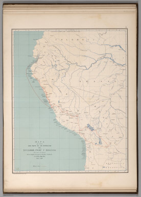
Mapa que contiene una parte de las Republicas del Ecuador, Peru y Bolivia para servir a la historia de las campanas del ejercito Colombiano en el alto y bajo Peru, 1823 a 1826. Grabado por Erhard Hermanos, 8 Calle Nicole, Paris. (to accompany) Atlas geografico e historico de la Republica de Colombia (Antigua Nueva Granada).
Publisher
A. Lahure
Author
[Codazzi, Agustín, 1793-1859, Paz, Manuel María, 1820-1902]
Full Title
Division politica de Colombia en 1824. Grabado por Erhard Hermanos, 8 Calle Nicole, Paris. (to accompany) Atlas geografico e historico de la Republica de Colombia (Antigua Nueva Granada).
Publisher
A. Lahure
Author
[Codazzi, Agustín, 1793-1859, Paz, Manuel María, 1820-1902]
Full Title
Carta de la Nueva Granada: dividida en provincias; 1832 a 1856; Uti-possidetis de 1810. Grabado por Erhard Hermanos, 8 Calle Nicole, Paris. (to accompany) Atlas geografico e historico de la Republica de Colombia (Antigua Nueva Granada).
Publisher
A. Lahure
Author
[Codazzi, Agustín, 1793-1859, Paz, Manuel María, 1820-1902]
Full Title
Carta de la Republica de Colombia (Antigua Nueva Granada) : dividida en departmentos ; 1886. Grabado por Erhard Hermanos, 8 Calle Nicole, Paris. (to accompany) Atlas geografico e historico de la Republica de Colombia (Antigua Nueva Granada).
Publisher
A. Lahure
Author
[Paullin, Charles O., Wright, John K.]
Full Title
Plate 1. Natural Environment: Natural Regions, Glaciated Areas, Ocean Currents. Major Geographical Regions. Cultivated Crops. Winds and Sailing Routes - Winter. Winds and Sailing Routes - Summer.
Publisher
[Carnegie Institution of Washington, American Geographical Society of New York]
Author
[Paullin, Charles O., Wright, John K.]
Full Title
Plate 2. Physical Geography and Vegetation. Relief; Soil Regions. Physical Divisions. Vegetation Regions.
Publisher
[Carnegie Institution of Washington, American Geographical Society of New York]
Author
[Paullin, Charles O., Wright, John K.]
Full Title
Plate 3. Forests; Growing Season. Area of Virgin Forest 1620. Area of Virgin Forest 1850. Area of Virgin Forest 1926. National Forest 1930. Average Length of Growing Season.
Publisher
[Carnegie Institution of Washington, American Geographical Society of New York]
Author
[Paullin, Charles O., Wright, John K.]
Full Title
Plate 4. Climate. Snow Cover. Droughts. Relative Humidity. Cloudiness. Pressure.
Publisher
[Carnegie Institution of Washington, American Geographical Society of New York]
Author
[Paullin, Charles O., Wright, John K.]
Full Title
Plate 5. Climate. Temperature. Rainfall.
Publisher
[Carnegie Institution of Washington, American Geographical Society of New York]
Author
[Paullin, Charles O., Wright, John K.]
Full Title
Plate 6. Mineral Resources. Coal Fields, Distribution and Production of Iron Ore.
Publisher
[Carnegie Institution of Washington, American Geographical Society of New York]
Author
[Paullin, Charles O., Wright, John K.]
Full Title
Plate 7. Mineral Resources. Oil and Gas Fields. Gold, Silver, and Copper Districts.
Publisher
[Carnegie Institution of Washington, American Geographical Society of New York]
Author
[Paullin, Charles O., Wright, John K.]
Full Title
Plate 8. Cartography 1492-1867. Behaim Globe Gores, 1492. (Facsimile).
Publisher
[Carnegie Institution of Washington, American Geographical Society of New York]
Author
[Paullin, Charles O., Wright, John K.]
Full Title
Plate 9. Cartography 1492-1867. Cantino Map, ca. 1502. (Facsimile).
Publisher
[Carnegie Institution of Washington, American Geographical Society of New York]
Author
[Paullin, Charles O., Wright, John K.]
Full Title
Plate 10. Cartography 1492-1867. La Cosa Map, 1500. (Facsimile).
Publisher
[Carnegie Institution of Washington, American Geographical Society of New York]
Author
[Paullin, Charles O., Wright, John K.]
Full Title
Plate 11. Cartography 1492-1867. Magiolo Map ca. 1519. Ortelius Map, 1589. (Facsimiles).
Publisher
[Carnegie Institution of Washington, American Geographical Society of New York]
Author
[Paullin, Charles O., Wright, John K.]
Full Title
Plate 12. Cartography 1492-1867. De Soto Map ca. 1544. Gastaldi Map, 1546. (Facsimiles).
Publisher
[Carnegie Institution of Washington, American Geographical Society of New York]
Author
[Paullin, Charles O., Wright, John K.]
Full Title
Plate 13. Cartography 1492-1867. Verrazano Map, 1529. (Facsimile).
Publisher
[Carnegie Institution of Washington, American Geographical Society of New York]
Author
[Paullin, Charles O., Wright, John K.]
Full Title
Plate 14. Cartography 1492-1867. Harleian Map ca. 1536. (Facsimile).
Publisher
[Carnegie Institution of Washington, American Geographical Society of New York]
Author
[Paullin, Charles O., Wright, John K.]
Full Title
Plate 15. Cartography 1492-1867. Mercator Map, 1569. (Facsimile).
Publisher
[Carnegie Institution of Washington, American Geographical Society of New York]
Author
[Paullin, Charles O., Wright, John K.]
Full Title
Plate 16. Cartography 1492-1867. Lemoyne Map, 1591. (Facsimile).
Publisher
[Carnegie Institution of Washington, American Geographical Society of New York]
Author
[Paullin, Charles O., Wright, John K.]
Full Title
Plate 17. Cartography 1492-1867. Cortes Map, 1520. Turin Map, ca. 1523. Vizcaino Map, 1603. Molineaux-Wright Map, 1600. Tattonus Map, 1600. (Facsimiles).
Publisher
[Carnegie Institution of Washington, American Geographical Society of New York]
Author
[Paullin, Charles O., Wright, John K.]
Full Title
Plate 18. Cartography 1492-1867. Smith Map, 1612. Champlain Map, 1612. (Facsimiles).
Publisher
[Carnegie Institution of Washington, American Geographical Society of New York]
Author
[Paullin, Charles O., Wright, John K.]
Full Title
Plate 20. Cartography 1492-1867. Hondius Map, 1630. Sanson, 1656. Jesuit Map 1672. Raffeix Map, 1688. (Facsimiles).
Publisher
[Carnegie Institution of Washington, American Geographical Society of New York]
Author
[Paullin, Charles O., Wright, John K.]
Full Title
Plate 21. Cartography 1492-1867. De Laet Map, 1630. (Facsimile).
Publisher
[Carnegie Institution of Washington, American Geographical Society of New York]
Author
[Paullin, Charles O., Wright, John K.]
Full Title
Plate 22. Cartography 1492-1867. Delisle Map, 1700. Gentil Map, ca. 1700. (Facsimiles).
Publisher
[Carnegie Institution of Washington, American Geographical Society of New York]
Author
[Paullin, Charles O., Wright, John K.]
Full Title
Plate 23. Delisle Map, 1703. Delisle Map 1750. Bellin Map, 1743. (Facsimiles).
Publisher
[Carnegie Institution of Washington, American Geographical Society of New York]
Author
[Paullin, Charles O., Wright, John K.]
Full Title
Plate 24. Cartography 1492-1867. Delisle Map, 1718. (Facsimile).
Publisher
[Carnegie Institution of Washington, American Geographical Society of New York]
Author
[Paullin, Charles O., Wright, John K.]
Full Title
Plate 25. Cartography 1492-1867. Muller Map, 1754. Vancouver Map, 1798. (Facsimiles).
Publisher
[Carnegie Institution of Washington, American Geographical Society of New York]
Author
[Paullin, Charles O., Wright, John K.]
Full Title
Plate 26. Cartography 1492-1867. Evans Map, 1755. (Facsimile).
Publisher
[Carnegie Institution of Washington, American Geographical Society of New York]
Author
[Paullin, Charles O., Wright, John K.]
Full Title
Plate 27. Cartography 1492-1867. Popple Map, 1733. (Facsimile).
Publisher
[Carnegie Institution of Washington, American Geographical Society of New York]
Author
[Paullin, Charles O., Wright, John K.]
Full Title
Plate 28. Cartography 1492-1867. Lewis Map, 1804. (Facsimile).
Publisher
[Carnegie Institution of Washington, American Geographical Society of New York]
Author
[Paullin, Charles O., Wright, John K.]
Full Title
Plate 29. Cartography 1492-1867. Arrowsmith Map, 1814. (Facsimile).
Publisher
[Carnegie Institution of Washington, American Geographical Society of New York]
Author
[Paullin, Charles O., Wright, John K.]
Full Title
Plate 30. Cartography 1492-1867. Pike Map, 1810. Humboldt Map, 1811. (Facsimiles).
Publisher
[Carnegie Institution of Washington, American Geographical Society of New York]
Author
[Paullin, Charles O., Wright, John K.]
Full Title
Plate 31. Cartography 1492-1867. Bonneville Map, 1837. Greenhow Map. 1840. Pike Map of Mississippi River, 1810. (Facsimiles).
Publisher
[Carnegie Institution of Washington, American Geographical Society of New York]
Author
[Paullin, Charles O., Wright, John K.]
Full Title
Plate 32. Cartography 1492-1867. Clark Map, 1810. Chapin Map, 1839. Smith Map, 1843. Colton Map, 1867. (Facsimiles).
Publisher
[Carnegie Institution of Washington, American Geographical Society of New York]
Author
[Paullin, Charles O., Wright, John K.]
Full Title
Plate 33. Indians. Indian Tribes and Linguistic Stocks, 1650.
Publisher
[Carnegie Institution of Washington, American Geographical Society of New York]
Author
[Paullin, Charles O., Wright, John K.]
Full Title
Plate 34. Indians. Indian Battles, 1521-1700. Indian Battles, 1701-1800. Indian Battles, 1801-1845. Indian Battles, 1846-1890.
Publisher
[Carnegie Institution of Washington, American Geographical Society of New York]
|