Who What Where WhenREMOVE |
REFINE
Browse All : Military of U.S. South
1-30 of 30
Author
Ruger, Edward
Full Title
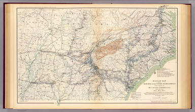
Map Prepared to exhibit the Campaigns in which the Army Of The Cumberland Took part during the War of the Rebellion. By order of Maj. Genl. Geo. H. Thomas. U.S.A. Compiled under the direction of Bvt. Major Genl. Z.B. Tower Chief Engr. Military Div. of the Tenn. by Ed. Ruger, Supt. Topl. Engr. Office at Nashville. Assistants. Capt. A. Kilp & Lieut. R. Flach 3rd U.S.C.A. (Heavy) & Asst. Top. Engrs. ... Photolith. by the N.Y. Lithg. Engrg. & Prtg. Co. 16 & 18 Park Place.
Publisher
N.Y. Litho & Engr.
Author
Davies & Co.
Full Title
(Covers to) Map Of The Seat Of Civil War In America. October, 1862. Davies & Co. 1, Finch Lane, London. Maclure, Macdonald & Macgregor, 37, Walbrook, London, Lithographers by Steam Power. (inset) Enlarged Plan Of The Site Of The Most Recent Battles.
Publisher
Davies & Co.
Author
Davies & Co.
Full Title
Map Of The Seat Of Civil War In America. October, 1862. Davies & Co. 1, Finch Lane, London. Maclure, Macdonald & Macgregor, 37, Walbrook, London, Lithographers by Steam Power. (inset) Enlarged Plan Of The Site Of The Most Recent Battles.
Publisher
Davies & Co.
Author
Harper's Weekly
Full Title
Map Of The Southern States, Including Rail Roads, County Towns, State Capitals, County Roads, The Southern Coast ... To Texas, Showing The Harbors, Inlets, Forts And Position Of Blockading Ships. Prepared For Harper's Weekly November 1861. (untitled inset map of Washington D.C. and vicinity).
Publisher
Harper's Weekly
Author
Harper's Weekly
Full Title
(Text Page to) Map Of The Southern States, Including Rail Roads, County Towns, State Capitals, County Roads, The Southern Coast ... To Texas, Showing The Harbors, Inlets, Forts And Position Of Blockading Ships. Prepared For Harper's Weekly November 1861. (untitled inset map of Washington D.C. and vicinity).
Publisher
Harper's Weekly
Author
National Tribune Co.
Full Title
Army of the Cumberland. Constituted by General Order No. 57, August 15, 1861 ... This is to Certify, Sergeant Edwin T. Connell served in the Army of the Cumberland, having been a member of Detachment of Signal Corps at Hd'qrs of, Maj. Gen W.S. Rosecrans. (Signed) B.F. Fisher .... Copyright, 1904, by The National Tribune Co., Washington, D.C. ... (with map of Southern States) Field Of Operations.
Publisher
The National Tribune Co.
Author
Phelps & Watson
Full Title
(Covers to) Phelps & Watson's Historical And Military Map Of The Border & Southern States. Published By Phelps & Watson, 18 Beekman St. New York, 1863 ... Entered ... 1862 by Phelps & Watson ... New York.
Publisher
Phelps & Watson
Author
Phelps & Watson
Full Title
Phelps & Watson's Historical And Military Map Of The Border & Southern States. Published By Phelps & Watson, 18 Beekman St. New York, 1863 ... Entered ... 1862 by Phelps & Watson ... New York.
Publisher
Phelps & Watson
Author
Perrine, Charles O.
Full Title
(Covers to) Perrine's New Topographical War Map Of The Southern States. Taken from the latest Government Surveys and Official Reports. E.R. Jewett & Co., Engravers, Buffalo, N.Y. Entered ... 1863, by C.O. Perrine ... Indiana. (inset) Southern Part Of Florida.
Publisher
Chas 0. Perrine.
Author
Perrine, Charles O.
Full Title
Perrine's New Topographical War Map Of The Southern States. Taken from the latest Government Surveys and Official Reports. E.R. Jewett & Co., Engravers, Buffalo, N.Y. Entered ... 1863, by C.O. Perrine ... Indiana. (inset) Southern Part Of Florida.
Publisher
Chas 0. Perrine.
Author
Perrine, Charles O.
Full Title
(Covers to) Perrine's New Military Map Illustrating The Seat of War. Entered according to Act of Congress, in the year 1862, by C. O. Perrine, in the Clerk's Office of the District Court of the State of Indiana. (with) Inset map of Southern Part of Florida.
Publisher
Mumford & Co.
Author
Perrine, Charles O.
Full Title
Perrine's New Military Map Illustrating The Seat of War. Entered according to Act of Congress, in the year 1862, by C. O. Perrine, in the Clerk's Office of the District Court of the State of Indiana. (with) Inset map of Southern Part of Florida.
Publisher
Mumford & Co.
Author
[Duane, James C., United States. War Department]
Full Title
Map showing the operations of the Army of the Potomac under command of Maj. Gen. George G. Meade, from March 29th to April 9th, 1865. J.C. Duane, Major of Engineers ... (with) Map of portions of Mississippi, Alabama and Georgia showing march of Cavalry Corps, Military Division of the Mississippi, from March 22d to April 20th 1865. (with) No. 3. Map showing routes of marches of the army of Gen. W.T. Sherman from Atlanta, Ga. to Goldsborough, N.C. ... (with) Plat showing the battle-ground at Rivers' Bridge, Big Salkehatchie River, S.C. (with) Chart accompanying project for effectually closing Cape Fear River and the port of Wilmington, N.C. to blockade runners. (with) Plans, sections and elevation of pile bridge, James River near Varina, Va., January 1865. W.R. King, 1st Lieut. U.S. Engrs. ... Julius Bien & Co., Lith., N.Y. (1891-1895)
Publisher
U.S. Government Printing Office
Author
Wyld, James, 1812-1887
Full Title
(Covers to) Wyld's Military Map Of The United States, The Northern States, And The Southern Confederate States: With The Forts, Harbours, Arsenals And Military Positions. James Wyld, 457 Strand; Charing Cross East And 2, Royal Exchange London. London, Published By James Wyld, Geographer To The Queen & H.R.H. The Prince Consort ... (with 4 inset maps).
Publisher
James Wyld
Author
Wyld, James, 1812-1887
Full Title
Wyld's Military Map Of The United States, The Northern States, And The Southern Confederate States: With The Forts, Harbours, Arsenals And Military Positions. James Wyld, 457 Strand; Charing Cross East And 2, Royal Exchange London. London, Published By James Wyld, Geographer To The Queen & H.R.H. The Prince Consort ... (with 4 inset maps).
Publisher
James Wyld
Author
Phelps & Watson
Full Title
(Covers to) Phelps & Watson's Historical And Military Map Of The Border & Southern States. Published By Phelps & Watson, 16 Beekman St. New York. 1864 ... Entered ... 1862 by Phelps & Watson ... New York.
Publisher
Phelps & Watson
Author
Phelps & Watson
Full Title
Phelps & Watson's Historical And Military Map Of The Border & Southern States. Published By Phelps & Watson, 16 Beekman St. New York. 1864 ... Entered ... 1862 by Phelps & Watson ... New York.
Publisher
Phelps & Watson
Author
Phelps & Watson
Full Title
(Covers to) Phelps & Watson's Historical And Military Map Of The Border & Southern States. Published By Phelps & Watson, 16 Beekman St. New York. 1864 ... Entered ... 1862 by Phelps & Watson ... New York.
Publisher
Phelps & Watson
Author
Phelps & Watson
Full Title
Phelps & Watson's Historical And Military Map Of The Border & Southern States. Published By Phelps & Watson, 16 Beekman St. New York. 1864 ... Entered ... 1862 by Phelps & Watson ... New York.
Publisher
Phelps & Watson
Author
Asher & Company
Full Title
(Covers to) The Historical War Map. Asher & Co. Entered ... 1862, by Asher & Co. ... Indiana. E.R. Jewett & Co. Engravers, Buffalo, N.Y.
Publisher
Asher & Company
Author
Asher & Company
Full Title
The Historical War Map. Asher & Co. Entered ... 1862, by Asher & Co. ... Indiana. E.R. Jewett & Co. Engravers, Buffalo, N.Y.
Publisher
Asher & Company
Author
[Jenney, William LeB., United States. War Department]
Full Title
Military map of the marches of the United States forces under command of Maj. Gen. W.T. Sherman, U.S.A. during the years 1863, 1864, 1865. Compiled by order of Maj. Gen. W.T. Sherman ... under the direction of Bvt. Maj. W.L.B. Jenney ... Drawn by Capt. William Kossak ... and John B. Muller, draughtsman. St. Louis, Mo., 1865. Julius Bien & Co., Lith., N.Y. (1891-1895)
Publisher
U.S. Government Printing Office
Author
[Ruger, Edward, United States. War Department]
Full Title
Map prepared to exhibit the campaigns in which the Army of the Cumberland took part during the War of the Rebellion. By order of Maj. Gen. Geo. H. Thomas, U.S.A. Compiled under the direction of Bvt. Maj. Gen. Z.B. Tower, Chief Engr., Milit. Div. of the Tenn., by Ed. Ruger ... Assistants: Capt. A. Kilp and Lieut. R. Flach ... (with) Map illustrating the operations of the Seventh Division under Brig. Gen. G.W. Morgan at Cumberland Gap, Tenn., during a portion of the year 1862. Compiled by Edward Ruger ... 1877 (with) Map of the environs of Petersburg, Va., from the Appomattox River to Ft. Howard, showing the positions of the entrenched lines occupied by the Ninth Army Corps, A.P. during the siege. Julius Bien & Co., Lith., N.Y. (1891-1895)
Publisher
U.S. Government Printing Office
Author
[Colton, G.W., United States. War Department]
Full Title
Section of G. Woolworth Colton's new guide map of the United States and Canada with railroads, counties, etc. 1863. Used by General Grant in marking the proposed lines of operations of the armies of the United States, in 1864. Julius Bien & Co., Lith., N.Y. (1891-1895)
Publisher
U.S. Government Printing Office
Author
Magnus, Charles
Full Title
Panorama Of The Mississippi Valley And Its Fortifications. Published by C. Magnus, 12 Frankfort Street, New York. Eng. by F.W. Boell.
Publisher
Charles Magnus
Author
Magnus, Charles
Full Title
One Hundred & Fifty Miles Around Richmond. Charles Magnus' New York Printing Establishment - Offices: 12 Frankfort St., New York, and 520 7th St. Washington, D.C. Eleventh Edition 3000 of Magnus' all around Map ... Battle Ground of the Wilderness and Spottsylvania Court House. May, 5-23, 1864. Price 50 Cents. (with 9 small maps) Memphis And Nashville, Tenn. 225 Miles Around Vicksburg, Miss. 250 Miles Around Galveston, Texas. 200 Miles Around Montgomery, Ala. 100 Miles Around Milledgeville, Ga. Fortifications Around Richmond, Va. 250 Miles Around Charleston, S.C. 100 Miles Around Chattanooga, Tenn. Knoxville, Tenn., Danville, Ky. And Parkersburg, Va.
Publisher
Charles Magnus
Author
[Hall, E.S., New York Herald]
Full Title
War Maps And Diagrams. Our Naval And Military Operations At A Glance. The Coast and Land Line of the Rebellious States ... The Union Blockade of the Atlantic and Gulf Coast ... The Rebel Batteries on the Mississippi ... The Forts on the Southern Sea Line. The New York Herald. New York. Saturday, November 16, 1861. (with) 17 additional maps.
Publisher
New York Herald
Author
[Asher & Company, Russell, Benjamin B.]
Full Title
(Covers to) The Historical War Map. Asher & Co. Entered ... 1862, by Asher & Co. ... Indiana. E.R. Jewett & Co. Engravers, Buffalo, N.Y.
Publisher
Benjamin B. Russell
Author
[Asher & Company, Russell, Benjamin B.]
Full Title
The Historical War Map. Asher & Co. Entered ... 1862, by Asher & Co. ... Indiana. E.R. Jewett & Co. Engravers, Buffalo, N.Y.
Publisher
Benjamin B. Russell
Author
[Jenney, W. L. B., Kossak, William, Muller, John B., United States. Army. Military Division of the Mississippi]
Full Title
Military map showing the marches of the United States Forces under the command of Maj. Genl. W.T. Sherman, U.S.A. During the years 1863, 1864, 1865 ... Drawn by Capt. William Kossak ... and John B. Muller, draughtsman. St. Louis, Mo., 1865. Printed by Joseph F. Gedney. Engraved at Head Qrs., Corps of Engineers, U.S.A. by H.C. Evans & F. Courtenay.
Publisher
Joseph F. Gedney
1-30 of 30
|