Who What Where WhenREMOVE |
REFINE
Browse All : Military of United States
1-45 of 45
Author
[Stanford, Edward, W. & A.K. Johnston Limited]
Full Title
(Covers to) United States. W. & A.K. Johnston, Edinburgh. (inset) Plan Of Charleston, Vicinity And Harbour.
Publisher
W. & A.K. Johnston
Author
[Stanford, Edward, W. & A.K. Johnston Limited]
Full Title
United States. W. & A.K. Johnston, Edinburgh. (inset) Plan Of Charleston, Vicinity And Harbour.
Publisher
W. & A.K. Johnston
Author
Harrison, Richard Edes
Full Title
Outward From The U.S. (to accompany) Look At The World: The Fortune Atlas For world Strategy. By Richard Edes Harrison. Text by Editor of Fortune. New York: Alfred A. Knopf 1944. (on verso) Copyright 1944 by Time Incorporated.
Publisher
A. A. Knopf
Author
Harrison, Richard Edes
Full Title
The U.S. From The Outside. (to accompany) Look At The World: The Fortune Atlas For world Strategy. By Richard Edes Harrison. Text by Editor of Fortune. New York: Alfred A. Knopf 1944. (on verso) Copyright 1944 by Time Incorporated.
Publisher
A. A. Knopf
Author
Johnson, A.J.
Full Title
Johnson's New Military Map of the United States Showing the Forts, Military Posts &c. With Enlarged Plans of Southern Harbors From Authentic Data Obtained at the War Department, Washington, (by) Johnson and Ward. Entered ... One Thousand Eight Hundred & Sixty-one, by A.J. Johnson & Browning ... New York. With 9 inset maps.
Publisher
Johnson and Ward
Author
Duval, P.S. and Son
Full Title
Military Map Of The United States & Territories Showing The Location of the Military Posts, Arsenals, Navy Yards, & Ports of Entry. Compiled from Pub - Doc - 1861. Published by P.S. Duval & Son. Nos. 22&24 South 5th St. Philada. Entered ... 1861 by P.S. Duval & Son ... Penna. (inset) Pensacola & Perdido Bays. (untitled inset map of Key West).
Publisher
P.S. Duval & Son
Author
[Cowles, Calvin D., Davis, George B., Kirkley, JAW., Perry, Leslie J., United States. War Department]
Full Title
(Title Page to) Atlas to accompany the official records of the Union and Confederate armies. Published under the direction of the Hons. Redfield Proctor, Stephen B. Elkins and Daniel S. Lamont, secretaries of war, by Maj. George B. Davis, U.S. Army, Mr. Leslie J. Perry, civilian expert, Mr. Joseph W. Kirkley, civilian expert, Board of Publication. Compiled by Capt. Calvin D. Cowles, 23d U.S. Infantry. Washington: Government Printing Office, 1891-1895.
Publisher
U.S. Government Printing Office
Author
[Cowles, Calvin D., Davis, George B., Kirkley, JAW., Perry, Leslie J., United States. War Department]
Full Title
(Text Page to) Atlas to accompany the official records of the Union and Confederate armies. Published under the direction of the Hons. Redfield Proctor, Stephen B. Elkins and Daniel S. Lamont, secretaries of war, by Maj. George B. Davis, U.S. Army, Mr. Leslie J. Perry, civilian expert, Mr. Joseph W. Kirkley, civilian expert, Board of Publication. Compiled by Capt. Calvin D. Cowles, 23d U.S. Infantry. Washington: Government Printing Office, 1891-1895.
Publisher
U.S. Government Printing Office
Author
[Cowles, Calvin D., Davis, George B., Kirkley, JAW., Perry, Leslie J., United States. War Department]
Full Title
(Contents to) Atlas to accompany the official records of the Union and Confederate armies. Published under the direction of the Hons. Redfield Proctor, Stephen B. Elkins and Daniel S. Lamont, secretaries of war, by Maj. George B. Davis, U.S. Army, Mr. Leslie J. Perry, civilian expert, Mr. Joseph W. Kirkley, civilian expert, Board of Publication. Compiled by Capt. Calvin D. Cowles, 23d U.S. Infantry. Washington: Government Printing Office, 1891-1895.
Publisher
U.S. Government Printing Office
Author
Wyld, James, 1812-1887
Full Title
(Covers to) Wyld's Military Map Of The United States, The Northern States, And The Southern Confederate States: With The Forts, Harbours, Arsenals And Military Positions. James Wyld, 457 Strand; Charing Cross East And 2, Royal Exchange London. London, Published By James Wyld, Geographer To The Queen & H.R.H. The Prince Consort ... (with 4 inset maps).
Publisher
James Wyld
Author
Wyld, James, 1812-1887
Full Title
Wyld's Military Map Of The United States, The Northern States, And The Southern Confederate States: With The Forts, Harbours, Arsenals And Military Positions. James Wyld, 457 Strand; Charing Cross East And 2, Royal Exchange London. London, Published By James Wyld, Geographer To The Queen & H.R.H. The Prince Consort ... (with 4 inset maps).
Publisher
James Wyld
Author
Wyld, James, 1812-1887
Full Title
(Covers to) Map Of The Southern States of North America With The Forts Harbours & Military Positions. James Wyld, Geographer To The Queen. 457 Strand, 11 & 12 Charing Cross & 2 Royal Exchange. 1865. London, Published By James Wyld ...
Publisher
James Wyld
Author
Wyld, James, 1812-1887
Full Title
Map Of The Southern States of North America With The Forts Harbours & Military Positions. James Wyld, Geographer To The Queen. 457 Strand, 11 & 12 Charing Cross & 2 Royal Exchange. 1865. London, Published By James Wyld ...
Publisher
James Wyld
Author
Duval, P.S. and Son
Full Title
(covers to) Military Map Of The United States & Territories Showing The Location of the Military Posts, Arsenals, Navy Yards, & Ports of Entry. Compiled from Pub - Doc - 1861. Published by P.S. Duval & Son. Nos. 22&24 South 5th St. Philada. Entered ... 1861 by P.S. Duval & Son ... Penna. (inset) Pensacola & Perdido Bays. (untitled inset map of Key West).
Publisher
P.S. Duval & Son
Author
Duval, P.S. and Son
Full Title
Military Map Of The United States & Territories Showing The Location of the Military Posts, Arsenals, Navy Yards, & Ports of Entry. Compiled from Pub - Doc - 1861. Published by P.S. Duval & Son. Nos. 22&24 South 5th St. Philada. Entered ... 1861 by P.S. Duval & Son ... Penna. (inset) Pensacola & Perdido Bays. (untitled inset map of Key West).
Publisher
P.S. Duval & Son
Author
[Jenney, William LeB., United States. War Department]
Full Title
Military map of the marches of the United States forces under command of Maj. Gen. W.T. Sherman, U.S.A. during the years 1863, 1864, 1865. Compiled by order of Maj. Gen. W.T. Sherman ... under the direction of Bvt. Maj. W.L.B. Jenney ... Drawn by Capt. William Kossak ... and John B. Muller, draughtsman. St. Louis, Mo., 1865. Julius Bien & Co., Lith., N.Y. (1891-1895)
Publisher
U.S. Government Printing Office
Author
Julius Bien & Co.
Full Title
Map of the United States of America showing the boundaries of the Union and Confederate geographical divisions and departments, Dec. 31, 1860. Julius Bien & Co., Lith., N.Y. (1891-1895)
Publisher
U.S. Government Printing Office
Author
Julius Bien & Co.
Full Title
Map of the United States of America showing the boundaries of the Union and Confederate geographical divisions and departments, June 30, 1861. Julius Bien & Co., Lith., N.Y. (1891-1895)
Publisher
U.S. Government Printing Office
Author
Julius Bien & Co.
Full Title
Map of the United States of America showing the boundaries of the Union and Confederate geographical divisions and departments, Dec. 31, 1861. Julius Bien & Co., Lith., N.Y. (1891-1895)
Publisher
U.S. Government Printing Office
Author
Julius Bien & Co.
Full Title
Map of the United States of America showing the boundaries of the Union and Confederate geographical divisions and departments, June 30, 1862. Julius Bien & Co., Lith., N.Y. (1891-1895)
Publisher
U.S. Government Printing Office
Author
Julius Bien & Co.
Full Title
Map of the United States of America showing the boundaries of the Union and Confederate geographical divisions and departments, Dec. 31, 1862. Julius Bien & Co., Lith., N.Y. (1891-1895)
Publisher
U.S. Government Printing Office
Author
Julius Bien & Co.
Full Title
Map of the United States of America showing the boundaries of the Union and Confederate geographical divisions and departments, June 30, 1863. Julius Bien & Co., Lith., N.Y. (1891-1895)
Publisher
U.S. Government Printing Office
Author
Julius Bien & Co.
Full Title
Map of the United States of America showing the boundaries of the Union and Confederate geographical divisions and departments, Dec. 31, 1863. Julius Bien & Co., Lith., N.Y. (1891-1895)
Publisher
U.S. Government Printing Office
Author
Julius Bien & Co.
Full Title
Map of the United States of America showing the boundaries of the Union and Confederate geographical divisions and departments, June 30, 1864. Julius Bien & Co., Lith., N.Y. (1891-1895)
Publisher
U.S. Government Printing Office
Author
Julius Bien & Co.
Full Title
Map of the United States of America showing the boundaries of the Union and Confederate geographical divisions and departments, Dec. 31, 1864. Julius Bien & Co., Lith., N.Y. (1891-1895)
Publisher
U.S. Government Printing Office
Author
Julius Bien & Co.
Full Title
Map of the United States of America showing the boundaries of the Union and Confederate geographical divisions and departments, April 9, 1865. Julius Bien & Co., Lith., N.Y. (1891-1895)
Publisher
U.S. Government Printing Office
Author
Julius Bien & Co.
Full Title
(Uniforms, officers and enlisted men). (with) Badges to distinguish rank, U.S. Army, epaulettes, shoulder straps, chevrons. (with) Buttons, U.S. Army. (with) Collar badges, C.S. Army. (with) Sleeve badges, C.S. Army. (with) Chevrons, C.S. Army. (with) Caps, C.S. Army. (with) Buttons, C.S. Army. Julius Bien & Co., Lith., N.Y. (1891-1895)
Publisher
U.S. Government Printing Office
Author
Julius Bien & Co.
Full Title
(Ordnance, ordnance stores, etc.). Julius Bien & Co., Lith., N.Y. (1891-1895)
Publisher
U.S. Government Printing Office
Author
Julius Bien & Co.
Full Title
(Care of and means of transportation of sick or wounded). Julius Bien & Co., Lith., N.Y. (1891-1895)
Publisher
U.S. Government Printing Office
Author
Julius Bien & Co.
Full Title
(Corps flags, badges, etc.). Julius Bien & Co., Lith., N.Y. (1891-1895)
Publisher
U.S. Government Printing Office
Author
[Paullin, Charles O., Wright, John K.]
Full Title
Plate 160. Military History. The American Revolution, 1775 - 1783. 1775 - 1776. 1777. 1778 - 1779. Naval Battles, 1776 - 1800, War of the Revolution and War with France. The South, 1778 - 1779. The South, 1780. New York and New Jersey, 1780, Greene's Campaigns, 1781. 1781, Yorktown, 1781.
Publisher
[Carnegie Institution of Washington, American Geographical Society of New York]
Author
[Paullin, Charles O., Wright, John K.]
Full Title
Plate 161. Military History. Colonial Wars, 1689 - 1754. Colonial Wars, 1755 - 1763.
Publisher
[Carnegie Institution of Washington, American Geographical Society of New York]
Author
[Paullin, Charles O., Wright, John K.]
Full Title
Plate 162. Military History. 1812. Jackson's Campaigns 1813 - 1815. War of 1812. 1814. Niagara Campaign, 1814. Chesapeake Campaign, 1814. Coast Towns Harassed by British 1813-1814. Naval Battles, 1811 - 1815. Texan Campaigns, 1835 - 1836. Mexican War, 1846 - 1847. Vicinity of Mexico City, 1847. Vera Cruz to Mexico City, 1847. Vera Cruz and Yucatan. Palo ALto to Buena Vista, 1846 - 1847.
Publisher
[Carnegie Institution of Washington, American Geographical Society of New York]
Author
[Paullin, Charles O., Wright, John K.]
Full Title
Plate 163. Military History. Civil War 1861 - 1865. 1861 - 1862. 1863. 1864 - 1865. Conquest of the South 1861 - 1865.
Publisher
[Carnegie Institution of Washington, American Geographical Society of New York]
Author
[Paullin, Charles O., Wright, John K.]
Full Title
Plate 164. Military History. Virginia Campaigns, 1862. Virginia Campaigns, 1863. Virginia Campaigns 1864 - 1865. Sucession 1860 - 1861. Reconstruction, 1861 - 1877.
Publisher
[Carnegie Institution of Washington, American Geographical Society of New York]
Author
[Paullin, Charles O., Wright, John K.]
Full Title
Plate 165. Military History. Spanish American War, 1898. Battle of Manila Bay, May 1, 1898. Western Theatre of War. Campaign of Santiago de Cuba. Lines of Communication, American Expeditionary Forces, 1917 - 1919. Western Front American Operations Prior to September 11, 1918. Western Front American Operations, Spept. 11 to Nov. 11, 1918. Meuse Argonne Offensive, Sep. 26 - Nov. 11, 1918. St. Mihiel Offensive, Sep. 12 - 18, 1918.
Publisher
[Carnegie Institution of Washington, American Geographical Society of New York]
Author
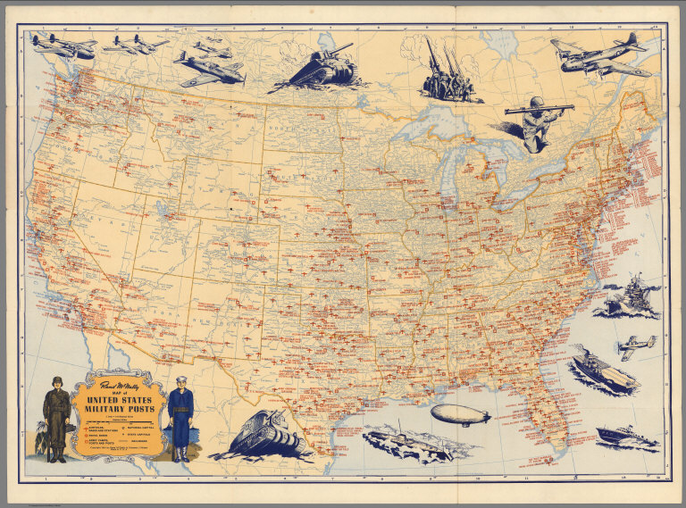
Rand McNally & Co.
Full Title
Rand McNally Map of United States Military Posts.
Publisher
Rand McNally & Co.
Author
[Haskins, Charles, Lloyd, H.H., Viele, Egbert L.]
Full Title
H.H. Lloyd & Co's Campaign Military Charts Showing The Principal Strategic Places Of Interest. Engraved Expressly To Meet A Public Want During The Present War. Compiled From Official Data By Egbert L. Viele, Military and Civil Engineer; and Charles Haskins. Published Under The Auspices Of The American Geographical And Statistical Society. Entered ... 1861 by H.H. Lloyd & Co. H.H. Lloyd & Co's Military Charts. Sixteen Maps On One Sheet.
Publisher
H.H. Lloyd & Co.
Author
Lloyd, H.H.
Full Title
The National Political Chart. Lloyd's New Political Chart, 1861. With a Map of the United States, showing the Free States, Border Slave States, Cotton States, and Territories, in Different Colors. Published at H.H. Lloyd & Co.'s Agents' General Depot for Books, Maps, and Stationery Packages, 25 Howard Street, New York. Entered ... 1861, by H.H. Lloyd & Co. ... New York.
Publisher
H.H. Lloyd & Co.
Author
Prang, L. & Co.
Full Title
Map of the Atlantic States, Showing Distances From Washington (In BeeLine) By 50 Mile Circles. (The Traveling Distance is about 1/6 to 1/3 more than the BeeLine.) (with) Map of the Battle Ground (with) Map of Norfolk Harbor, Fort Monroe, and Vicinity. (with two insets) Position of Forces at Bull Run and Fortress Monroe. Published By L. Prang & Co. - No. 84 Merchants Row, Boston, Mass. Entered ... 1861 by L. Prang & Co. ... Massachusetts.
Publisher
L. Prang & Co.
Author
Magnus, Charles
Full Title
Union Military Chart. Complete Map Of The Rail Roads And Water Courses In The United States & Canada. Charles Magnus & Co. ... Liverpool, New York Office No. 12 Frankfort St. ... Entered ... 1859 by Charles Magnus & Co. ... New York. (with) Military Map Of Maryland & Virginia. (with) Map Of Northern Military Movements: Between New York & St. Louis. Published by Chs. Magnus ... Entered ... 1861 by Charles Magnus ... New York. (with two small untitled maps: Pensacola Bay and United States).
Publisher
Charles Magnus
Author
[Jenney, W. L. B., Kossak, William, Muller, John B., United States. Army. Military Division of the Mississippi]
Full Title
Military map showing the marches of the United States Forces under the command of Maj. Genl. W.T. Sherman, U.S.A. During the years 1863, 1864, 1865 ... Drawn by Capt. William Kossak ... and John B. Muller, draughtsman. St. Louis, Mo., 1865. Printed by Joseph F. Gedney. Engraved at Head Qrs., Corps of Engineers, U.S.A. by H.C. Evans & F. Courtenay.
Publisher
Joseph F. Gedney
Author
Jouvet et Cie.
Full Title
Carte Militaire des Etats - Unis (Partie Orientale). Atlas St. Cyr. Furne, Jouvet et Cie. Editeurs. Imp. Lemercier et Cie. Paris. (1882)
Publisher
Jouvet et Cie
Author
Jouvet et Cie.
Full Title
Carte Militaire des Etats - Unis (Partie Occidentale). Atlas St. Cyr. Furne, Jouvet et Cie. Editeurs. Imp. Lemercier et Cie. Paris. (1882)
Publisher
Jouvet et Cie
1-45 of 45
|