Who What Where WhenREMOVE |
Author
Berghaus, Heinrich
Full Title
Erdkarte zur Ubersicht Der Vertheilung des Starren und Flussigen, der Verschiedenheit der Oberflachen Gestaltung. Nebst Andeutungen zu Einer Arithmetisch-Geographischen Entwickelung der Wagerechten und Senkrechten Ausdehnungen. 3te Abtheilung: Geologie, No. 1. Gezeichnet v. F. Schelle. Gestochen v. Wilh. Jattnig in Berlin. Gotha, J. Perthes, 1839. Bearbeitet in der Geographischen Kunstschule zu Potsdam.
Publisher
Justus Perthes
Author
Berghaus, Heinrich
Full Title
Bergketten In Asien Und Europa. 3te Abtheilung: Geologie, No. 2. Potsdam, gez. u. gest. in der geogr. Kunstschule. Gotha, bei Justus Perthes, 1842.
Publisher
Justus Perthes
Author
Berghaus, Heinrich
Full Title
Europa's Haupt-Gebirgs Systeme. 3te Abtheilung: Geologie, No. 3. Gez. u. gest. in der geograph. Kunstschule zu Potsdam. Gotha bei Justus Perthes. 1842.
Publisher
Justus Perthes
Author
Berghaus, Heinrich
Full Title
Europa in Geologischer Beziehung nach den Hauptmassen der Gebirgs-Formationen. 3te Abtheilung: Geologie, No. 4. Gotha, bei J. Perthes. 1843.
Publisher
Justus Perthes
Author
Berghaus, Heinrich
Full Title
Karte von Sud-Amerika zur Ubersicht der Unebenheiten des Bodens. 3te Abtheilung: Geologie, No. 5. Potsdam, gez. u. gest. in der geogr. Kunstschule. Gotha, bei Justus Perthes, 1843.
Publisher
Justus Perthes
Author
[Berghaus, Heinrich, Humboldt, Alexander von, 1769-1859]
Full Title
Bergketten in Nord-Amerika. 3te Abtheilung: Geologie, No. 6. Potsdam, gez. u. gest. in der geogr. Kunstschule. Gotha, bei Justus Perthes, 1842.
Publisher
Justus Perthes
Author
Berghaus, Heinrich
Full Title
Specialia vom Vulkan Gurtel des Atlantischen Oceans. 3te Abtheilung: Geologie, No. 8. Gezeichnet von F. Schelle. Gestochen von Joh. Carl Ausfeld. Gotha, J. Perthes, 1839.
Publisher
Justus Perthes
Author
Berghaus, Heinrich
Full Title
Die Vulkanreihe von Guatemala, die Landengen von Tehuantepec, Nicaragua und Panama, und die Central Vulkane der Sud See. 3te Abtheilung: Geologie, No. 10. Potsdam, gez. u. gest. in der geogr. Kunstschule. Gotha, bei J. Perthes, 1840.
Publisher
Justus Perthes
Author
Berghaus, Heinrich
Full Title
Spezial-Karte vom Riesen-Gebirge. 3te Abtheilung: Geologie, No. 13. Gezeichnet u. gestochen in der geogr. Kunstschule zu Potsdam. Gotha, J. Perthes, 1843.
Publisher
Justus Perthes
Author
Berghaus, Heinrich
Full Title
Vermischtes zur Geologie. 3te Abtheilung: Geologie, No. 15. Potsdam, gez. u. gest. in der geogr. Kunstschule. Gotha, bei J. Perthes, 1844.
Publisher
Justus Perthes
Author
Colton, G.W.
Full Title
Mountains & Rivers. Published by J.H. Colton & Co. No. 172 William St. New York. Entered ... 1855, by J.H. Colton & Co. ... New York. No. II-No. III.
Publisher
J.H. Colton
Author
Colton, G.W.
Full Title
(Text Page) Principal Rivers and Lakes in the World.
Publisher
G. W & C. B. Colton & Co.
Author
Colton, G.W.
Full Title
Mountains & Rivers. Published by G. W. & C. B. Colton & Co., No. 182 William St. New York.
Publisher
G. W & C. B. Colton & Co.
Author
Colton, G.W.
Full Title
(Index to) Principal Mountains in the World.
Publisher
G. W & C. B. Colton & Co.
Author
Colton, G.W.
Full Title
(Text Page) Principal Rivers and Lakes in the world.
Publisher
G. W & C. B. Colton & Co.
Author
Colton, G.W.
Full Title
Mountains & Rivers.
Publisher
G. W & C. B. Colton & Co.
Author
Colton, G.W.
Full Title
(Text to) Principal Mountains in the World.
Publisher
G. W & C. B. Colton & Co.
Author
Colton, G.W.
Full Title
Mountains & Rivers. Published by G.W. & C.B. Colton, No. 172 William St., New York.
Publisher
G.W. & C.B. Colton
Author
Colton, G.W.
Full Title
(Text Page) Principal Rivers and Lakes in the world.
Publisher
G.W. & C.B. Colton
Author
Colton, G.W.
Full Title
(Index to) Principal Mountains in the World.
Publisher
G.W. & C.B. Colton
Author
Garnier, F. A., 1803-1863
Full Title
Tableau de systeme general de la cosmographie moderne, indiquant les principaux phenomenes celestes, la theorie des saisons et celle des eclipses, la rose des vents, ainsi que les divers elemens de la sphere, et les accidents exterieurs les plus remarquables du globe terrestre. Atlas spheroidal & universel de geographie dresse par F.A. Garnier, geographe. Paris, Vve. Jules Renouard, Editeur, Rue de Tournon, no. 6, Paris, 1860. Imp. Sarazin, Rue Git-le-Coeur, 8. Paris.
Publisher
Veuve Jules Renouard, Libraire
Author
Johnson, A.J.
Full Title
Mountains & Rivers. By Johnson and Ward. (to accompany) Johnson's New Illustrated (Steel Plate) Family Atlas, With Physical Geography, And With Descriptions Geographical, Statistical, And Historical ... By Richard Swainson Fisher, M.D. ... Maps Compiled, Drawn, And Engraved Under The Supervision Of J.H. Colton And A.J. Johnson. New York: Johnson And Ward, Successors To Johnson And Browning (Successors To J.H. Colton And Company,) No. 113 Fulton Street. 1864. Entered ... One Thousand Eight Hundred and Sixty-four, by A.J. Johnson ... New York.
Publisher
Johnson and Ward
Author
Mitchell, Samuel Augustus
Full Title
Lengths of the Principal Rivers in the World. Heights of the Principal Mountains in the World. F. Humphreys, Sculpt. Entered ... 1850 by Thomas, Cowperthwait & Co. ... Pennsylvania.
Publisher
Cowperthwait, Desilver & Butler
Author
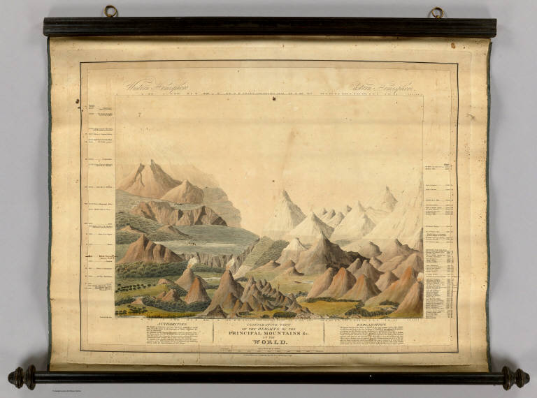
Smith, Charles, fl. 1800-1822
Full Title
Comparative View Of The Heights Of The Principal Mountains &c. In The World. Western Hemisphere. Eastern Hemisphere. London, Published by C. Smith, Mapseller No. 172 Strand, Augt. 1st 1816. Gardner Sculpt.
Publisher
C. Smith
Author
Radefeld, Carl Christian Franz, 1788-1874
Full Title
Spanien, westliche Halfte. Nach den besten Quellen entworf. u. gezeichnet, von Hauptm. Radefeld. 1847. (with) Madrid. Stich, Druck und Verlag des Bibliographischen Instituts zu Hildburghausen, (1860)
Publisher
Bibliographischen Instituts
Author
Radefeld, Carl Christian Franz, 1788-1874
Full Title
(Spanien, oestliche Halfte. Nach den besten Quellen entworf. u. gezeichnet, von Hauptm. Radefeld. 1847) (with Canarische Inseln) (with Fernando Po) Stich, Druck und Verlag des Bibliographischen Instituts zu Hildburghausen, (1860)
Publisher
Bibliographischen Instituts
Author
Radefeld, Carl Christian Franz, 1788-1874
Full Title
(Composite of) Spanien ... Nach den besten Quellen entworf. u. gezeichnet, von Hauptm. Radefeld. 1847. (with) Madrid. (with) Canarische Inseln. (with) Fernando Po. Stich, Druck und Verlag des Bibliographischen Instituts zu Hildburghausen, (1860)
Publisher
Bibliographischen Instituts
Author
Grassl, J. (Joseph)
Full Title
Karte des Thuringer-Wald-Gebirges zugleich special Karte des Herzogthums Sachs-Meiningen-Hildburghausen, des Furstenthums Coburg und der Schwarzburgischen Furstenthumer Rudolstadt und Sondershausen. (with) Grundriss von Hildburghausen. (with) Grundriss von Coburg. Entworf. u. gezeichnet von J. Graessl. 1850. Stich, Druck und Verlag des Bibliographischen Instituts in Hildburghausen, (1860)
Publisher
Bibliographischen Instituts
Author
Gotthard, A.
Full Title
Der Harz. Gezeichnet v. Prem. Leutn. Gotthardt. 1852. Stich, Druck und Verlag des Bibliographischen Instituts in Hildburghausen, (1860)
Publisher
Bibliographischen Instituts
Author
Meyer, Joseph, 1796-1856
Full Title
Neueste Karte von Ungarn, Galizien, Slavonien und Croatien, Siebenburgen und dem Militairgrenzland. 1847. Aus der Geographischen Graviranstalt des Bibliographischen Instituts zu Hildburghausen, Amsterdam, Paris u. Philadelphia, (1860)
Publisher
Bibliographischen Instituts
Author
Radefeld, Carl Christian Franz, 1788-1874
Full Title
Bergsystem von Nord-America, 1848. Nach den neuesten Forshungen entw. u. gez. v. Hauptm. C. Radefeld. H. Schleifmann sc. Stich, Druck und Verlag des Bibliographischen Instituts in Hildburghausen, (1860)
Publisher
Bibliographischen Instituts
Author
Radefeld, Carl Christian Franz, 1788-1874
Full Title
Sud-America's Bergsysteme und Stromgebiete. Nach den besten Quellen entworf. u. gezeichnet von Hauptm. Radefeld. 1847. Stich, Druck und Verlag des Bibliographischen Instituts in Hildburghausen, (1860)
Publisher
Bibliographischen Instituts
Author
Colton, G.W.
Full Title
Principal mountains in the World. (Published by J.H. Colton & Co. 1856)
Publisher
J.H. Colton
Full Title
Carte des principales montagnes du globe. Hauteur comparative des principales montagnes du globe. Fonderie et Imprimerie de J. Carez. (1825)
Publisher
J. Carez
Author
Desjardins, Constant
Full Title
Orographische Karte von Europa, oder Beschreibung der Gebirgs-Systeme, Ketten und Landrucken, nebst der Bedeutung der vorzuglishsten Thaler, Haiden, Vorgebirge und Inseln von Europa; der Jugend gewidmet von C. Desjardins. (with) Hochste Spitzen der Haupt-Gebirgskette von Europa. Diese Karte is zu haben in Wien bei dem Herausgeber, Salvatorgasse Nr. 368, in der Kunsthandlung des H.F. Muller, Kohlmarkt, und in allen soliden Kunsthandlungen. (1837)
Publisher
Verfasser
Full Title
Mount Rainier, Washington, one of the highest peaks in the United States. By courtesy of the Alaska-Yukon Exposition. On the Snoqualmie River, near Snoqualmie, Washington. By courtesy of H.A. Chadwick, Seattle. (Published by Ellis A. Davis. Berkeley, Cal. Seattle. 1909)
Publisher
E.A. Davis
Author
Flemming, Carl
Full Title
Fluss- und Gebirgs-Karte von Mittel-Europa. Entw. u. gez. v. F. Handtke. H. Muller lith. Druck u. Verlag v. C. Flemming in Glogau. (1855)
Publisher
C. Flemming
Full Title
Table of the comparative heights of the principal mountains &c. in the World. (Written and engraved by Jos. Perkins. 1845)
Publisher
Tanner's Geographical Establishment
Author
[Brue, Adrien Hubert, 1786-1832, Humboldt, Alexander von, 1769-1859, Picquet, C.]
Full Title
Carte des republiques de la Nle. Grenade, de Venezuela et de l'Equateur formees de l'ancien Etat de Colombie; et des Guyanes Francaise, Hollandaise et Anglaise. (with) Profil de l'Amerique Meridionale de l'est a l'ouest, par M.A. de Humboldt. (with) Hauteurs comparees des villes, coupe ideale des Andes, de 21 (degrees) de latitude boreale et 13 (degrees) de lat. australe, par M.A. de Humboldt. Redigee par A. Brue, Geographe du Roi. Revue et augmentee par Ch. Picquet, Geographe du Roi et du Duc d'Orleans. Paris, 1836. Chez Chles. Picquet, Quai Conti No. 17, pres du Pont des Arts.
Publisher
C. Picquet
Author
[Dower, John Nicaragua, Teesdale, Henry]
Full Title
A Comparative View of the Heights of the Principal Mountains and Lengths of the Principal Rivers in the World. London: Published by Henry Teesdale & Co. Drawn & Engraved by J. Dower, Pentonville, London. (1844)
Publisher
Henry Teesdale & Co.
Author
Stein, Christ. Gottfr. Dan.
Full Title
Hemisphaeren. Entworfen und gezeichnet von G. Heck. Gestochen von R. Schmidt u. H. Eberhardt. J.C. Hinrichs'sche Buchhandlung, Leipzig. (1865)
Publisher
J.C. Hinrichs'sche Buch- und Landkartenhandlung
Author
[McKenzie, D., Thomson, John]
Full Title
A comparative view of the heights of the principal mountains of Scotland. (with) View of the Grampian Mountains, being a specimen of the formation of that range. Drawn by D. McKenzie S.A. Engd. by W.H. Lizars. Published by John Thomson, Edinburgh, 1831. (1832)
Publisher
[Baldwin & Cradock, John Cumming, John Thomson & Co.]
Author
Fullarton, A. & Co.
Full Title
The World in Hemispheres with Comparative Views of the Heights of the Principal Mountains and Basins of the principal Rivers on the Globe. I. By G.H. Swanston. Published by A. Fullarton & Co. Edinburgh, London & Dublin.
Publisher
A. Fullarton & Co.
Author
[Brue, Adrien Hubert, 1786-1832, Humboldt, Alexander von, 1769-1859]
Full Title
Carte generale de Colombie, de la Guyane Francaise, Hollandaise et Anglaise. (with) Profil de l'Amerique Meridionale de l'est a l'ouest, par M.A. de Humboldt. (with) Hauteurs comparees des villes, coupe ideale des Andes, de 21 (degrees) de latitude boreale et 13 (degrees) de lat. australe, par M.A. de Humboldt. Redigee par A. Brue, Geographe du Roi, d'apres les observations astronomiques de M. Alex. de Humboldt ... Paris, 1826. Chez l'Auteur, rue des Macons-Sorbonne, no. 9, et chez les principaux m(archan)ds de cartes geographiques.
Publisher
A. Brue
Full Title
New map of the World in hemispheres, with comparative views of the heights of the principal mountains and lengths of the principal rivers on the globe. (By Frank A. Gray. Drawn by Frank A. Gray. Engraved by William H. Holmes). Entered ... 1879, by O.W. Gray & Son, in the Office of the Librarian of Congress at Washington. (1894)
Publisher
J.H. Stuart & Co.
Author
Gray, Frank Arnold
Full Title
Gray's new map of the World in hemispheres, with comparative views of the heights of the principal mountains and lengths of the principal rivers on the globe. By Frank A. Gray. Drawn by Frank A. Gray. Engraved by William H. Holmes. Entered ... 1879, by O.W. Gray & Son, in the Office of the Librarian of Congress at Washington. (1885)
Publisher
George N. Colby
Author
[Berghaus, Hermann, Luddecke, Richard]
Full Title
Hohen und Tiefen. Entworfen u. bearbeitet v. Dr. R. Luddecke. Gest v. O. Hess. Ausgabe 1891. Gotha: Justus Perthes (1892)
Publisher
Justus Perthes
Author
Finley, Anthony
Full Title
Map of Florida according to the Latest Authorities. (with) Comparative Elevation of the Principal Mountains Cities &c. in North & South America. J.H. Young Sc. Philadelphia Published by A. Finley 1826.
Publisher
Anthony Finley
Author
[Perrot, A. M. (Aristide Michel), 1793-1879, Vandermaelen, Philippe, 1795-1869]
Full Title
Tableau comparatif des principales hauteurs du globe. D'apres A.M. Perrot. (Dresse par Ph. Vandermaelen, lithographie par H. Ode. Premier partie. - Europe. Bruxelles. 1827)
Publisher
Ph. Vandermaelen
Author
Cornell, S. S. (Sarah S.)
Full Title
The World, showing its great river systems. Designed to accompany Cornell's High school geography. (with Lengths of rivers, heights of mountains). Engraved by Geo. Rae Smith, N.Y.. Entered ... 1856, by S.S. Cornell ... Southern District of New York. New York: D. Appleton & Co., 443 & 445 Broadway. (1864)
Publisher
Appleton & Co.
|