Browse All

1828 The world. School Atlas The World. J.W. Barber sc. (with) A view … |
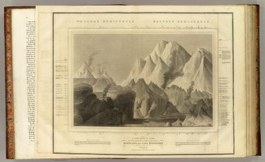
1817 Heights of mountains. World Atlas A comparative view of the heights of the … |

1827 Virginie, Pensylvanie. Physical Atlas Carte des montagnes coupees par des rivi … |

1827 Mont Gibel, Etna. Physical Atlas Plan du Mont Gibel, anciennement Mont Et … |

1827 Monte Vesuve. Physical Atlas Carte du Monte Vesuve. Grave par Ambrois … |

1827 Ile de Mascareigne. Physical Atlas Partie orientale de l'ile de Mascareigne … |

1827 Champs Phlegreens. Physical Atlas Champs Phlegreens. Grave par Ambroise Ta … |

1830 Mountains, rivers. School Atlas Height of the principal mountains on the … |

1831 Table of mountain chains. World Atlas Table of mountain chains: together with … |

1831 Table of mountain chains. World Atlas Table of mountain chains: together with … |

1890 Western Hemisphere. World Atlas Western Hemisphere. Copyright 1887 by Wm … |

1890 Eastern Hemisphere. World Atlas Eastern Hemisphere. Copyright 1887 by Wm … |

1895 W., E. Hemispheres. World Atlas Western and Eastern Hemispheres. (with) … |

1881 Weltverkehrs, Meeresstromungen. World Atlas Karte des Weltverkehrs und der Meeresstr … |

1829 Rivers, mountains. School Atlas Comparative lengths of the principal riv … |

1787 L'Europe lacs, fleuves ... School Atlas Lacs, fleuves, rivieres et principales m … |

1787 L'Asie lacs, fleuves, rivieres, montagne … School Atlas Lacs, fleuves, rivieres et principales m … |

1787 L'Afrique lacs, fleuves ... School Atlas Lacs, fleuves, rivieres et principales m … |

1787 L'Amerique lacs, fleuves ... School Atlas Lacs, fleuves, rivieres et principales m … |

1826 Heights mountains. School Atlas Comparative heights of mountains. (Bosto … |

1693 L'Europe mers, fleuves, montagnes. [Manuscript Map, World Atlas] L'Europe avec trois mers, trois fleuves … |

1693 L'Europe (mers, fleuves, montagnes - out … [Manuscript Map, World Atlas] L'Europe (avec trois mers, trois fleuves … |

1880 Western Hemisphere. World Atlas Western Hemisphere. Entered ... 1879 by … |

1880 Eastern Hemisphere. World Atlas Eastern Hemisphere. Entered ... 1879 by … |

1835 Heights mountains, lengths rivers. World Atlas A comparative view of the heights of the … |

1823 Comparative Height of the Principal Moun … World Atlas Comparative Height of the Principal Moun … |

1856 Geological structure of globe. Physical Atlas The geological structure of the globe ac … |

1856 Geological phenomena. Physical Atlas Comparative views of remarkable geologic … |

1856 Asia, Europe river systems. Physical Atlas The river systems of Asia & Europe, show … |

1856 America river systems. Physical Atlas The river systems of America, extended f … |

1829 Maine vertical sections. State Atlas Vertical sections, exhibiting the compar … |

1823 Cover: Comparative heights, principal mo … Case Map (Covers to) New and Improved View of the … |

1875 Fluss Und Bergkarte Von Deutschland Und … World Atlas Fluss Und Bergkarte Von Deutschland Und … |

1823 Comparative Heights of the Principal Mou … Case Map New and Improved View of the Comparative … |

1850 Hauteur des montagnes. World Atlas Tableau comparatif de la forme et de la … |

1846 Heights Of The Principal Mountains In Th … World Atlas Heights Of The Principal Mountains In Th … |

1840 (Cuadros de alturas, superficie, poblaci … National Atlas (Un cuadro de alturas que comprende las … |

1885 Carta Orografica. National Atlas Carta Orografica. VI. A. Garcia Cubas. P … |

1838 Die Isothermkurven Der Nordlichen Halbku … World Atlas Die Isothermkurven Der Nordlichen Halbku … |

1836 Des Principales Montagnes et des Princip … World Atlas Tableau Comparatif et Figure de La Haute … |

1865 Mountains and Rivers. World Atlas Mountains & Rivers. |

1865 Text: Principal Rivers and Lakes of the … World Atlas (Text Page) Principal Rivers and Lakes i … |

1865 Index: Principal Mountains in the World. World Atlas (Index to) Principal Mountains in the Wo … |

1869 Text: Principal Rivers and Lakes in the … World Atlas (Text Page) Principal Rivers and Lakes i … |

1869 Mountains and Rivers in the World. World Atlas Mountains & Rivers. Published by G. W. & … |

1869 Index: Principal Mountains in the World. World Atlas (Index to) Principal Mountains in the Wo … |

1873 Coupes geologiques diverses - altitudes. National Atlas Coupes geologiques diverses - altitudes. … |

1873 Coupes orographiques, territoire Argenti … National Atlas Coupes orographiques des parties central … |

1873 Coupes du continent Sud Americain. National Atlas No. 1. Coupes du continent Sud Americain … |

1948 Great Lakes including Canals and Tributa … World Atlas The Northern and Northwestern Lakes incl … |