|
REFINE
Browse All : National Atlas and Atlas Map of Massachusetts and Boston (Mass.)
1-7 of 7
Author
Jefferys, Thomas
Full Title
A Map of the most Inhabited part of New England, containing the Provinces of Massachusetts Bay and New Hampshire, with the Colonies of Conecticut And Rhode Island, Divided into Counties and Townships: The Whole composed from Actual Surveys and its Situation adjusted by Astronomical Observations. (with) A Plan of the Town of Boston. November 29th 1774. Published according to Act by Thos. Jefferys Geographer to His Royal highness the Prince of Wales near Charing Cross. (Northern section)
Publisher
Sayer and Bennett
Author
Shell Oil Company
Full Title
Shell Map of Metropolitan Boston and Cape Cod (cover title). Shell Metropolitan Boston and Vicinity. 9-DD-1956-1.
Publisher
Shell Oil Company
Author
Colton, G.W.
Full Title
Map of Boston and Adjacent Cities. No. 13. Published by J.H. Colton & Co., No 172 William St., New York. Entered according to the Act of Congress in the year 1855 by J.H. Colton & Co. in the Clerk's Office of the District Court of the United States for the Southern District of New York.
Publisher
J.H. Colton
Author
Bradford, Thomas G.
Full Title
Boston. Engraved by G.W. Boynton.
Publisher
[Weeks, Jordan & Co., Wiley and Putnam.]
Author
[Johnston, Alexander Keith, 1804-1871, Rogers, Henry Darwin]
Full Title
Philadelphia & Vicinity. Boston and its Environs. London ... & according to an act of Congress ... 1857, by H.D. Rogers ... Massachusetts. London, John Murray, Albemarle Street, Edinburgh, W. & A.K. Johnston. Engraved by W. & A.K. Johnston, Edinburgh.
Publisher
Edward Stanford
Author
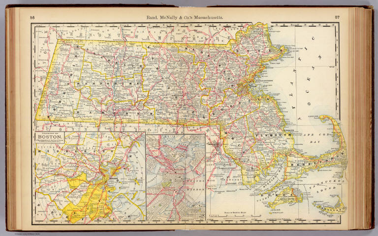
Rand McNally and Company
Full Title
Commercial Atlas of America. Rand McNally Standard Map of Massachusetts. (with) Environs of Boston.
Publisher
Rand McNally and Company
1-7 of 7
|