Who What Where WhenREMOVE |
REFINE
Browse All : National Atlas and Atlas Map of Texas
1-47 of 47
Author
Asher & Adams
Full Title
Asher & Adams' Texas eastern portion. Entered according to Act of Congress in the year 1874 by Asher & Adams ... at Washington. (New York, 1874)
Publisher
Asher and Adams
Author
Asher & Adams
Full Title
Asher & Adams' Texas western portion. Entered according to Act of Congress in the year 1874 by Asher & Adams ... at Washington. (New York, 1874)
Publisher
Asher and Adams
Author
Schonberg & Co.
Full Title
Schonberg's Map of Texas. Entered ... 1866 ... New York.
Publisher
Schonberg & Co.
Author
Shell Oil Company
Full Title
Shell Map of Texas (cover title). Shell Highway Map of Texas (eastern portion). 6-DD-1956-1. (insets) Enlarged Map of the Houston District; Enlarged Map of the Fort Worth - Dallas District.
Publisher
Shell Oil Company
Author
Shell Oil Company
Full Title
Shell Highway Map of Texas (western portion). 6-DD-1956-1. (Verso to) Shell Highway Map of Texas (eastern portion).
Publisher
Shell Oil Company
Author
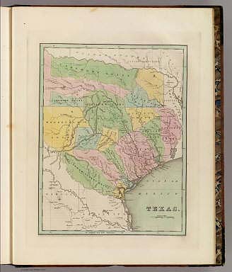
[Breese, Samuel, 1802-1873, Morse, Sidney E. (Sidney Edwards), 1794-1871]
Full Title
Texas. Entered ... 1844 by Sidney E. Morse and Samuel Breese ... New York. (New York: Published by Harper & Brothers, 1845)
Publisher
Harper & Brothers
Author
Asher & Adams
Full Title
Asher & Adams' Indian Territory and Texas north west portion. Entered according to Act of Congress in the year 1874 by Asher & Adams ... at Washington. (New York, 1874)
Publisher
Asher and Adams
Author
Mitchell, Samuel Augustus Jr.
Full Title
County Map of the State of Texas, Showing also portions of the Adjoining States and Territories. (inset) Plan of Galveston and Vicinity. Entered ... 1874 by S. Augustus Mitchell ... Washington.
Publisher
Ziegler & McCurdy
Author
[Lloyd, H.H., Warner & Beers]
Full Title
Atlas of the United States, Map of Texas. Warner & Beers, Publishers. From H.H. Lloyd & Co.'s Atlas of the United States.
Publisher
Warner & Beers
Author
[Johnston, Alexander Keith, 1804-1871, Rogers, Henry Darwin]
Full Title
State Of Texas. By Prof. H.D. Rogers & A. Keith Johnston, F.R.S.E. Entered in Sta. Hall. London ... & according to an act of Congress ... 1857, by H.D. Rogers ... Massachusetts. London, John Murray, Albemarle Street, Edinburgh, W. & A.K. Johnston. Engraved by W. & A.K. Johnston, Edinburgh.
Publisher
Edward Stanford
Author
Asher & Adams
Full Title
Asher & Adams' Indian Territory and Texas, North West Portion Entered according to Act of Congress 1874 by Asher & Adams in the Office of the Librarian of Congress at Washington.
Publisher
Asher & Adams.
Author
Asher & Adams
Full Title
Asher & Adams' Texas, Eastern Portion. Entered according to Act of Congress 187? by Asher & Adams in the Office of the Librarian of Congress at Washington. (1875)
Publisher
Asher & Adams.
Author
Asher & Adams
Full Title
Asher & Adams' Texas, Western Portion. Entered according to Act of Congress 1874 by Asher & Adams in the Office of the Librarian of Congress at Washington.
Publisher
Asher & Adams.
Author
Rand McNally and Company
Full Title
Rand McNally junior auto road map Texas. Copyright by Rand McNally & Co., Chicago, Ill. (1927)
Publisher
Rand McNally
Author
Rand McNally and Company
Full Title
St. Louis and vicinity. New Orleans and vicinity. Dallas Ft. Worth and vicinity. Portland and vicinity (Oregon). Copyright by Rand McNally & Co., Chicago, Ill. (1927)
Publisher
Rand McNally
Author
Colton, G.W.
Full Title
New Map of the State of Texas, Compiled from J. De Cordova's Large Map. No (35-) 36. Entered according to the Act of Congress in the year 1855 by J.H. Colton & Co. in the Clerk's Office of the District Court of the United States for the Southern District of New York.
Publisher
J.H. Colton
Author
Bradford, Thomas G.
Full Title
Texas. Entered ... 1838, by T.G. Bradford ... Massachusetts. Engraved by G.W. Boynton.
Publisher
[Weeks, Jordan & Co., Wiley and Putnam.]
Author
National Map Company
Full Title
Texas. (Copyrighted by) National Map Company, Indianapolis. (to accompany) Official Paved Road and Commercial Survey of the United States. (with inset).
Publisher
National Map Company
Author
Cram, George Franklin
Full Title
Cram's Rail Road & Township Map of Texas. Published by Geo. F. Cram. Proprietor of the Western Map Depot. 66, Lake St. Chicago Ills. 1875.
Publisher
Cram Atlas Company
Author
[Rand McNally and Company, State Farm Insurance Companies Travel Bureau]
Full Title
Rand McNally Road map, Texas. Copyright by Rand McNally & Company, Chicago, Ill. Lithographed in the U.S.A. (inset maps) Panhandle Section, and Brownsville Section. (to accompany) State Farm Road Atlas: United States, Canada, Mexico,Central and South America. Copyright 1940 by Rand McNally & Company, Chicago, Ill.
Publisher
State Farm Insurance Companies Travel Bureau
Author
Hillebrands, A.J.
Full Title
Atlas de Vereenigde Staten No. 10. Mississippi, Louisiana, en Texas.
Publisher
[J. Oomkens, J. Zoon]
Author
Bradstreet Company
Full Title
Texas. (to accompany) Bradstreet's Pocket Atlas Of The United States. Published Exclusively for Macullar, Parker & Company, Boston, Massachusetts ... New York: The Bradstreet Company, 1885. (on verso) Entered ... 1879, by The Bradstreet Company ... Washington. (inset map) Indian Ter. Kiowa & Comanches.
Publisher
Bradstreet Co.
Author
[Taylor, Frank J., White, Ruth Taylor]
Full Title
Texas.
Publisher
Little, Brown, and Company
Author
[Morse, Sidney E., Breese, S.]
Full Title
Texas. (to accompany) Supplement To The New-York Observer. The Cerographic Atlas Of The United States. No.3. 1845. Entered ... 1844, by Sidney E. Morse and Samuel Breese ... New-York.
Publisher
Sidney E. Morse & Co.
Author
[Morse, Sidney E., Breese, S.]
Full Title
A map of the Indian territory : Northern Texas and New Mexico; showing the great western prairies, by Josiah Gregg. Entered ... 1844, by Sidney E. Morse and Samuel Breese ... New-York. (to accompany) Supplement To The New-York Observer. The Cerographic Atlas Of The United States. No.3. 1845.
Publisher
Sidney E. Morse & Co.
Author
[Morse, Sidney E., Breese, S.]
Full Title
A map of the Indian Territory, northern Texas and New Mexico : Showing the great western prairies by Josiah Gregg. Entered ... 1844 by Sidney E. Morse and Samuel Breese ... New York. (New York: Published by Harper & Brothers, 1845). (to accompany) Morse's Cerographic Maps. 1845. No. I.
Publisher
Harper and Brothers
Author
[Morse, Sidney E., Breese, Samuel]
Full Title
Texas. Entered ... 1844 by Sidney E. Morse and Samuel Breese ... New York. (New York: Published by Harper & Brothers, 1845). (to accompany) Morse's Cerographic Maps. No. IV.
Publisher
Harper and Brothers
Author
[Gray, Frank A., Gray, O.W.]
Full Title
Gray's Map of Texas and the Indian Territory by Frank A. Gray. Copyright 1876 by O.W. Gray & Son. (insets) Hypsometric Sketch of Texas and the Indian Territory. Austin. Matagorda Bay. The City of Galveston. Entrance to Galveston Bay. The River Systems if Texas and the Indian Territory.
Publisher
Stedman & Brown
Author
Cram, George Franklin
Full Title
Cram's Rail Road & County Map of Texas.
Publisher
George F. Cram
Author
[Rand McNally and Company, State Farm Insurance Companies Travel Bureau]
Full Title
Rand McNally Road map: Texas. Copyright by Rand McNally & Company, Chicago, Ill. Lithorgaphed in the U.S.A. U.3630. (to accompany) State Farm road atlas : United States, Canada, Mexico. (inset) Panhandle section ; Brownsville section.
Publisher
State Farm Insurance Companies Travel Bureau
Author
Arbuckle Bros.
Full Title
Indian Territory, New Mexico, South Dakota, Texas. Copyright 1889 Arbuckle Bros. N.Y.
Publisher
Arbuckle Bros.
Author
Smith, J. Calvin
Full Title
(Arkansas, Oklahoma, Texas).
Publisher
Theodor Fischer
Author
Smith, J. Calvin
Full Title
(Texas, Louisiana).
Publisher
Theodor Fischer
Author
Marbut, Curtis F.
Full Title
Soil Map of the United States by Curtis F. Marbut and Associates in the Soil Survery, U.S. Department of Agriculture, F.J. Marschner, Cartographer and Associate in Compilation. 1931. Soils, Plate 5, Section 10. Lith. A. Hoen & Co., Inc. Atlas of American Agriculture.
Publisher
U.S. Department of Agriculture
Author
Marbut, Curtis F.
Full Title
Soil Map of the United States by Curtis F. Marbut and Associates in the Soil Survery, U.S. Department of Agriculture, F.J. Marschner, Cartographer and Associate in Compilation. 1931. Soils, Plate 5, Section 11. Lith. A. Hoen & Co., Inc. Atlas of American Agriculture.
Publisher
U.S. Department of Agriculture
Author
Rand McNally and Company
Full Title
Commercial Atlas of America. Rand McNally AutoTrails Map, District Number 18, (Texas, Oklahoma, Louisiana, Arkansas).
Publisher
Rand McNally and Company
Author
Rand McNally and Company
Full Title
Commercial Atlas of America. Rand McNally Standard Map of Texas (Eastern Section).
Publisher
Rand McNally and Company
Author
Rand McNally and Company
Full Title
Commercial Atlas of America. Rand McNally Standard Map of Texas (Western Section).
Publisher
Rand McNally and Company
Author
Rand McNally and Company
Full Title
Commercial Atlas of America. Rand McNally Black and White Mileage Map, Texas.
Publisher
Rand McNally and Company
Author
Lange, Henry, 1821-1893.
Full Title
Texas. H. Lange's Atlas v. Nord Amerika Blatt XII. Braunschweig: Verlag v. George Westermann. Lith. Anst. von L. Kraatz in Berlin.
Publisher
George Westermann.
Author
[Bartholomew, John, Black, Adam & Charles]
Full Title
Texas, Part of New Mexico. Published by A. & C. Black. Edinburgh. Printed in Colours by Schenck & Macfariane. Edinburgh. Drawn & Engraved by J. Bartholomew, Edinburgh.
Publisher
A. & C. Black
Author
[Bartholomew, John, Black, Adam & Charles]
Full Title
Western States, including California, Oregon, Utah, Washington, New Mexico, Nebraska, Kansas, Indian Territory, &c. Published by A. & C. Black. Edinburgh. Printed in Colours by Schenck & Macfariane. Edinburgh. Drawn & Engraved by J. Bartholomew, Edinburgh.
Publisher
A. & C. Black
Author
Rand McNally and Company
Full Title
Rand, McNally & Co.'s Texas.
Publisher
Rand McNally and Company
Author
Rand McNally and Company
Full Title
Rand, McNally & Co.'s Texas No. 1. Rand McNally & Co's New Enlarged Scale Railroad and County Map of Texas. (with) (Outline Map of Texas Counties).
Publisher
Rand McNally
Author
Rand McNally and Company
Full Title
Rand, McNally & Co.'s Texas No. 2.
Publisher
Rand McNally
Author
[Carey, H. C., Humboldt, Alexander von, 1769-1859, Lea, I.]
Full Title
Geographical, Historical, And Statistical Map Of Mexico. Mexico And Internal Provinces. No. 38. Prepared from Humboldt's Map & other Documents by J. Finlayson. Engrav'd by Young & Delleker.
Publisher
H.C. Carey & I. Lea
1-47 of 47
|